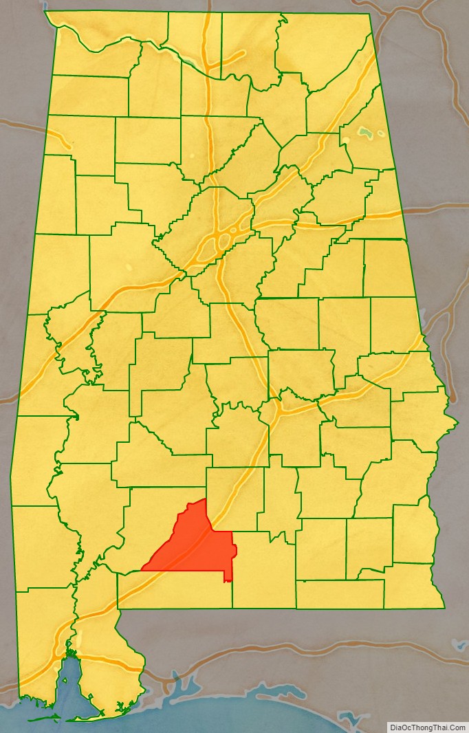
Conecuh County (/kəˈnɛkə/) is a county located in the south central portion of the U.S. state of Alabama. As of the 2020 census the population was 11,597. Its county seat is Evergreen. Its name is believed to be derived from a Creek Indian term meaning “land of cane.”
| Name: | Conecuh County |
|---|---|
| FIPS code: | 01-035 |
| State: | Alabama |
| Founded: | February 13, 1818 |
| Seat: | Evergreen |
| Largest city: | Evergreen |
| Total Area: | 853 sq mi (2,210 km²) |
| Land Area: | 850 sq mi (2,200 km²) |
| Total Population: | 11,597 |
| Population Density: | 14/sq mi (5.2/km²) |
| Time zone: | UTC−6 (Central) |
| Summer Time Zone (DST): | UTC−5 (CDT) |
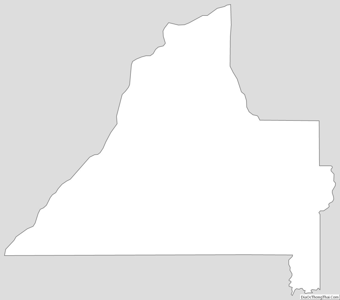
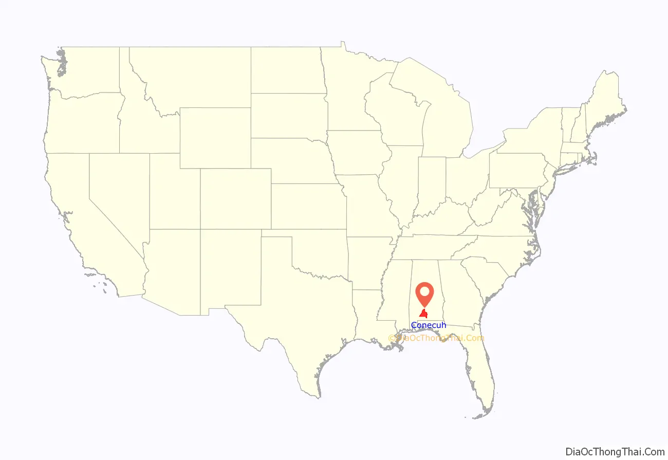
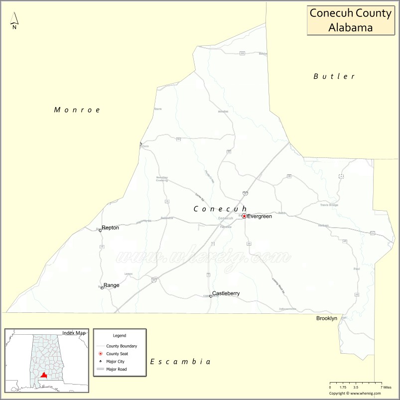
Conecuh County location map. Where is Conecuh County?
History
The areas along the rivers had been used by varying cultures of indigenous peoples for thousands of years. French and Spanish explorers encountered the historic Creek Indians. Later, British colonial traders developed relationships with the Creek, and several married high-status Creek women. As the tribe has a matrilineal system, children are considered born into their mother’s clan and take their status from her family.
During the American Revolutionary War, the Upper Creek chief Alexander McGillivray, whose father was Scottish, allied his tribe with the British, hoping they could stop colonial Americans from encroaching on Creek land. Commissioned a British colonel, McGillivray named Jean-Antoine Le Clerc, a French adventurer who lived with the Creeks for 20 years, as the war chief to lead the Creek warriors.
Conecuh County was established by Alabama on February 13, 1818. Some of its territory was taken in 1868 by the Republican state legislature during the Reconstruction era to establish Escambia County. Located in the coastal plain, 19th century Conecuh County was an area of plantations and cotton cultivation, and it is still quite rural today. Thousands of African American residents left in the 1940s, during the Second Great Migration, mostly for industrial regions in the major cities.
In September 1979, the county was declared a disaster area, due to damage caused by Hurricane Frederic.
Conecuh County was mentioned as the birthplace of Theodore Bagwell in the television series Prison Break.
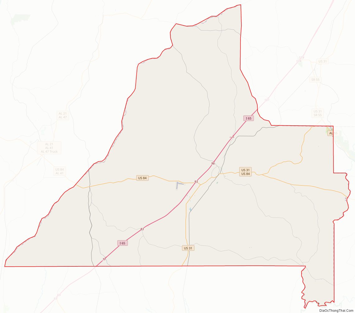
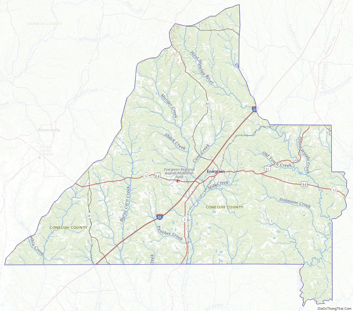
Conecuh County Road Map
Geography
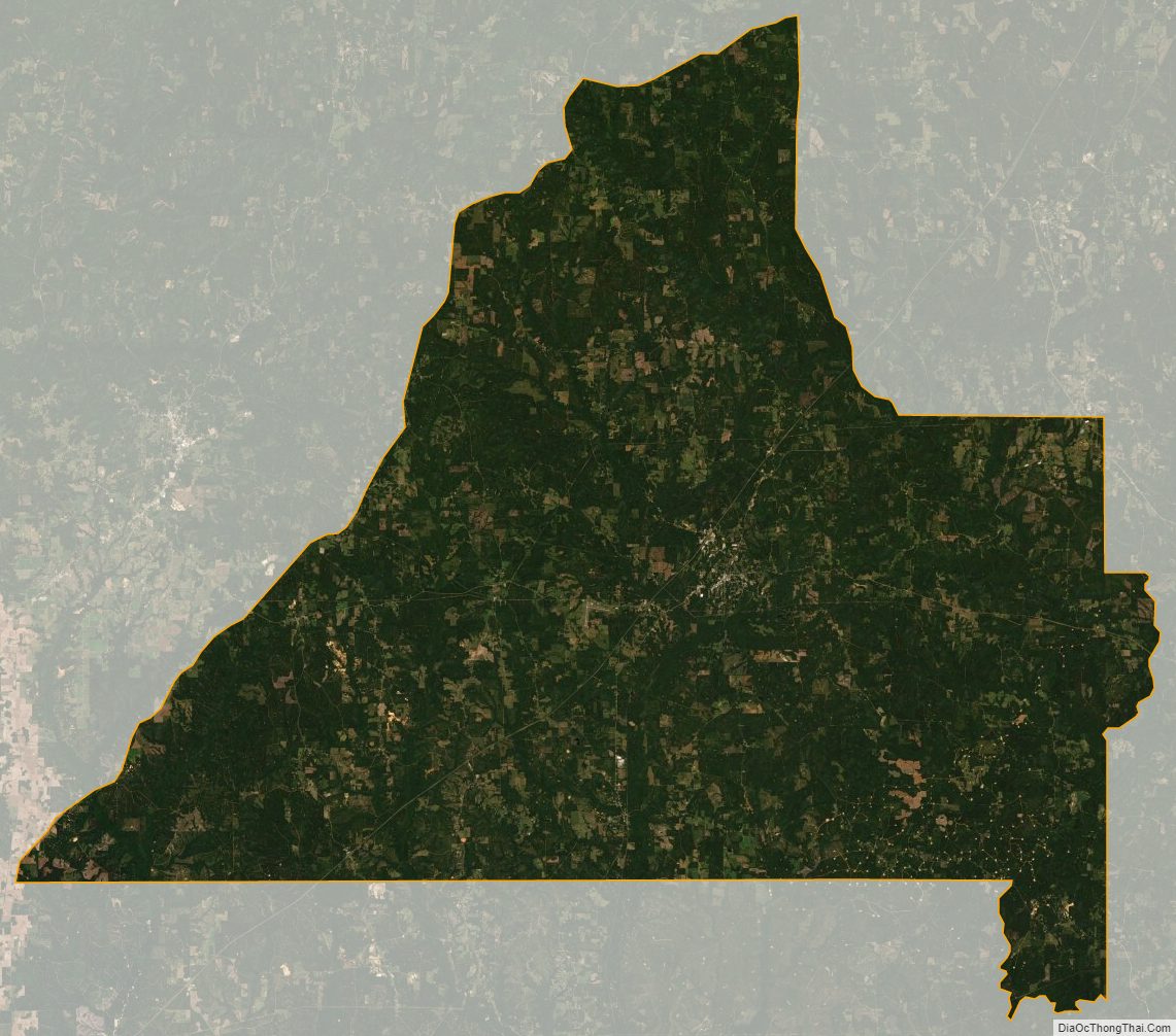
According to the United States Census Bureau, the county has a total area of 853 square miles (2,210 km), of which 850 square miles (2,200 km) is land and 2.6 square miles (6.7 km) (0.3%) is water.
Major highways
- Interstate 65
- U.S. Highway 31
- U.S. Highway 84
- State Route 41
- State Route 83
Adjacent counties
- Butler County (northeast)
- Covington County (southeast)
- Escambia County (south)
- Monroe County (northwest)
Conecuh County Topographic Map
Conecuh County Satellite Map
Conecuh County Outline Map