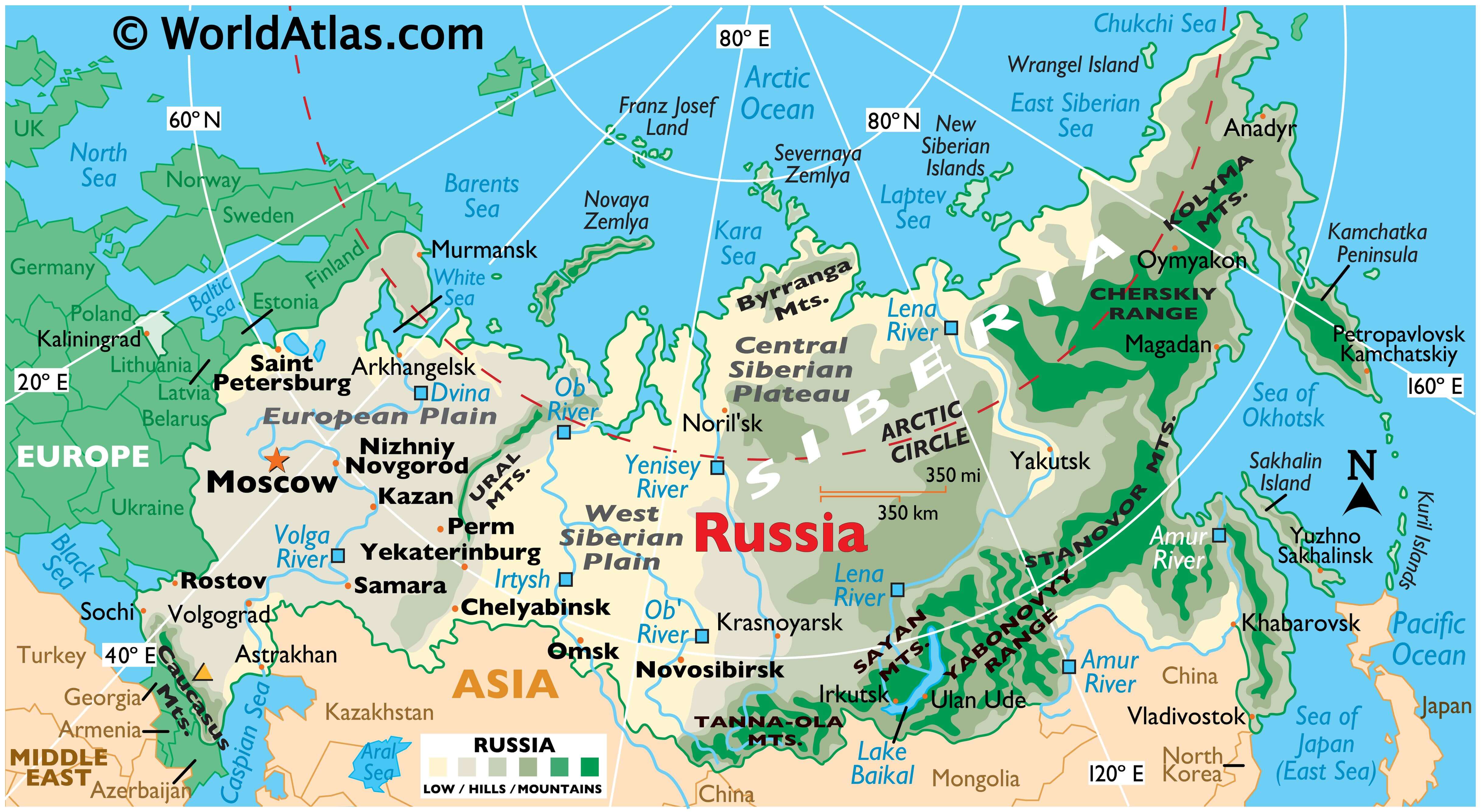
As the world’s largest country in total area, Russia showcases a wide diversity of landforms. In general terms, it is divided into some very specific geographical zones.
The broad European Plain, or Volga River Plain extends from the Ural Mountains to its western borders with Europe.
The central and southern areas of Russia include large fertile areas, marsh, steppes (plains without trees) and massive coniferous forests.
Siberia is a combination of frozen tundra, with rolling hills rising to plateaus, punctuated by scattered mountain ranges.
Mountains Mountain ranges are found across Russia, with many of the major ones stretching along its southwestern, southeastern and eastern borders
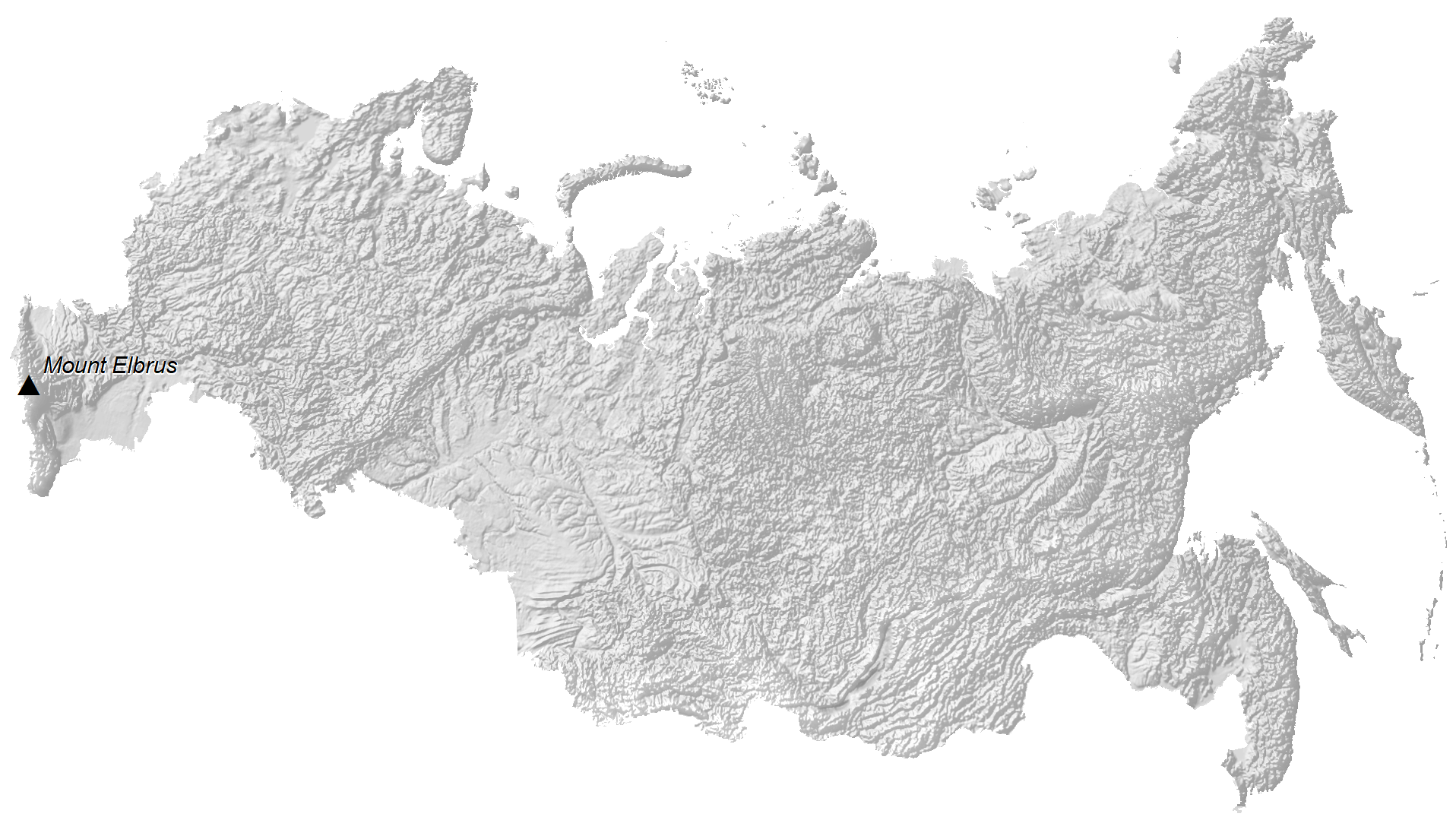
In the far southwest the Caucasus Mountains slice across the land. The country’s highest point, Mt. Elbrus at 18,481 ft. (5,633 m), is located there. It has been marked on the map above by a yellow upright triangle.
Making up the natural border between European Russia and Asia, the Ural Mountains extend from the Arctic Ocean to Kazakhstan’s northern border.
The Kolyma Mountains in far northeastern Russia extend about 1,126 km (700 mi) north and south to the east of the Kolyma River and roughly parallel to the coast of Siberia. Some rise to over 6000 feet (1830 meters).
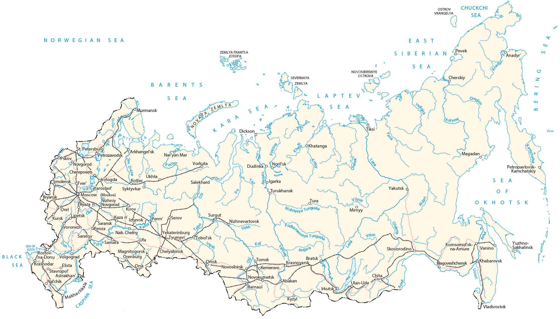
Rivers Russia has more than 100,000 rivers with a length of 7 miles, or greater. Some of the world’s longest rivers flow through the vast lowland plains that dominate the Russian landscape.
Significant rivers include the Volga, Dnieper and Dvina (west), the Lena, Ob, and Yenisey (central) and the Amur in the far east.
At 1,642 m (5,387 ft), Lake Baikal (marked on the map) is the deepest and among the clearest of all lakes in the world. Baikal is home to more than 1,700 species of plants and animals, two thirds of which can be found nowhere else in the world.
Steppe Long characterized as the typical Russian landscape, the steppe region displays a broad range of treeless, grassy plains punctuated by mountain ranges, and provides the best conditions for human settlement.
Taiga Accounting for over 60% of Russia, this forested region extends from its western borders then east towards the Pacific Ocean. Russia contains the world’s largest reserve of coniferous wood, however, due to extensive logging the supply is steadily on the decrease; as well, to make way for agriculture, much of the forested zone has been cleared.
Tundra Stretching 4,349 miles (7,000 km) from west to east, the Russian Arctic is a vast treeless and marshy plain, and is well-known for its white nights (dusk after midnight, and dawn fairly soon after) through summer and days of near total darkness through winter.
| Flag: |  |
|---|---|
| Legal Name: | Russian Federation |
| Capital Value: | Moscow |
| Demonym(s): | Russian |
| Government: | Federal semi-presidential republic under an authoritarian dictatorship |
| Legislature: | Federal Assembly |
| Total Area: | 17,098,242 km² |
| Land Area: | 16,377,742 km² |
| Water Area: | 720,500 km² |
| Population: | 144,373,535 |
| Density: | 8.4/km (21.8/sq mi) (181st) |
| GDP: | $1.70 Trillion |
| GDP Per Capita: | $11,585.00 |
| Currency Value: | Russian rubles (RUB) |
| Driving side: | right |
| Calling code: | +7 |
| Internet TLD: |
|
Explore the Vastness of Russia
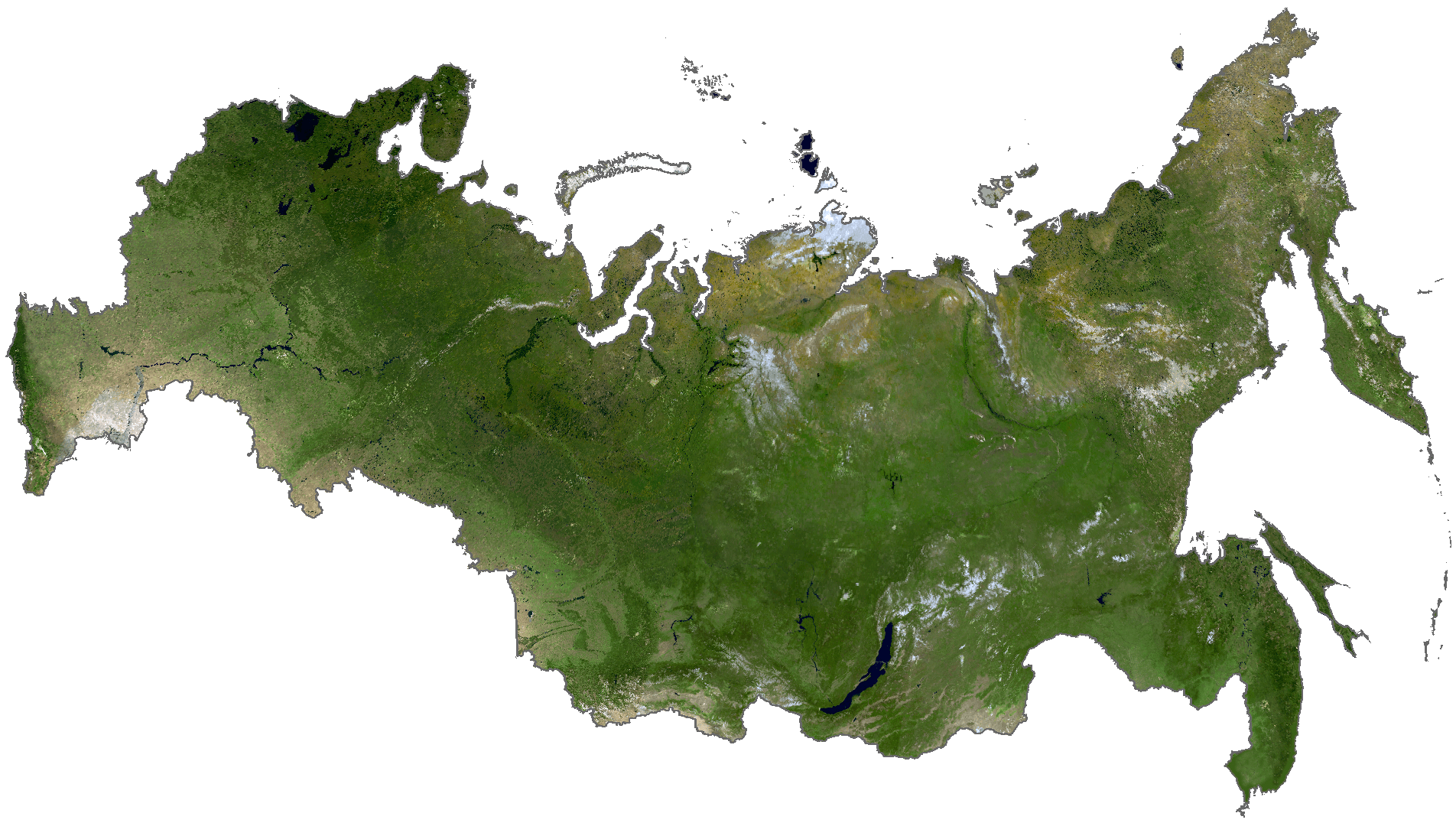
Russia is the largest country in the world, spanning across two continents and nine time zones. With its long-reaching landscape, Russia offers an array of breathtaking views and cultural experiences. From its cities and towns to its highways, roads, lakes, and rivers, this map of Russia offers a comprehensive look at the country’s vastness. Moreover, satellite imagery and an elevation map of Russia provide a unique perspective of the country’s topography and Siberia.
Location Maps
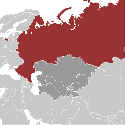
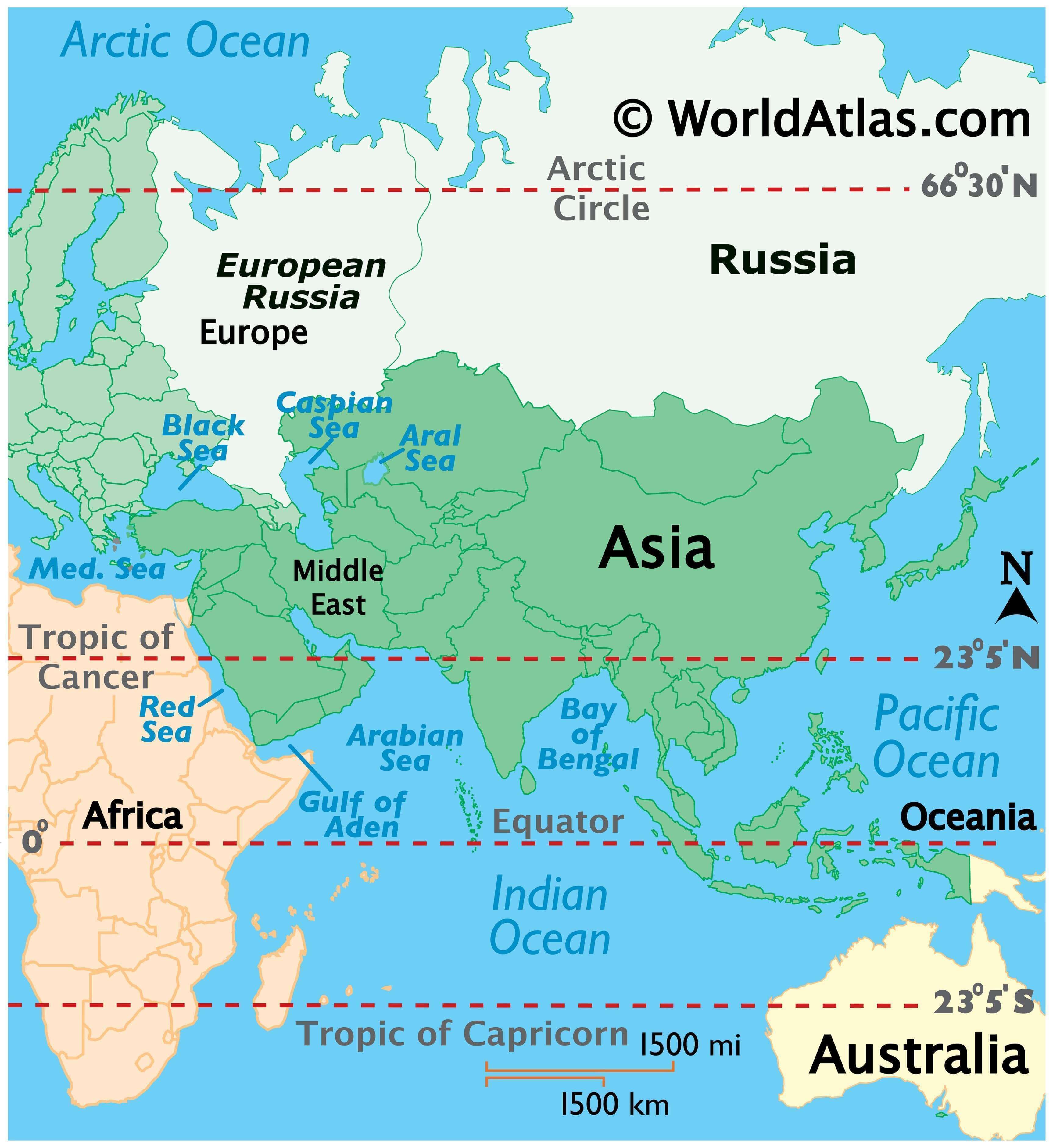
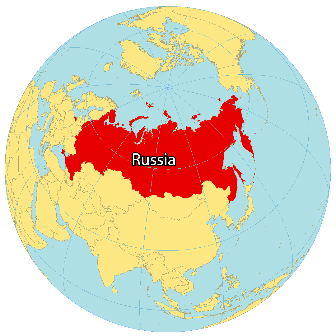
Where is Russia?
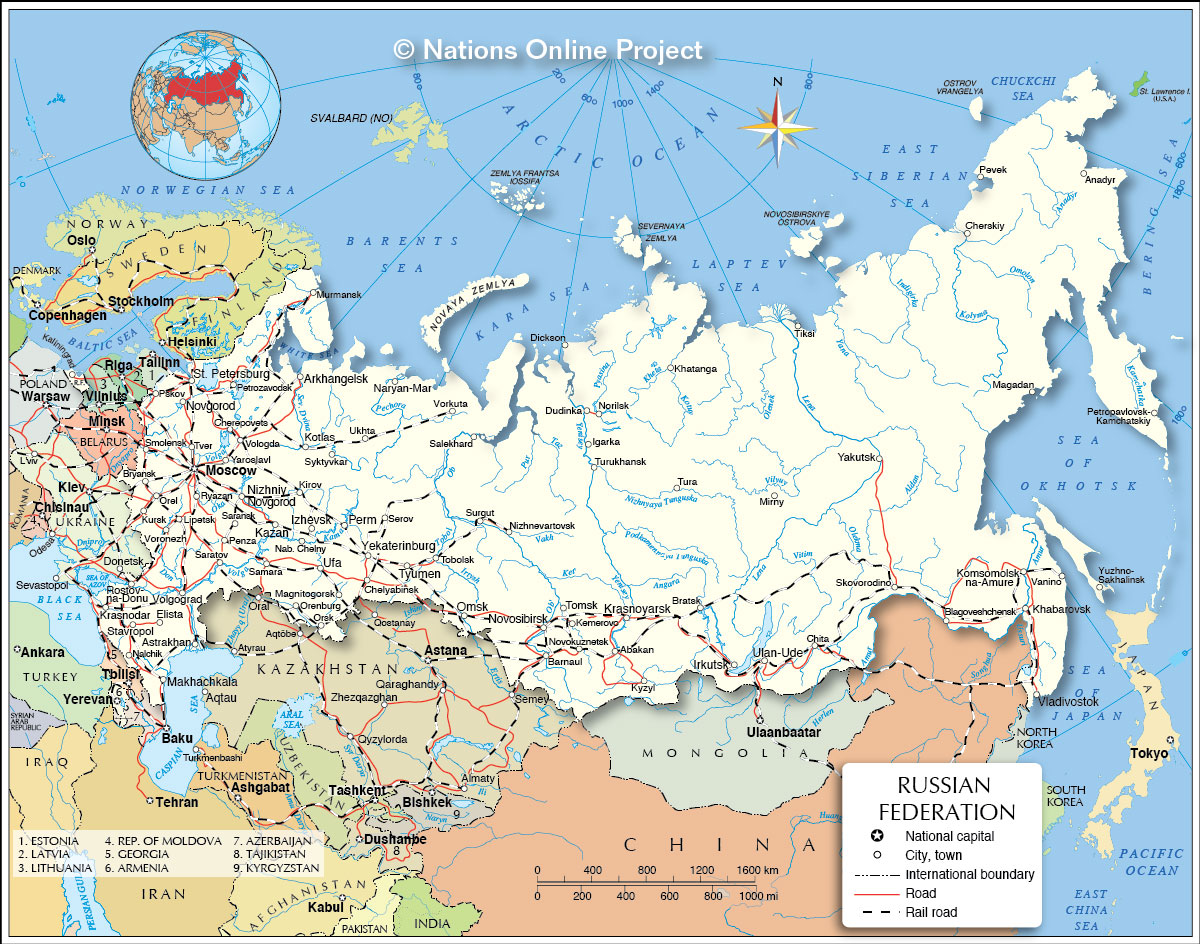
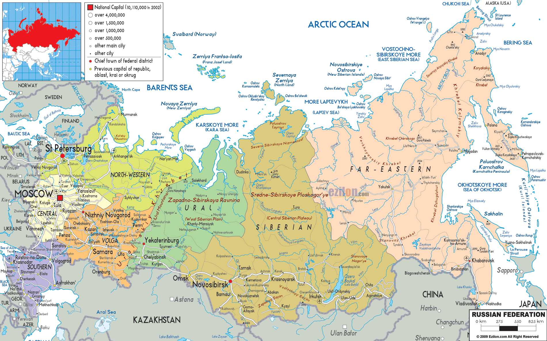
Russia is a transcontinental country located in both North Asia and Europe. It shares borders with 14 countries, the most of any other country in the world. These countries include Azerbaijan, Belarus, China, Estonia, Finland, Georgia, Kazakhstan, North Korea, Latvia, Lithuania, Mongolia, Norway, Poland, and Ukraine. Russia is the largest country in terms of its landmass, spanning over 17 million square kilometers (6.6 million sq mi). This accounts for more than one-eighth of Earth’s inhabited land area and crosses eleven different time zones. The Arctic Ocean borders the country to the north, Europe to the east, and Asia to the south. Moscow is the capital and largest city in Russia, but Saint Petersburg, Novosibirsk, and Yekaterinburg are other major cities.
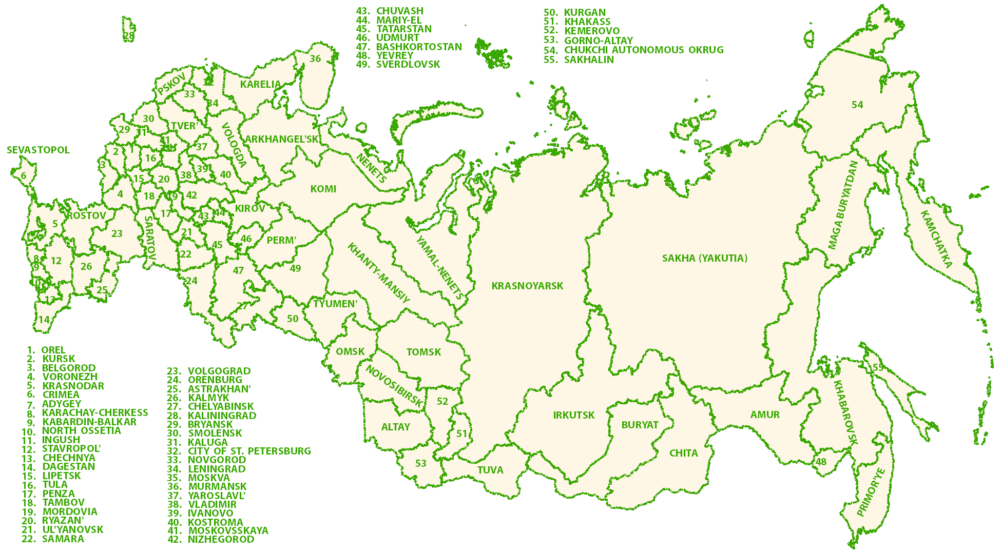
High Definition Political Map of Russia
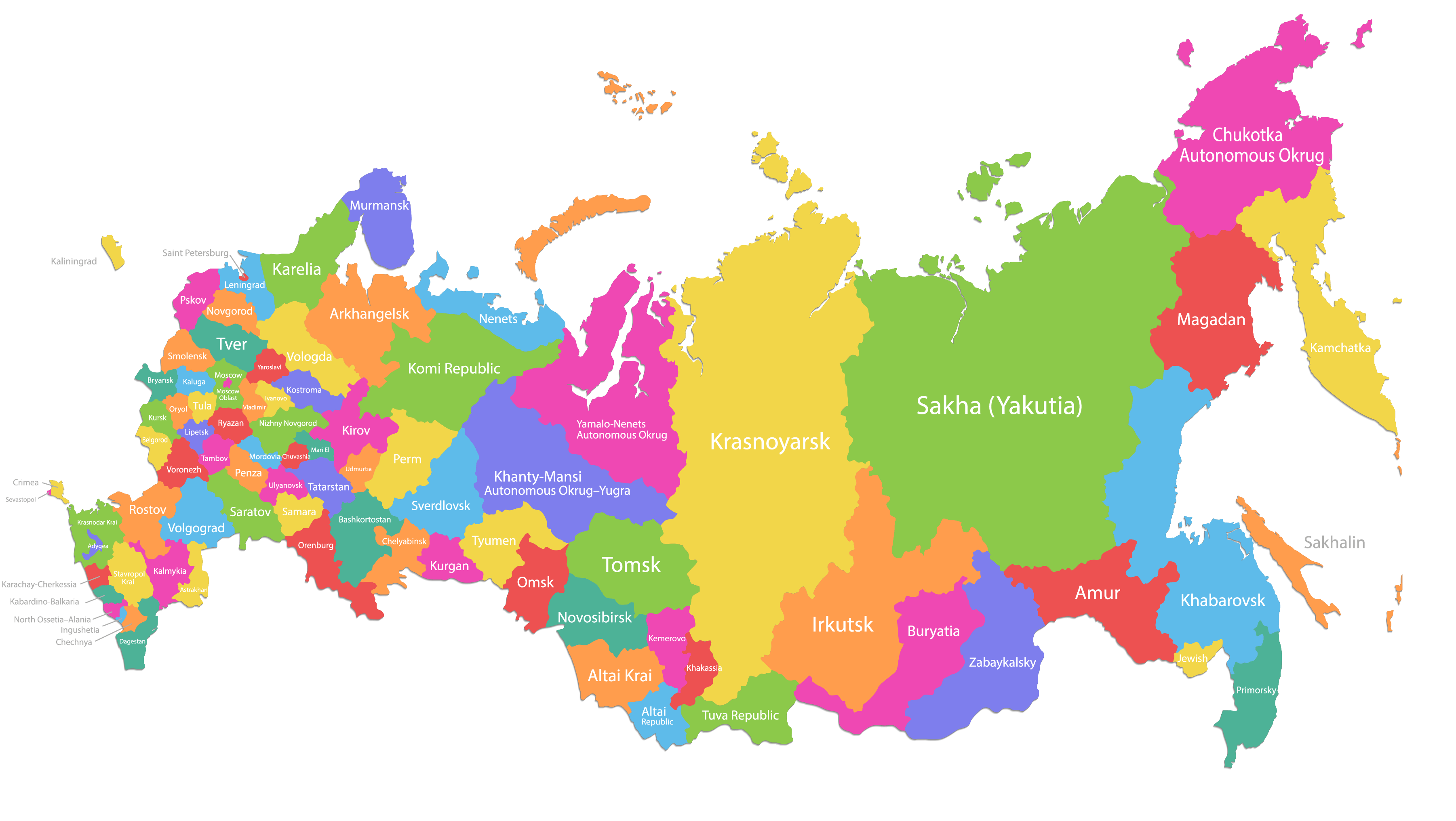
Russia Administrative Map
Physical Map of Russia

Russia Satellite Map
Elevation Map
great