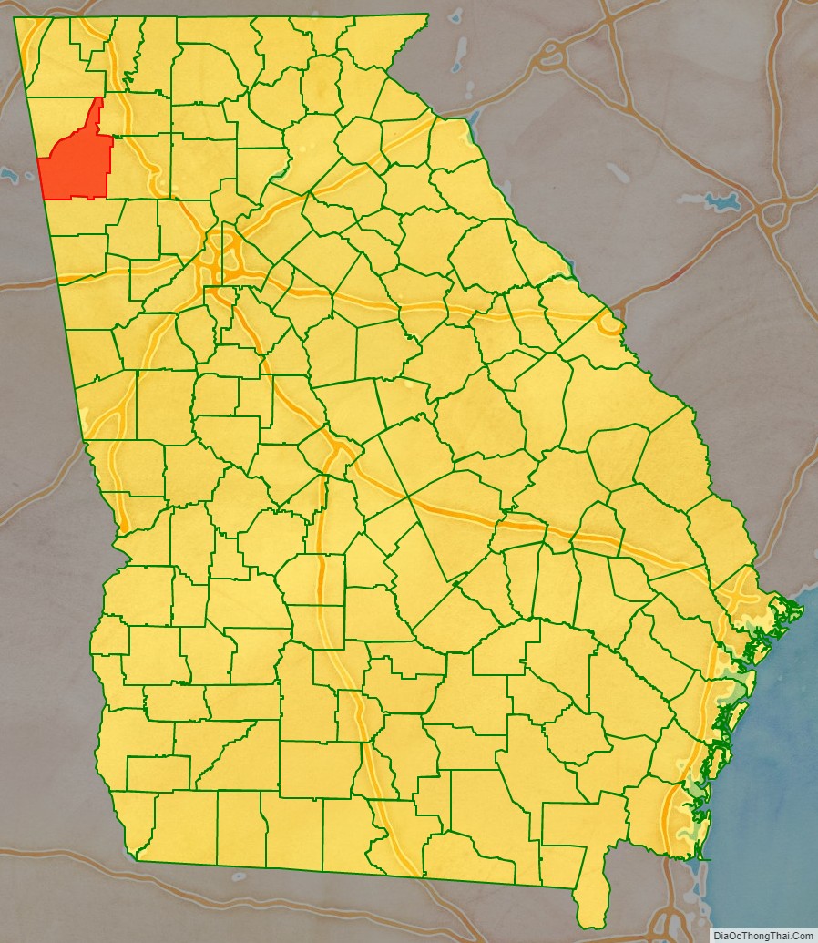
Floyd County is a county located in the northwestern part of the U.S. state of Georgia. As of the 2020 United States Census, the population was 98,584. The county seat is Rome.
Floyd County comprises the Rome, GA metropolitan statistical area.
| Name: | Floyd County |
|---|---|
| FIPS code: | 13-115 |
| State: | Georgia |
| Founded: | 1832 |
| Named for: | John Floyd |
| Seat: | Rome |
| Largest city: | Rome |
| Total Area: | 518 sq mi (1,340 km²) |
| Land Area: | 510 sq mi (1,300 km²) |
| Total Population: | 98,584 |
| Time zone: | UTC−5 (Eastern) |
| Summer Time Zone (DST): | UTC−4 (EDT) |
| Website: | www.romefloyd.com |
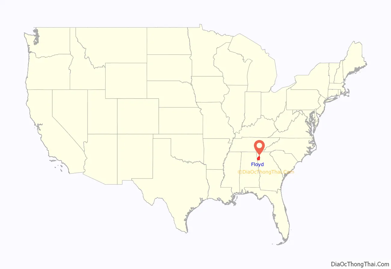
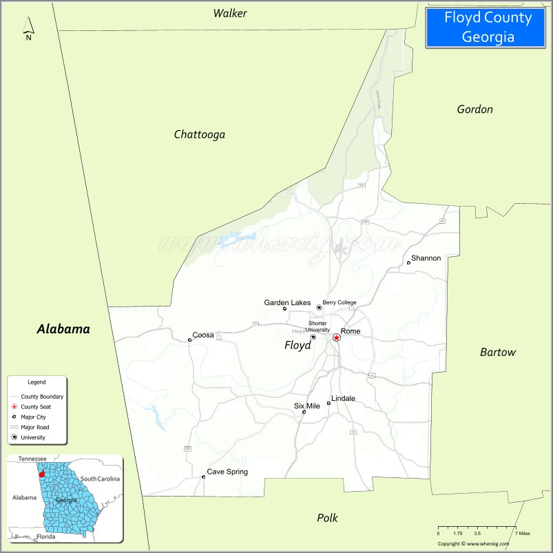
Floyd County location map. Where is Floyd County?
History
The county was established on December 3, 1832, by an act of the Georgia General Assembly, and was created from land that was part of Cherokee County at the time. The county is named after United States Congressman John Floyd.
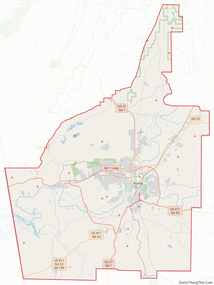
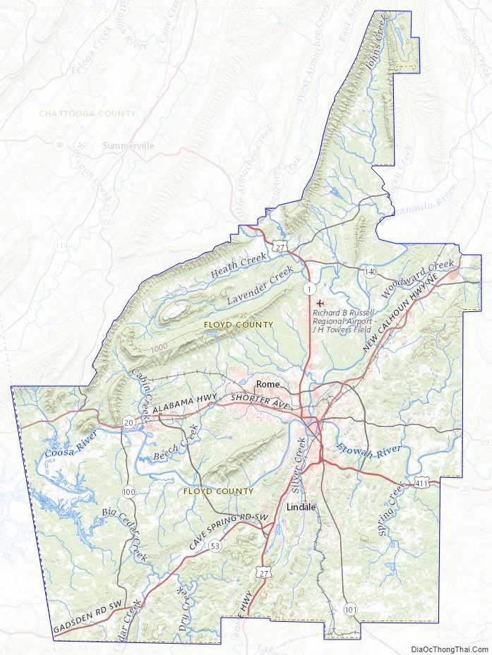
Floyd County Road Map
Geography
According to the U.S. Census Bureau, the county has a total area of 518 square miles (1,340 km), of which 510 sq mi (1,300 km) are land and 8.6 sq mi (22 km) (1.7%) are covered by water.
The northern third of Floyd County is located in the Oostanaula River sub-basin of the ACT River Basin (Coosa-Tallapoosa River Basin). The eastern third of the county is located in the Etowah River sub-basin of the larger ACT River Basin, while the western third of Floyd County is located in the Upper Coosa River sub-basin of the same ACT River Basin.
Lakes and reservoirs
- Antioch Lake
- Lake Conasauga
- DeSoto Lake
- Heath Lake
- Lake Marvin
- Powers Lake
- Weiss Lake
Adjacent counties
- Walker County – north
- Gordon County – northeast
- Bartow County – east
- Polk County – south
- Cherokee County, Alabama – west (CST)
- Chattooga County – northwest
National protected area
- Chattahoochee National Forest (part)
Floyd County Topographic Map
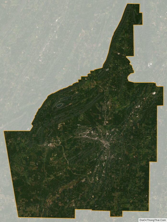
Floyd County Satellite Map
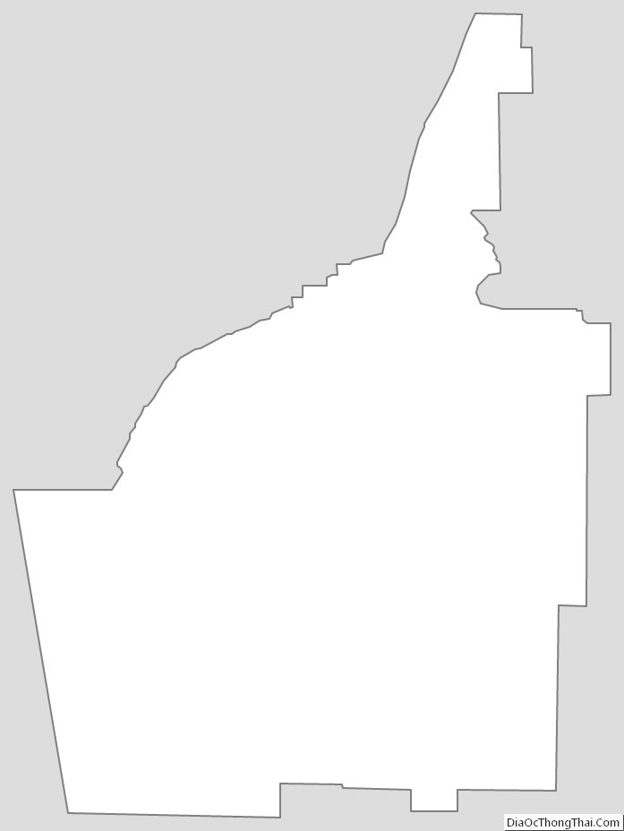
Floyd County Outline Map