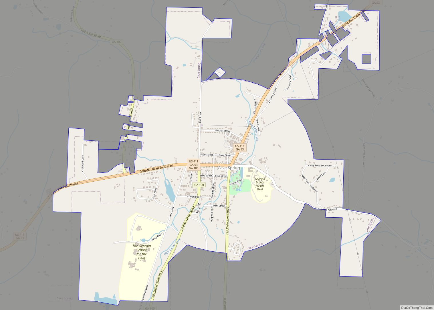
Cave Spring is a city in Floyd County, Georgia, United States. It is located 17 miles (27 km) southwest of Rome, the county seat. The population of Cave Spring was 1,200 at the 2010 census, up from 975 at the 2000 census. It is part of the Rome, Georgia Metropolitan Statistical Area.
The town is named for its natural limestone cave and mineral spring site which serves as the main source of drinking water for nearby communities. The spring flows from the cave into a rock holding pond in Rolater Park and then into a 1.5-acre (6,100 m) swimming pool constructed of stones.
Spring water is piped to local homes and businesses by the public-utility service of Cave Spring. Visitors may also bring jugs to fill at the spring and take home for drinking.
| Name: | Cave Spring city |
|---|---|
| LSAD Code: | 25 |
| LSAD Description: | city (suffix) |
| State: | Georgia |
| County: | Floyd County |
| Elevation: | 640 ft (195 m) |
| Total Area: | 3.68 sq mi (9.54 km²) |
| Land Area: | 3.67 sq mi (9.50 km²) |
| Water Area: | 0.02 sq mi (0.04 km²) |
| Total Population: | 1,174 |
| Population Density: | 320.15/sq mi (123.61/km²) |
| ZIP code: | 30124 |
| Area code: | 706/762 |
| FIPS code: | 1314108 |
| GNISfeature ID: | 0355041 |
| Website: | www.cityofcavespring.com |
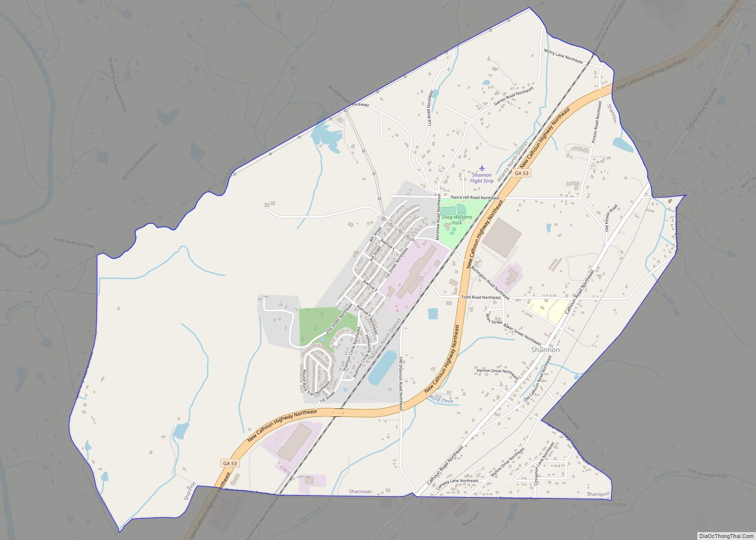
Online Interactive Map
Click on ![]() to view map in "full screen" mode.
to view map in "full screen" mode.
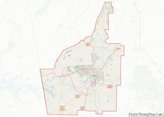
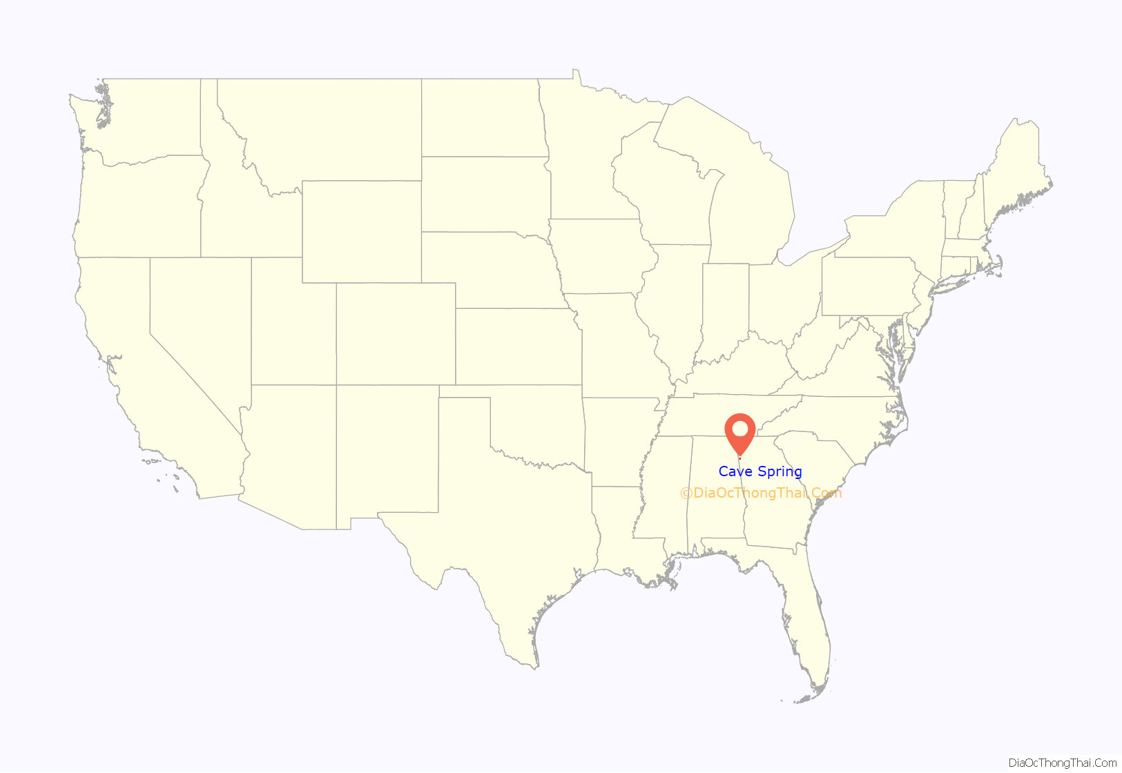
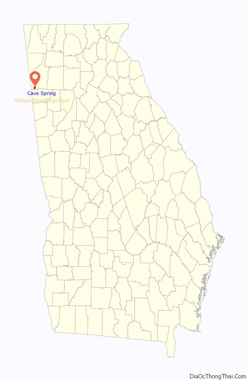
Cave Spring location map. Where is Cave Spring city?
History
The town of Cave Spring dates to 1832, but the community is much older. Historically, indigenous peoples of the area (both Cherokee and the earlier Mississippian culture) used the site for drinking water, tribal meetings, and games, according to legend.
The town was founded in 1832 by Baptists who were among its early settlers. It takes its name from a clear water spring which still serves as the main source of drinking water for Cave Spring and nearby communities. The water is now delivered by a modern pumping system and has won awards for purity and taste.
The spring flows from its source inside the cave into a small rock pool or open reservoir, separated from a larger duck pond. Both ponds are located just outside the cave entrance, which is fronted by a man-made rock wall. These improvements were added as part of Rolater Park, named in 1921.
The wall encloses a lobby leading to the natural cave entrance, which widens to a larger cavity. The cave features limestone formations; one, a large stalagmite, is named the Devil’s Stool. There is also a manmade staircase inside the cave for those who want to view the formations from above.
The park site was formerly used by educational institutions such as Cave Spring Manual Labor School (renamed Hearn Academy) and others including Georgia School for the Deaf. During the Atlanta Campaign of the Civil War in 1864, both Confederate and Union troops came to Cave Spring for hospitalization and rest.
Cave Spring has historic homes and buildings from its early years, such as the 1867 Presbyterian Church, 1880 train depot, and 19th century hotels and boarding houses.
Cave Spring Road Map

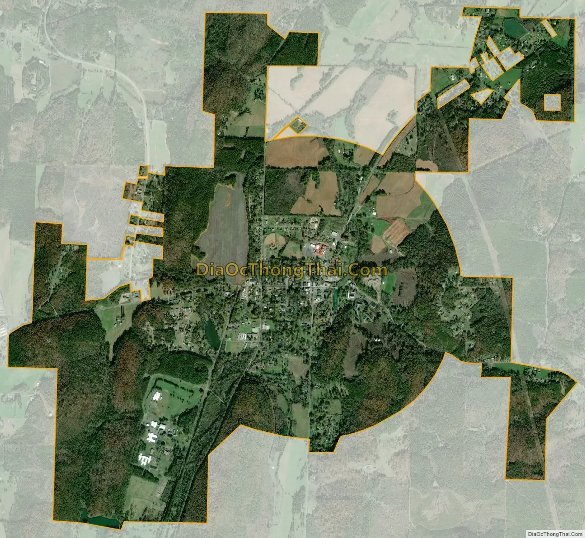
Cave Spring city Satellite Map
Geography
Cave Spring is located in southwestern Floyd County at 34°6′32″N 85°20′10″W / 34.10889°N 85.33611°W / 34.10889; -85.33611 (34.108912, -85.336018). U.S. Route 411 passes through the city, leading northeast 17 miles (27 km) to Rome and west 46 miles (74 km) to Gadsden, Alabama. The Alabama border is 5 miles (8 km) west of Cave Spring. Georgia State Route 100 leads north from Cave Spring 12 miles (19 km) to Coosa and southeast 11 miles (18 km) to Cedartown.
According to the United States Census Bureau, the city of Cave Spring has a total area of 4.1 square miles (10.5 km), of which 0.02 square miles (0.04 km), or 0.36%, is water.
See also
Map of Georgia State and its subdivision:- Appling
- Atkinson
- Bacon
- Baker
- Baldwin
- Banks
- Barrow
- Bartow
- Ben Hill
- Berrien
- Bibb
- Bleckley
- Brantley
- Brooks
- Bryan
- Bulloch
- Burke
- Butts
- Calhoun
- Camden
- Candler
- Carroll
- Catoosa
- Charlton
- Chatham
- Chattahoochee
- Chattooga
- Cherokee
- Clarke
- Clay
- Clayton
- Clinch
- Cobb
- Coffee
- Colquitt
- Columbia
- Cook
- Coweta
- Crawford
- Crisp
- Dade
- Dawson
- Decatur
- DeKalb
- Dodge
- Dooly
- Dougherty
- Douglas
- Early
- Echols
- Effingham
- Elbert
- Emanuel
- Evans
- Fannin
- Fayette
- Floyd
- Forsyth
- Franklin
- Fulton
- Gilmer
- Glascock
- Glynn
- Gordon
- Grady
- Greene
- Gwinnett
- Habersham
- Hall
- Hancock
- Haralson
- Harris
- Hart
- Heard
- Henry
- Houston
- Irwin
- Jackson
- Jasper
- Jeff Davis
- Jefferson
- Jenkins
- Johnson
- Jones
- Lamar
- Lanier
- Laurens
- Lee
- Liberty
- Lincoln
- Long
- Lowndes
- Lumpkin
- Macon
- Madison
- Marion
- McDuffie
- McIntosh
- Meriwether
- Miller
- Mitchell
- Monroe
- Montgomery
- Morgan
- Murray
- Muscogee
- Newton
- Oconee
- Oglethorpe
- Paulding
- Peach
- Pickens
- Pierce
- Pike
- Polk
- Pulaski
- Putnam
- Quitman
- Rabun
- Randolph
- Richmond
- Rockdale
- Schley
- Screven
- Seminole
- Spalding
- Stephens
- Stewart
- Sumter
- Talbot
- Taliaferro
- Tattnall
- Taylor
- Telfair
- Terrell
- Thomas
- Tift
- Toombs
- Towns
- Treutlen
- Troup
- Turner
- Twiggs
- Union
- Upson
- Walker
- Walton
- Ware
- Warren
- Washington
- Wayne
- Webster
- Wheeler
- White
- Whitfield
- Wilcox
- Wilkes
- Wilkinson
- Worth
- Alabama
- Alaska
- Arizona
- Arkansas
- California
- Colorado
- Connecticut
- Delaware
- District of Columbia
- Florida
- Georgia
- Hawaii
- Idaho
- Illinois
- Indiana
- Iowa
- Kansas
- Kentucky
- Louisiana
- Maine
- Maryland
- Massachusetts
- Michigan
- Minnesota
- Mississippi
- Missouri
- Montana
- Nebraska
- Nevada
- New Hampshire
- New Jersey
- New Mexico
- New York
- North Carolina
- North Dakota
- Ohio
- Oklahoma
- Oregon
- Pennsylvania
- Rhode Island
- South Carolina
- South Dakota
- Tennessee
- Texas
- Utah
- Vermont
- Virginia
- Washington
- West Virginia
- Wisconsin
- Wyoming