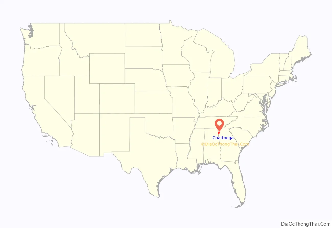
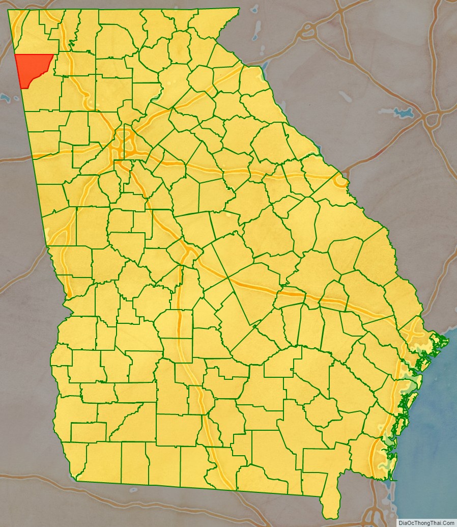
Chattooga County is a county located in the northwestern part of the U.S. state of Georgia. As of the 2020 census, the population was 24,965. The county seat is Summerville. The county was created on December 28, 1838.
Chattooga County comprises the Summerville, GA Micropolitan Statistical Area, which is included in the Rome-Summerville Combined Statistical Area.
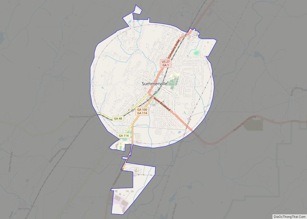
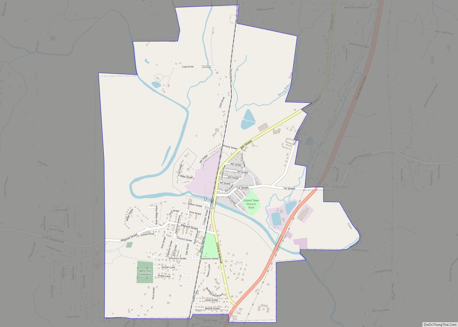
Summerville is the site of the Chattooga County Courthouse. The county is home to several properties listed on the National Register of Historic Places.
| Name: | Chattooga County |
|---|---|
| FIPS code: | 13-055 |
| State: | Georgia |
| Founded: | 1838 |
| Named for: | Chattooga River (Alabama-Georgia) |
| Seat: | Summerville |
| Largest city: | Summerville |
| Total Area: | 314 sq mi (810 km²) |
| Land Area: | 313 sq mi (810 km²) |
| Total Population: | 24,965 |
| Population Density: | 80/sq mi (30/km²) |
| Time zone: | UTC−5 (Eastern) |
| Summer Time Zone (DST): | UTC−4 (EDT) |
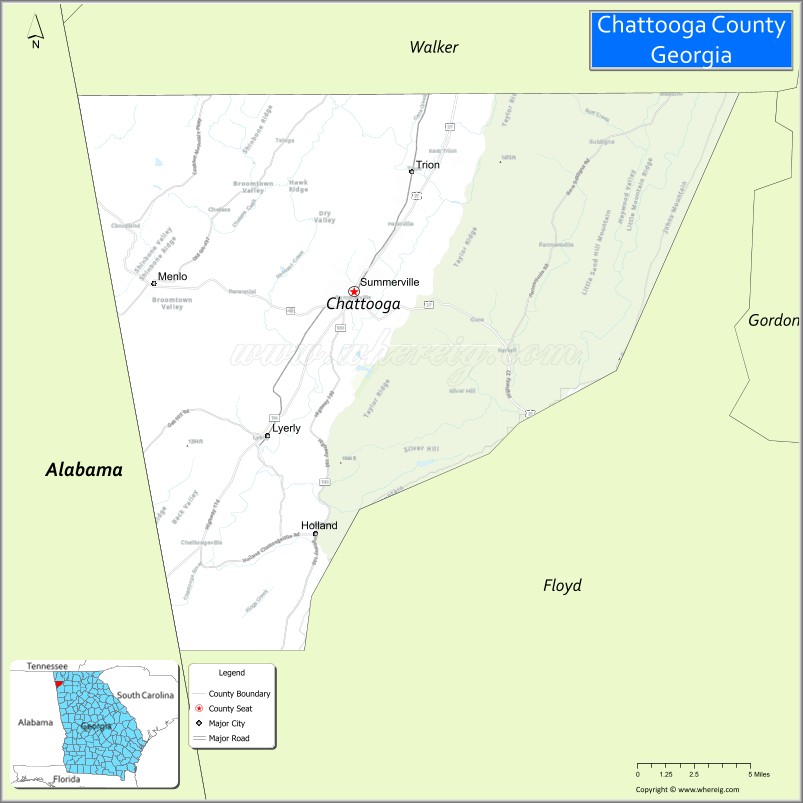
Chattooga County location map. Where is Chattooga County?
History
Chattooga County is named for the Chattooga River, which flows through it. It was originally settled by the “mound builder” culture. A few small mounds can be found throughout the Alpine and Menlo areas. Sometime in the pre-European settlement era, the county was settled by at first the Creek Native Americans and later the Cherokee Native Americans. The principal Cherokee towns in Chattooga were Rivertown (Trion) and Broomtown in Shinbone valley. With the onset of European settlers and after gold was discovered in northern Georgia, the federal government forcibly removed the Cherokees to Oklahoma from Chattooga County in the early 1830s in what has become known as “the Trail of Tears.” In this removal, thousands of Native Americans died from sickness, hunger and abuse. The land was then divided amongst white settlers in the Cherokee Land Lottery of 1832. The Lottery transformed Chattooga into a thriving agricultural area in the antebellum South with farms of varying size dotting the fertile landscape of the Chattooga Valley.
The coming of the American Civil War saw Chattoogans polarized into pro and anti-union camps. Confederate armies received five regiments from Chattooga. Several engagements were fought in the county prior to the battle of Chickamauga. General Nathan Bedford Forrest fought an engagement near Alpine with Federal cavalry resulting in the Federals being thrown back to the Chattanooga area. The largest single engagement in Chattooga was the “Battle of Trion Factory,” fought on Sept. 15th, 1863 on present day First Street near the site of the East Trion Church of God. Confederate Infantry forces under the command of General Benjamin Hardin Helm and cavalry under the command of Gen. Joseph Wheeler defeated Union forces in a running battle that started somewhere near Summerville and ended in Trion. The front section of the Old Trion Cemetery on First Street contains the remains of fifty-five Union soldiers and seven Confederates killed in this action, but the graves are unmarked.
The 1860 county census shows population of 7,165, 28.7 percent of whom were enslaved.
In September 2009, the Chattooga County Camp 507, Sons of Confederate Veterans in conjunction with the Missionary Ridge Camp 63 Sons of Union Veterans, and several local groups erected a memorial monument to remember the “First Battle of Trion Factory” and the soldiers who are buried in unmarked graves at Trion.
In an interesting side note, Confederate General Helm was a brother-in-law to Mary Lincoln and was killed five days after the Battle of Trion Factory on Sept. 19th at the Battle of Chickamauga in Walker County, GA
The coming of Sherman
After the fall of Atlanta, Confederate General John Bell Hood led his Army of Tennessee from the Atlanta battleground to the north and west, in an attempt to lead General William Tecumseh Sherman’s Army of the Cumberland away from Atlanta and out of Georgia. Sherman left a detachment in Atlanta while he took the remainder of his army in pursuit of Hood and the Confederates. Hood’s army passed through Chattooga County in September 1864 en route to Gaylesville, Alabama.
General Sherman reportedly stated, upon first seeing the Chattooga Valley from atop Taylors Ridge, that it “is a good fertile valley suitable for agriculture.” Upon reaching Summerville, Sherman was informed of a Confederate training camp several miles up the river from town. He proceeded north about two miles and “fired a few shots at the retreating rear guard” of the Confederate force. Reportedly, every road leading out of Chattooga to the west was filled with retreating Confederate soldiers. Sherman telegraphed General Henry Halleck and President Abraham Lincoln from Summerville, to outline his plan for the “March to the Sea,” making Chattooga County the birthplace of his march.
Chattooga County Road Map
Geography
According to the U.S. Census Bureau, the county has a total area of 314 square miles (810 km), of which 313 square miles (810 km) is land and 0.2 square miles (0.52 km) (0.07%) is water.
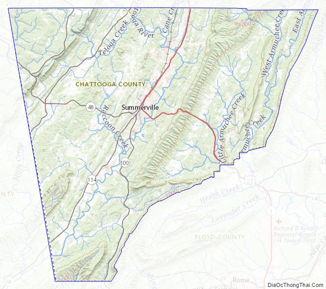
The eastern third of Chattooga County is located in the Oostanaula River sub-basin of the ACT River Basin (Coosa-Tallapoosa River Basin), while the western two-thirds of the county is located in the Upper Coosa River sub-basin of the same ACT River Basin.
Major highways
- U.S. Route 27
- State Route 1
- State Route 48
- State Route 100
- State Route 114
- State Route 157
- State Route 337
Adjacent counties
- Walker County – north
- Floyd County – southeast
- Cherokee County, Alabama – west (CST)
- DeKalb County, Alabama – west (CST)
National protected area
- Chattahoochee National Forest (part)
Chattooga County Topographic Map
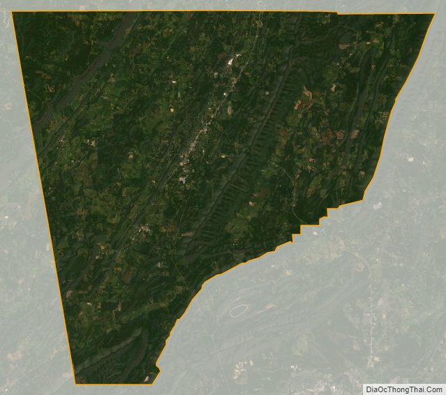
Chattooga County Satellite Map
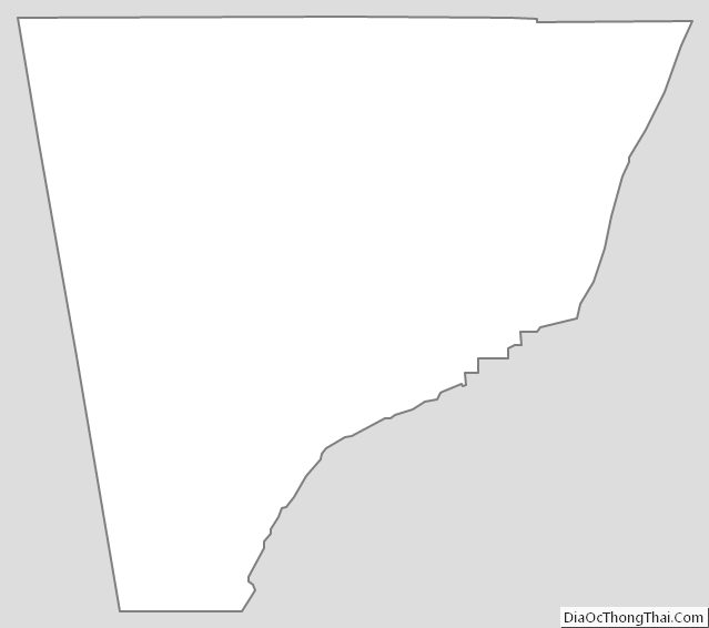
Chattooga County Outline Map