| Name: | Garza County |
|---|---|
| FIPS code: | 48-169 |
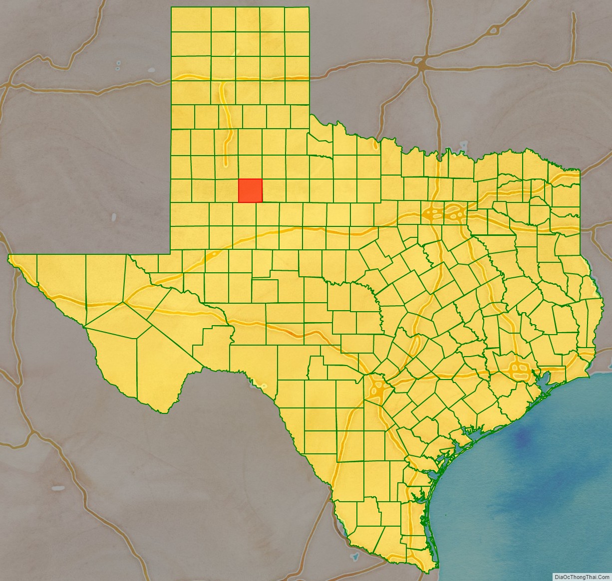
| State: | Texas |
| Founded: | 1907 |
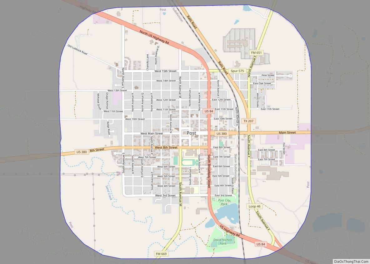
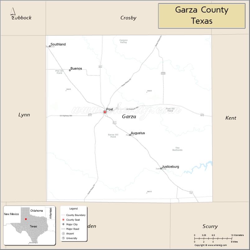
| Seat: | Post |
| Largest city: | Post |
| Total Area: | 896 sq mi (2,320 km²) |
| Land Area: | 893 sq mi (2,310 km²) |
| Total Population: | 5,816 |
| Population Density: | 6.5/sq mi (2.5/km²) |
| Time zone: | UTC−6 (Central) |
| Summer Time Zone (DST): | UTC−5 (CDT) |
| Website: | www.garzacounty.net/index.html |
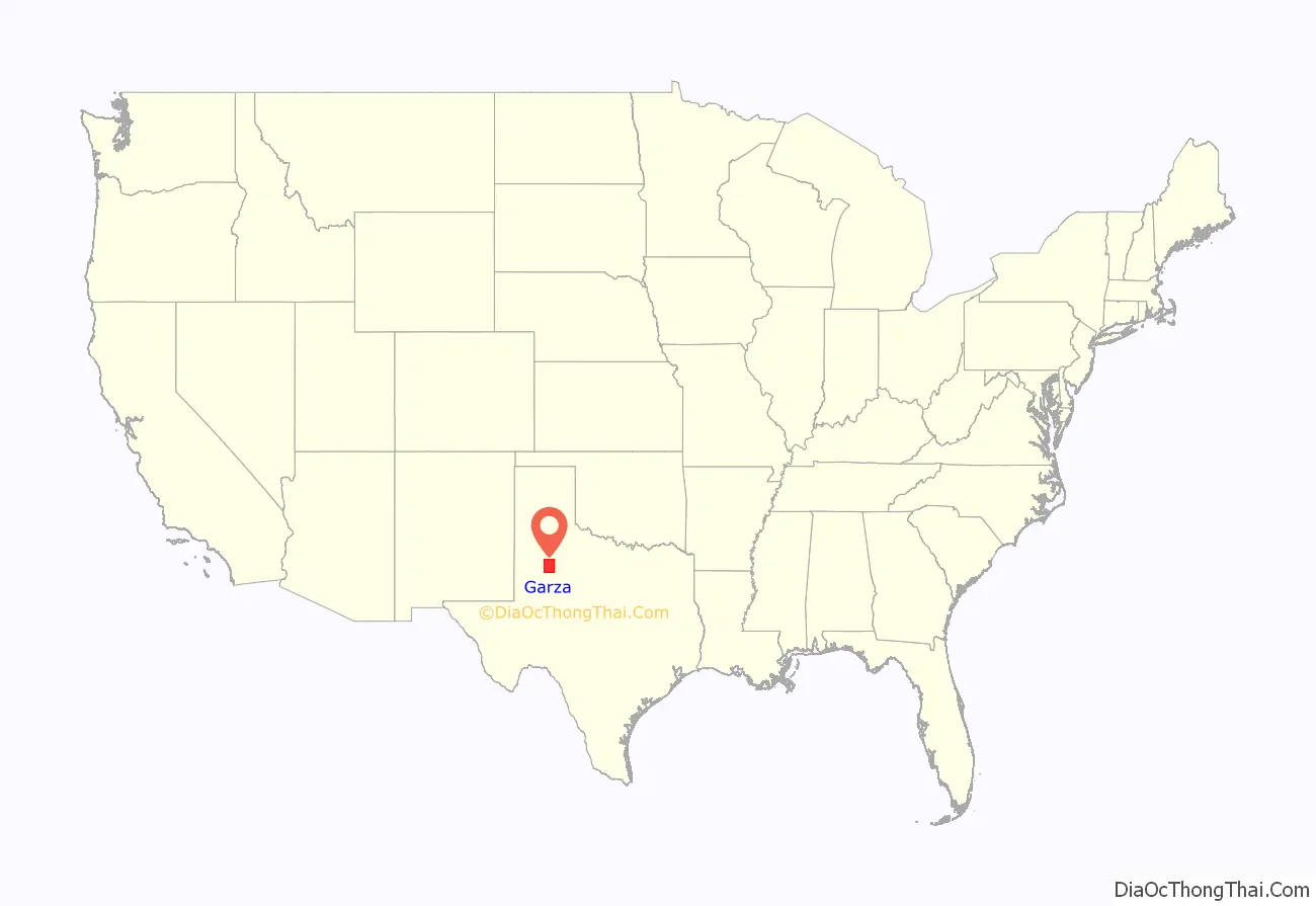
Garza County location map. Where is Garza County?
History
Indigenous peoples of the Americas were the first inhabitants of the area, with evidence from around 2000 BC. Later inhabitants were the Kiowa and Comanche.
In 1875, W. C. Young of Fort Worth and Irishman Ben Galbraith of Illinois established the beginnings of the Curry Comb Ranch in the northwestern part of Garza County.
Garza County was formed in 1876 from Bexar County, and named for the prominent Bexar County family of José Antonio de la Garza.
By 1880, the county census count was 36 people. The Square and Compass Ranch was started 2 years later by the Nave and McCord Cattle Company. They put up the first barbed-wire fence in 1884. That same year, OS Ranch was founded by brothers Andrew J. and Frank M. Long of Lexington, Kentucky. The county’s population reached 185 persons by the last year of the 19th century. Post was founded in 1907 as a utopian venture by, and named for, cereal king C.W. Post. From 1909 to 1913, C.W. Post built a cotton gin and a cotton mill, and attempted to improve agriculture production through rainmaking, involving the heavy use of explosives fired from kites and towers along the rim of the Caprock Escarpment.
In 1926, oil was discovered in the county. Quanah and Bryan Maxey discovered a 16-foot-long tusk of a prehistoric imperial mammoth in 1934. This tusk is currently located in the American Museum of Natural History, New York City.
In 1957, a prehistoric Indian site was recorded at Cowhead Mesa by Emmet Shedd of Post. In 1960–1965, South Plains Archaeological Society excavations of Cowhead Mesa found artifacts to date inhabitation back to 2000 BC.
The most important businesses in the county by 1980 were agribusiness, oil and gas extraction, and textile mills.
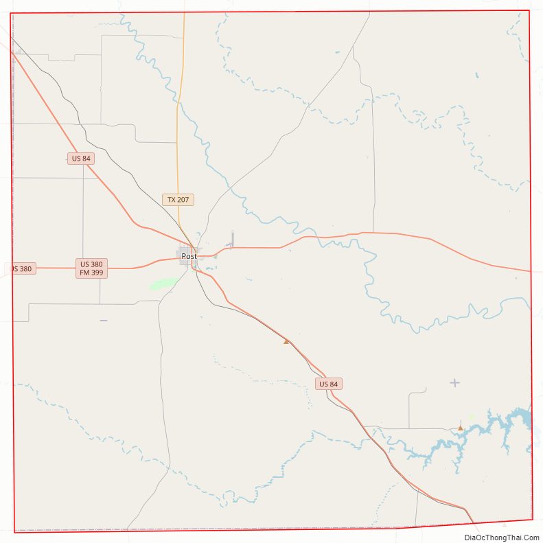
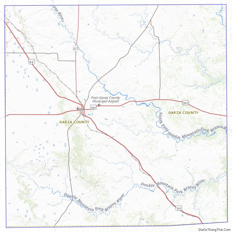
Garza County Road Map
Geography
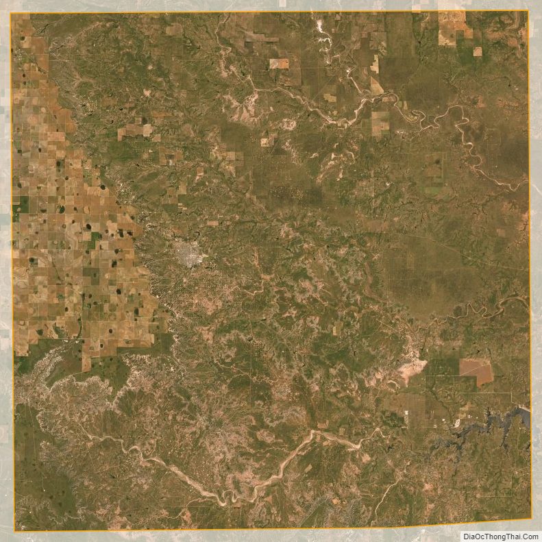
According to the U.S. Census Bureau, the county has a total area of 896 sq mi (2,320 km), of which 893 sq mi (2,310 km) are land and 2.8 sq mi (7.3 km) (0.3%) are covered by water. It is located southeast of Lubbock in the Canyonlands of the Llano Estacado Escarpment.
Major roads and highways
- U.S. Highway 84
- U.S. Highway 380
- State Highway 207
- Farm to Market Road 669
Adjacent counties
- Crosby County (north)
- Dickens County (northeast)
- Kent County (east)
- Scurry County (southeast)
- Borden County (south)
- Lynn County (west)
- Lubbock County (northwest)
Garza County Topographic Map
Garza County Satellite Map
Garza County Outline Map