Post is a city in and the county seat of Garza County, Texas, United States. Its population was 5,376 at the 2010 census.
| Name: | Post city |
|---|---|
| LSAD Code: | 25 |
| LSAD Description: | city (suffix) |
| State: | Texas |
| County: | Garza County |
| Elevation: | 2,605 ft (794 m) |
| Total Area: | 3.77 sq mi (9.77 km²) |
| Land Area: | 3.75 sq mi (9.70 km²) |
| Water Area: | 0.03 sq mi (0.08 km²) |
| Total Population: | 5,376 |
| Population Density: | 1,365.82/sq mi (527.38/km²) |
| ZIP code: | 79356 |
| Area code: | 806 |
| FIPS code: | 4859012 |
| GNISfeature ID: | 1365627 |
| Website: | www.cityofposttexas.com |
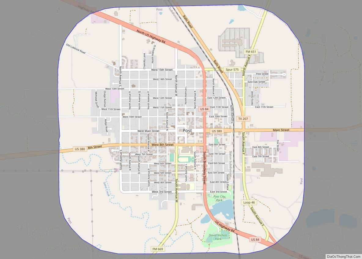
Online Interactive Map
Click on ![]() to view map in "full screen" mode.
to view map in "full screen" mode.
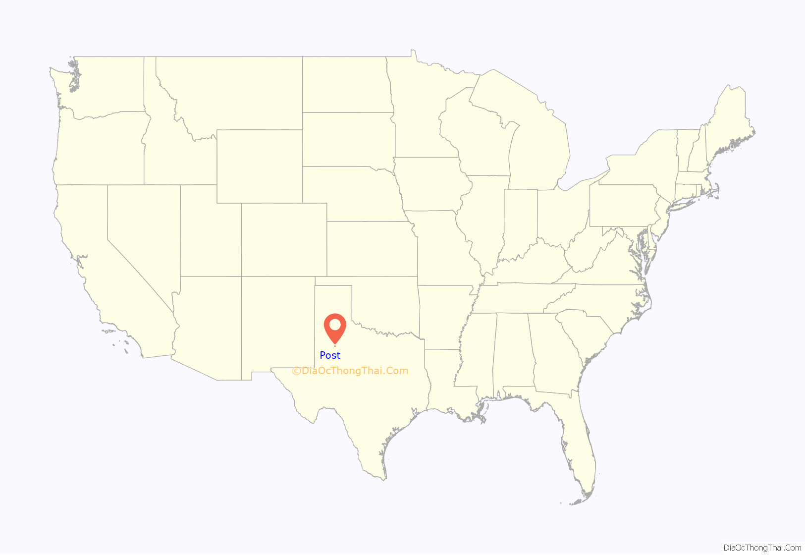
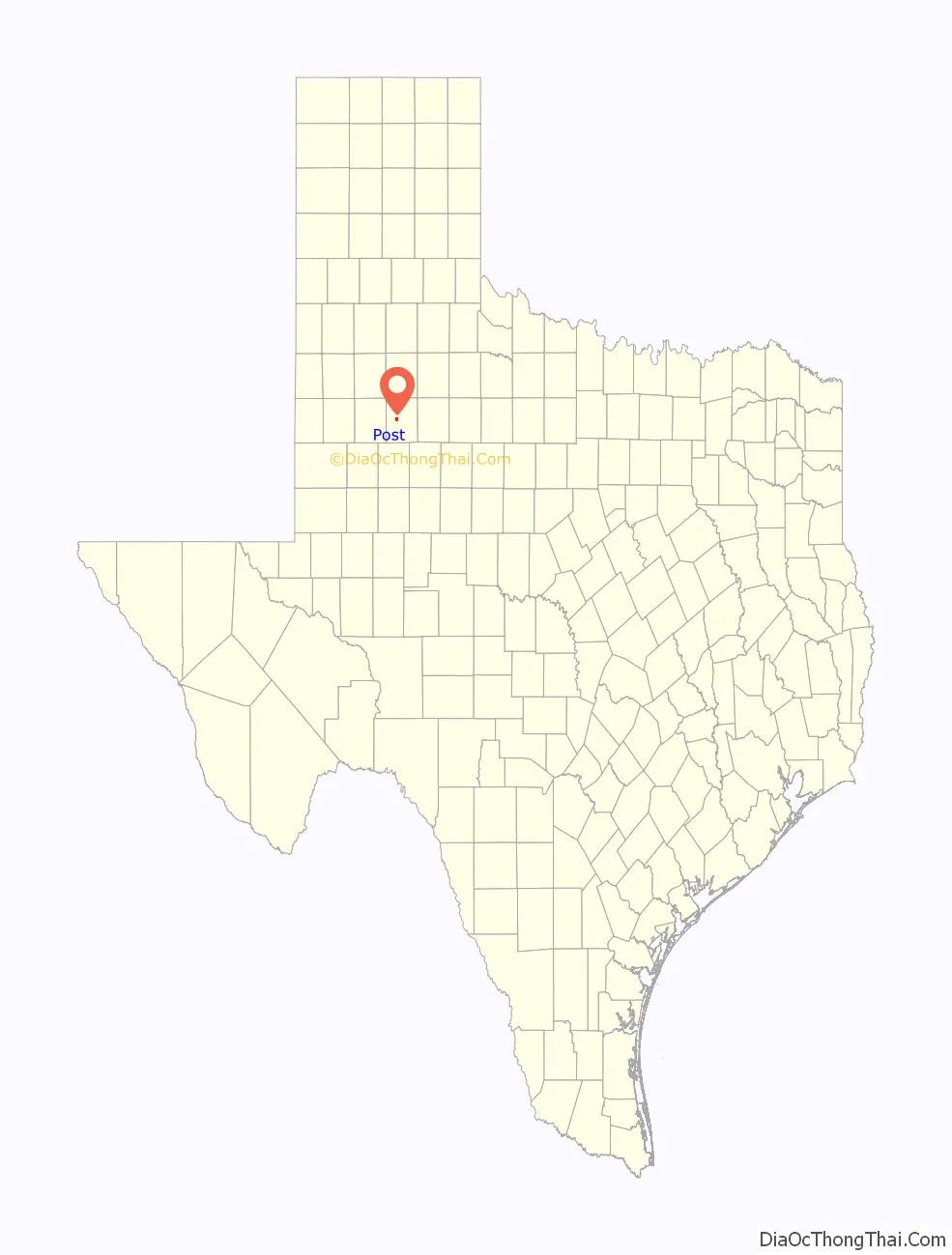
Post location map. Where is Post city?
History
Post is located on the edge of the caprock escarpment of the Llano Estacado, the southeastern edge of the Great Plains. It is at the crossroads of U.S. Routes 84 and 380.
The land belonged to John Bunyan Slaughter, as it was on his U Lazy S Ranch. In 1906, Slaughter sold it to C. W. Post, the breakfast cereal manufacturer, who founded “Post City” as a utopian colonizing venture in 1907. Post devised the community as a model town. He purchased 200,000 acres (810 km) of ranchland and established the Double U Company to manage the town’s construction. The company built trim houses and numerous structures, which included the Algerita Hotel, a gin, and a textile plant. They planted trees along every street and prohibited alcoholic beverages and brothels. The Double U Company rented and sold farms and houses to settlers. A post office began in a tent during the year of Post City’s founding, being established (with the name Post) July 18, 1907, with Frank L. Curtis as first postmaster. Two years later, the town had a school, a bank, and a newspaper, the Post City Post, the same name as the daily in St. Louis, Missouri. The Garza County paper today is called the Post Dispatch. The railroad reached the town in 1910. The town changed its name to “Post” when it incorporated in 1914, the year of C. W. Post’s death. By then, Post had a population of 1000, 10 retail businesses, a dentist, a physician, a sanitarium, and Baptist, Methodist, and Presbyterian churches.
From 1910 to 1913, Post experimented with attempts at rainmaking. Explosives were detonated in the atmosphere at timed intervals. Precipitation records, however, showed that the efforts failed.
The C. W. Post estate pledged $75,000, and the town raised $35,000 in 1916 to bid unsuccessfully to become the site of the proposed West Texas Agricultural and Mechanical College.
Postex Cotton Mills began production in 1913 with 250 employees. When the Post interests sold the business in 1945 to Ely and Walker Dry Goods Company of St. Louis, the plant was producing six million yards of cloth a year and employed 375 workers, who manufactured Postex cotton sheets and Garza pillow cases. Ely and Walker sold Postex in 1955 to Burlington Industries, the world’s largest textile manufacturer at that time. By 1973, the company employed 450 persons. The mill has since closed.
Oilfield service companies have been important to the economy, as have farming and ranching. In 1989, Post had two libraries, a hospital, a nursing home, an airport, the Post Dispatch (founded 1926), and 90 businesses. The population reached 3,400 in 1928, declined to 2,000 in 1940, and increased to 3,100 during the 1950s. With the development of the local oil industry, the town’s population attained its highest level of 4,800 in 1964. The 1980 census showed a population of 3,864, but by 1988, the Texas Almanac reported 4,162. In 1990, the population was 3,768.
Many ranchers and civic boosters live in Garza County, among them Giles McCrary, a former mayor, who until his death in 2011, operated the OS Museum, a hybrid of exhibits from both the American West and Asia, which are changed three times per year. Two baseball fields in Post are named for former resident Norm Cash.
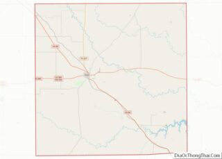
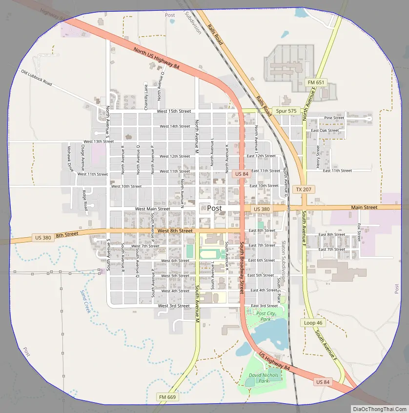
Post Road Map
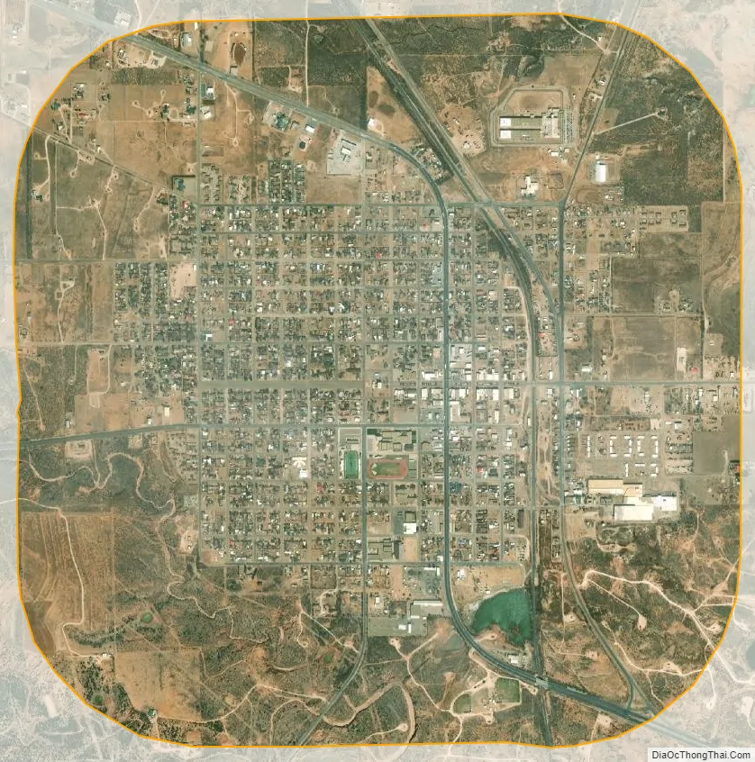
Post city Satellite Map
Geography
Post is located on the rolling plains at the foot of the Llano Estacado at 33°11′30″N 101°22′50″W / 33.19167°N 101.38056°W / 33.19167; -101.38056 (33.191789, –101.380432).
According to the United States Census Bureau, the city has a total area of 3.8 square miles (9.8 km), of which 3.8 square miles (9.8 km) are land and 0.04 square miles (0.10 km) of it (0.53%) is covered by water.
Climate
According to the Köppen climate classification, Post has a semiarid climate. According to other climatic maps, it falls in a subtropical climate (Köppen: Cfa). Surpassing the 100° meridian, it is the city more to the west in the USA with such categorization. In any case, the city suffers influence from both sides, being the transition from a humid to dry environment in the subtropics.
See also
Map of Texas State and its subdivision:- Anderson
- Andrews
- Angelina
- Aransas
- Archer
- Armstrong
- Atascosa
- Austin
- Bailey
- Bandera
- Bastrop
- Baylor
- Bee
- Bell
- Bexar
- Blanco
- Borden
- Bosque
- Bowie
- Brazoria
- Brazos
- Brewster
- Briscoe
- Brooks
- Brown
- Burleson
- Burnet
- Caldwell
- Calhoun
- Callahan
- Cameron
- Camp
- Carson
- Cass
- Castro
- Chambers
- Cherokee
- Childress
- Clay
- Cochran
- Coke
- Coleman
- Collin
- Collingsworth
- Colorado
- Comal
- Comanche
- Concho
- Cooke
- Coryell
- Cottle
- Crane
- Crockett
- Crosby
- Culberson
- Dallam
- Dallas
- Dawson
- Deaf Smith
- Delta
- Denton
- Dewitt
- Dickens
- Dimmit
- Donley
- Duval
- Eastland
- Ector
- Edwards
- El Paso
- Ellis
- Erath
- Falls
- Fannin
- Fayette
- Fisher
- Floyd
- Foard
- Fort Bend
- Franklin
- Freestone
- Frio
- Gaines
- Galveston
- Garza
- Gillespie
- Glasscock
- Goliad
- Gonzales
- Gray
- Grayson
- Gregg
- Grimes
- Guadalupe
- Hale
- Hall
- Hamilton
- Hansford
- Hardeman
- Hardin
- Harris
- Harrison
- Hartley
- Haskell
- Hays
- Hemphill
- Henderson
- Hidalgo
- Hill
- Hockley
- Hood
- Hopkins
- Houston
- Howard
- Hudspeth
- Hunt
- Hutchinson
- Irion
- Jack
- Jackson
- Jasper
- Jeff Davis
- Jefferson
- Jim Hogg
- Jim Wells
- Johnson
- Jones
- Karnes
- Kaufman
- Kendall
- Kenedy
- Kent
- Kerr
- Kimble
- King
- Kinney
- Kleberg
- Knox
- La Salle
- Lamar
- Lamb
- Lampasas
- Lavaca
- Lee
- Leon
- Liberty
- Limestone
- Lipscomb
- Live Oak
- Llano
- Loving
- Lubbock
- Lynn
- Madison
- Marion
- Martin
- Mason
- Matagorda
- Maverick
- McCulloch
- McLennan
- McMullen
- Medina
- Menard
- Midland
- Milam
- Mills
- Mitchell
- Montague
- Montgomery
- Moore
- Morris
- Motley
- Nacogdoches
- Navarro
- Newton
- Nolan
- Nueces
- Ochiltree
- Oldham
- Orange
- Palo Pinto
- Panola
- Parker
- Parmer
- Pecos
- Polk
- Potter
- Presidio
- Rains
- Randall
- Reagan
- Real
- Red River
- Reeves
- Refugio
- Roberts
- Robertson
- Rockwall
- Runnels
- Rusk
- Sabine
- San Augustine
- San Jacinto
- San Patricio
- San Saba
- Schleicher
- Scurry
- Shackelford
- Shelby
- Sherman
- Smith
- Somervell
- Starr
- Stephens
- Sterling
- Stonewall
- Sutton
- Swisher
- Tarrant
- Taylor
- Terrell
- Terry
- Throckmorton
- Titus
- Tom Green
- Travis
- Trinity
- Tyler
- Upshur
- Upton
- Uvalde
- Val Verde
- Van Zandt
- Victoria
- Walker
- Waller
- Ward
- Washington
- Webb
- Wharton
- Wheeler
- Wichita
- Wilbarger
- Willacy
- Williamson
- Wilson
- Winkler
- Wise
- Wood
- Yoakum
- Young
- Zapata
- Zavala
- Alabama
- Alaska
- Arizona
- Arkansas
- California
- Colorado
- Connecticut
- Delaware
- District of Columbia
- Florida
- Georgia
- Hawaii
- Idaho
- Illinois
- Indiana
- Iowa
- Kansas
- Kentucky
- Louisiana
- Maine
- Maryland
- Massachusetts
- Michigan
- Minnesota
- Mississippi
- Missouri
- Montana
- Nebraska
- Nevada
- New Hampshire
- New Jersey
- New Mexico
- New York
- North Carolina
- North Dakota
- Ohio
- Oklahoma
- Oregon
- Pennsylvania
- Rhode Island
- South Carolina
- South Dakota
- Tennessee
- Texas
- Utah
- Vermont
- Virginia
- Washington
- West Virginia
- Wisconsin
- Wyoming