Fort Worth is the fifth-largest city in the U.S. state of Texas and the 13th-largest city in the United States. It is the county seat of Tarrant County, covering nearly 350 square miles (910 km) into four other counties: Denton, Johnson, Parker, and Wise. According to a 2022 United States census estimate, Fort Worth’s population was 958,692. Fort Worth is the second-largest city in the Dallas–Fort Worth–Arlington metropolitan area, which is the fourth most populous metropolitan area in the United States.
The city of Fort Worth was established in 1849 as an army outpost on a bluff overlooking the Trinity River. Fort Worth has historically been a center of the Texas Longhorn cattle trade. It still embraces its Western heritage and traditional architecture and design. USS Fort Worth (LCS-3) is the first ship of the United States Navy named after the city. Nearby Dallas has held a population majority as long as records have been kept, yet Fort Worth has become one of the fastest-growing cities in the United States at the beginning of the 21st century, nearly doubling its population since 2000.
Fort Worth is the location of the Van Cliburn International Piano Competition and several museums designed by contemporary architects. The Kimbell Art Museum was designed by Louis Kahn, with an addition designed by Renzo Piano. The Modern Art Museum of Fort Worth was designed by Tadao Ando. The Amon Carter Museum of American Art, designed by Philip Johnson, houses American art. The Sid Richardson Museum, redesigned by David M. Schwarz, has a collection of Western art in the U.S., emphasizing Frederic Remington and Charles Russell. The Fort Worth Museum of Science and History was designed by Ricardo Legorreta of Mexico.
Fort Worth is the location of several university communities: Texas Christian University, Texas Wesleyan, University of North Texas Health Science Center, and Texas A&M University School of Law. Several multinational corporations, including Bell Textron, American Airlines, BNSF Railway, and Chip 1 Exchange are headquartered in Fort Worth.
| Name: | Fort Worth city |
|---|---|
| LSAD Code: | 25 |
| LSAD Description: | city (suffix) |
| State: | Texas |
| County: | Denton County, Parker County, Tarrant County, Wise County |
| Incorporated: | 1874 |
| Elevation: | 541 ft (165 m) |
| Total Area: | 355.56 sq mi (920.89 km²) |
| Land Area: | 347.27 sq mi (899.44 km²) |
| Water Area: | 8.28 sq mi (21.45 km²) |
| Total Population: | 918,915 |
| Population Density: | 2,600/sq mi (1,000/km²) |
| FIPS code: | 4827000 |
| GNISfeature ID: | 2410531 |
| Website: | www.fortworthtexas.gov |
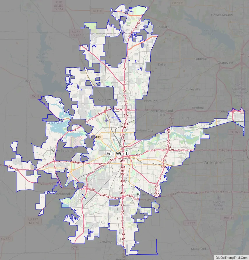
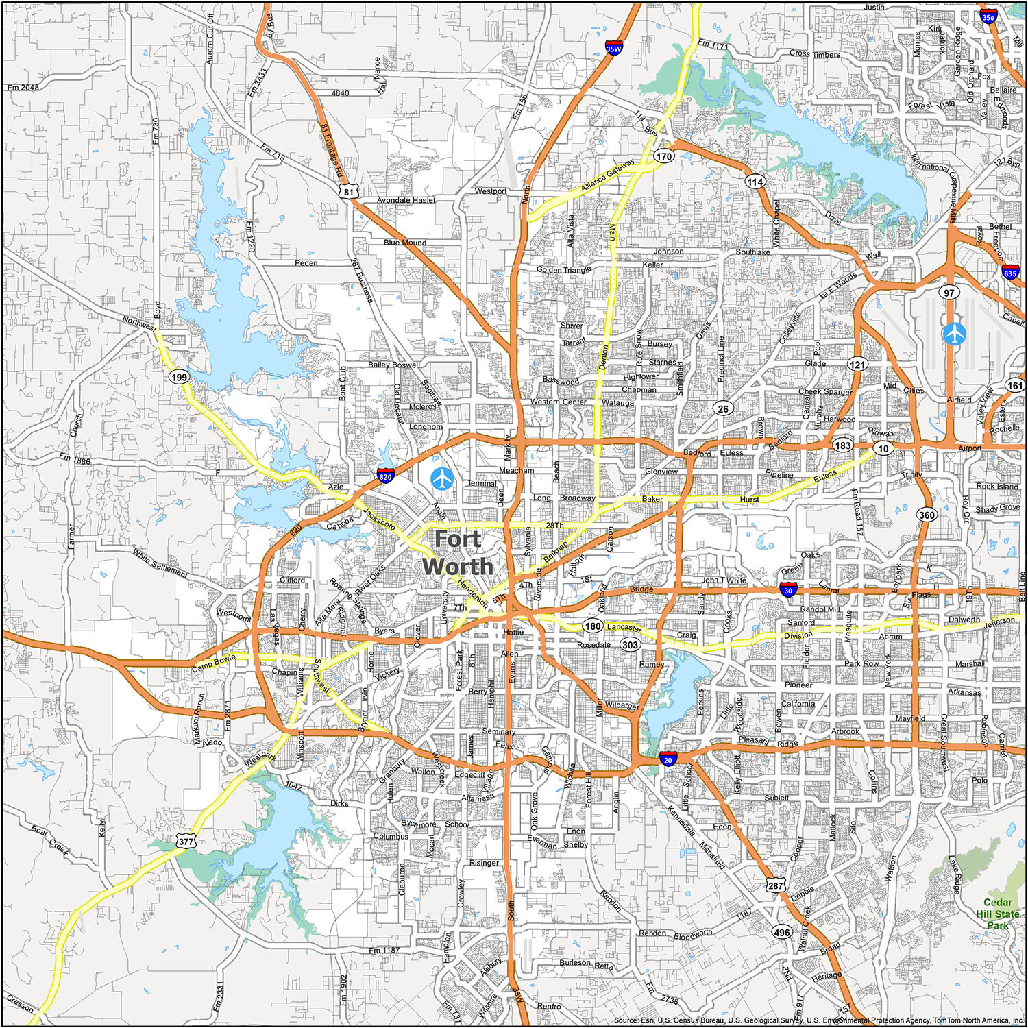
This interactive Fort Worth map will help you explore the city and its surrounding areas, with information about highways, roads, points of interest, and more. You can also find nearby attractions, including the Fort Worth Zoo, the Stockyards, and the Fort Worth Botanic Garden.
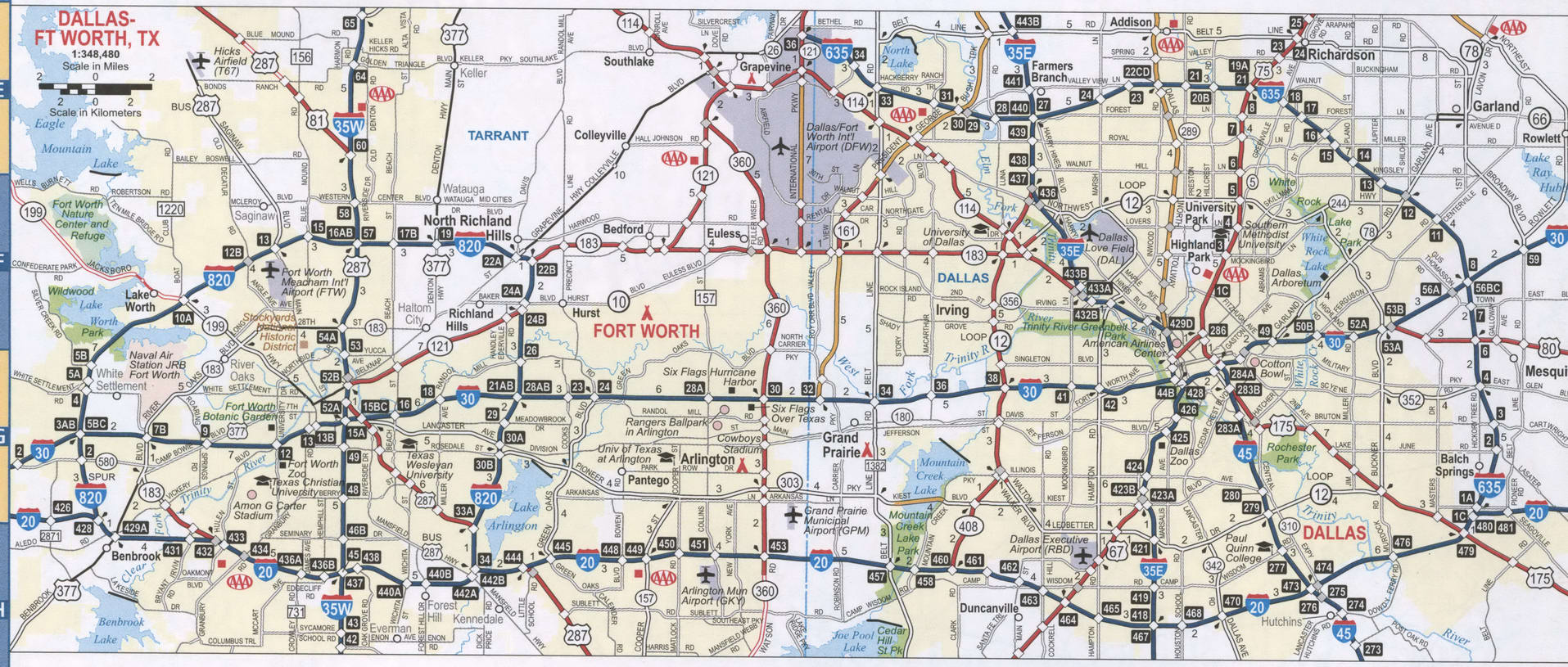
Explore the roads and highways of Fort Worth on this detailed map. It includes the major highways, such as I-30, I-35W, I-35E, and US 287, as well as the main roads and streets in the city.
Use this Fort Worth map to plan your trip around the city, find great restaurants, attractions, and more. Whether you’re visiting for business or pleasure, this map will help you make the most of your time in the city.
Discover the roads, highways, and attractions of Fort Worth, Texas with this interactive map. Explore the city’s main highways, such as I-30, I-35W, I-35E, and US 287, and find the best places to visit, including the Fort Worth Zoo, the Stockyards, and the Fort Worth Botanic Garden.
Online Interactive Map
Click on ![]() to view map in "full screen" mode.
to view map in "full screen" mode.
This map includes all the attractions, hotels, restaurants, and more that you will need to plan your trip. Whether you’re planning a day out or you’re on vacation, this map will help you find your way around. This map is like having an interactive tour of the city which includes museums, sports venues, and lots of shopping. You have everything you need to know so you can get around and have a great time.
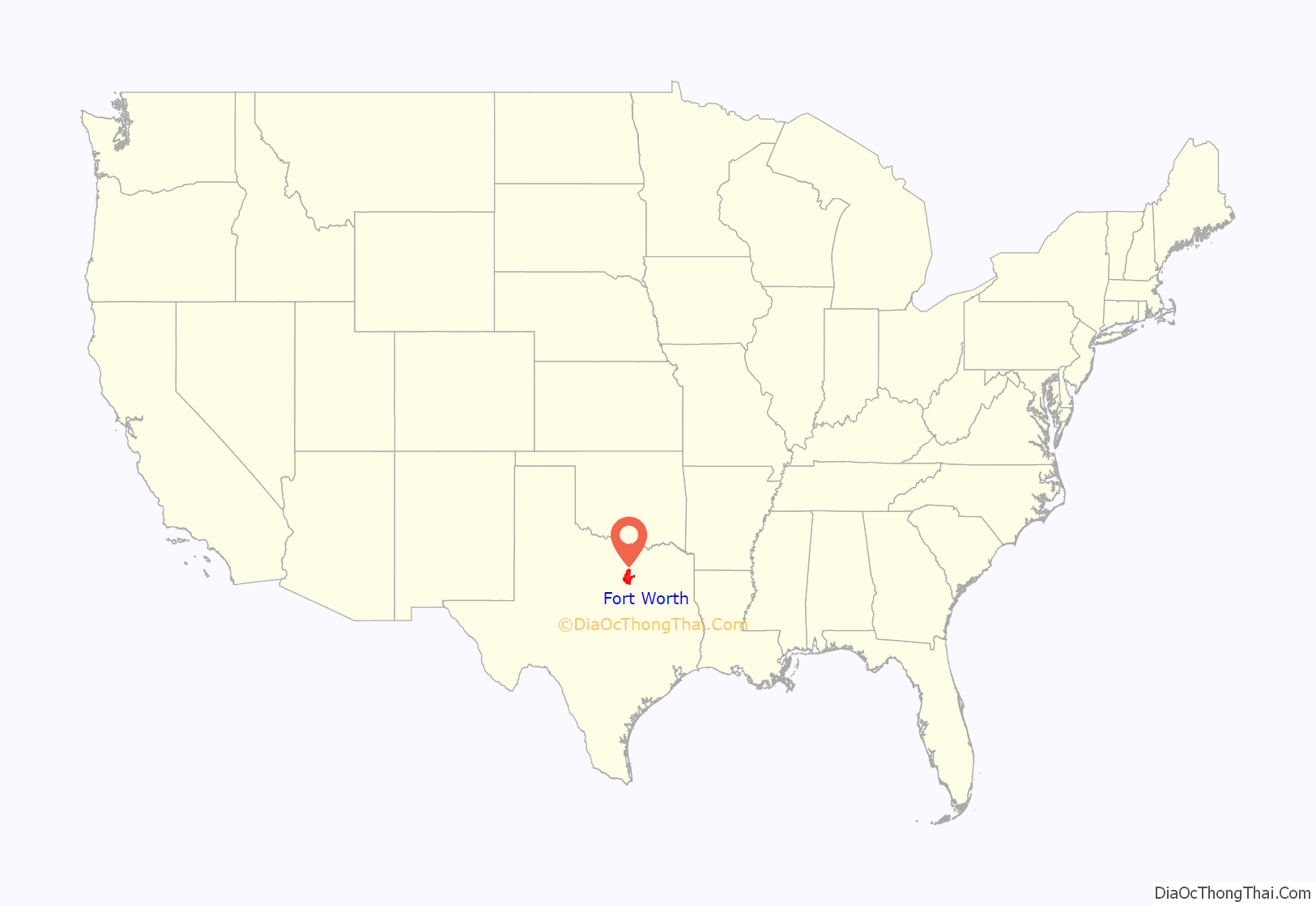
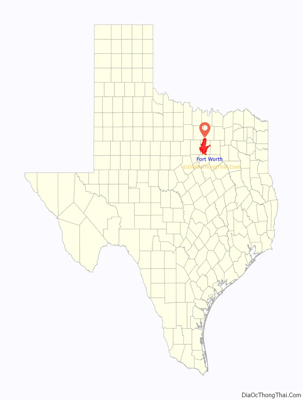
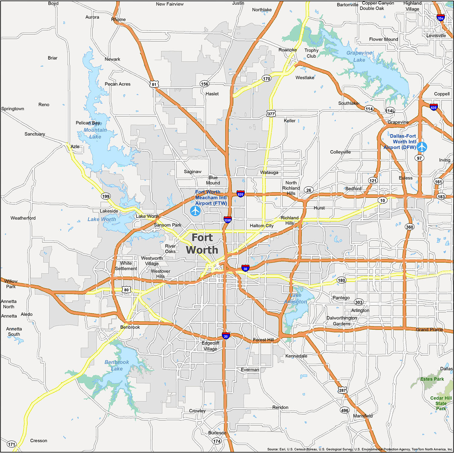
Fort Worth location map. Where is Fort Worth city?
Fort Worth Road Map
If you’re planning a trip to Fort Worth, Texas, you’ll need to know the lay of the land. To help you out, we’ve compiled a comprehensive road map of the city. This map includes all the major interstates, highways, freeways, and parkways, as well as many of the major roads. Now you can know exactly where to go and where to avoid. Plus, if you’re traveling outside Fort Worth, you can download our Texas road map for free.
Fort Worth is an amazing city with so much to offer. From its vibrant culture to its beautiful lakes, parks and neighborhoods, there is something for everyone. With this reference map, you can explore the city and its surrounding areas like never before. Learn about the airports, cities, towns, and census-designated places that make up Fort Worth, Texas. Plan your vacation and get the most out of your trip to Fort Worth with this comprehensive map.
10 things to do in Fort Worth city
Fort Worth, Texas is a city with something for everyone. From art and culture to outdoor recreation and dining, there is plenty to explore. Whether you’re looking for unique experiences or to explore the city’s hidden gems, Fort Worth has something for everyone. Check out our map for some of the most popular and interesting places to visit in the city.
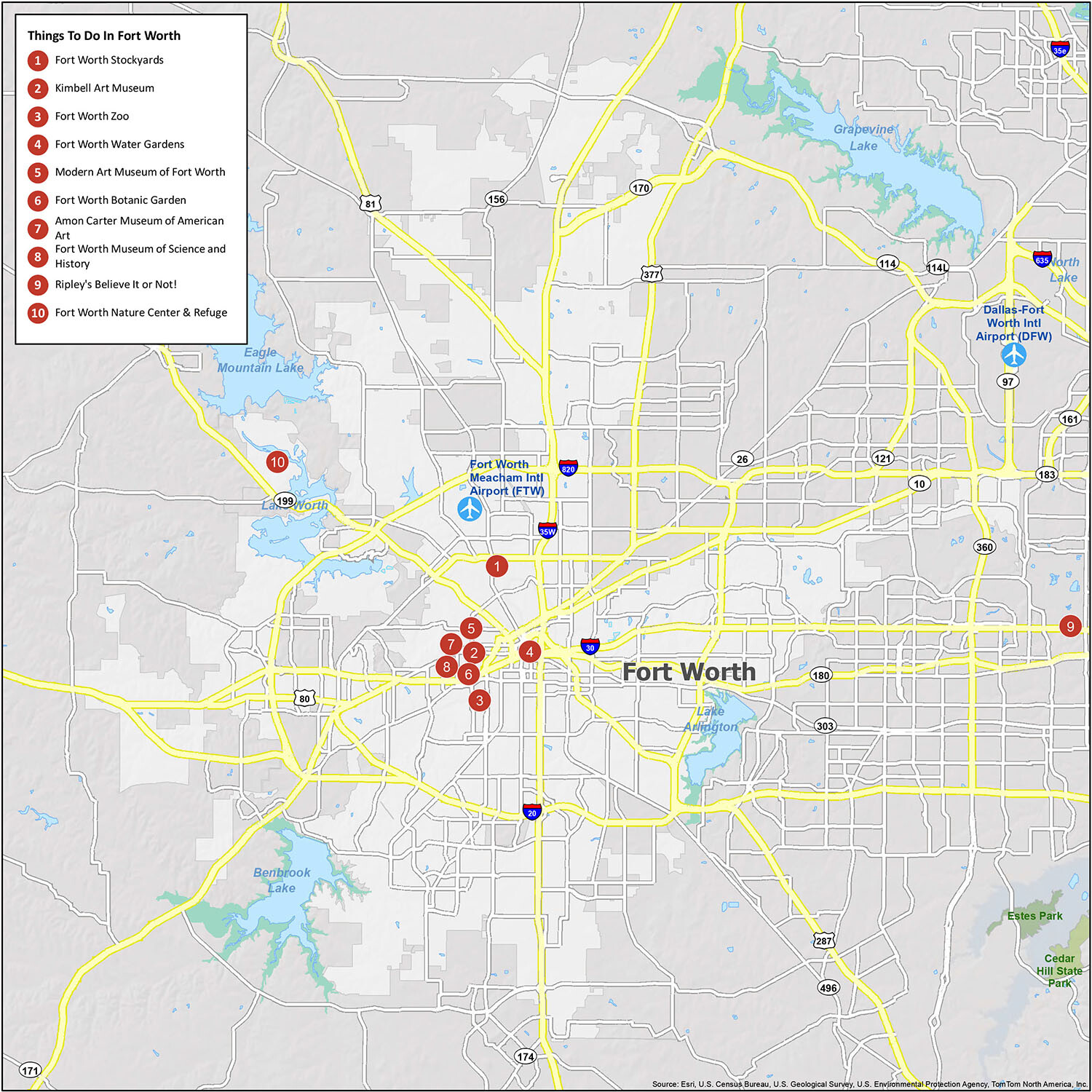
Explore the city of Fort Worth and all it has to offer. From the iconic Fort Worth Stockyards to the Amon Carter Museum of American Art, there are plenty of unique experiences waiting to be discovered. Discover the city’s hidden gems, explore its art and culture, and find out why Fort Worth is a hotbed of activity. Check out our map for some of the most popular and interesting places to visit in the city.
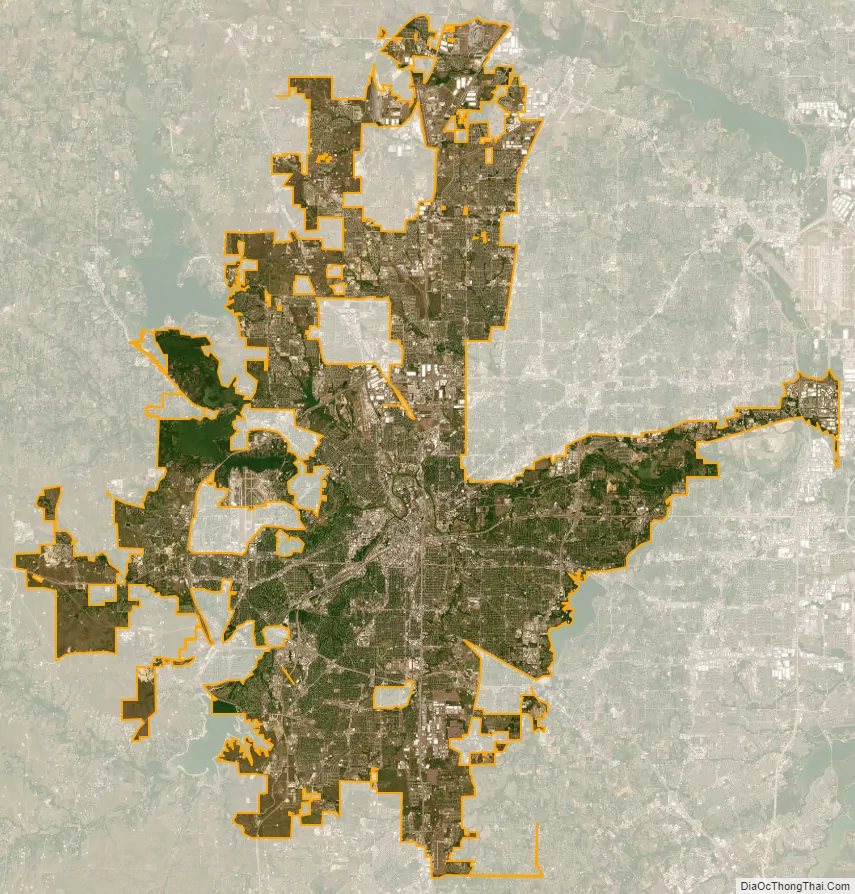
Fort Worth city Satellite Map
Geography
Fort Worth is located in North Texas, and has a generally humid subtropical climate. It is part of the Cross Timbers region; this region is a boundary between the more heavily forested eastern parts and the rolling hills and prairies of the central part. Specifically, the city is part of the Grand Prairie ecoregion within the Cross Timbers. According to the United States Census Bureau, the city has a total area of 349.2 square miles (904 km), of which 342.2 square miles (886 km) are land and 7.0 square miles (18 km) are covered by water. It is a principal city in the Dallas–Fort Worth metroplex, and the second largest.
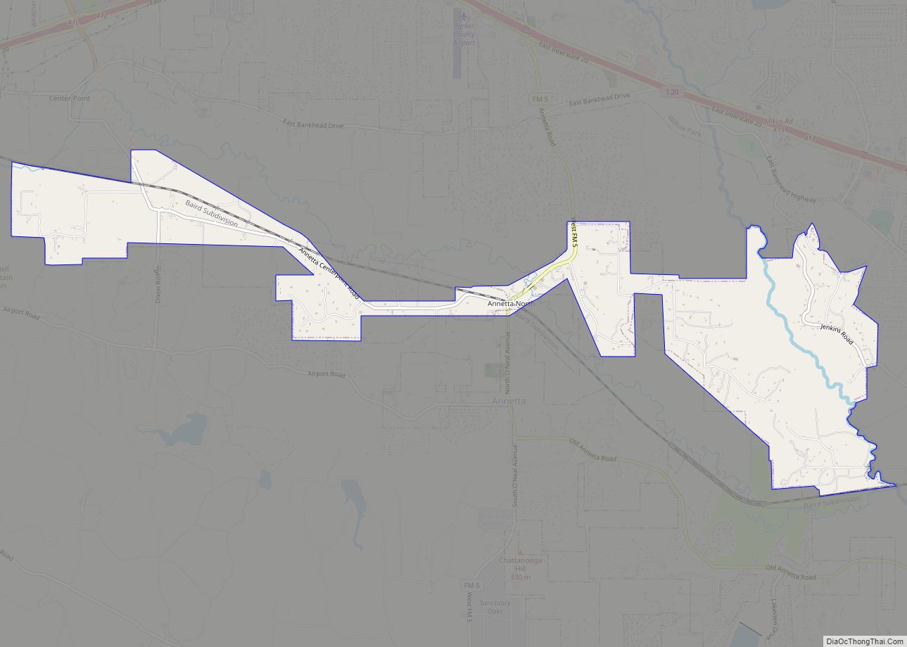
The city of Fort Worth is not entirely contiguous and has several enclaves, practical enclaves, semienclaves, and cities that are otherwise completely or nearly surrounded by it, including: Westworth Village, River Oaks, Saginaw, Blue Mound, Benbrook, Everman, Forest Hill, Edgecliff Village, Westover Hills, White Settlement, Sansom Park, Lake Worth, Lakeside, and Haslet.
Fort Worth contains over 1,000 natural-gas wells (December 2009 count) tapping the Barnett Shale. Each well site is a bare patch of gravel 2–5 acres (8,100–20,200 m) in size. As city ordinances permit them in all zoning categories, including residential, well sites can be found in a variety of locations. Some wells are surrounded by masonry fences, but most are secured by chain link.
A large storage dam was completed in 1914 on the West Fork of the Trinity River, 7 miles (11 km) from the city, with a storage capacity of 33,495 acre feet of water. The lake formed by this dam is known as Lake Worth.
Neighborhoods
The Fort Worth Stockyards are a National Historic District. The Stockyards was once among the largest livestock markets in the United States and played a vital role in the city’s early growth. Today the neighborhood is characterized by its many bars, restaurants, and notable country music venues such as Billy Bob’s. Fort Worth celebrity chef Tim Love of Iron Chef America and Top Chef Masters operates multiple restaurants in the neighborhood.
The Upper West Side is a district on the western end of downtown Fort Worth. It is bound roughly by Henderson Street to the east, the Trinity River to the west, Interstate 30 to the south, and White Settlement Road to the north. The neighborhood contains several small and mid-sized office buildings and urban residences, but very little retail.
Tanglewood consists of land in the low areas along the branch of the Trinity River and is about 5 miles southwest from the Fort Worth central business district. The Tanglewood area lies within two surveys. The western part of the addition is part of the 1854 Felix G. Beasley survey, and the eastern part, along the branch of the river, is the 1876 James Howard survey. The original approach to the Tanglewood area consisted of a two-rut dirt road which is now Bellaire Drive South. Up to the time of development, children enjoyed swimming in the river in a deep hole that was located where the bridge is now on Bellaire Drive South near Trinity Commons Shopping Center. The portions of Tanglewood that are now Bellaire Park Court, Marquette Court, and Autumn Court were originally a dairy farm.
Architecture
Downtown Fort Worth, with its unique rustic architecture, is mainly known for its Art Deco-style buildings. The Tarrant County Courthouse was created in the American Beaux Arts design, which was modeled after the Texas State Capitol building. Most of the structures around Sundance Square have preserved their early 20th-century façades. Multiple blocks surrounding Sundance Square are illuminated at night in Christmas lights year-round, the only city in Texas to do so.
Climate
Fort Worth has a humid subtropical climate (Cfa) according to the Köppen climate classification system and is within USDA hardiness zone 8a. This region features very hot, humid summers and mild to cool winters. The hottest month of the year is August, when the average high temperature is 96 °F (35.6 °C), and overnight low temperatures average 75 °F (23.9 °C), giving an average temperature of 85 °F (29.4 °C). The coldest month of the year is January, when the average high temperature is 56 °F (13.3 °C) and low temperatures average 35 °F (1.7 °C). The average temperature in January is 46 °F (8 °C). The highest temperature ever recorded in Fort Worth is 113 °F (45.0 °C), on June 26, 1980, during the Great 1980 Heat Wave, and June 27, 1980. The coldest temperature ever recorded in Fort Worth was −8 °F (−22.2 °C) on February 12, 1899. Because of its position in North Texas, Fort Worth is very susceptible to supercell thunderstorms, which produce large hail and can produce tornadoes.
The average annual precipitation for Fort Worth is 34.01 inches (863.9 mm). The wettest month of the year is May, when an average of 4.58 inches (116.3 mm) of precipitation falls. The driest month of the year is January, when only 1.70 inches (43.2 mm) of precipitation falls. The driest calendar year since records began has been 1921 with 17.91 inches (454.9 mm) and the wettest 2015 with 62.61 inches (1,590.3 mm). The wettest calendar month has been April 1922 with 17.64 inches (448.1 mm), including 8.56 inches (217.4 mm) on April 25.
The average annual snowfall in Fort Worth is 2.6 inches (66.0 mm). The most snowfall in one month has been 13.5 inches (342.9 mm) in February 1978, and the most in a season 17.6 inches (447.0 mm) in 1977/1978.
The National Weather Service office, which serves the Dallas–Fort Worth metroplex, is based in northeastern Fort Worth.
See also
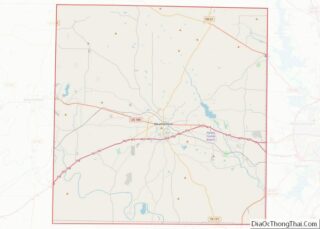
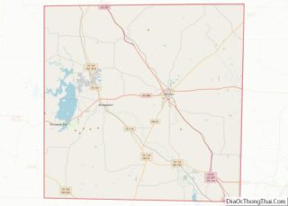
Map of Texas State and its subdivision:- Anderson
- Andrews
- Angelina
- Aransas
- Archer
- Armstrong
- Atascosa
- Austin
- Bailey
- Bandera
- Bastrop
- Baylor
- Bee
- Bell
- Bexar
- Blanco
- Borden
- Bosque
- Bowie
- Brazoria
- Brazos
- Brewster
- Briscoe
- Brooks
- Brown
- Burleson
- Burnet
- Caldwell
- Calhoun
- Callahan
- Cameron
- Camp
- Carson
- Cass
- Castro
- Chambers
- Cherokee
- Childress
- Clay
- Cochran
- Coke
- Coleman
- Collin
- Collingsworth
- Colorado
- Comal
- Comanche
- Concho
- Cooke
- Coryell
- Cottle
- Crane
- Crockett
- Crosby
- Culberson
- Dallam
- Dallas
- Dawson
- Deaf Smith
- Delta
- Denton
- Dewitt
- Dickens
- Dimmit
- Donley
- Duval
- Eastland
- Ector
- Edwards
- El Paso
- Ellis
- Erath
- Falls
- Fannin
- Fayette
- Fisher
- Floyd
- Foard
- Fort Bend
- Franklin
- Freestone
- Frio
- Gaines
- Galveston
- Garza
- Gillespie
- Glasscock
- Goliad
- Gonzales
- Gray
- Grayson
- Gregg
- Grimes
- Guadalupe
- Hale
- Hall
- Hamilton
- Hansford
- Hardeman
- Hardin
- Harris
- Harrison
- Hartley
- Haskell
- Hays
- Hemphill
- Henderson
- Hidalgo
- Hill
- Hockley
- Hood
- Hopkins
- Houston
- Howard
- Hudspeth
- Hunt
- Hutchinson
- Irion
- Jack
- Jackson
- Jasper
- Jeff Davis
- Jefferson
- Jim Hogg
- Jim Wells
- Johnson
- Jones
- Karnes
- Kaufman
- Kendall
- Kenedy
- Kent
- Kerr
- Kimble
- King
- Kinney
- Kleberg
- Knox
- La Salle
- Lamar
- Lamb
- Lampasas
- Lavaca
- Lee
- Leon
- Liberty
- Limestone
- Lipscomb
- Live Oak
- Llano
- Loving
- Lubbock
- Lynn
- Madison
- Marion
- Martin
- Mason
- Matagorda
- Maverick
- McCulloch
- McLennan
- McMullen
- Medina
- Menard
- Midland
- Milam
- Mills
- Mitchell
- Montague
- Montgomery
- Moore
- Morris
- Motley
- Nacogdoches
- Navarro
- Newton
- Nolan
- Nueces
- Ochiltree
- Oldham
- Orange
- Palo Pinto
- Panola
- Parker
- Parmer
- Pecos
- Polk
- Potter
- Presidio
- Rains
- Randall
- Reagan
- Real
- Red River
- Reeves
- Refugio
- Roberts
- Robertson
- Rockwall
- Runnels
- Rusk
- Sabine
- San Augustine
- San Jacinto
- San Patricio
- San Saba
- Schleicher
- Scurry
- Shackelford
- Shelby
- Sherman
- Smith
- Somervell
- Starr
- Stephens
- Sterling
- Stonewall
- Sutton
- Swisher
- Tarrant
- Taylor
- Terrell
- Terry
- Throckmorton
- Titus
- Tom Green
- Travis
- Trinity
- Tyler
- Upshur
- Upton
- Uvalde
- Val Verde
- Van Zandt
- Victoria
- Walker
- Waller
- Ward
- Washington
- Webb
- Wharton
- Wheeler
- Wichita
- Wilbarger
- Willacy
- Williamson
- Wilson
- Winkler
- Wise
- Wood
- Yoakum
- Young
- Zapata
- Zavala
- Alabama
- Alaska
- Arizona
- Arkansas
- California
- Colorado
- Connecticut
- Delaware
- District of Columbia
- Florida
- Georgia
- Hawaii
- Idaho
- Illinois
- Indiana
- Iowa
- Kansas
- Kentucky
- Louisiana
- Maine
- Maryland
- Massachusetts
- Michigan
- Minnesota
- Mississippi
- Missouri
- Montana
- Nebraska
- Nevada
- New Hampshire
- New Jersey
- New Mexico
- New York
- North Carolina
- North Dakota
- Ohio
- Oklahoma
- Oregon
- Pennsylvania
- Rhode Island
- South Carolina
- South Dakota
- Tennessee
- Texas
- Utah
- Vermont
- Virginia
- Washington
- West Virginia
- Wisconsin
- Wyoming