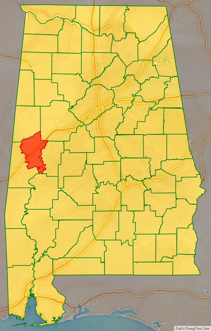
Greene County is a county located in the west central portion of the U.S. state of Alabama. As of the 2020 census, the population was 7,730, the least populous county in Alabama. Its county seat is Eutaw. It was named in honor of Revolutionary War General Nathanael Greene of Rhode Island.
As of the 2020 census, the county’s population was 81% African American, making it the fourth-most heavily black county by proportion in the United States, and the most black county among all counties located outside of the state of Mississippi. It is documented as one of the unhealthiest counties in the United States, with a population with an obesity percentage of 46.3 percent, the highest of any county in the state, and second to only Claiborne County in the western portion of neighboring Mississippi. The life expectancy there is 74.9 years, over 2 years lower than the national average.
| Name: | Greene County |
|---|---|
| FIPS code: | 01-063 |
| State: | Alabama |
| Founded: | December 13, 1819 |
| Named for: | Nathanael Greene |
| Seat: | Eutaw |
| Largest city: | Eutaw |
| Total Area: | 660 sq mi (1,700 km²) |
| Land Area: | 647 sq mi (1,680 km²) |
| Total Population: | 7,730 |
| Population Density: | 12/sq mi (4.5/km²) |
| Time zone: | UTC−6 (Central) |
| Summer Time Zone (DST): | UTC−5 (CDT) |
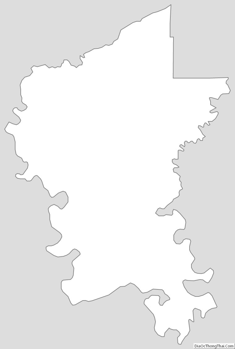
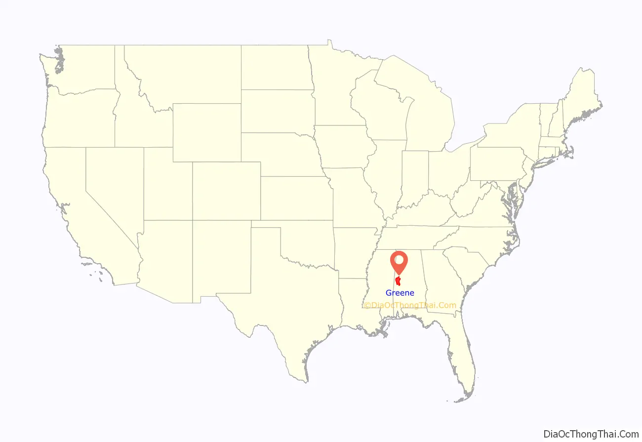
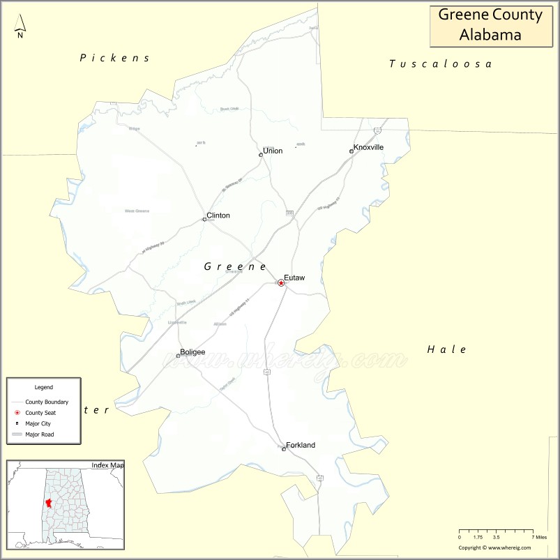
Greene County location map. Where is Greene County?
History
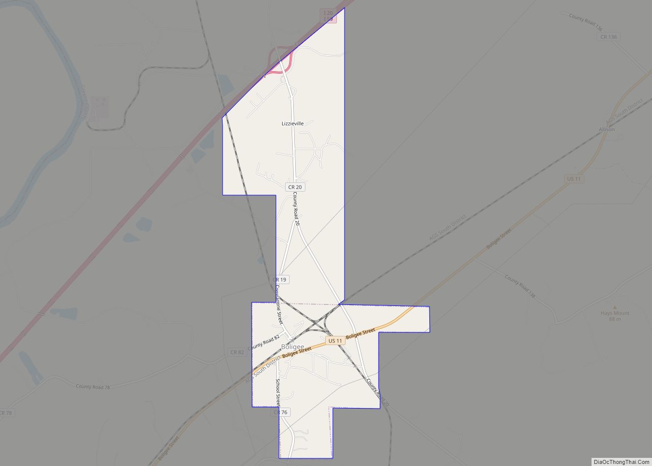
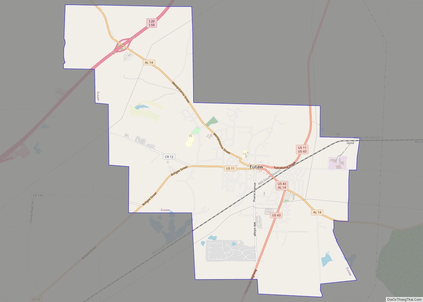
Greene County was established on December 13, 1819. Eutaw was established as the county seat in 1838, when the seat was moved from Erie. Eutaw is more centrally located.
Being designated as the seat of government stimulated growth in Eutaw.
Reconstruction era (1865–1876)
In 1867 the Reconstruction legislature organized Hale County, taking much of it from the eastern part of Greene County, plus sections of other neighboring counties. This was a period of continuing insurgency by whites, who attempted to maintain dominance over blacks. The latter comprised a majority in Greene County and others in the Black Belt.
The Greene County Courthouse in Eutaw was burned by arson in 1868, in a year with considerable election-associated violence throughout the South. On March 31, 1870, there were at least two insurgent attacks in Greene County. James Martin, a prominent black Republican, was shot and wounded by unidentified gunmen near his home in Union, Alabama. When a physician tried to remove the bullet to help him, the gunmen interrupted and took Martin away. He was “disappeared”, believed dead.
That same night, Republican County Solicitor, Alexander Boyd, a white native of South Carolina and Alabama resident, was murdered by the Ku Klux Klan in his hotel in Eutaw. The prevailing theory by historians for the burning of the courthouse is that the records of some 1,800 suits by freedmen against planters were about to be prosecuted; the fire destroyed the documents. The deaths of Martin and Boyd were typical of the KKK, who attacked Republican officeholders and freedmen sympathizers, in addition to freedmen, especially politicians.
Although Governor William Hugh Smith sent a special agent, John Minnis, to explore these deaths, he said he was unable to identify Boyd’s killers. (Minnis later served as US Attorney and prosecuted Klansmen under the Enforcement Acts.) He suggested that the killers had come from Mississippi. A grand jury was called on Boyd’s death, but no one was prosecuted. No grand jury was called for Martin’s disappearance and presumed death.
In the fall of 1870, two more black Republicans were killed in violence before the election. At a Republican rally on October 25, 1870, attracting 2,000 blacks in Eutaw, white Klansmen attacked the crowd in the courthouse square, leaving at least four blacks dead and 54 wounded. After this, most blacks stayed away from the polls or voted Democratic out of fear of reprisals; the Democratic gubernatorial candidate carried Greene County.
Civil Rights Era (1964–1970)
On July 30, 1969, Greene County made history when it became “the first in the South since reconstruction with both the commission and the school board dominated by Negroes.” Barred from the ballot in the November 1968 general election, the new “National Democratic Party of Alabama” filed suit in federal court and a special election was ordered. In the new vote, African-American candidates won four of the five seats on the Greene County Commission, and two additional seats on the five-member Greene County School Board, and the Montgomery Advertiser would note the next day that “the election gave blacks control of both major governing bodies— a first in Alabama.” The date of the vote would later be described as “a watershed for black political empowerment in Alabama,”, leading to African-American candidates finally winning the right to govern counties where white residents were the minority.
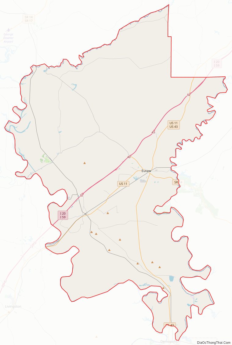
Greene County Road Map
Geography
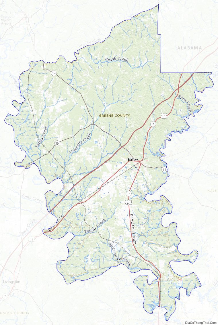
According to the United States Census Bureau, the county has a total area of 660 square miles (1,700 km), of which 647 square miles (1,680 km) is land and 13 square miles (34 km) (1.9%) is water. Over 90% of Greene County’s boundaries are dictated by the Tombigbee, Black Warrior, and Sipsey Rivers and much of the county is dominated by the valleys of the three rivers.
Major highways
- Interstate 20/Interstate 59
- U.S. Route 11
- U.S. Route 43
- State Route 14
- State Route 39
Adjacent counties
- Pickens County (north)
- Tuscaloosa County (northeast)
- Hale County (east)
- Marengo County (south)
- Sumter County (southwest)
Greene County Topographic Map
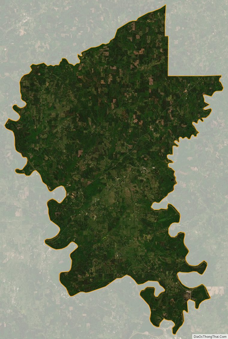
Greene County Satellite Map
Greene County Outline Map