Eutaw (/ˈjuːtɔː/ YOO-taw) is a city in and the county seat of Greene County, Alabama, United States. At the 2020 census, the population was 2,937. The city was named in honor of the Battle of Eutaw Springs, the last engagement of the American Revolutionary War in the Carolinas.
| Name: | Eutaw town |
|---|---|
| LSAD Code: | 43 |
| LSAD Description: | town (suffix) |
| State: | Alabama |
| County: | Greene County |
| Elevation: | 217 ft (66 m) |
| Total Area: | 12.01 sq mi (31.10 km²) |
| Land Area: | 11.93 sq mi (30.91 km²) |
| Water Area: | 0.08 sq mi (0.20 km²) |
| Total Population: | 2,937 |
| Population Density: | 246.12/sq mi (95.03/km²) |
| ZIP code: | 35462 |
| Area code: | 205 & 659 |
| FIPS code: | 0124664 |
| GNISfeature ID: | 0118059 |
Online Interactive Map
Click on ![]() to view map in "full screen" mode.
to view map in "full screen" mode.
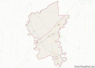
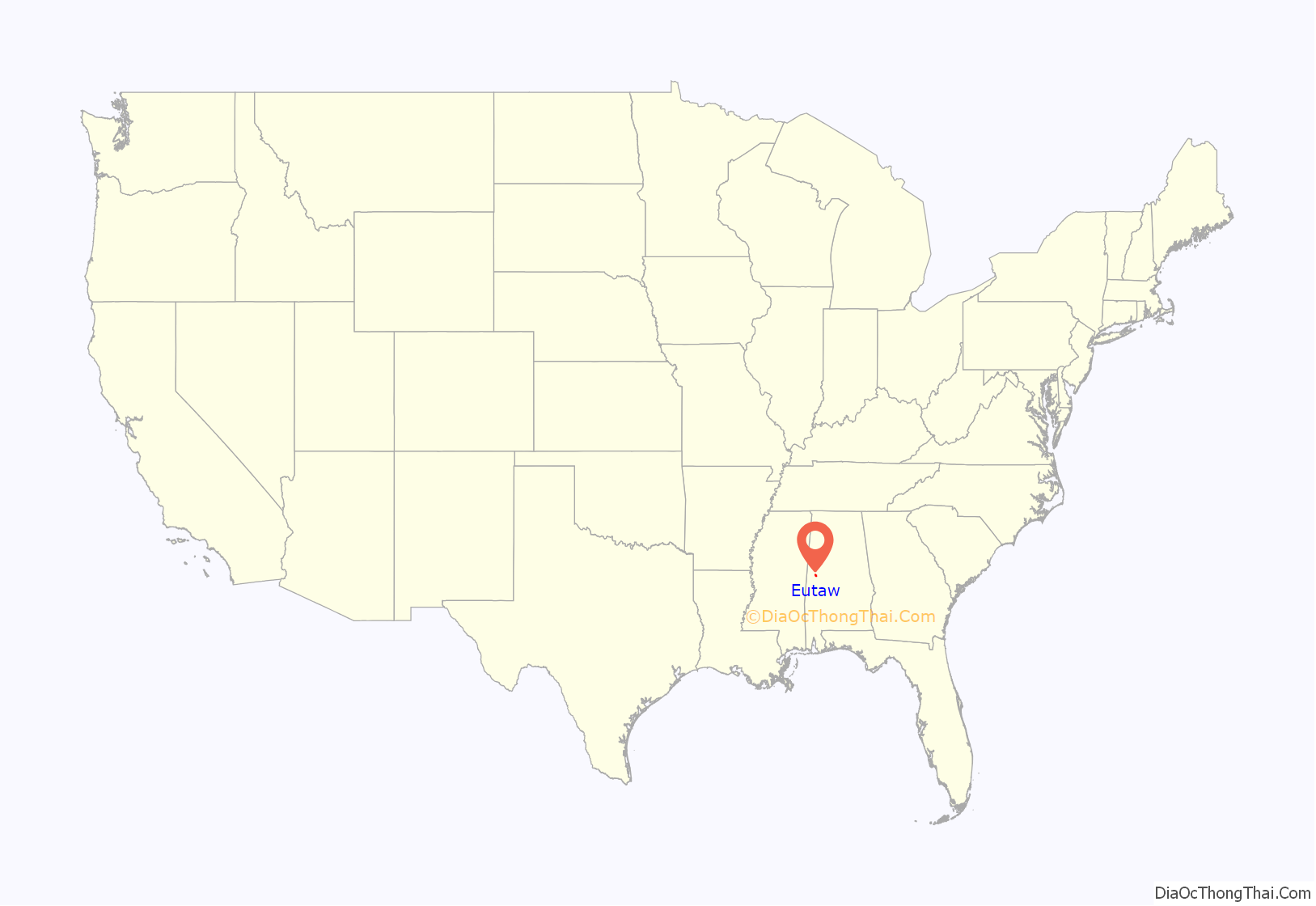
Eutaw location map. Where is Eutaw town?

History
Eutaw was laid out in December 1838 at the time that Greene County voters chose to relocate the county seat from Erie, which was located on the Black Warrior River. It was incorporated by an act of the state legislature on January 2, 1841.
As the county seat, Eutaw also developed as the trading center for the county, which developed an economy based on cultivation and processing of cotton, the chief commodity crop in the antebellum years. The crop was lucrative for major planters, who depended on the labor of enslaved African Americans and built fine homes in the city. Many have been preserved. Eutaw has twenty-seven antebellum structures on the National Register of Historic Places. Twenty-three of these are included in the Antebellum Homes in Eutaw multiple property submission. The Coleman-Banks House, Old Greene County Courthouse, First Presbyterian Church, and Kirkwood are listed individually. Additionally, the Greene County Courthouse Square District is a listed historic district in the heart of downtown. A nearby property, Everhope Plantation, is also listed in the register.
During the Reconstruction Era, Eutaw was the site of a number of Klan murders and acts by insurgents. The county courthouse was burned in 1868; the prevailing theory for the burning of the courthouse is that it was intended to destroy the records of some 1,800 suits by freedmen against planters, which were about to be prosecuted. On March 31, 1870, the Republican county solicitor, Alexander Boyd, was shot and killed at his hotel when resisting being taken by a masked group of armed Klan members. (An early-20th century historian of the Klan claimed the group was from Mississippi.) That same night, James Martin, a black Republican leader, was killed near his home in Union, Alabama, also in Greene County.
In the fall of 1870, in the run-up to the gubernatorial election, two more black Republican politicians were killed in Greene County. On October 25, 1870, whites attacked a Republican rally in the courthouse square that had attracted 2,000 black Republicans. The Eutaw massacre resulted in four black deaths and some 54 wounded outside the county courthouse. Most blacks did not vote in the fall’s election, which helped the Democratic candidate for governor.
The use of violence and intimidation of blacks continued across Alabama in the Post-Reconstruction era. Lynchings took place in the state, but none were documented in Greene County during this period, according to a 2015 report by the Equal Justice Initiative. This may be attributable to local officials enforcing the rule of law. On May 16, 1892, Sheriff Cullen and Deputy Sheriff E. C. Meredith of Greene County, with aid of a posse, distinguished themselves by going into Pickens County after a lynch mob of about 50 men. The mob had taken African-American suspect Jim Jones from the Greene County jail, saying they were going to hang him in Carrollton for an alleged crime there. Cullen and his posse confronted the mob at gunpoint, and took Jones back to Greene County.
20th century to present
Agriculture continues to dominate the county’s economy. Now conducted on an industrial scale, it has reduced the need for farm workers. Unemployment is high in the rural county.
James Bevel, the main strategist and architect of the Civil Rights Movement, was buried in Ancestors Village Cemetery in Eutaw on December 29, 2008. In addition to his early work in the Nashville Student Movement and Mississippi movement, Bevel initiated, planned, and directed the strategies for the 1963 Birmingham Children’s Crusade, the 1965 Selma to Montgomery march, and the 1966 Chicago Open Housing Movement.
Eutaw is home to the Roman Catholic Convent of Our Lady of Consolata, the Consolata Sisters, a small monastery for nuns in West Alabama. They are known throughout Greene County for their humanitarian efforts.
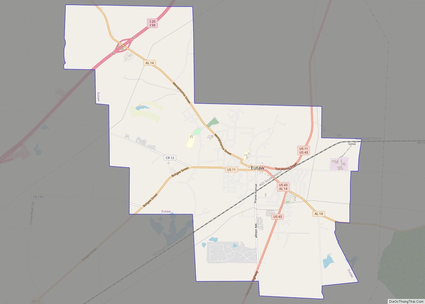
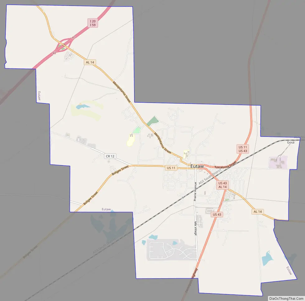
Eutaw Road Map
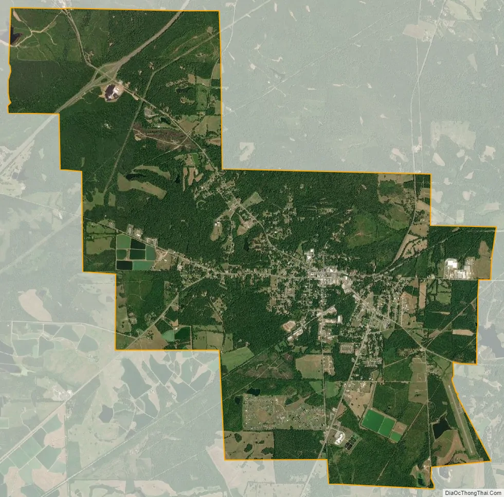
Eutaw city Satellite Map
Geography
Eutaw is located east of the center of Greene County. U.S. Routes 11 and 43 pass through the center of town. The highways enter together from the northeast as Tuscaloosa Street; US 11 exits the city to the west as Boligee Street, while US 43 leaves to the south as Demopolis Highway. Alabama State Route 14 passes through the city as Greensboro Street to the southeast and Mesopotamia Street to the northwest. Interstates 20 and 59 run through the northwest corner of the city, with access from Exit 40 (Highway 14), 3 miles (5 km) northwest of the center of town. Tuscaloosa is 34 miles (55 km) to the northeast via Interstate 20/59, and Meridian, Mississippi, is 60 miles (97 km) to the southwest. Demopolis is 24 miles (39 km) south via US 43, Greensboro is 21 miles (34 km) to the southeast via Highway 14, and Aliceville is 27 miles (43 km) to the northwest via Highway 14.
According to the U.S. Census Bureau, Eutaw has a total area of 12.0 square miles (31.1 km), of which 11.9 square miles (30.9 km) is land and 0.1 square miles (0.2 km), or 0.63%, is water. The center of town is 3 miles (5 km) west of the Black Warrior River, accessible to boats at Finches Ferry Public Use Area.
Climate
The climate in this area is characterized by hot, humid summers and generally mild to cool winters. According to the Köppen Climate Classification system, Eutaw has a humid subtropical climate, abbreviated “Cfa” on climate maps.
See also
Map of Alabama State and its subdivision:- Autauga
- Baldwin
- Barbour
- Bibb
- Blount
- Bullock
- Butler
- Calhoun
- Chambers
- Cherokee
- Chilton
- Choctaw
- Clarke
- Clay
- Cleburne
- Coffee
- Colbert
- Conecuh
- Coosa
- Covington
- Crenshaw
- Cullman
- Dale
- Dallas
- De Kalb
- Elmore
- Escambia
- Etowah
- Fayette
- Franklin
- Geneva
- Greene
- Hale
- Henry
- Houston
- Jackson
- Jefferson
- Lamar
- Lauderdale
- Lawrence
- Lee
- Limestone
- Lowndes
- Macon
- Madison
- Marengo
- Marion
- Marshall
- Mobile
- Monroe
- Montgomery
- Morgan
- Perry
- Pickens
- Pike
- Randolph
- Russell
- Saint Clair
- Shelby
- Sumter
- Talladega
- Tallapoosa
- Tuscaloosa
- Walker
- Washington
- Wilcox
- Winston
- Alabama
- Alaska
- Arizona
- Arkansas
- California
- Colorado
- Connecticut
- Delaware
- District of Columbia
- Florida
- Georgia
- Hawaii
- Idaho
- Illinois
- Indiana
- Iowa
- Kansas
- Kentucky
- Louisiana
- Maine
- Maryland
- Massachusetts
- Michigan
- Minnesota
- Mississippi
- Missouri
- Montana
- Nebraska
- Nevada
- New Hampshire
- New Jersey
- New Mexico
- New York
- North Carolina
- North Dakota
- Ohio
- Oklahoma
- Oregon
- Pennsylvania
- Rhode Island
- South Carolina
- South Dakota
- Tennessee
- Texas
- Utah
- Vermont
- Virginia
- Washington
- West Virginia
- Wisconsin
- Wyoming