Guthrie County is a county located in the U.S. state of Iowa. As of the 2020 census, the population was 10,623. The county seat is Guthrie Center. The county was formed on January 15, 1851, and named after Captain Edwin B. Guthrie, who died in the Mexican–American War.
Guthrie County is one of the six counties that make up the Des Moines–West Des Moines, IA Metropolitan Statistical Area.
| Name: | Guthrie County |
|---|---|
| FIPS code: | 19-077 |
| State: | Iowa |
| Founded: | 1851 |
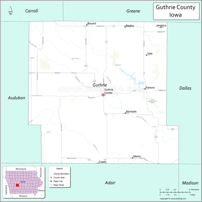
| Seat: | Guthrie Center |
| Largest city: | Guthrie Center |
| Total Area: | 593 sq mi (1,540 km²) |
| Land Area: | 591 sq mi (1,530 km²) |
| Total Population: | 10,623 |
| Population Density: | 18/sq mi (6.9/km²) |
| Time zone: | UTC−6 (Central) |
| Summer Time Zone (DST): | UTC−5 (CDT) |
| Website: | www.guthriecounty.org |
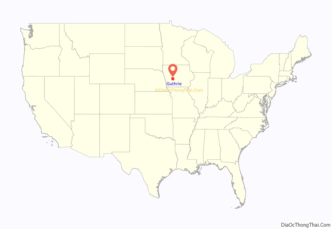
Guthrie County location map. Where is Guthrie County?
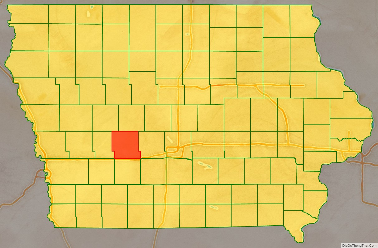
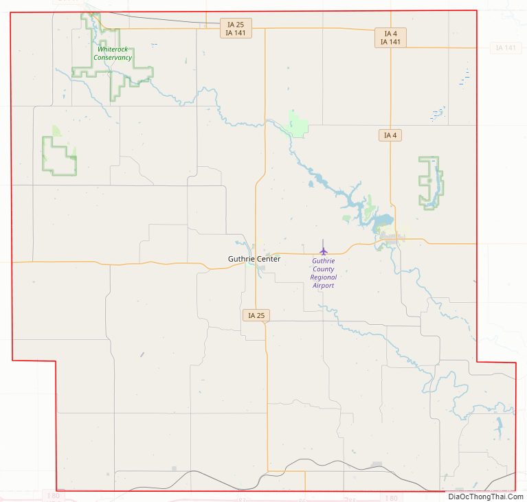
Guthrie County Road Map
Geography
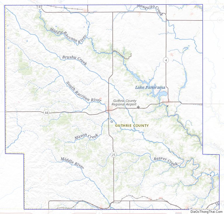
According to the U.S. Census Bureau, the county has a total area of 593 square miles (1,540 km), of which 591 square miles (1,530 km) is land and 2.5 square miles (6.5 km) (0.4%) is water.
Example of native vegetation: https://commons.wikimedia.org/wiki/File:Whiterock_Conservancy_Neighborhood_New_Wiki_Version.JPG
Major highways
- Iowa Highway 4
- Iowa Highway 25
- Iowa Highway 44
- Iowa Highway 141
Adjacent counties
- Greene County (north)
- Dallas County (east)
- Adair County (south)
- Audubon County (west)
- Carroll County (northwest)
Guthrie County Topographic Map
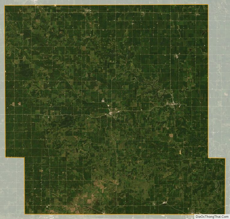
Guthrie County Satellite Map
Guthrie County Outline Map