Des Moines (/dəˈmɔɪn/ (listen)) is the capital and the most populous city in the U.S. state of Iowa. It is also the county seat of Polk County. A small part of the city extends into Warren County. It was incorporated on September 22, 1851, as Fort Des Moines, which was shortened to “Des Moines” in 1857. It is located on, and named after, the Des Moines River, which likely was adapted from the early French name, Rivière des Moines, meaning “River of the Monks”. The city’s population was 214,133 as of the 2020 census. The six-county metropolitan area is ranked 83rd in terms of population in the United States with 699,292 residents according to the 2019 estimate by the United States Census Bureau, and is the largest metropolitan area fully located within the state.
Des Moines is a major center of the US insurance industry and has a sizable financial services and publishing business base. The city was credited as the “number one spot for U.S. insurance companies” in a Business Wire article and named the third-largest “insurance capital” of the world. The city is the headquarters for the Principal Financial Group, Ruan Transportation, TMC Transportation, EMC Insurance Companies, and Wellmark Blue Cross Blue Shield. Other major corporations such as Wells Fargo, Cognizant, Voya Financial, Nationwide Mutual Insurance Company, ACE Limited, Marsh, Monsanto, and Corteva have large operations in or near the metropolitan area. In recent years, Microsoft, Hewlett-Packard, and Facebook have built data-processing and logistical facilities in the Des Moines area.
Des Moines is an important city in U.S. presidential politics; as the state’s capital, it is the site of the first caucuses of the presidential primary cycle. Many presidential candidates set up campaign headquarters in Des Moines. A 2007 article in The New York Times said, “If you have any desire to witness presidential candidates in the most close-up and intimate of settings, there is arguably no better place to go than Des Moines.”
| Name: | Des Moines city |
|---|---|
| LSAD Code: | 25 |
| LSAD Description: | city (suffix) |
| State: | Iowa |
| County: | Polk County, Warren County |
| Founded: | 1843 |
| Incorporated: | September 22, 1851 |
| Elevation: | 873 ft (266 m) |
| Land Area: | 88.18 sq mi (228.38 km²) |
| Water Area: | 2.52 sq mi (6.54 km²) |
| Population Density: | 2,428.39/sq mi (937.60/km²) |
| Area code: | 515 |
| FIPS code: | 1921000 |
| GNISfeature ID: | 465961 |
| Website: | www.dmgov.org |
Des Moines Map Collection
Explore the city of Des Moines with this collection of maps! Here you will find a highway/road map, reference map, and a list of things to do. Discover everything there is to see in Des Moines, Iowa like its museums, parks, and gardens.
Highway/Road Map
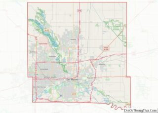
This map of Des Moines features the major highways and roads that make up the city. Use this map to navigate around the city and plan your route.
Reference Map
This reference map of Des Moines is a great tool to help you get a feel for the city. It includes important landmarks and points of interest, as well as the city’s boundaries.
Things to Do
Discover the many activities and attractions Des Moines has to offer. From its museums and parks to its gardens and shopping, there is something for everyone in the city.
Online Interactive Map
Click on ![]() to view map in "full screen" mode.
to view map in "full screen" mode.
Get to know what’s going on in this amazing city with a visit to one of the fastest-growing cities in the Midwest. Whether you’re looking for the best restaurant or just want to find a new place to visit, this interactive map is perfect for you. It allows you to zoom in to see the different areas. You can get a detailed view so that you can locate your favorite places before your visit.
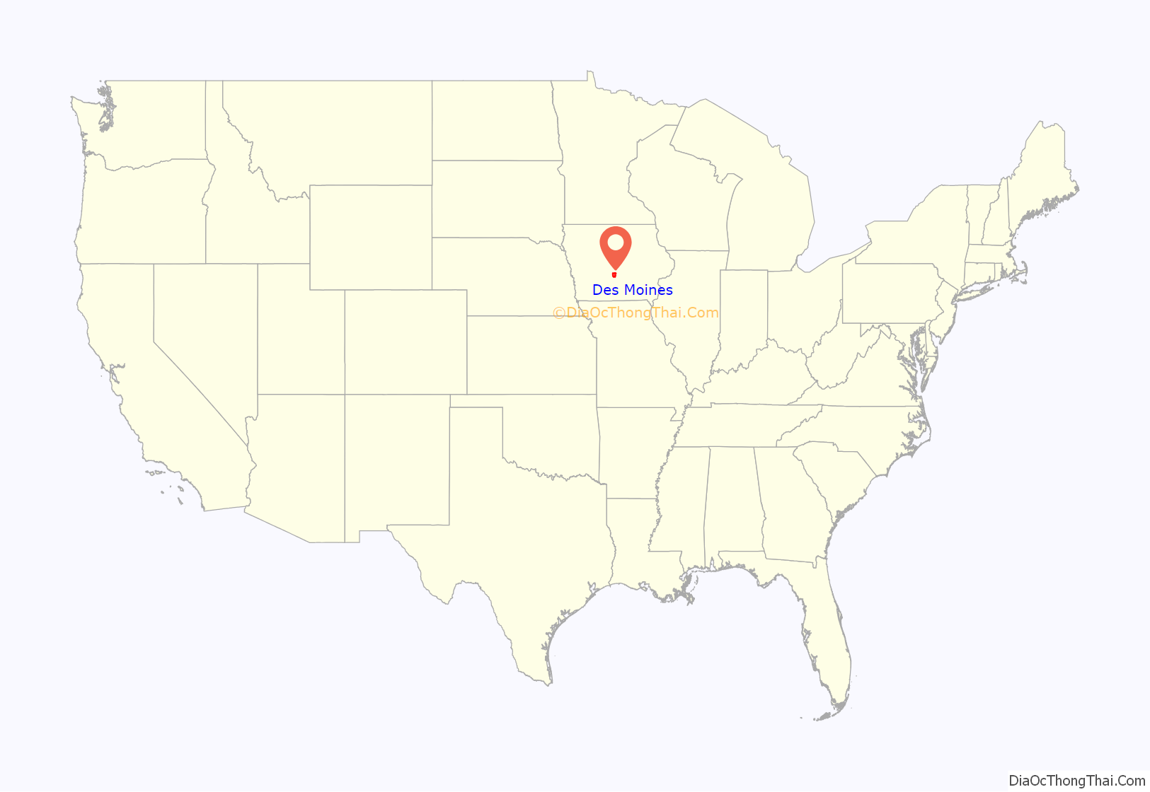
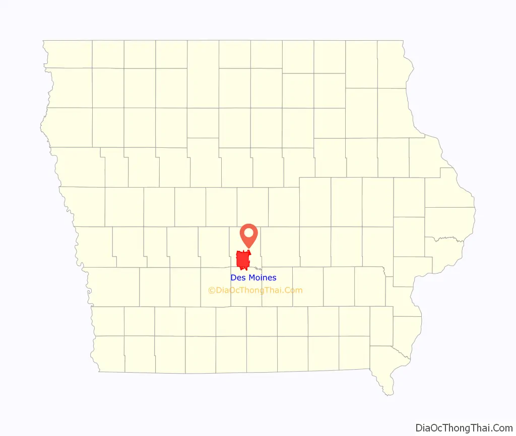
Des Moines location map. Where is Des Moines city?
History
Origin of Fort Des Moines
Des Moines traces its origins to May 1843, when Captain James Allen supervised the construction of a fort on the site where the Des Moines and Raccoon Rivers merge. Allen wanted to use the name Fort Raccoon; however, the U.S. War Department preferred Fort Des Moines. The fort was built to control the Sauk and Meskwaki tribes, whom the government had moved to the area from their traditional lands in eastern Iowa. The fort was abandoned in 1846 after the Sauk and Meskwaki were removed from the state and shifted to the Indian Territory.
The Sauk and Meskwaki did not fare well in Des Moines. The illegal whiskey trade, combined with the destruction of traditional lifeways, led to severe problems for their society. One newspaper reported:
After official removal, the Meskwaki continued to return to Des Moines until around 1857.
Archaeological excavations have shown that many fort-related features survived under what is now Martin Luther King Jr. Parkway and First Street. Soldiers stationed at Fort Des Moines opened the first coal mines in the area, mining coal from the riverbank for the fort’s blacksmith.
Early, non-Native American, settlement
Settlers occupied the abandoned fort and nearby areas. On May 25, 1846, the state legislature designated Fort Des Moines as the seat of Polk County. Arozina Perkins, a school teacher who spent the winter of 1850–1851 in the town of Fort Des Moines, was not favorably impressed:
In May 1851, much of the town was destroyed during the Flood of 1851. “The Des Moines and Raccoon Rivers rose to an unprecedented height, inundating the entire country east of the Des Moines River. Crops were utterly destroyed, houses and fences swept away.” The city started to rebuild from scratch.
Era of growth
On September 22, 1851, Des Moines was incorporated as a city; the charter was approved by voters on October 18. In 1857, the name “Fort Des Moines” was shortened to “Des Moines”, and it was designated as the second state capital, previously at Iowa City. Growth was slow during the Civil War period, but the city exploded in size and importance after a railroad link was completed in 1866.
In 1864, the Des Moines Coal Company was organized to begin the first systematic mining in the region. Its first mine, north of town on the river’s west side, was exhausted by 1873. The Black Diamond mine, near the south end of the West Seventh Street Bridge, sank a 150-foot (46 m) mine shaft to reach a 5-foot-thick (1.5 m) coal bed. By 1876, this mine employed 150 men and shipped 20 carloads of coal per day. By 1885, numerous mine shafts were within the city limits, and mining began to spread into the surrounding countryside. By 1893, 23 mines were in the region. By 1908, Des Moines’ coal resources were largely exhausted. In 1912, Des Moines still had eight locals of the United Mine Workers union, representing 1,410 miners. This was about 1.7% of the city’s population in 1910.
By 1880, Des Moines had a population of 22,408, making it Iowa’s largest city. It displaced the three Mississippi River ports: Burlington, Dubuque, and Davenport, that had alternated holding the position since the territorial period. Des Moines has remained Iowa’s most populous city. In 1910, the Census Bureau reported Des Moines’ population as 97.3% white and 2.7% black, reflecting its early settlement pattern primarily by ethnic Europeans.
“City Beautiful” project, decline and rebirth
At the turn of the 20th century, encouraged by the Civic Committee of the Des Moines Women’s Club, Des Moines undertook a “City Beautiful” project in which large Beaux Arts public buildings and fountains were constructed along the Des Moines River. The former Des Moines Public Library building (now the home of the World Food Prize); the United States central Post Office, built by the federal government (now the Polk County Administrative Building, with a newer addition); and the City Hall are surviving examples of the 1900–1910 buildings. They form the Civic Center Historic District.
The ornate riverfront balustrades that line the Des Moines and Raccoon Rivers were built by the federal Civilian Conservation Corps in the mid-1930s, during the Great Depression under Democratic President Franklin D. Roosevelt, as a project to provide local employment and improve infrastructure. The ornamental fountains that stood along the riverbank were buried in the 1950s when the city began a postindustrial decline that lasted until the late 1980s. The city has since rebounded, transforming from a blue-collar industrial city to a white-collar professional city.
In 1907, the city adopted a city commission government known as the Des Moines Plan, comprising an elected mayor and four commissioners, all elected at-large, who were responsible for public works, public property, public safety, and finance. Considered progressive at the time, it diluted the votes of ethnic and national minorities, who generally could not command the majority to elect a candidate of their choice.
That form of government was scrapped in 1950 in favor of a council-manager government, with the council members elected at-large. In 1967, the city changed its government to elect four of the seven city council members from single-member districts or wards, rather than at-large. This enabled a broader representation of voters. As with many major urban areas, the city core began losing population to the suburbs in the 1960s (the peak population of 208,982 was recorded in 1960), as highway construction led to new residential construction outside the city. The population was 198,682 in 2000 and grew slightly to 200,538 in 2009. The growth of the outlying suburbs has continued, and the overall metropolitan-area population is over 700,000 today.
During the Great Flood of 1993, heavy rains throughout June and early July caused the Des Moines and Raccoon Rivers to rise above flood stage levels. The Des Moines Water Works was submerged by floodwaters during the early morning hours of July 11, 1993, leaving an estimated 250,000 people without running water for 12 days and without drinking water for 20 days. Des Moines suffered major flooding again in June 2008 with a major levee breach. The Des Moines river is controlled upstream by Saylorville Reservoir. In both 1993 and 2008, the flooding river overtopped the reservoir spillway.
Today, Des Moines is a member of ICLEI Local Governments for Sustainability USA. Through ICLEI, Des Moines has implemented “The Tomorrow Plan”, a regional plan focused on developing central Iowa in a sustainable fashion, centrally-planned growth, and resource consumption to manage the local population.
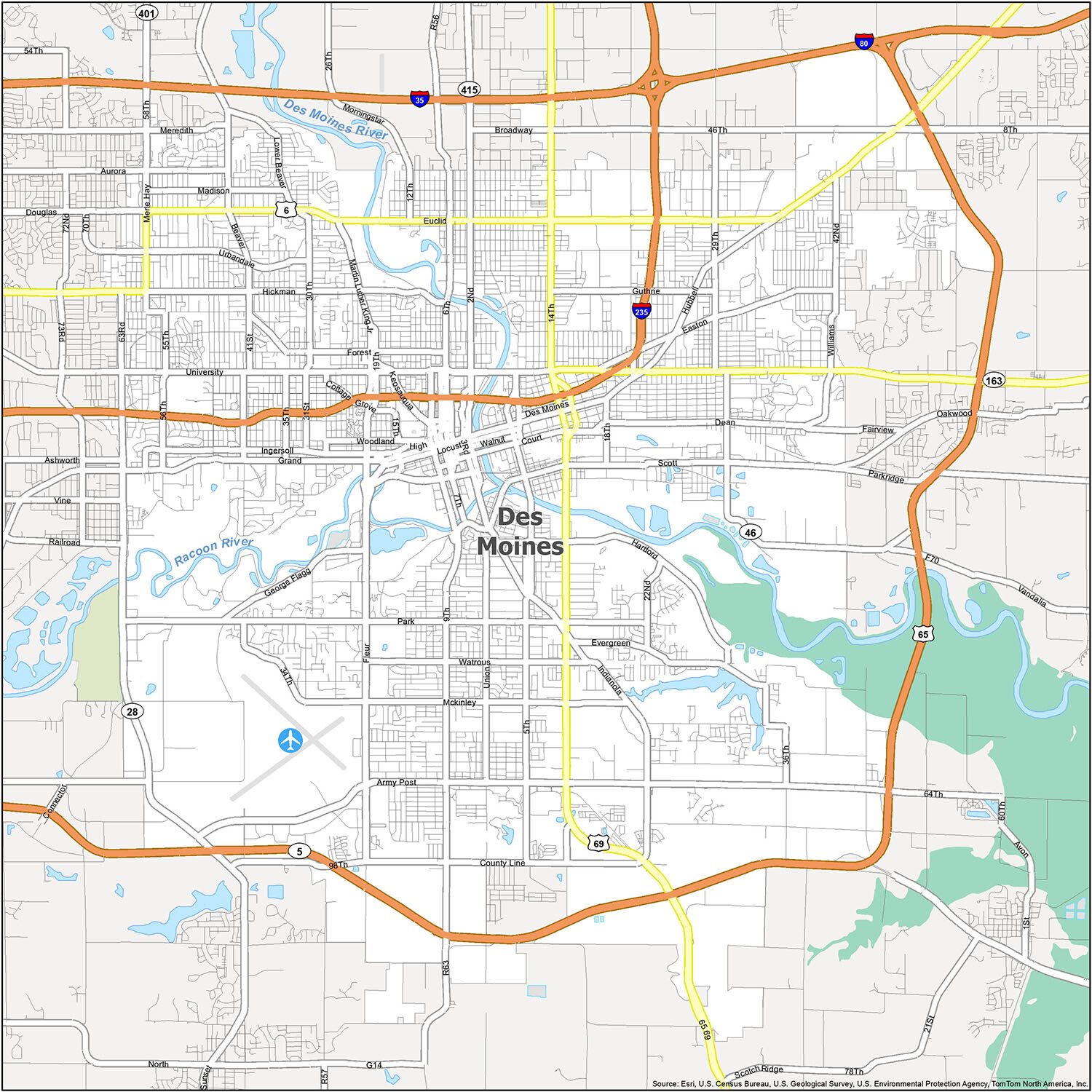
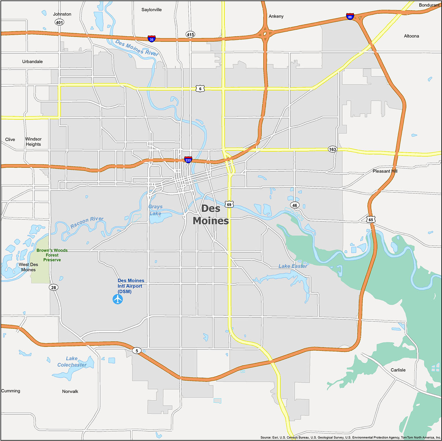
Des Moines Road Map
When you visit Des Moines, you can take in the sights and sounds of the city with the help of this convenient printable one-page map. It contains a wealth of information about key locations in and around the city, including highways like I-35, I-80, and I-235, as well as all the major roads. If you’re looking to explore outside of the city, you can also check out the Iowa road map for more highway and road information.
Interstate Highways: I-35, I-80, I-235
US Highways: 5, 6, 28, 46, 65, 69, 163
Parkways/Freeways: George Flagg Pky, Martin Luther King Jr Pky
Major Roads: 1st St, 2nd Ave, 2nd St, 14th St, 15th St, 30th St, 58th St, 63rd St, 64th Ave, Army Post Rd, Douglas Ave, Euclid Ave, Hickman Rd, Merle Hay Rd, Hickman Rd, Hubbell Ave, University Ave, Vandalia Rd
Discover the beauty of Des Moines, Iowa with this reference map. This map provides an overview of the city and its surrounding areas, including neighborhoods, lakes, rivers, airports, cities, and census-designated places. Get to know the area better and find the perfect spot to explore with this detailed map of Des Moines!
10 things to do in Des Moines city
When you travel to Des Moines, Iowa, you will find a variety of activities to enjoy. From exploring the Iowa State Capitol Building and walking the Pappajohn Sculpture Park to visiting the Greater Des Moines Botanical Garden and exploring the State Historical Museum, Des Moines has something for everyone. Don’t miss out on the chance to visit the Science Center of Iowa & Blank IMAX Dome Theater, Salisbury House & Gardens, Iowa State Fairgrounds, and Des Moines Art Center!
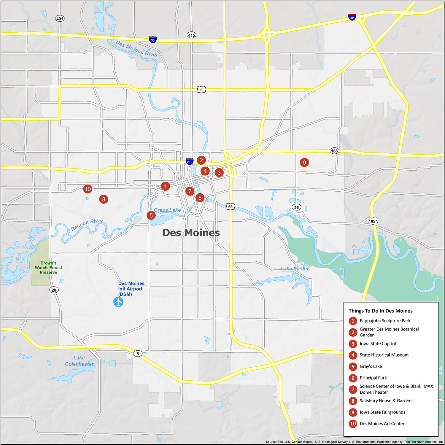
Des Moines, Iowa is a great place to explore, and with its location at the confluence of the Raccoon and Des Moines Rivers, there’s plenty to do for everyone. Whether you’re looking for outdoor activities like visiting the Pappajohn Sculpture Park or indoor attractions like the Iowa State Capitol, Des Moines has something for you!
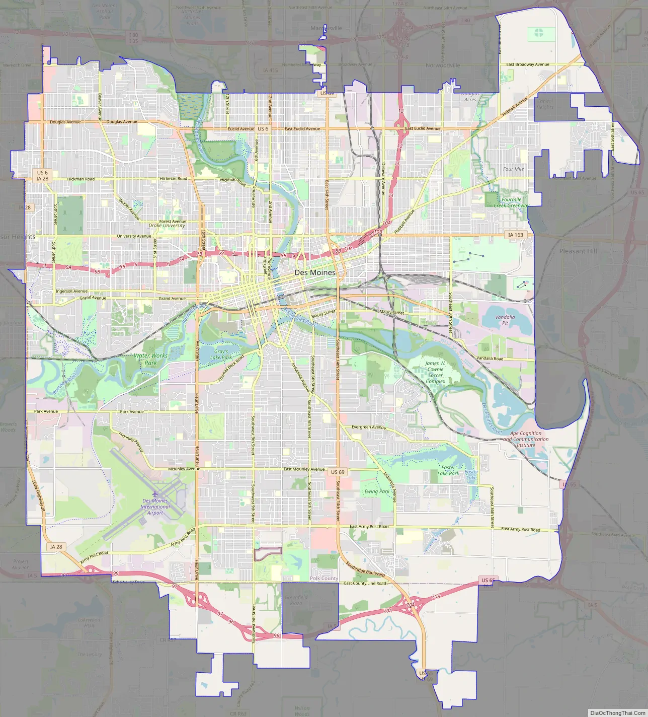
Des Moines city Satellite Map
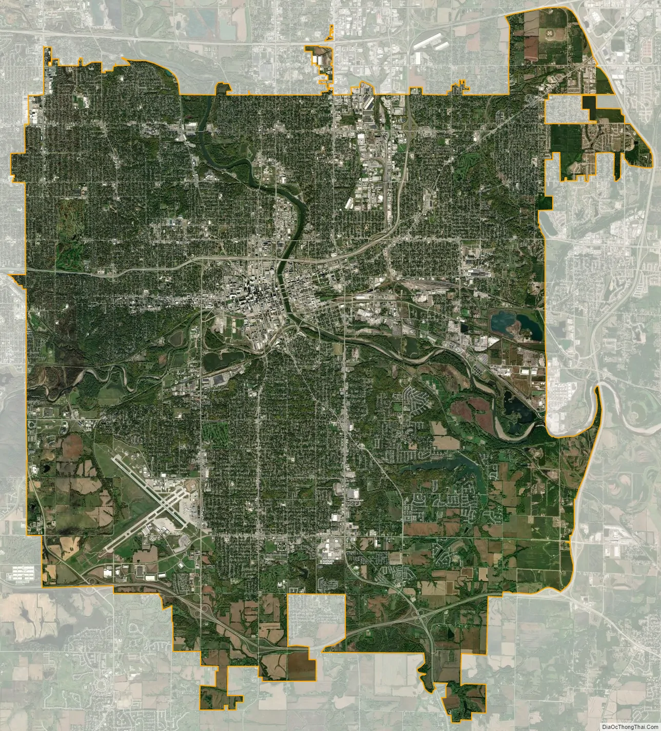
Geography
According to the United States Census Bureau, the city has an area of 90.65 square miles (234.78 km), of which 88.93 square miles (230.33 km) is land and 1.73 square miles (4.48 km) is covered by water. It is 850 feet (260 m) above sea level at the confluence of the Raccoon and Des Moines Rivers.
In November 2005, Des Moines voters approved a measure that allowed the city to annex parcels of land in the northeast, southeast, and southern corners of Des Moines without agreement by local residents, particularly areas bordering the Iowa Highway 5/U.S. 65 bypass. The annexations became official on June 26, 2009, as 5,174 acres (20.94 km) and around 868 new residents were added to the city of Des Moines. An additional 759 acres (3.07 km) were voluntarily annexed to the city over that same period.
Metropolitan area
Des Moines-West Des Moines Metropolitan Statistical Area
Des Moines-Ames–West Des Moines Combined Statistical Area
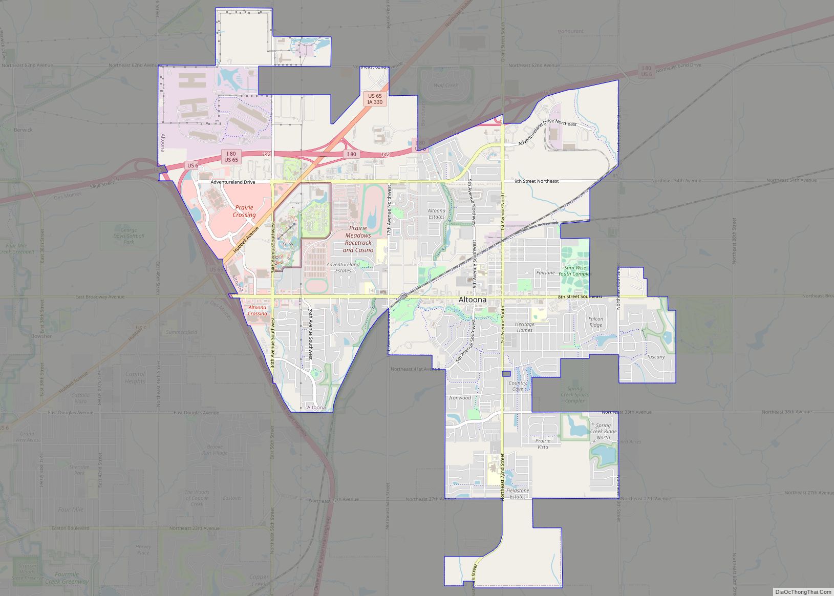
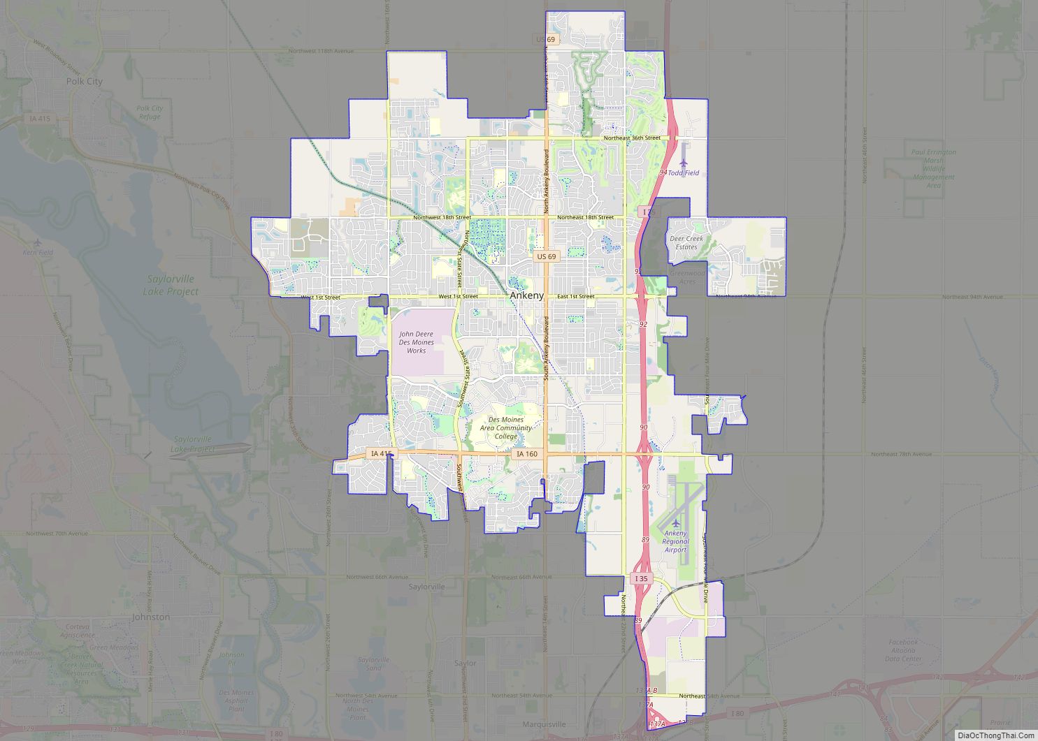
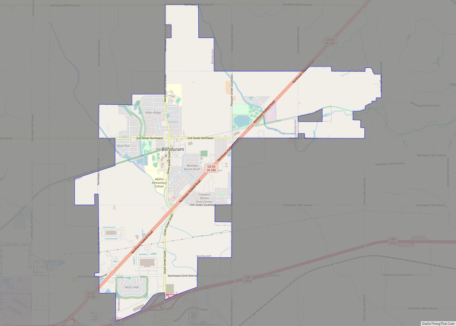
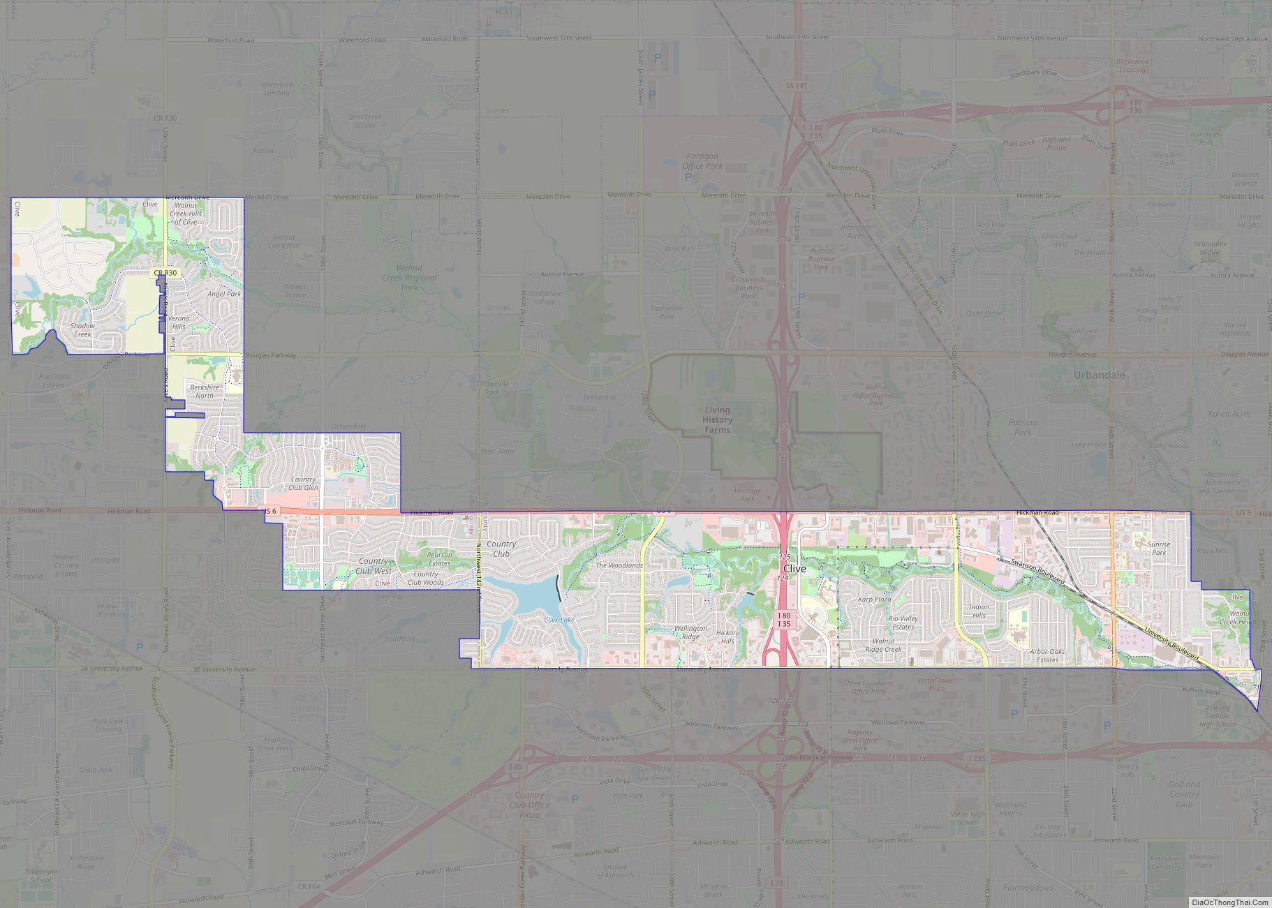
Des Moines’ suburban communities include Altoona, Ankeny, Bondurant, Carlisle, Clive, Grimes, Johnston, Norwalk, Pleasant Hill, Urbandale, Waukee, West Des Moines, and Windsor Heights.
Climate
At the center of North America and far removed from large bodies of water, the Des Moines area has a hot summer type humid continental climate (Köppen Dfa), with warm to hot, humid summers and cold, dry winters. Summer temperatures can often climb into the 90 °F (32 °C) range, occasionally reaching 100 °F (38 °C). Humidity can be high in spring and summer, with frequent afternoon thunderstorms. Fall brings pleasant temperatures and colorful fall foliage. Winters vary from moderately cold to bitterly cold, with low temperatures venturing below 0 °F (−18 °C) quite often. Snowfall averages 36.5 inches (93 cm) per season, and annual precipitation averages 36.55 inches (928 mm), with a peak in the warmer months. Winters are slightly colder than Chicago, but still warmer than Minneapolis, with summer temperatures being very similar between the Upper Midwest metropolitan areas.
See also
Map of Iowa State and its subdivision:- Adair
- Adams
- Allamakee
- Appanoose
- Audubon
- Benton
- Black Hawk
- Boone
- Bremer
- Buchanan
- Buena Vista
- Butler
- Calhoun
- Carroll
- Cass
- Cedar
- Cerro Gordo
- Cherokee
- Chickasaw
- Clarke
- Clay
- Clayton
- Clinton
- Crawford
- Dallas
- Davis
- Decatur
- Delaware
- Des Moines
- Dickinson
- Dubuque
- Emmet
- Fayette
- Floyd
- Franklin
- Fremont
- Greene
- Grundy
- Guthrie
- Hamilton
- Hancock
- Hardin
- Harrison
- Henry
- Howard
- Humboldt
- Ida
- Iowa
- Jackson
- Jasper
- Jefferson
- Johnson
- Jones
- Keokuk
- Kossuth
- Lee
- Linn
- Louisa
- Lucas
- Lyon
- Madison
- Mahaska
- Marion
- Marshall
- Mills
- Mitchell
- Monona
- Monroe
- Montgomery
- Muscatine
- O'Brien
- Osceola
- Page
- Palo Alto
- Plymouth
- Pocahontas
- Polk
- Pottawattamie
- Poweshiek
- Ringgold
- Sac
- Scott
- Shelby
- Sioux
- Story
- Tama
- Taylor
- Union
- Van Buren
- Wapello
- Warren
- Washington
- Wayne
- Webster
- Winnebago
- Winneshiek
- Woodbury
- Worth
- Wright
- Alabama
- Alaska
- Arizona
- Arkansas
- California
- Colorado
- Connecticut
- Delaware
- District of Columbia
- Florida
- Georgia
- Hawaii
- Idaho
- Illinois
- Indiana
- Iowa
- Kansas
- Kentucky
- Louisiana
- Maine
- Maryland
- Massachusetts
- Michigan
- Minnesota
- Mississippi
- Missouri
- Montana
- Nebraska
- Nevada
- New Hampshire
- New Jersey
- New Mexico
- New York
- North Carolina
- North Dakota
- Ohio
- Oklahoma
- Oregon
- Pennsylvania
- Rhode Island
- South Carolina
- South Dakota
- Tennessee
- Texas
- Utah
- Vermont
- Virginia
- Washington
- West Virginia
- Wisconsin
- Wyoming