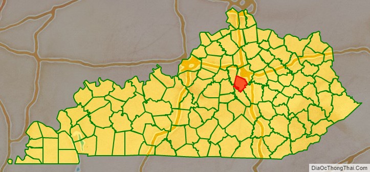
Jessamine County (/ˈdʒɛsəmɪn/) is a county located in the U.S. state of Kentucky. As of the 2020 census, the population was 52,991. Its county seat is Nicholasville. The county was founded in December 1798. Jessamine County is part of the Lexington-Fayette, KY Metropolitan Statistical Area. It is within the Inner Blue Grass region, long a center of farming and blooded stock raising, including thoroughbred horses. The legislature established a commercial wine industry here in the late 18th century.
| Name: | Jessamine County |
|---|---|
| FIPS code: | 21-113 |
| State: | Kentucky |
| Founded: | 1798 |
| Named for: | Jessamine Creek |
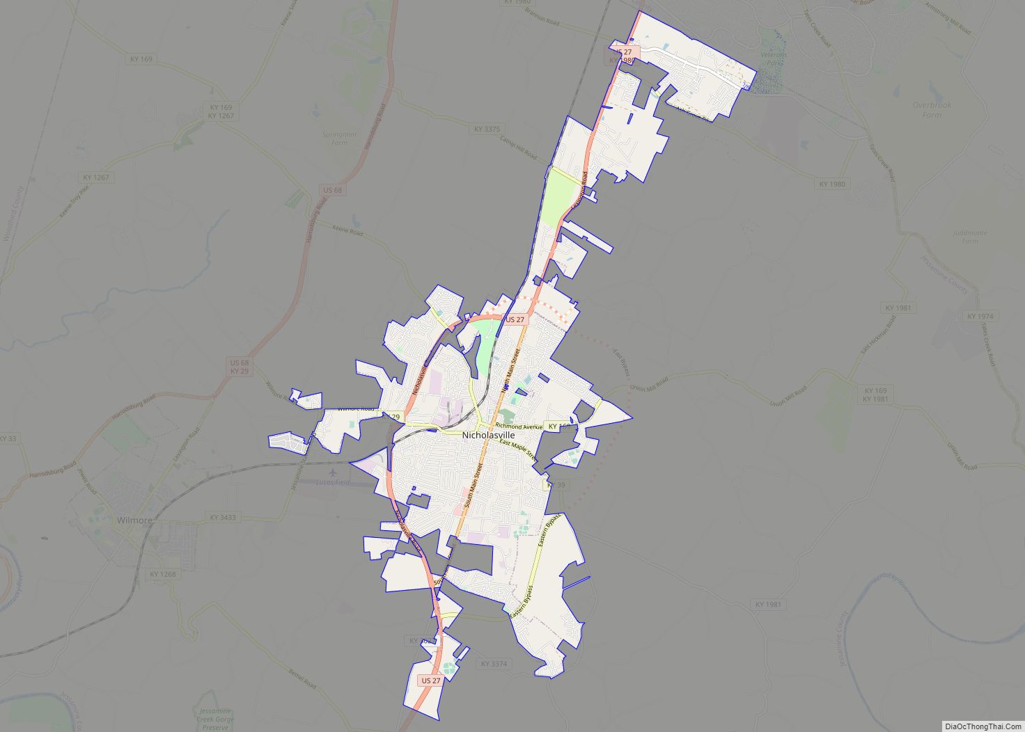
| Seat: | Nicholasville |
| Largest city: | Nicholasville |
| Total Area: | 175 sq mi (450 km²) |
| Land Area: | 172 sq mi (450 km²) |
| Total Population: | 52,991 |
| Population Density: | 300/sq mi (120/km²) |
| Time zone: | UTC−5 (Eastern) |
| Summer Time Zone (DST): | UTC−4 (EDT) |
| Website: | www.jessamineco.com |
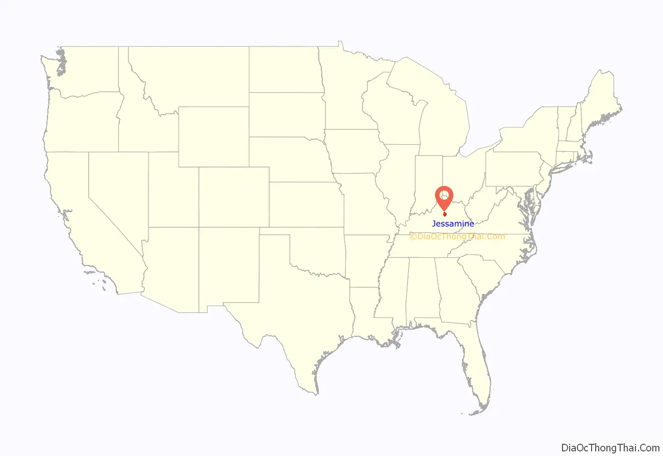
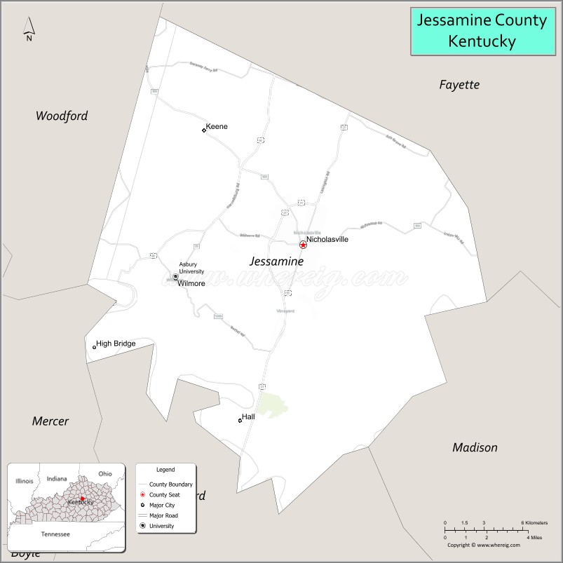
Jessamine County location map. Where is Jessamine County?
History
Jessamine County was established in 1798 from land given by Fayette County. Jessamine was the 36th Kentucky county in order of formation. The county is claimed to be named for a Jessamine Douglass, the daughter of a pioneer settler, who was either killed by Native Americans or committed suicide after being unlucky in love, but that story is dismissed by modern scholars, who say the name is from Jessamine Creek and the jasmine flowers that grow next to it. Most of the early pioneers were from Virginia, who came through the mountains after the American Revolutionary War.
In the late 18th century, the Kentucky General Assembly passed a bill to establish a commercial vineyard and winery, based in Nicholasville and the first in the United States, known as First Vineyard. Wine making based on European grapes became widespread in the United States. After the Prohibition era, which lasted from 1920 to 1933, the county voted to prohibit alcohol sales. Voters in the city of Nicholasville allowed package alcohol sales. The Chrisman Mill Vineyards is authorized to operate and sell its product in the “dry” portion of the county.
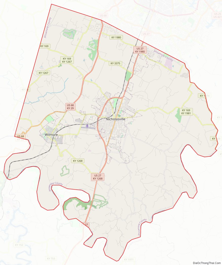
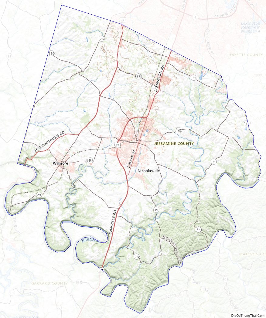
Jessamine County Road Map
Geography
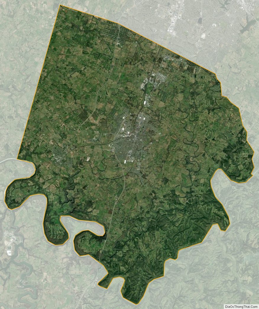
According to the United States Census Bureau, the county has a total area of 175 square miles (450 km), of which 172 square miles (450 km) is land and 2.4 square miles (6.2 km) (1.4%) is water. In 2000, nearly 129 square miles (330 km) of the county’s total area was dedicated to agriculture.
The county’s entire southern border is formed by the Kentucky River. Jessamine County’s river bank extends roughly 42 miles (68 km) long due to meandering, and the river’s scenic Palisades feature heavily along this border.
Adjacent counties
- Fayette County (northeast)
- Madison County (southeast)
- Garrard County (south)
- Mercer County (southwest)
- Woodford County (northwest)
Jessamine County Topographic Map
Jessamine County Satellite Map
Jessamine County Outline Map