Nicholasville is a home rule city in and the county seat of Jessamine County, Kentucky. The population was 31,490 during the 2020 U.S. census, making Nicholasville the 10th-largest settlement in the state.
Since the late 20th century, Nicholasville has undergone rapid growth; the population increased 440.23% between 1970 and 2020. The city serves as both a residential area for Lexington-area commuters and as an employment and shopping center for central Kentucky.
| Name: | Nicholasville city |
|---|---|
| LSAD Code: | 25 |
| LSAD Description: | city (suffix) |
| State: | Kentucky |
| County: | Jessamine County |
| Incorporated: | February 13, 1837 |
| Elevation: | 938 ft (286 m) |
| Total Area: | 14.85 sq mi (38.45 km²) |
| Land Area: | 14.78 sq mi (38.27 km²) |
| Water Area: | 0.07 sq mi (0.18 km²) |
| Total Population: | 31,093 |
| Population Density: | 2,104.29/sq mi (812.47/km²) |
| Area code: | 859 |
| FIPS code: | 2156136 |
| GNISfeature ID: | 499462 |
| Website: | www.nicholasville.org |
Online Interactive Map
Click on ![]() to view map in "full screen" mode.
to view map in "full screen" mode.
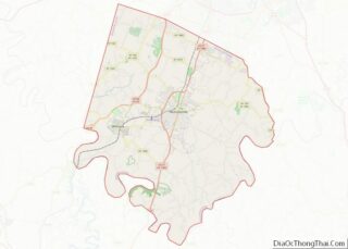
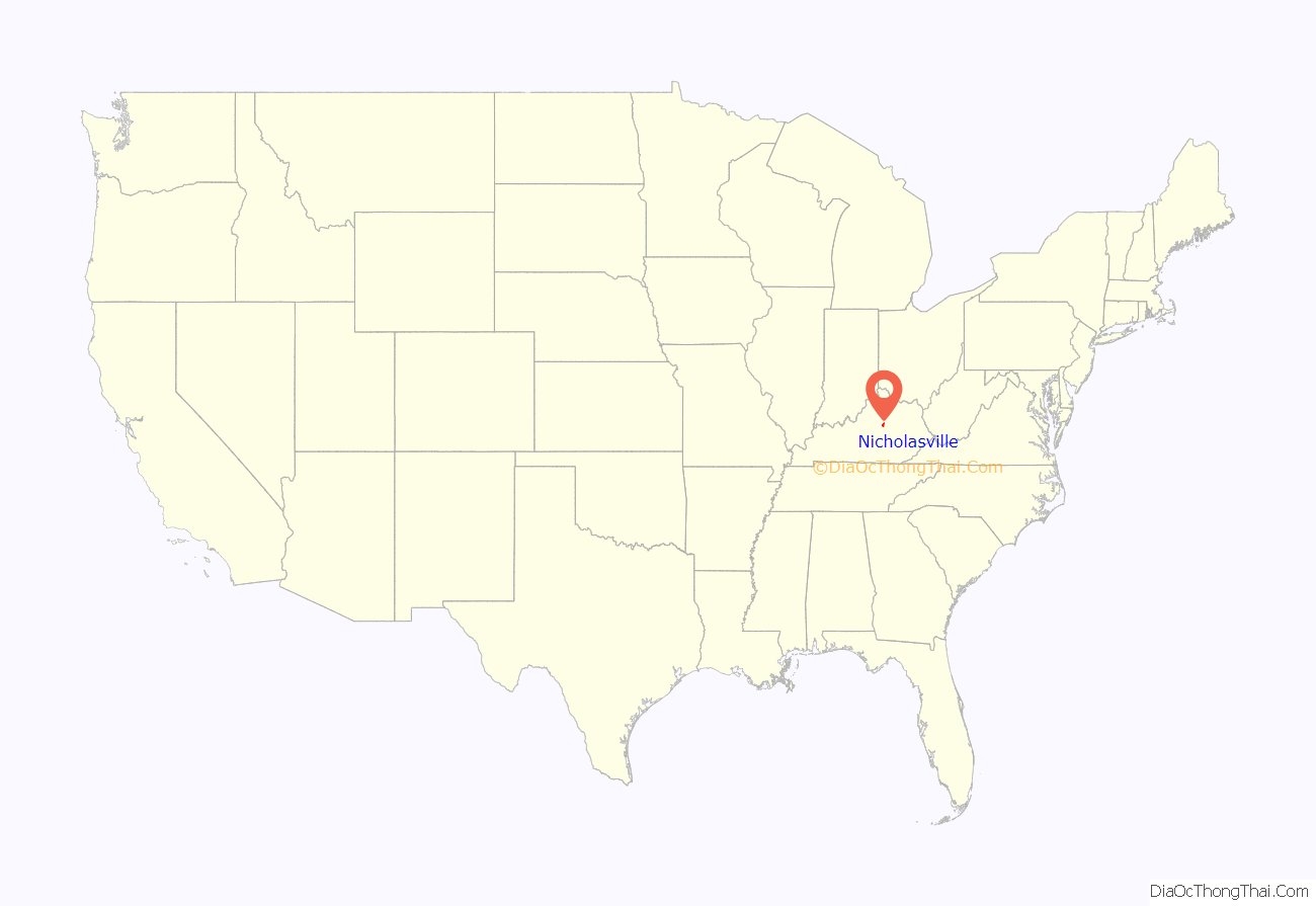
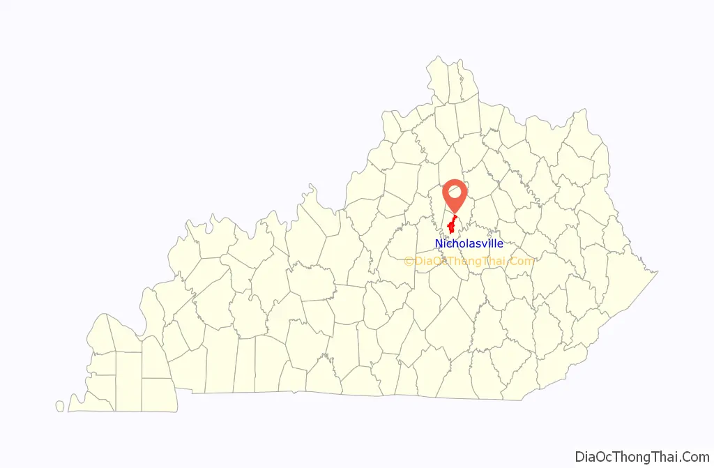
Nicholasville location map. Where is Nicholasville city?
History
Nicholasville was founded by European Americans in 1798, after the American Revolutionary War, and incorporated in 1837. The town was named in honor of Colonel George Nicholas, a father of the Kentucky Constitution in 1792. The Young House in Nicholasville is listed on the National Register of Historic Places.
The city has grown rapidly since the late 20th century and is working to accommodate new highways and transportation needs. Many residents commute to Lexington for work. Others are part of building Nicholasville as a center of retail services for the county.
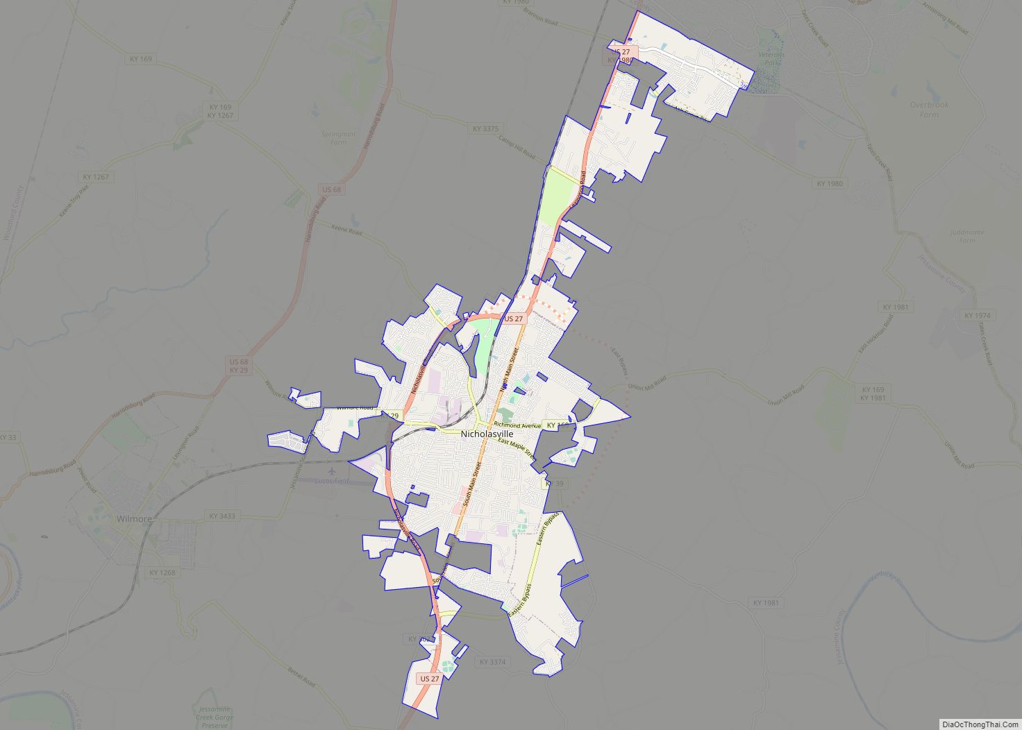
Nicholasville Road Map
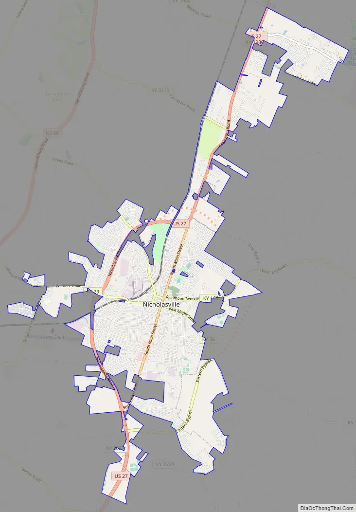
Nicholasville city Satellite Map

Geography
Downtown Nicholasville is approximately 6 miles (9.7 km) south of Fayette County. The city serves as a logistics and commuter hub between Lexington and Nicholasville’s neighboring counties, especially Garrard County. According to the U.S. Census Bureau, the city has a total area of 13.08 square miles (33.9 km), of which 13.01 square miles (33.7 km) is land and 0.07 square miles (0.18 km), or 0.52%, is water. Some artificial ponds, including Lake Mingo (named after the Native American Mingo people), are present in the city. Town Fork, a partially channelized stream, runs south and passes underneath downtown, eventually draining into Jessamine Creek.
Climate
Nicholasville is in the northern periphery of the humid subtropical climate zone, with hot and humid summers, cool winters, and occasional mild periods, especially in autumn. The city and the surrounding Bluegrass region have four distinct seasons that include cool plateau breezes, moderate nights in the summer, and no prolonged periods of rain, snow, or other severe weather.
See also
Map of Kentucky State and its subdivision:- Adair
- Allen
- Anderson
- Ballard
- Barren
- Bath
- Bell
- Boone
- Bourbon
- Boyd
- Boyle
- Bracken
- Breathitt
- Breckinridge
- Bullitt
- Butler
- Caldwell
- Calloway
- Campbell
- Carlisle
- Carroll
- Carter
- Casey
- Christian
- Clark
- Clay
- Clinton
- Crittenden
- Cumberland
- Daviess
- Edmonson
- Elliott
- Estill
- Fayette
- Fleming
- Floyd
- Franklin
- Fulton
- Gallatin
- Garrard
- Grant
- Graves
- Grayson
- Green
- Greenup
- Hancock
- Hardin
- Harlan
- Harrison
- Hart
- Henderson
- Henry
- Hickman
- Hopkins
- Jackson
- Jefferson
- Jessamine
- Johnson
- Kenton
- Knott
- Knox
- Larue
- Laurel
- Lawrence
- Lee
- Leslie
- Letcher
- Lewis
- Lincoln
- Livingston
- Logan
- Lyon
- Madison
- Magoffin
- Marion
- Marshall
- Martin
- Mason
- McCracken
- McCreary
- McLean
- Meade
- Menifee
- Mercer
- Metcalfe
- Monroe
- Montgomery
- Morgan
- Muhlenberg
- Nelson
- Nicholas
- Ohio
- Oldham
- Owen
- Owsley
- Pendleton
- Perry
- Pike
- Powell
- Pulaski
- Robertson
- Rockcastle
- Rowan
- Russell
- Scott
- Shelby
- Simpson
- Spencer
- Taylor
- Todd
- Trigg
- Trimble
- Union
- Warren
- Washington
- Wayne
- Webster
- Whitley
- Wolfe
- Woodford
- Alabama
- Alaska
- Arizona
- Arkansas
- California
- Colorado
- Connecticut
- Delaware
- District of Columbia
- Florida
- Georgia
- Hawaii
- Idaho
- Illinois
- Indiana
- Iowa
- Kansas
- Kentucky
- Louisiana
- Maine
- Maryland
- Massachusetts
- Michigan
- Minnesota
- Mississippi
- Missouri
- Montana
- Nebraska
- Nevada
- New Hampshire
- New Jersey
- New Mexico
- New York
- North Carolina
- North Dakota
- Ohio
- Oklahoma
- Oregon
- Pennsylvania
- Rhode Island
- South Carolina
- South Dakota
- Tennessee
- Texas
- Utah
- Vermont
- Virginia
- Washington
- West Virginia
- Wisconsin
- Wyoming