Johnson County is a county in the U.S. state of Illinois. According to the 2010 census, it has a population of 12,582. Its county seat is Vienna. It is located in the southern portion of Illinois known locally as “Little Egypt”.
| Name: | Johnson County |
|---|---|
| FIPS code: | 17-087 |
| State: | Illinois |
| Founded: | 1812 |
| Named for: | Richard Mentor Johnson |
| Seat: | Vienna |
| Largest city: | Vienna |
| Total Area: | 349 sq mi (900 km²) |
| Land Area: | 344 sq mi (890 km²) |
| Total Population: | 13,308 |
| Population Density: | 38/sq mi (15/km²) |
| Time zone: | UTC−6 (Central) |
| Summer Time Zone (DST): | UTC−5 (CDT) |
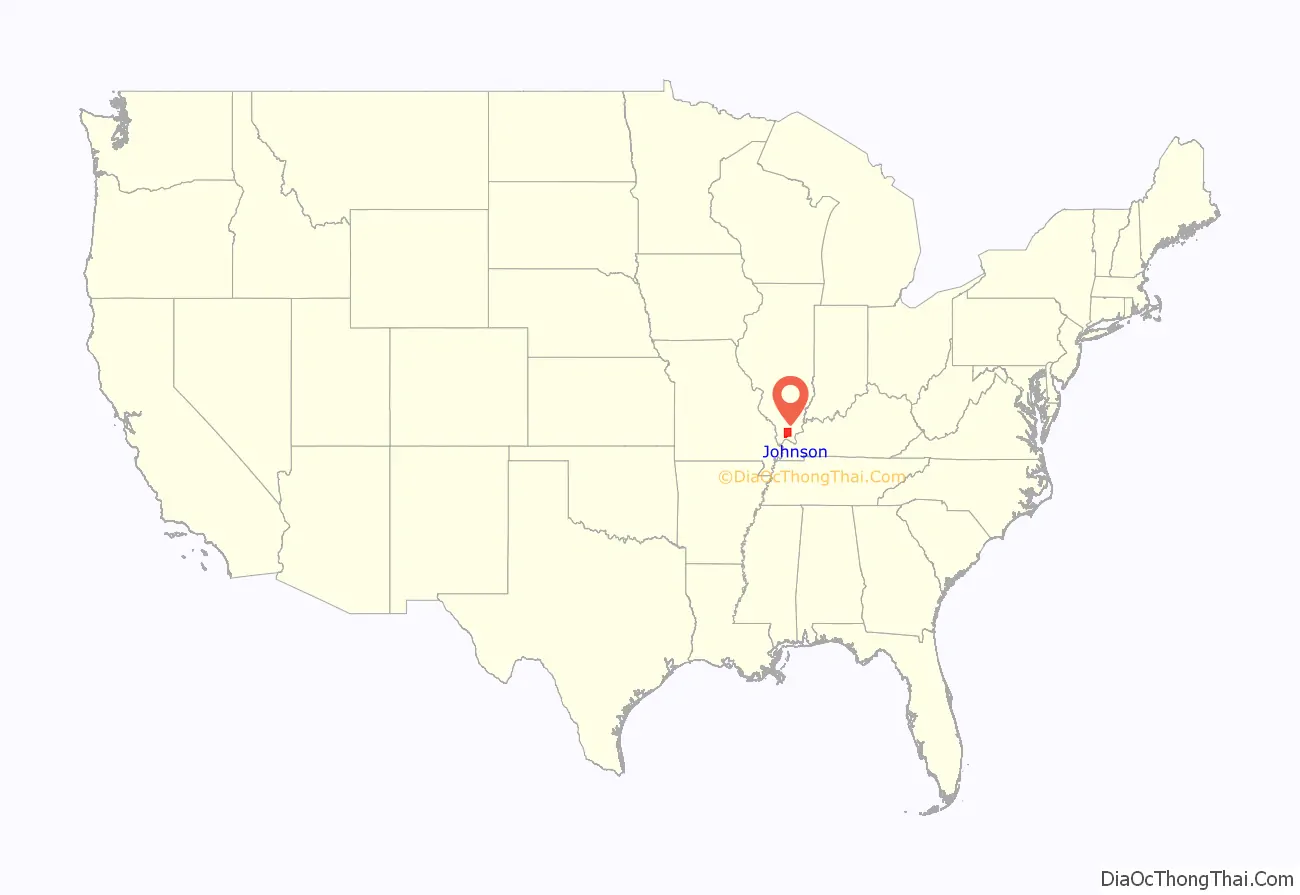
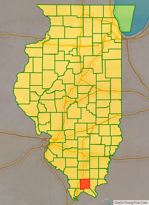
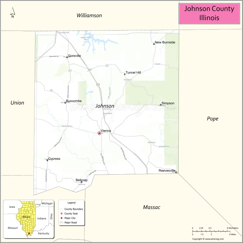
Johnson County location map. Where is Johnson County?
History
Johnson County was organized in 1812 out of Randolph County. It was named for Richard Mentor Johnson, who was then a U.S. Congressman from Kentucky. In 1813, Johnson commanded a Kentucky regiment at the Battle of the Thames, after which he claimed to have killed Tecumseh in hand-to-hand combat. Johnson went on to become Vice President of the United States.
Johnson County at the time of its creation to 1816
Johnson County between 1816 and 1818
Johnson County between 1818 and 1843
Johnson County in 1843, when it was reduced to its present size
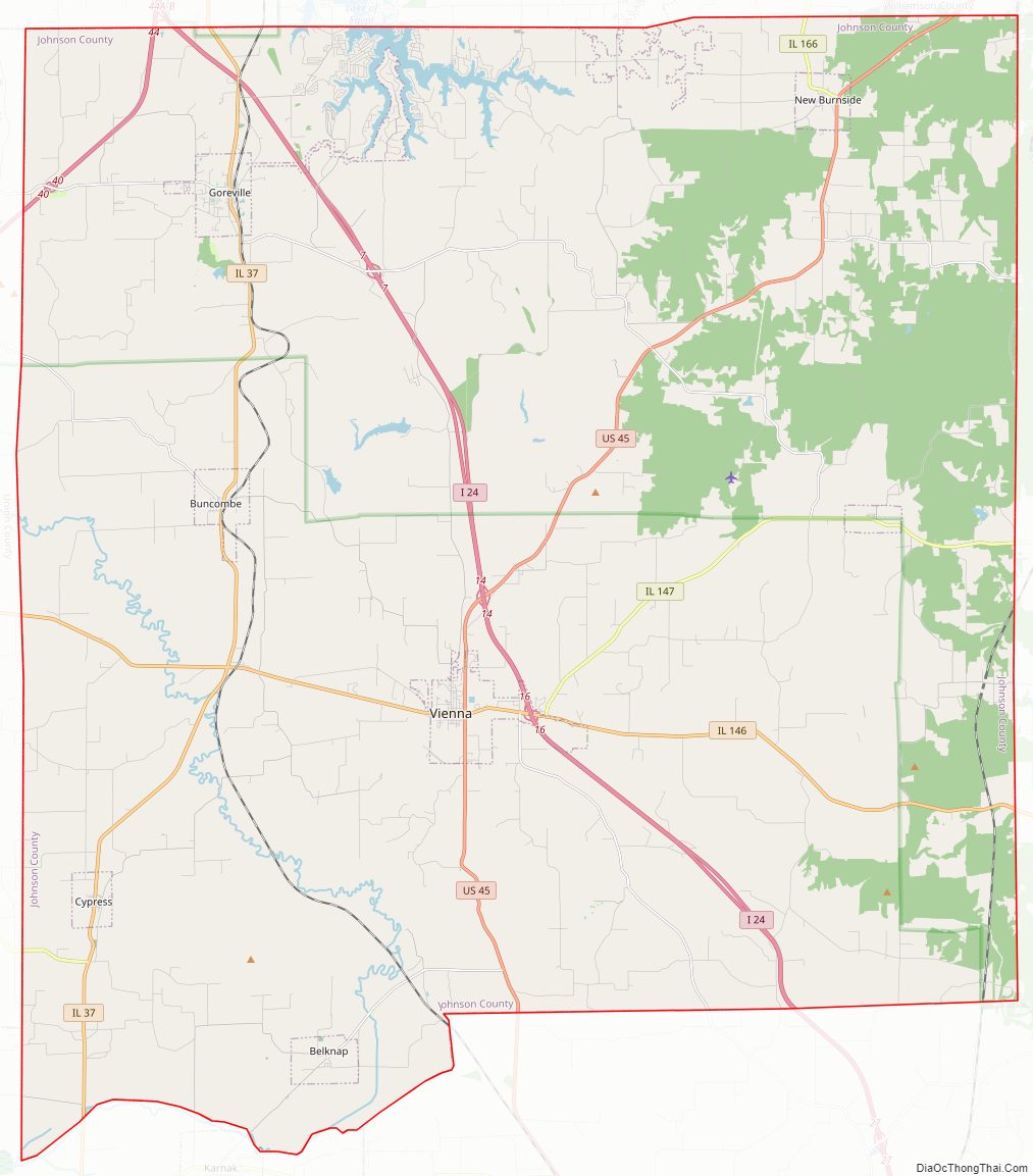
Johnson County Road Map
Geography
According to the U.S. Census Bureau, the county has a total area of 349 square miles (900 km), of which 344 square miles (890 km) is land and 4.9 square miles (13 km) (1.4%) is water.
Climate and weather
In recent years, average temperatures in the county seat of Vienna have ranged from a low of 25 °F (−4 °C) in January to a high of 90 °F (32 °C) in July, although a record low of −20 °F (−29 °C) was recorded in January 1977 and a record high of 103 °F (39 °C) was recorded in August 2007. Average monthly precipitation ranged from 3.16 inches (80 mm) in October to 5.16 inches (131 mm) in May.
Major highways
- Interstate 24
- Interstate 57
- U.S. Route 45
- Illinois Route 37
- Illinois Route 146
- Illinois Route 147
- Illinois Route 166
Transit
- List of intercity bus stops in Illinois
Adjacent counties
- Williamson County – north
- Saline County – northeast
- Pope County – east
- Massac County – southeast
- Pulaski County – southwest
- Union County – west
National protected areas
- Cypress Creek National Wildlife Refuge (part)
- Shawnee National Forest (part)
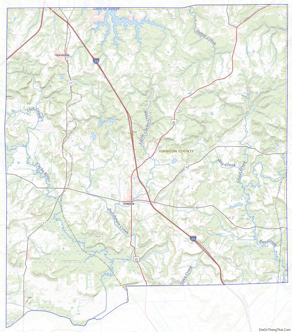
Johnson County Topographic Map
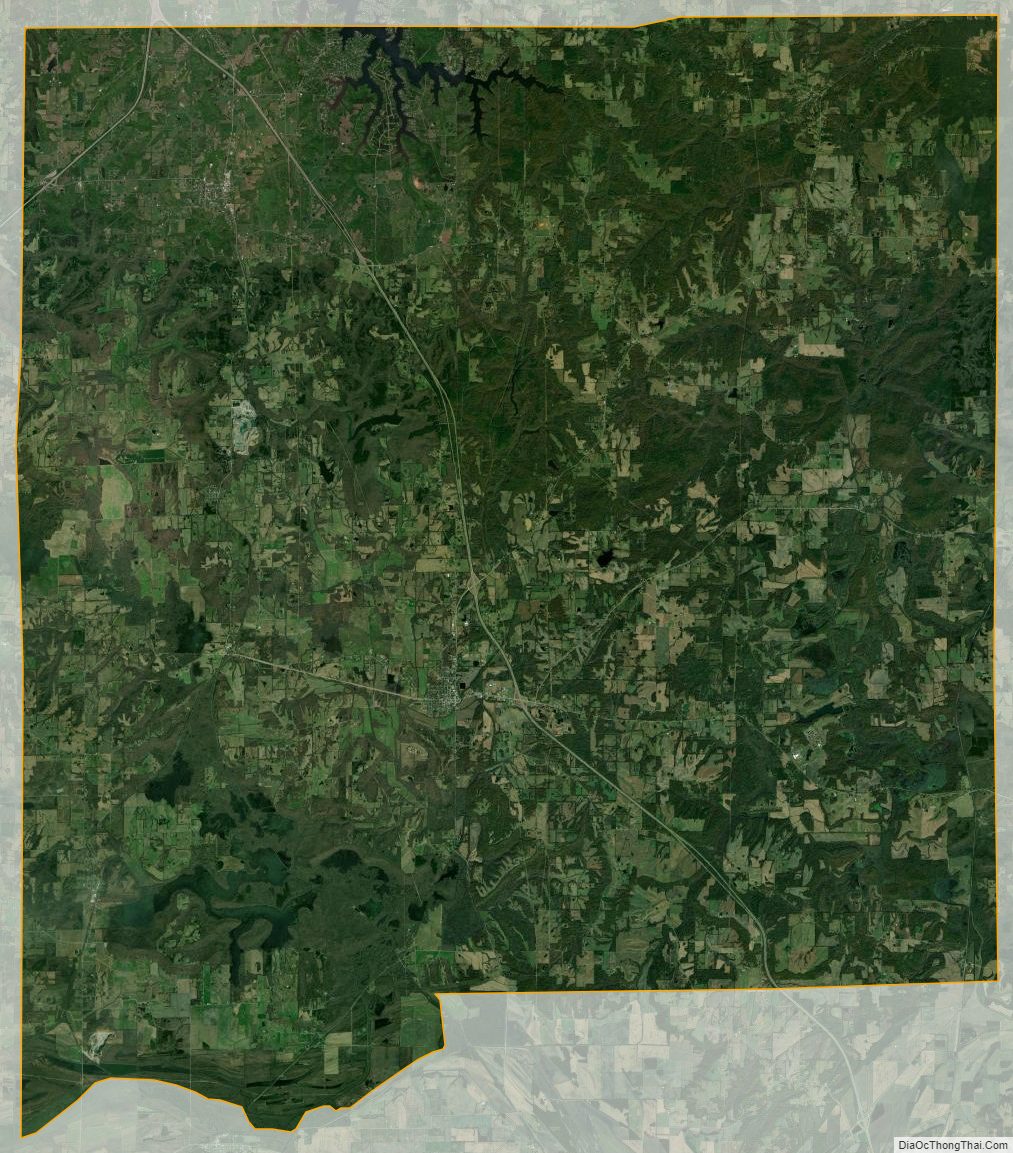
Johnson County Satellite Map
Johnson County Outline Map