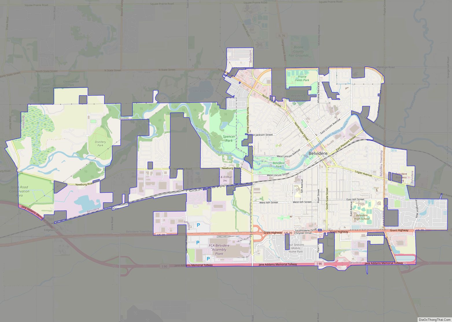
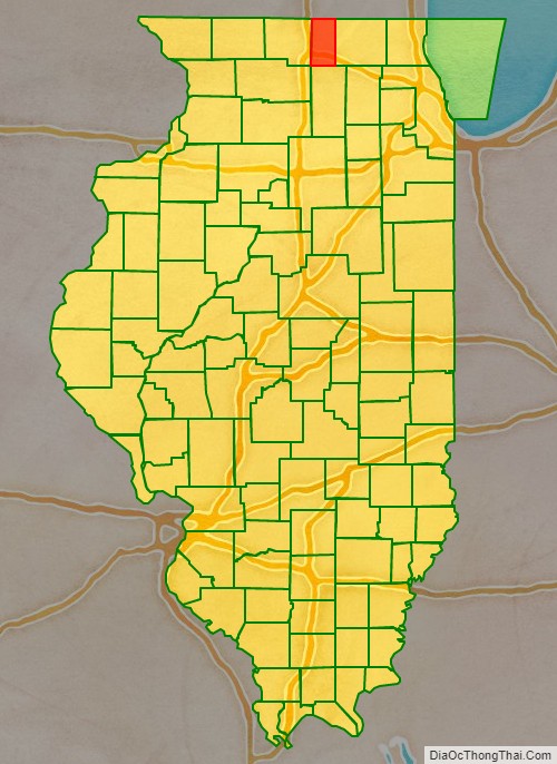
Boone County is a county located in the U.S. state of Illinois. As of the 2020 census, the population was 53,448. Its county seat is Belvidere.
Boone County is included in the Rockford, IL Metropolitan Statistical Area.
| Name: | Boone County |
|---|---|
| FIPS code: | 17-007 |
| State: | Illinois |
| Founded: | 1837 |
| Named for: | Daniel Boone |
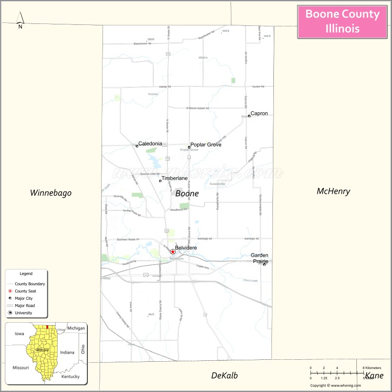
| Seat: | Belvidere |
| Largest city: | Belvidere |
| Total Area: | 282.039 sq mi (730.48 km²) |
| Land Area: | 280.741 sq mi (727.12 km²) |
| Total Population: | 53,448 |
| Population Density: | 190/sq mi (73/km²) |
| Time zone: | UTC−6 (Central) |
| Summer Time Zone (DST): | UTC−5 (CDT) |
| Website: | www.boonecountyil.org |
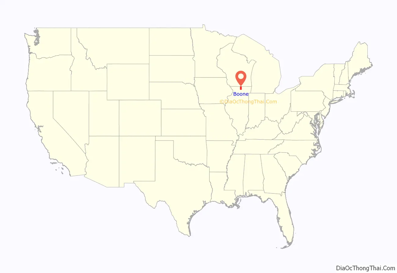
Boone County location map. Where is Boone County?
History
Unlike most of Illinois, much of Northern Illinois was not submerged in a shallow prehistoric sea. As a result, bedrock found in the area now bounded as Boone County is almost entirely Ordovician, as opposed to nearby counties like McHenry and Carroll which contain large areas of later Silurian bedrock. Till and outwash from the Illinoian glaciation covers area bedrock to a depth of several hundred feet. The county’s proximity to the driftless area protected the region somewhat from the more recent Wisconsin glaciation. As a result, the county’s northern townships resemble a driftless-like area, with higher peak elevations and more surface detail compared to the southern townships dominated by the broad flood plains of the Kishwaukee River and its tributaries.
By the time of the first identified human settlements, the region was made up of thickly wooded forested hills and grassy prairie plains. Archeological study at the Koster Site seems to indicate that humans had established complex societies ten thousand years ago along the river basins of the Illinois and Mississippi. By the time of European exploration, Upper Mississippian culture collapsed; westward expansion forced many Algonquin-speaking nations into conflict with each other as they moved after encroachment of their lands. Potowatomi and Mascouten tribes were still living in the region when white settlers arrived and statehood was declared in 1818.
As a political institution, Boone County was formed in 1837 out of Winnebago County. It was named for Kentucky frontiersman Daniel Boone. The first non-Native American settlers arrived in what is now Boone County in 1835. They arrived as a result of the end of the Black Hawk War as well as the completion of the Erie Canal. They consisted entirely of settlers from New England. These were “Yankee” settlers, that is to say they were descended from the English Puritans who settled New England in the colonial era. They were primarily members of the Congregational Church though due to the Second Great Awakening many of them had converted to Methodism and some had become Baptists before coming to what is now Boone County. When the New England settlers arrived in what is now Boone County there was nothing but a dense virgin forest and wild prairie. In the late 1870s immigrants began arriving from Germany and Ireland.
Boone County at the time of its creation in 1837
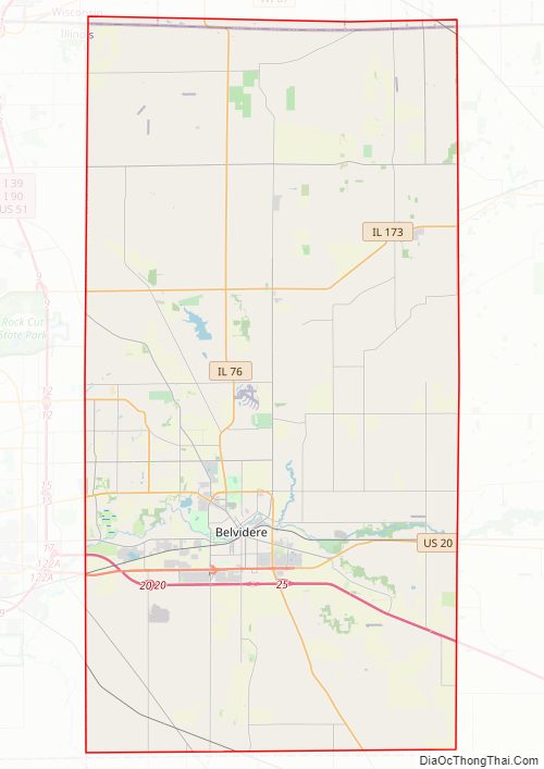
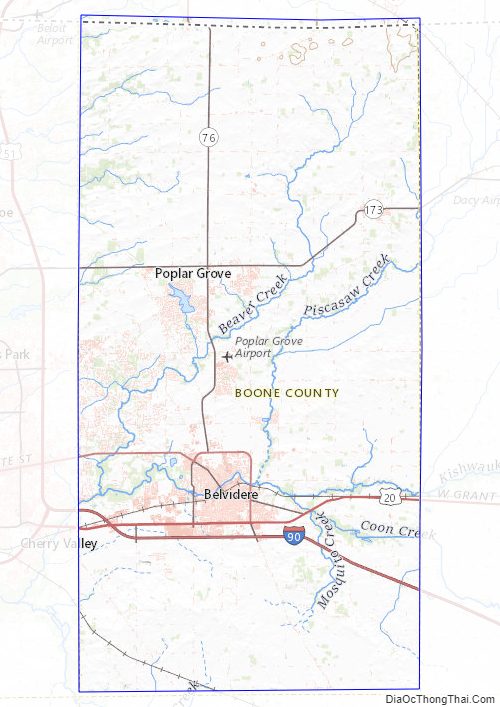
Boone County Road Map
Geography
According to the U.S. Census Bureau, the county has a total area of 282.039 square miles (730.48 km) (99.5%), of which 280.741 square miles (727.12 km) is land and 1.298 square miles (3.36 km) (0.5%) is water.
Adjacent counties
- Rock County, Wisconsin – north
- Walworth County, Wisconsin – northeast
- McHenry County – east
- DeKalb County – south
- Ogle County – southwest
- Winnebago County – west
Major highways
- Interstate 90
- US Route 20
- Illinois Route 76
- Illinois Route 173
Logan Avenue county route 40 Genoa Road (T-40) Garden Prairie Road county route 41 Poplar Grove Road county route 32 Capron Road (T-41)
Climate and weather
In recent years, average temperatures in the county seat of Belvidere have ranged from a low of 11 °F (−12 °C) in January to a high of 85 °F (29 °C) in July, although a record low of −29 °F (−34 °C) was recorded in January 1979 and a record high of 109 °F (43 °C) was recorded in July 1936. Average monthly precipitation ranged from 1.29 inches (33 mm) in February to 4.56 inches (116 mm) in June.
Boone County Topographic Map
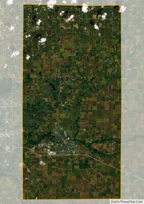
Boone County Satellite Map
Boone County Outline Map