Kenedy County is a county located in the U.S. state of Texas. As of the 2020 census, its population was 350. It is the third-least populous county in Texas and fourth-least populous in the United States. Its county seat is Sarita. The county was created in 1921 from parts of Hidalgo and Willacy counties and is named for Mifflin Kenedy, an early area rancher and steamboat operator.
Kenedy County is included in the Kingsville, TX Kingsville Micropolitan Statistical Area, which is also included in the Corpus Christi-Kingsville-Alice, TX Combined Statistical Area. There are no incorporated municipalities in Kenedy County.
In 1999, Hurricane Bret struck the county, but damage was minimal due to the sparse population. The Peñascal Wind Power Project was built near Sarita in the early 21st Century and is expected to slightly raise the population of the area.
The King Ranch, of which Mifflin Kenedy had been a partner prior to 1868, covers a large part of the county.
| Name: | Kenedy County |
|---|---|
| FIPS code: | 48-261 |
| State: | Texas |
| Founded: | 1921 |
| Named for: | Mifflin Kenedy |
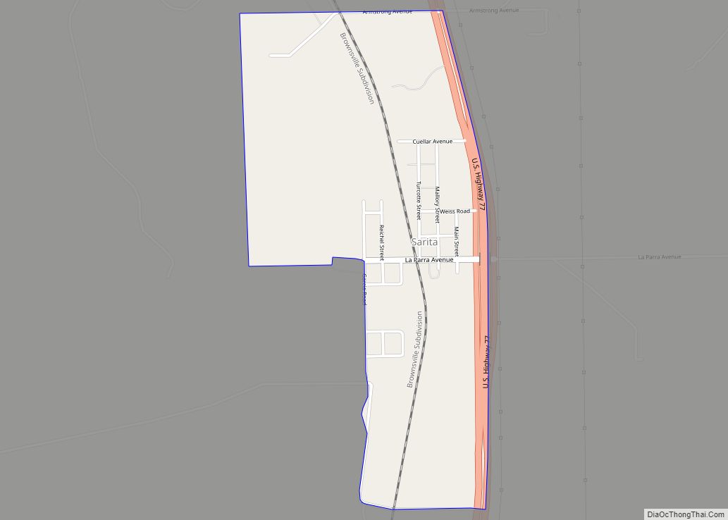
| Seat: | Sarita |
| Total Area: | 1,946 sq mi (5,040 km²) |
| Land Area: | 1,458 sq mi (3,780 km²) |
| Total Population: | 350 |
| Population Density: | 0.18/sq mi (0.069/km²) |
| Time zone: | UTC−6 (Central) |
| Summer Time Zone (DST): | UTC−5 (CDT) |
| Website: | www.co.kenedy.tx.us |
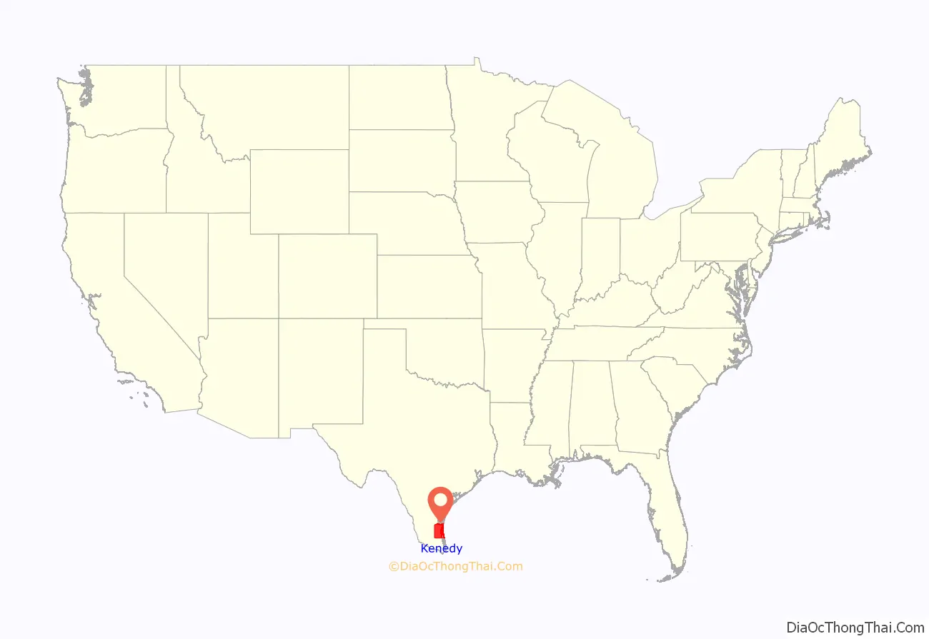
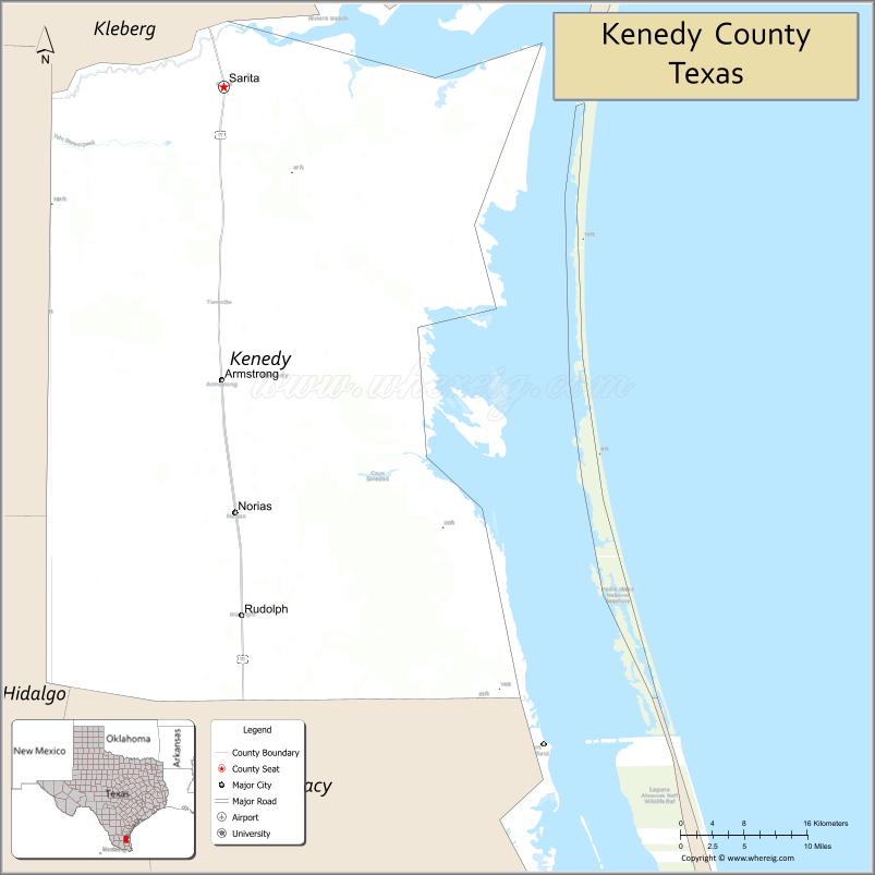
Kenedy County location map. Where is Kenedy County?
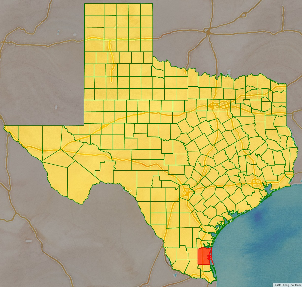
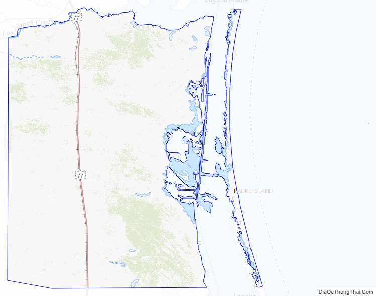
Kenedy County Road Map
Geography
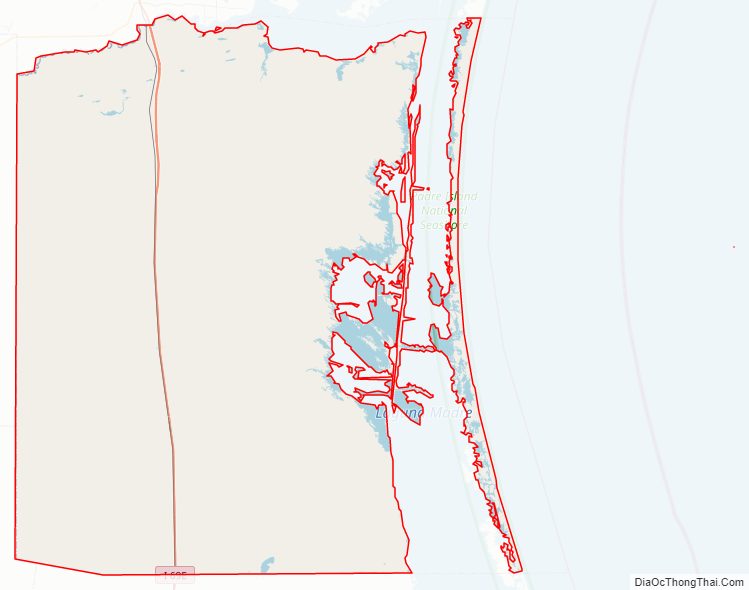
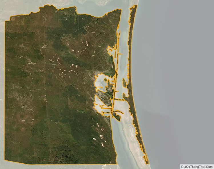
According to the U.S. Census Bureau, the county has a total area of 1,946 square miles (5,040 km), of which 1,458 square miles (3,780 km) is land and 487 square miles (1,260 km) (25%) is water. In total area, Kenedy is the 13th largest county in Texas. In land area only, it is the 25th-largest county in Texas. It borders the Gulf of Mexico. Baffin Bay makes up much of the border with Kleberg County.
Major highways
US 77 is the only highway (federal or state) in Kenedy County.
- U.S. Highway 77
- Interstate 69E is currently under construction and will follow the current route of U.S. 77 in most places.
Kenedy County Topographic Map
Kenedy County Satellite Map
Kenedy County Outline Map