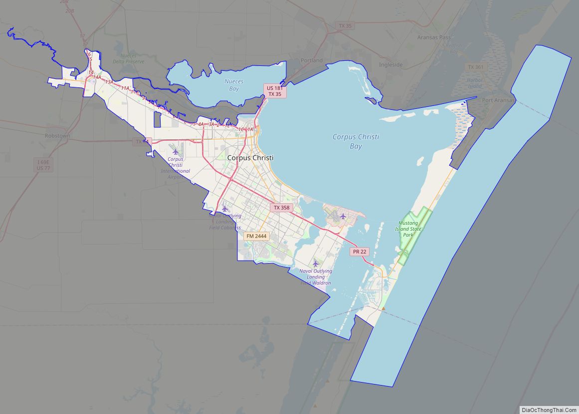
Corpus Christi (/ˌkɔːrpəs ˈkrɪsti/; Ecclesiastical Latin: “Body of Christ”) is a coastal city in the South Texas region of the U.S. state of Texas and the county seat and largest city of Nueces County, it also extends into Aransas, Kleberg, and San Patricio Counties. It is 130 miles (210 km) southeast of San Antonio. Its political boundaries encompass Nueces Bay and Corpus Christi Bay. Its zoned boundaries include small land parcels or water inlets of three neighboring counties.
The city’s population was 317,863 in 2020, making it the eighth-most populous city in Texas. The Corpus Christi metropolitan area had an estimated population of 442,600. It is also the hub of the six-county Corpus Christi–Kingsville Combined Statistical Area, with a 2013 estimated population of 516,793. The Port of Corpus Christi is the fifth-largest in the United States. The region is served by the Corpus Christi International Airport.
The city’s name means body of Christ in Ecclesiastical Latin, in reference to the Christian sacrament of Holy Communion. The name was given to the settlement and surrounding bay by Spanish explorer Alonso Álvarez de Pineda in 1519, as he discovered the lush semitropical bay on the Western Christian feast day of Corpus Christi.
Corpus Christi is home to Naval Air Station Corpus Christi, one of two locations training primary student pilots and advanced multi-engine pilots of the US Navy, US Marine Corps, and US Coast Guard.
| Name: | Corpus Christi city |
|---|---|
| LSAD Code: | 25 |
| LSAD Description: | city (suffix) |
| State: | Texas |
| County: | Aransas County, Kleberg County, Nueces County, San Patricio County |
| Elevation: | 7 ft (2 m) |
| Land Area: | 160.63 sq mi (416.03 km²) |
| Water Area: | 328.10 sq mi (849.77 km²) |
| Population Density: | 2,033.17/sq mi (785.01/km²) |
| Area code: | 361 |
| FIPS code: | 4817000 |
| GNISfeature ID: | 2410234 |
| Website: | www.cctexas.com |
At our website, you can find the perfect Corpus Christi map for your needs. From city maps featuring streets, landmarks and things to do to an interactive map of the Texas city, you can find it all here and print them out.
Corpus Christi is an amazing place to visit and explore. With miles of beaches, a rich maritime history, and plenty of things to do, the city is a great destination for travelers of all types. Our website offers you the perfect Corpus Christi map for your journey.
Browse through our selection of maps and print them out to start exploring. From city maps to an interactive one, you can find them all here. Begin your journey through Corpus Christi, Texas and start learning about its maritime history.
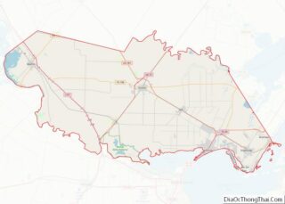
Online Interactive Map
Click on ![]() to view map in "full screen" mode.
to view map in "full screen" mode.
Whether you are a history buff, a big fan of the ocean, or just looking for a great place to visit, Corpus Christi is a great option. Corpus Christi has many great attractions for all travelers. For instance, it is home to some of the largest shipwrecks in history. With museums, art galleries, and amazing restaurants, this map will allow you to find the best restaurants, attractions, and things to do.
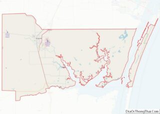
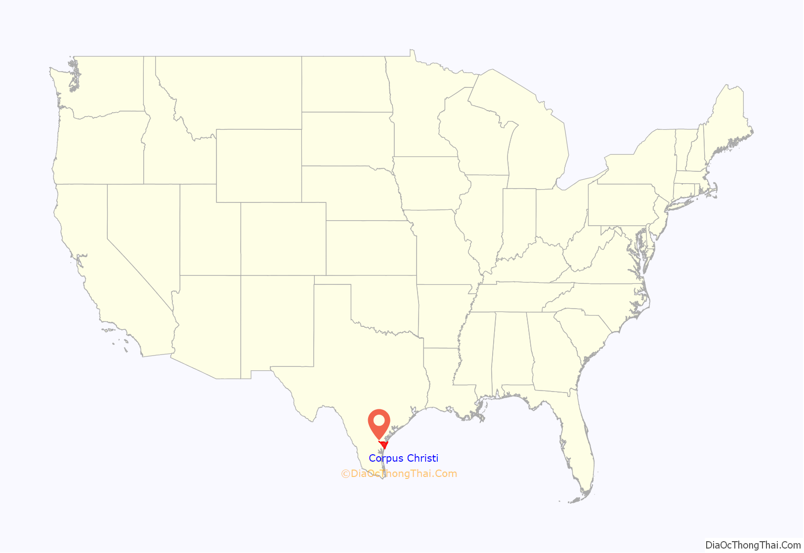
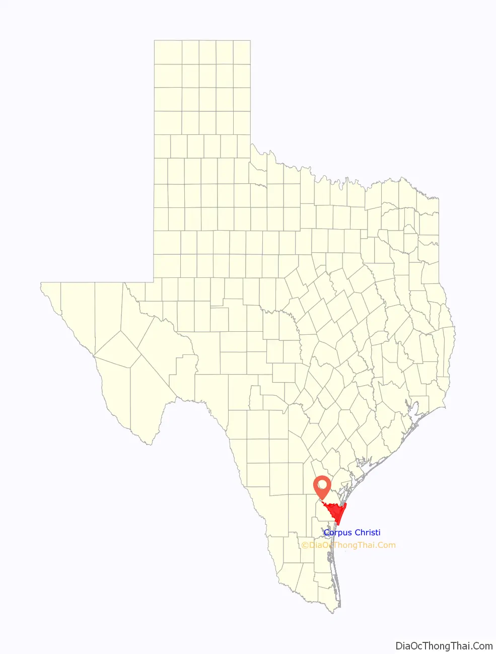
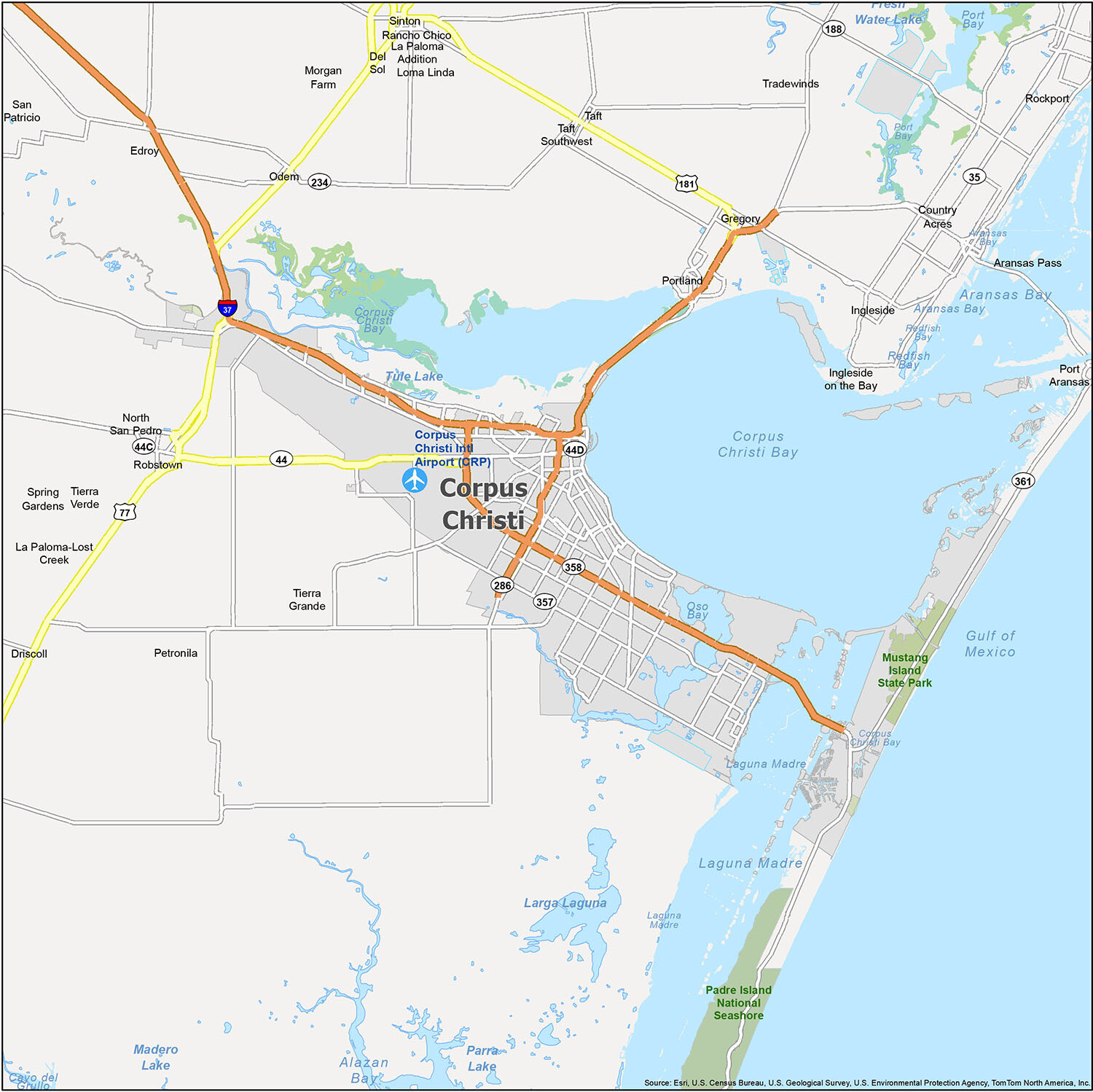
Corpus Christi location map. Where is Corpus Christi city?
History
Spaniard Alonso Alvarez de Pineda traveled in 1519 to this bay on the day of the religious Feast of Corpus Christi, so named the semitropical bay Corpus Christi.
Cabeza de Vaca may have passed through Corpus Christi in the 1500s, but the first European to study the Nueces River and Corpus Christi Bay was Joaquín de Orobio y Basterr in 1747. A few years later, José de Escandón organized a colony of about 50 families to settle the head of the bay, though this was short-lived.
In 1839, the first known permanent settlement of Corpus Christi was established by Colonel Henry Lawrence Kinney and William P. Aubrey as Kinney’s Trading Post, or Kinney’s Ranch. It was a small trading post that sold supplies to a Mexican revolutionary army camped about 25 mi (40 km) west. In July 1845, U.S. troops commanded by General Zachary Taylor set up camp there in preparation for war with Mexico, where they remained until March 1846. About a year later, the settlement was named Corpus Christi and was incorporated on September 9, 1852.
The Battle of Corpus Christi was fought between August 12 and August 18, 1862, during the American Civil War. United States Navy forces blockading Texas fought a small land and sea engagement with Confederate forces in and around Corpus Christi Bay and bombarded the city. Union forces defeated Confederate States Navy ships operating in the area, but were repulsed when they landed on the coast.
The Port of Corpus Christi was opened in 1926, and the Corpus Christi Naval Air Station was commissioned in 1941.
The 1919 Storm devastated the city, killing hundreds on September 14. Only three structures survived the storm on North Beach. To protect the city, the seawall was built. The city also suffered damage from Hurricane Celia in 1970 and Hurricane Allen in 1980, but little damage from Hurricane Ike in 2008. In 2017, the city was affected by Hurricane Harvey then by Hurricane Hanna in 2020. Rough surf from Hurricane Laura caused one death and one injury at a beach in the city in late August 2020, just a month after Hanna.
Civil rights
- In November 1873, seven Mexican shepherds were lynched by a mob near the city. The crime was never solved.
- In February 1929, the League of United Latin American Citizens (LULAC) was founded in Corpus Christi. This organization was created to battle racial discrimination against Hispanic people in the United States. Since its founding, LULAC has grown and now has a national headquarters in Washington, DC.
- In March 1949, the American GI Forum (AGIF) was founded in Corpus Christi. Currently, AGIF focuses on veteran’s issues, education, and civil-rights issues. This organization was founded after concerns over the segregation of Mexican-American veterans from other veterans groups and the denial of medical services based on race by the United States Department of Veterans Affairs.
- Cisneros v. Corpus Christi Independent School District (1970) was the first case to extend the U.S. Supreme Court’s Brown v. the Board of Education of Topeka, Kansas decision (1954) to Mexican Americans. It recognized them as a minority group that could be and was frequently discriminated against. Such segregation and discrimination was ruled unconstitutional. Judge Woodrow Seals found that the school board consciously fostered a system that perpetuated traditional segregation. This included a system that bused Anglo students to schools out of their neighborhoods, renovated old schools in black and Mexican-American neighborhoods rather than building new ones, assigned black and Hispanic teachers to segregated schools, and limited hiring of such teachers at other schools; the school board also lacked a majority-to-minority busing system.
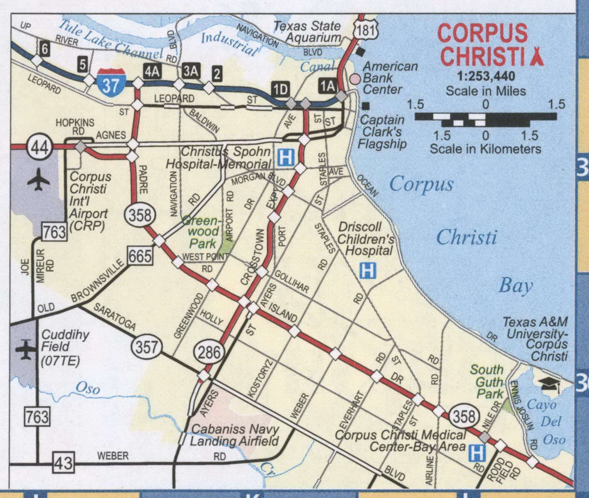
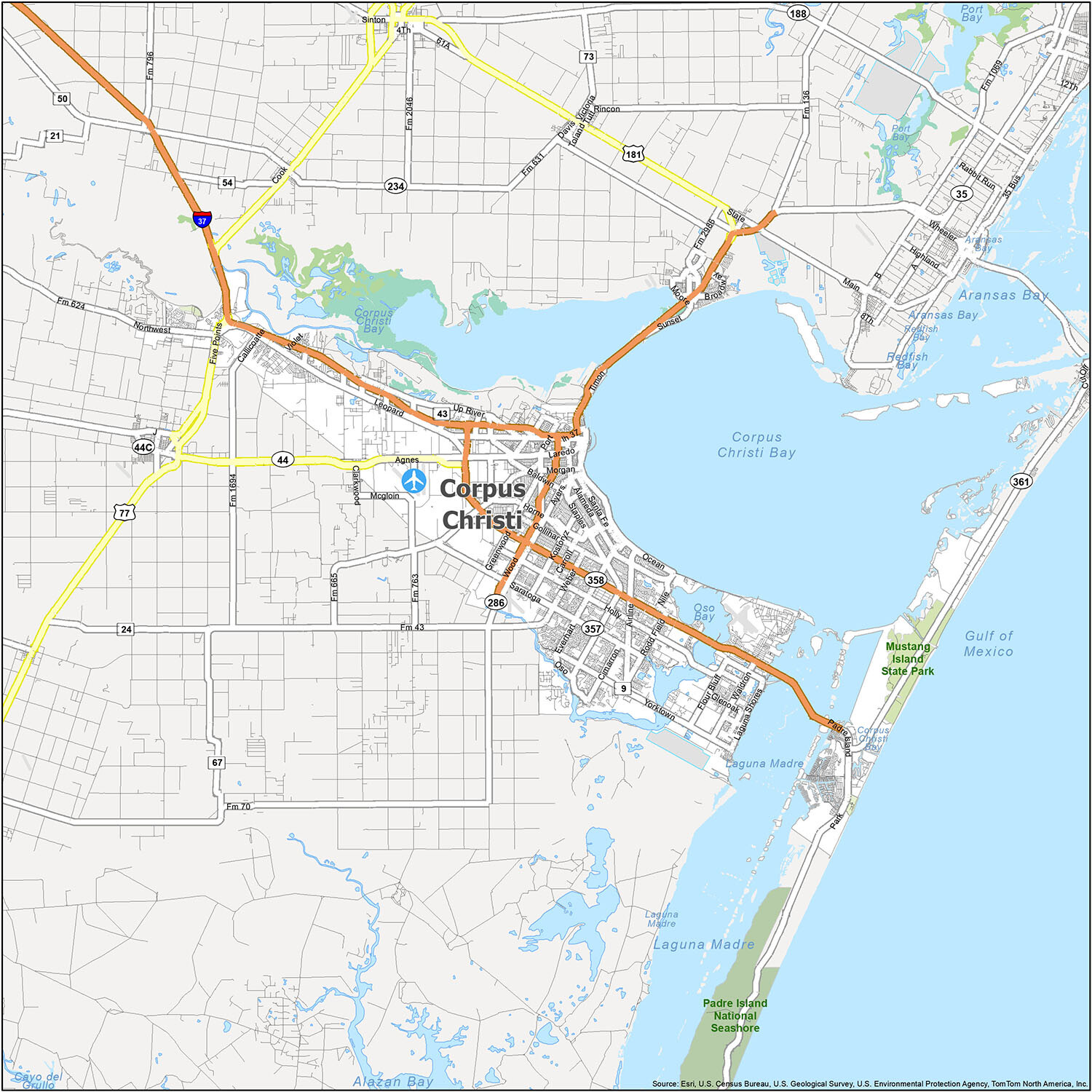
Corpus Christi Road Map
Corpus Christi, Texas is a beautiful port city that is known for its year-round warm climate and various historic and beautiful buildings. This road map of the city can help you navigate its intricate road network, which includes Interstate 37 and US Highways 9, 11, 17, 22, 37, 43, 44, 53, 54, 77, 181, 286, 357, 358, and 361. Additionally, the city features two parkways, Brawner Pky and Oso Pky, as well as a number of major roads such as Airline Rd, Everhart Rd, Five Points Rd, Gollihar Rd, Greenwood Dr, Holly Rd, Horne Rd, Mcardle Rd, Ocean Dr, Old Robstown Rd, Padre Island Dr, Rodd Field Rd, Saratoga Blvd, Staples St, and Wood St. If you want to travel outside the city, you can use the free Texas road map available online.
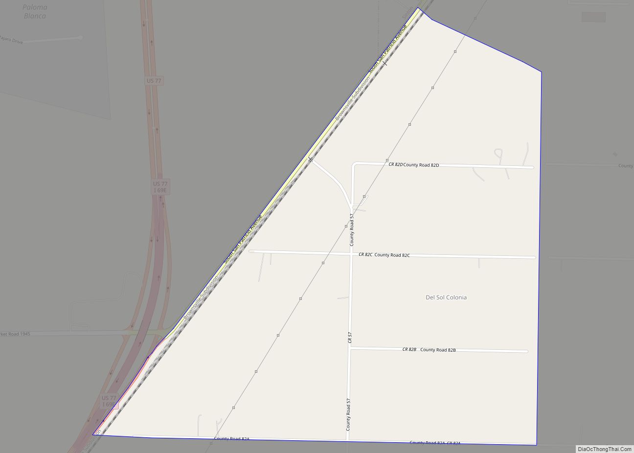
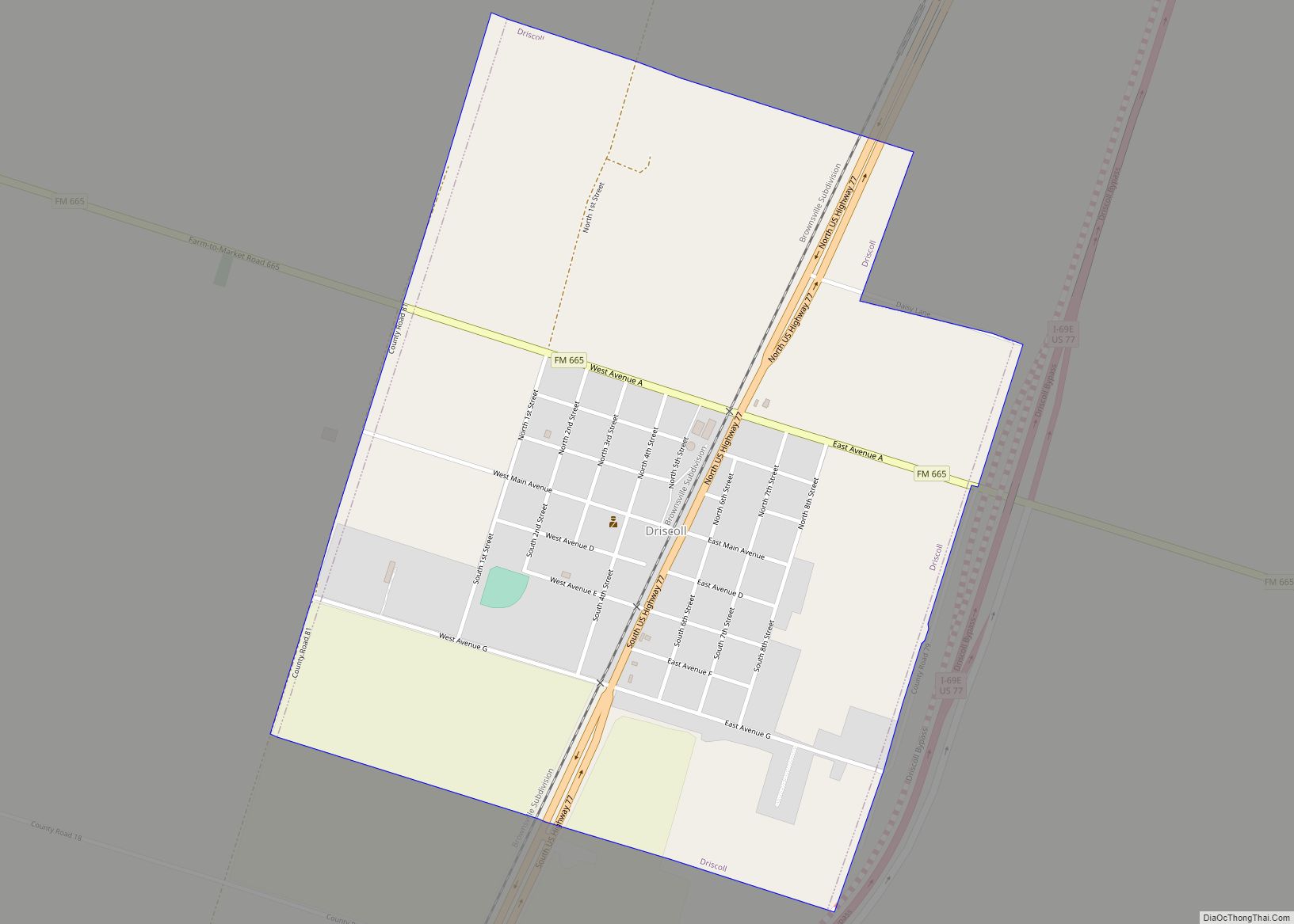
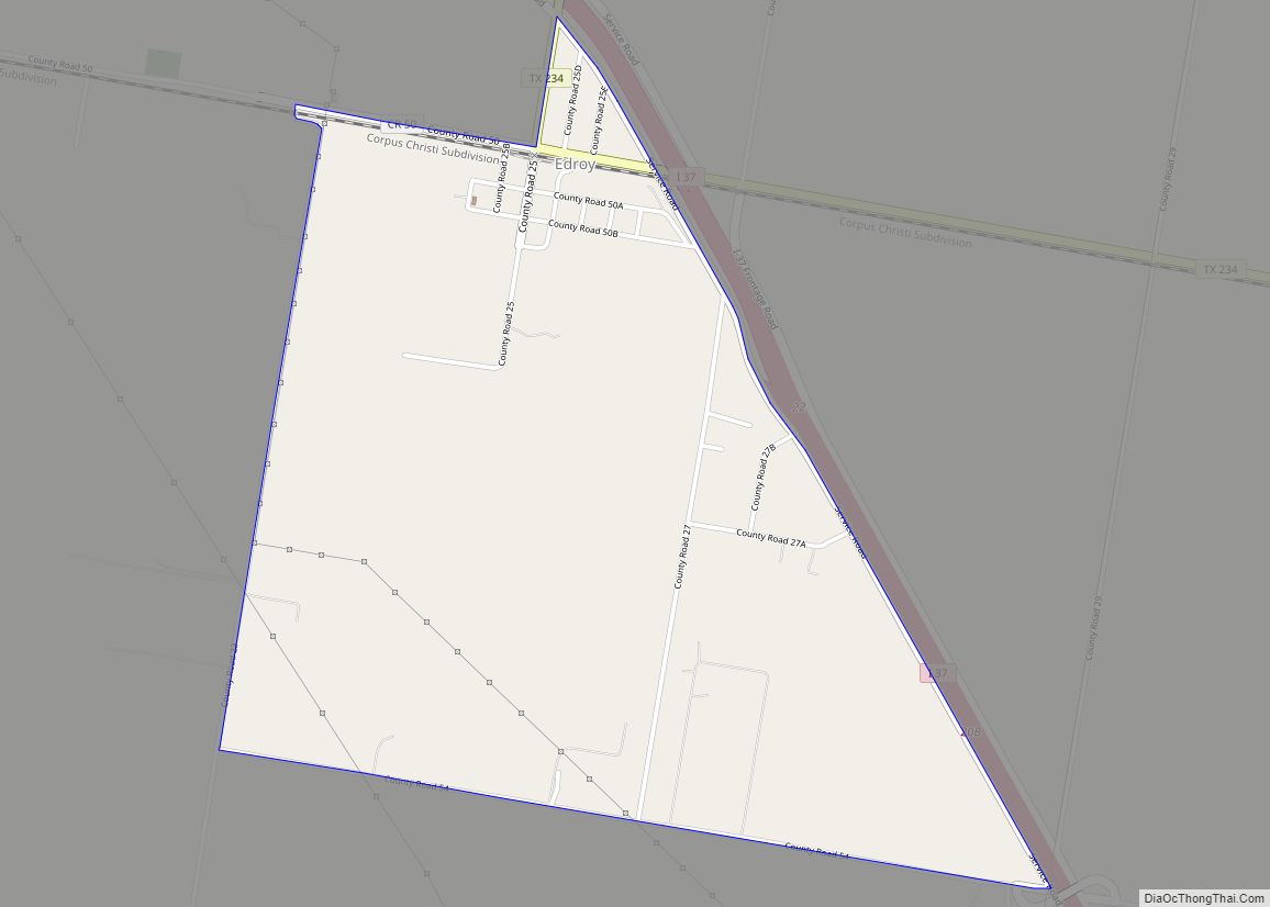
Corpus Christi is the eighth-largest city in the state of Texas, with a population of just shy of 325,000 people. Situated on the Gulf Coast, Corpus Christi offers miles of beaches and year-round warm weather, making it an ideal destination for a getaway. The city is served by the Corpus Christi International Airport (CRP), and is close to a number of other cities and census-designated places, including Bexley, Aransas Pass, Driscoll, Gregory, Ingleside, Ingleside on the Bay, Odem, Petronila, Port Aransas, Portland, Robstown, Rockport, San Patricio, Sinton, Taft, Country Acres, Del Sol, Edroy, Falman, La Paloma Addition, La Paloma-Lost Creek, Loma Linda, Morgan Farm, North San Pedro, Rancho Chico, Spring Gardens, Taft Southwest, Tierra Grande, Tierra Verde, and Tradewinds. With so much to do, Corpus Christi is the perfect place to plan your next vacation!
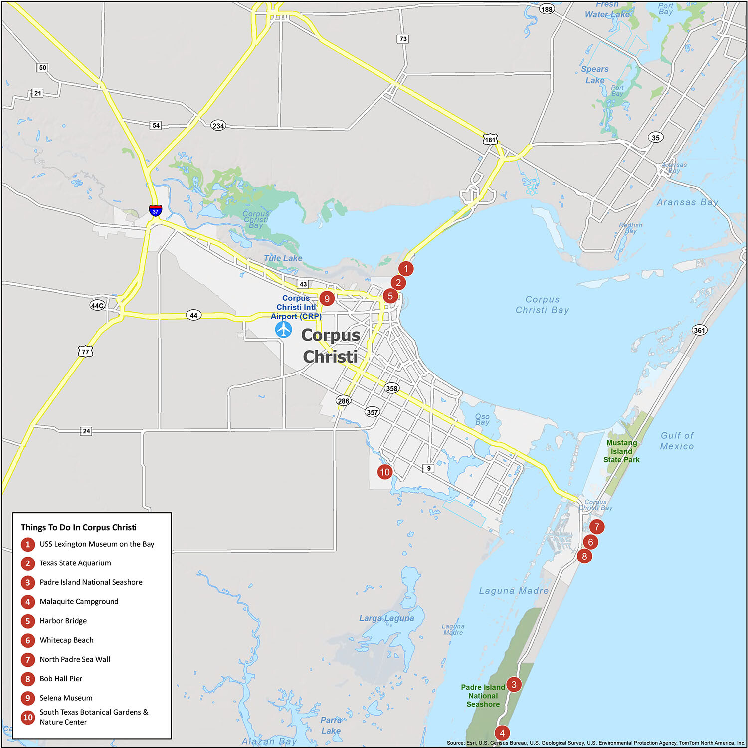
10 things to do in Corpus Christi city
From its beautiful beaches to its historic places, Corpus Christi has something for everyone. From family-friendly activities and attractions to museums and aquariums, you’ll find something to keep everyone happy and satisfied. The USS Lexington Museum on the Bay, the Texas State Aquarium, Padre Island National Seashore, Malaquite Campground, Harbor Bridge, Whitecap Beach, North Padre Sea Wall, Bob Hall Pier, Selena Museum, and South Texas Botanical Gardens & Nature Center are all worth checking out!
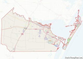
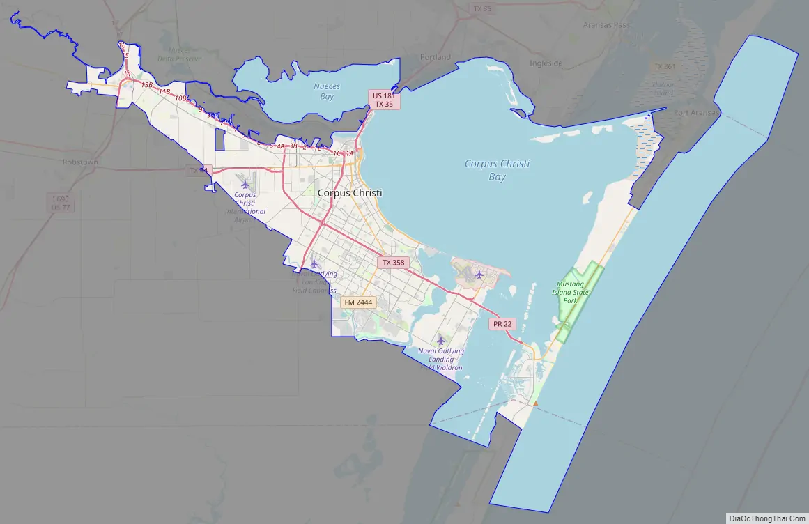
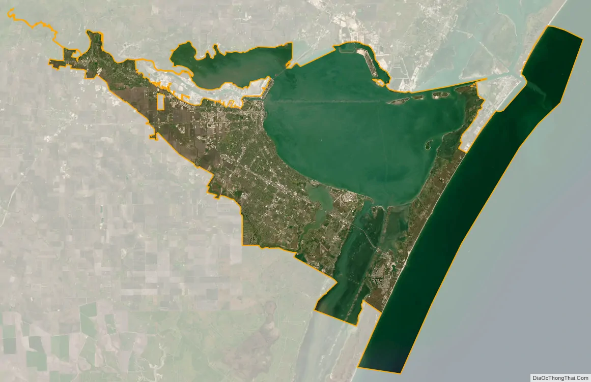
Corpus Christi city Satellite Map
Geography
Corpus Christi is situated on fluvial deposits that are of Holocene—Pleistocene age. Although no solidified rock occurs naturally at the surface, the Deweyville Formation of sand, silt, clay, and gravel, is locally indurated with calcium carbonate (caliche) deposits. In 2017, Hurricane Harvey’s storm surge eroded down to shale bedrock at a depth around 40 ft in Packery Channel, an artificial pass cut between North Padre and Mustang Islands. This feature has become a gathering place for game fish, and can be identified from the surface by its whirlpool-like current. The large, shallow bay makes Corpus Christi an ideal feeding place for birds, and this is one reason why Corpus Christi is known as the “Bird Capital” of North America. Consequently, the San Diego Audubon Society has designated Corpus Christi as “America’s birdiest place”.
According to the United States Census Bureau, Corpus Christi has a total area of 460.2 square miles (1,192.0 km), of which 154.6 mi (400.5 km, 33.60%) are land and 305.6 mi (791.5 km, 66.40%) are covered by water.
Annexation
Since its founding, the city has annexed nearby lands and waters for growth and development purposes. The original area encompassed several city blocks in present-day downtown Corpus Christi with the majority of city expansion occurring in the 20th century.
Neighborhoods
- Annaville
- Clarkwood
- Bayside
- Calallen
- Flour Bluff
- Gardendale
- Hillcrest
- North Beach
- South Side
- Mustang Island
- North Padre Island
Suburbs
- Portland
- Robstown
- Aransas Pass
- Port Aransas
- Sinton
- Odem
- Gregory
- Mathis
- Taft
- Ingleside
- Agua Dulce
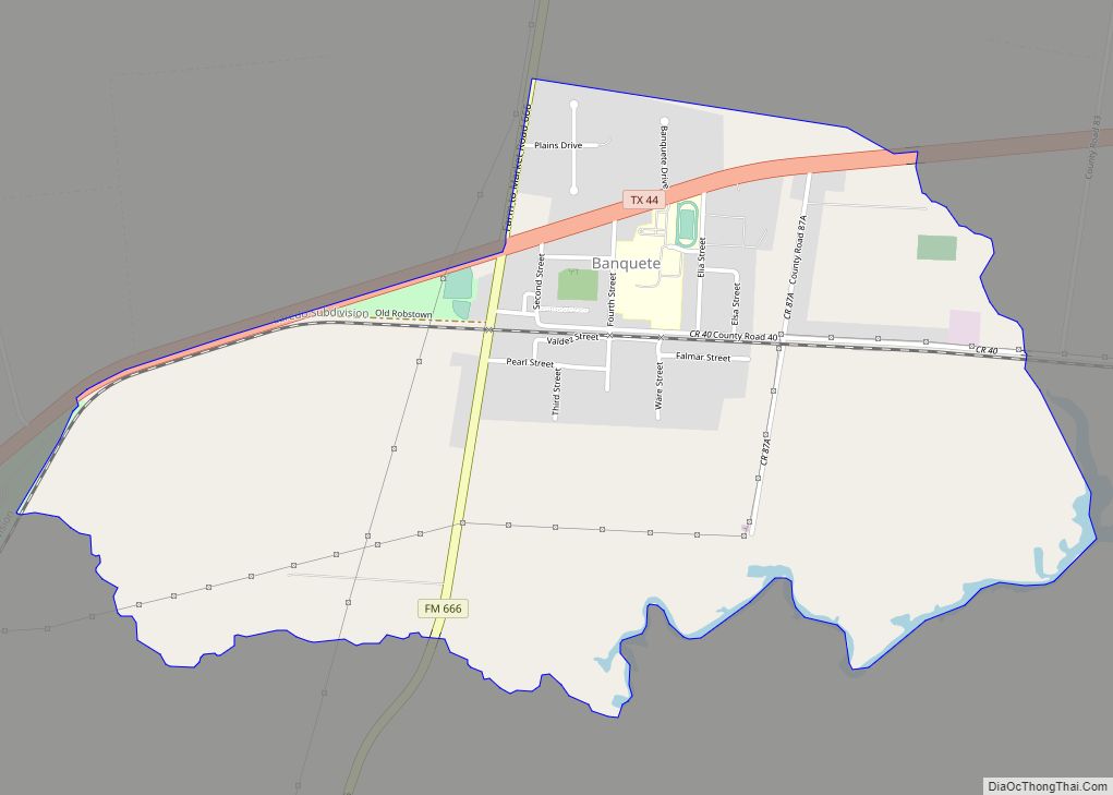
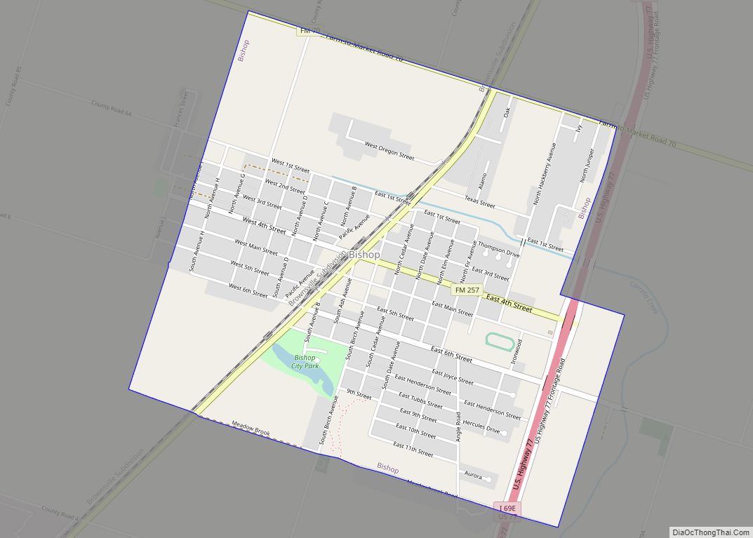
- Bishop
Climate
The city has a humid subtropical climate (Köppen: Cfa), with hot, very humid summers and very short, mild winters. In November through February, the weather is the coolest. A noticeable warming trend occurs in March through April. The warmest part of the year is June through September, with August being the peak of summer. October in the city is very warm, but not as hot as the summer. The city itself much like the Gulf Coast of Texas experiences just two seasons, a monsoon summer from April to October and a dry winter from November to March. Corpus Christi is very windy, with wind speeds often reaching 25 miles per hour (40 km/h; 11 m/s) with gusts reaching more than 35 mph (56 km/h; 16 m/s). The city’s record high temperature is 109 °F (43 °C), on September 5, 2000, and the hottest month August 2012 with an average of 88.3 °F (31.3 °C). Average night-time winter lows in January, the coldest month, are a little less than 50 °F (10 °C) and its record low is 11 °F (−12 °C) on February 12, 1899, and the coldest maximum 26 °F (−3 °C) on five occasions, the most recent being on January 30, 1951. Winter and early spring are generally dry, and average monthly precipitation is highest in September, when the threat from hurricanes and other tropical weather systems is greatest. The coolest month on record has been February 1905, with a mean of 45.6 °F (7.6 °C). In December 2004, the city experienced snowfall on Christmas Eve, the city’s largest recorded snowstorm at 4.4 in (11 cm). The snow melted the day after Christmas. The city experienced light snowfall a second time, on December 8, 2017, nearly 13 years later.
Between 1981 and 2010, Corpus Christi averaged 31.73 in (806 mm) of rainfall; however, long periods with very little rainfall are normal, and hurricanes can frequently produce daily falls of over 4 in (100 mm). The wettest day on record is July 2, 2007, with 9.86 inches or 250 millimetres, while the wettest month on record is September 1967, with 20.33 in (516 mm), including four days with over 3 in (76 mm). Eight months with not even a trace of rainfall have happened, of which the most recent was May 1998, and 21 with merely a trace. The longest spell without measurable rainfall in Corpus Christi has been 55 days from June 23 to August 17 (inclusive) of 1895, and from June 1 to July 25 of 1915, while easily the driest calendar year has been 1917, with a mere 5.38 in (137 mm). The two wettest calendar years have been 1888 with 48.16 in (1,223 mm) and 1991 with 48.07 in (1,221 mm), although from August 1967 to July 1968, 59.09 in (1,501 mm) fell, and for the 12 months ending January 1918, only 5.22 in (133 mm).
Hurricanes seldom hit the city, but those which have were destructive, such as the 1919 Florida Keys hurricane and Hurricane Harvey in 2017. The city also can see tornadoes, with an F2 tornado hitting the area on April 29, 1961.
See also
Map of Texas State and its subdivision:- Anderson
- Andrews
- Angelina
- Aransas
- Archer
- Armstrong
- Atascosa
- Austin
- Bailey
- Bandera
- Bastrop
- Baylor
- Bee
- Bell
- Bexar
- Blanco
- Borden
- Bosque
- Bowie
- Brazoria
- Brazos
- Brewster
- Briscoe
- Brooks
- Brown
- Burleson
- Burnet
- Caldwell
- Calhoun
- Callahan
- Cameron
- Camp
- Carson
- Cass
- Castro
- Chambers
- Cherokee
- Childress
- Clay
- Cochran
- Coke
- Coleman
- Collin
- Collingsworth
- Colorado
- Comal
- Comanche
- Concho
- Cooke
- Coryell
- Cottle
- Crane
- Crockett
- Crosby
- Culberson
- Dallam
- Dallas
- Dawson
- Deaf Smith
- Delta
- Denton
- Dewitt
- Dickens
- Dimmit
- Donley
- Duval
- Eastland
- Ector
- Edwards
- El Paso
- Ellis
- Erath
- Falls
- Fannin
- Fayette
- Fisher
- Floyd
- Foard
- Fort Bend
- Franklin
- Freestone
- Frio
- Gaines
- Galveston
- Garza
- Gillespie
- Glasscock
- Goliad
- Gonzales
- Gray
- Grayson
- Gregg
- Grimes
- Guadalupe
- Hale
- Hall
- Hamilton
- Hansford
- Hardeman
- Hardin
- Harris
- Harrison
- Hartley
- Haskell
- Hays
- Hemphill
- Henderson
- Hidalgo
- Hill
- Hockley
- Hood
- Hopkins
- Houston
- Howard
- Hudspeth
- Hunt
- Hutchinson
- Irion
- Jack
- Jackson
- Jasper
- Jeff Davis
- Jefferson
- Jim Hogg
- Jim Wells
- Johnson
- Jones
- Karnes
- Kaufman
- Kendall
- Kenedy
- Kent
- Kerr
- Kimble
- King
- Kinney
- Kleberg
- Knox
- La Salle
- Lamar
- Lamb
- Lampasas
- Lavaca
- Lee
- Leon
- Liberty
- Limestone
- Lipscomb
- Live Oak
- Llano
- Loving
- Lubbock
- Lynn
- Madison
- Marion
- Martin
- Mason
- Matagorda
- Maverick
- McCulloch
- McLennan
- McMullen
- Medina
- Menard
- Midland
- Milam
- Mills
- Mitchell
- Montague
- Montgomery
- Moore
- Morris
- Motley
- Nacogdoches
- Navarro
- Newton
- Nolan
- Nueces
- Ochiltree
- Oldham
- Orange
- Palo Pinto
- Panola
- Parker
- Parmer
- Pecos
- Polk
- Potter
- Presidio
- Rains
- Randall
- Reagan
- Real
- Red River
- Reeves
- Refugio
- Roberts
- Robertson
- Rockwall
- Runnels
- Rusk
- Sabine
- San Augustine
- San Jacinto
- San Patricio
- San Saba
- Schleicher
- Scurry
- Shackelford
- Shelby
- Sherman
- Smith
- Somervell
- Starr
- Stephens
- Sterling
- Stonewall
- Sutton
- Swisher
- Tarrant
- Taylor
- Terrell
- Terry
- Throckmorton
- Titus
- Tom Green
- Travis
- Trinity
- Tyler
- Upshur
- Upton
- Uvalde
- Val Verde
- Van Zandt
- Victoria
- Walker
- Waller
- Ward
- Washington
- Webb
- Wharton
- Wheeler
- Wichita
- Wilbarger
- Willacy
- Williamson
- Wilson
- Winkler
- Wise
- Wood
- Yoakum
- Young
- Zapata
- Zavala
- Alabama
- Alaska
- Arizona
- Arkansas
- California
- Colorado
- Connecticut
- Delaware
- District of Columbia
- Florida
- Georgia
- Hawaii
- Idaho
- Illinois
- Indiana
- Iowa
- Kansas
- Kentucky
- Louisiana
- Maine
- Maryland
- Massachusetts
- Michigan
- Minnesota
- Mississippi
- Missouri
- Montana
- Nebraska
- Nevada
- New Hampshire
- New Jersey
- New Mexico
- New York
- North Carolina
- North Dakota
- Ohio
- Oklahoma
- Oregon
- Pennsylvania
- Rhode Island
- South Carolina
- South Dakota
- Tennessee
- Texas
- Utah
- Vermont
- Virginia
- Washington
- West Virginia
- Wisconsin
- Wyoming