Hidalgo County (/hɪˈdælɡoʊ/; Spanish pronunciation: [iˈð̞alɣ̞o]) is located in the U.S. state of Texas. The county seat is Edinburg and the largest city is McAllen. The county is named for Miguel Hidalgo y Costilla, the priest who raised the call for Mexico‘s independence from Spain. It is located in the Rio Grande Valley of South Texas and is one of the fastest-growing counties in the United States. As of the 2020 census, the population of Hidalgo County was 870,781, making it the eighth-most populous county in Texas. Hidalgo County is designated by the U.S. Census Bureau as the McAllen-Edinburg-Mission metropolitan statistical area, which itself is part of the McAllen-Edinburg-Mission-Rio Grande City, Texas combined statistical area with neighboring Starr County.
With a population that is 91.9% Hispanic as of 2020, it is Texas’ second-most populous majority-Hispanic county and the fifth-largest nationwide. It is also the largest county which is over 90% Hispanic. It is also the southernmost landlocked county in the United States, and in 2021, it was the largest county in the nation with a total fertility rate above the replacement level (at 2.13).
| Name: | Hidalgo County |
|---|---|
| FIPS code: | 48-215 |
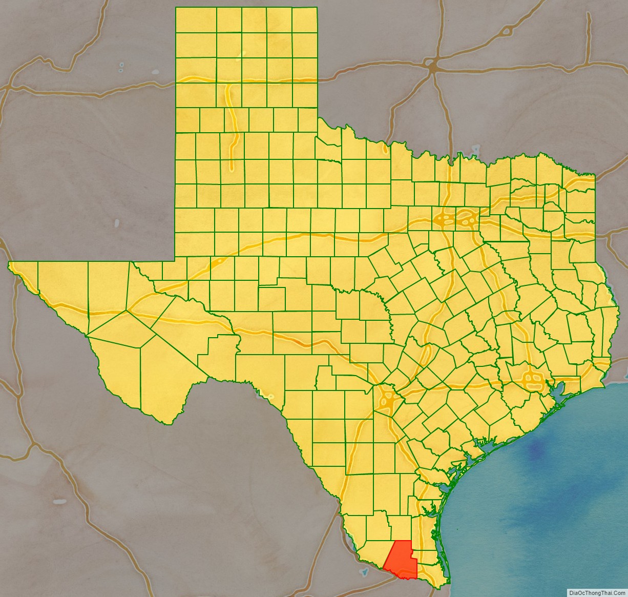
| State: | Texas |
| Founded: | January 24, 1852 |
| Named for: | Miguel Hidalgo y Costilla |
| Seat: | Edinburg |
| Largest city: | McAllen |
| Total Area: | 1,583 sq mi (4,100 km²) |
| Land Area: | 1,571 sq mi (4,070 km²) |
| Total Population: | 870,781 |
| Population Density: | 550/sq mi (210/km²) |
| Time zone: | UTC−6 (Central) |
| Summer Time Zone (DST): | UTC−5 (CDT) |
| Website: | www.hidalgocounty.us |
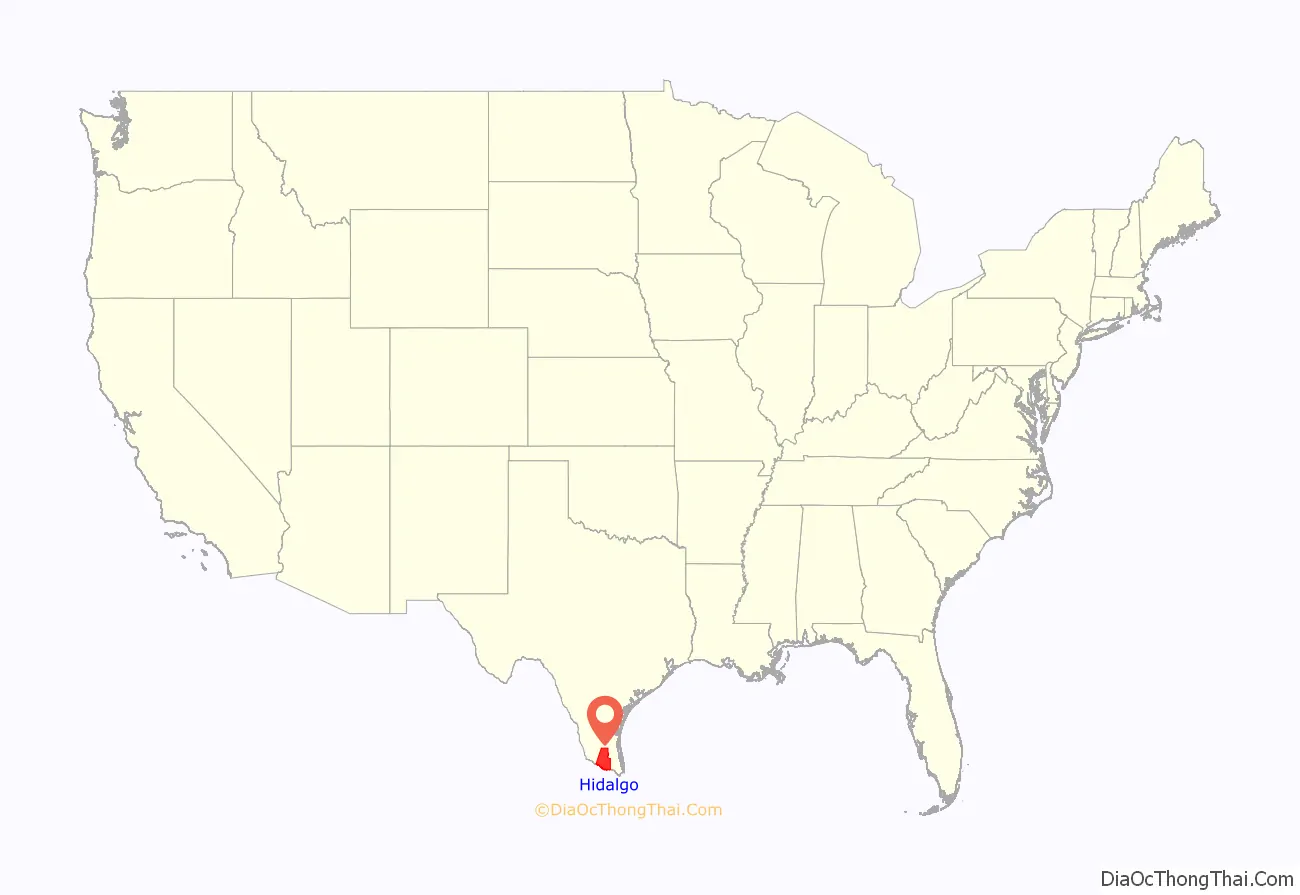
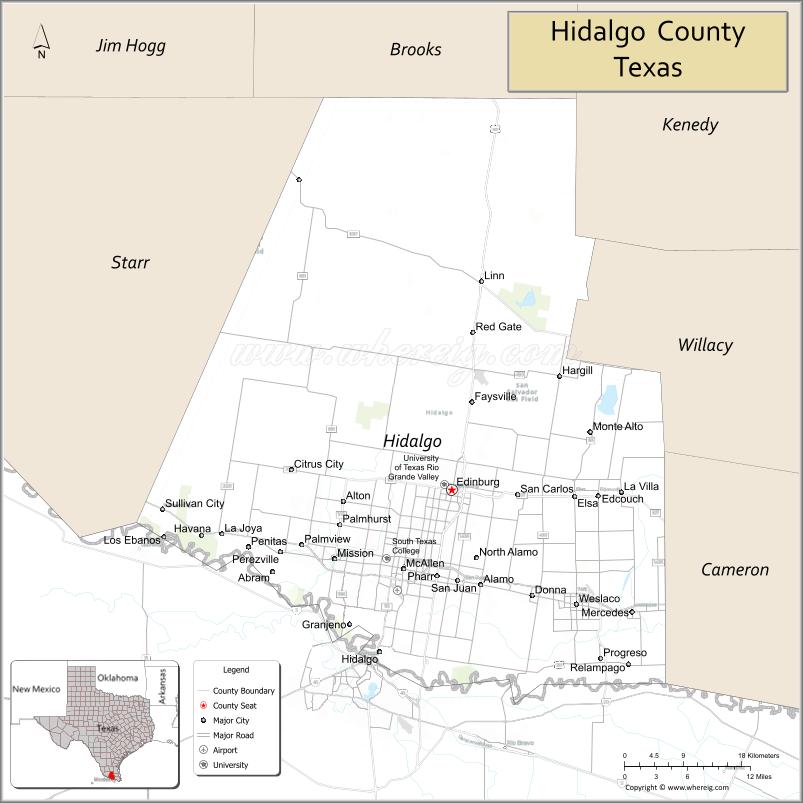
Hidalgo County location map. Where is Hidalgo County?
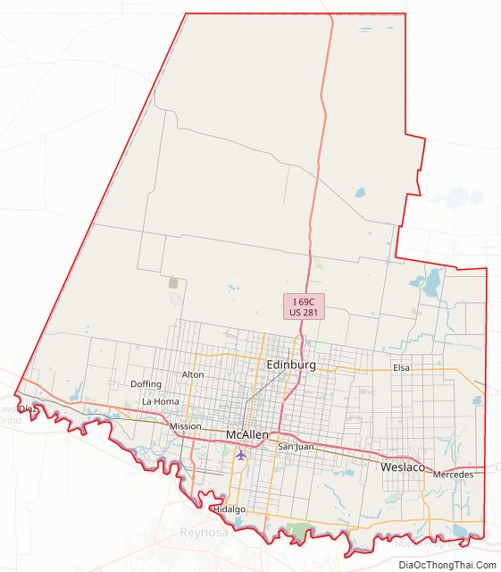
Hidalgo County Road Map
Geography
According to the U.S. Census Bureau, the county has a total area of 1,583 sq mi (4,100 km), of which 12 sq mi (31 km) (0.8%) are covered by water. The northern part of the county has sandy and light loamy soils over deep reddish or mottled, clayey subsoils. In some areas, limestone lies within 40 in (1 m) of the surface. The southern part of the county has moderately deep to deep loamy surfaces over clayey subsoils. Along the Rio Grande, brown to red clays occur. Hidalgo County is in the South Texas Plains vegetation area, which features grasses, mesquite, live oaks, and chaparral. Native plants, reduced in recent years by extensive farming, include chapote, guayacán, ebony, huisache, brasil, and yucca.
Natural resources included caliche, sand, gravel, oil, and gas. Oil and gas production in 1982 totaled 98,487,211,000 cubic feet (2.7888472×10 m) of gas-well gas, 139,995 barrels of crude oil, 1,101,666 barrels of condensate, and 15,784,000 cubic feet (447,000 m) of casinghead gas. The climate is subtropical and subhumid. Temperatures range from an average low of 47 °F (8 °C) in January to an average high to 96 °F (36 °C) in July; the average annual temperature is 73 °F (23 °C). Rainfall averages 23 inches (580 mm) a year, and the growing season lasts for 320 days of the year.
Major highways
- Interstate 2
- Interstate 69C (Under Construction)
- U.S. Highway 83
- U.S. Highway 281
- Texas State Highway 107
- Texas State Highway 186
- Texas State Highway 336
- Texas State Highway 495
- Farm to Market Road 364
- Farm to Market Road 490
- Farm to Market Road 492
- Farm to Market Road 493
- Farm to Market Road 494
- Farm to Market Road 676
- Farm to Market Road 681
- Farm to Market Road 907
- Farm to Market Road 1016
- Farm to Market Road 1017
- Farm to Market Road 1423
- Farm to Market Road 1426
- Farm to Market Road 1924
- Farm to Market Road 1925
- Farm to Market Road 2061
- Farm to Market Road 2557
- Farm to Market Road 3072
Adjacent counties and municipalities
- Brooks County (north)
- Kenedy County (northeast)
- Willacy County (east)
- Cameron County (east)
- Starr County (west)
- Gustavo Díaz Ordaz Municipality, Tamaulipas, Mexico (south)
- Reynosa Municipality, Tamaulipas, Mexico (south)
- Río Bravo Municipality, Tamaulipas, Mexico (south)
- Matamoros Municipality, Tamaulipas, Mexico (south)
National protected areas
- Lower Rio Grande Valley National Wildlife Refuge (part)
- Santa Ana National Wildlife Refuge
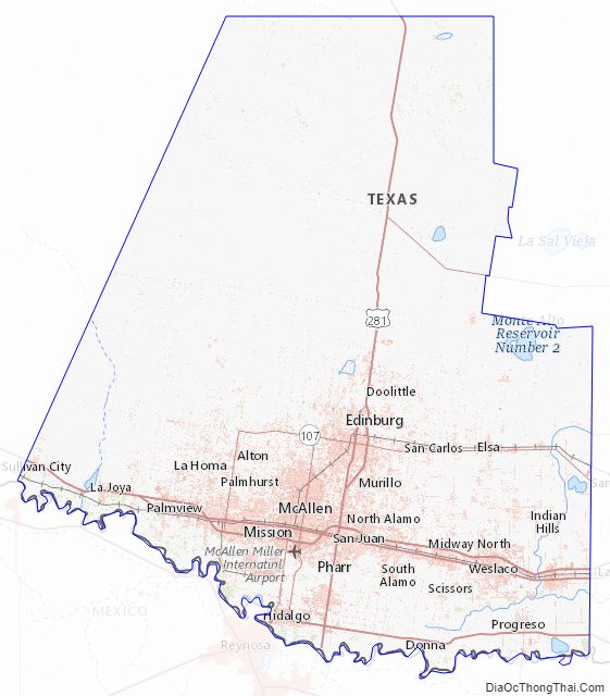
Hidalgo County Topographic Map
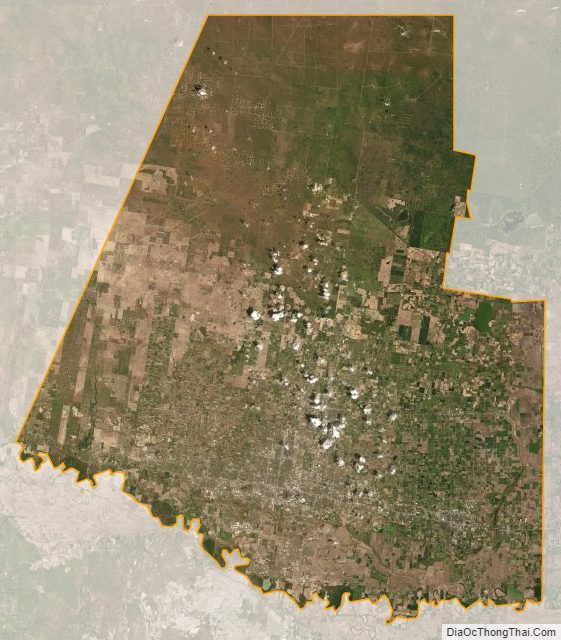
Hidalgo County Satellite Map
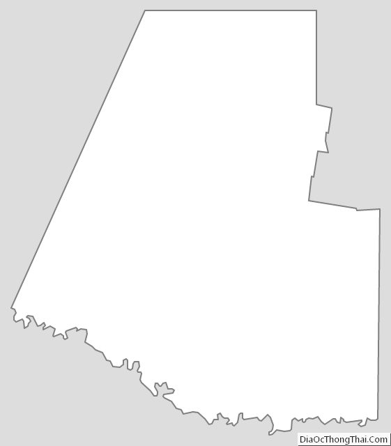
Hidalgo County Outline Map