Khmelnytskyi Oblast (Ukrainian: Хмельни́цька о́бласть, romanized: Khmelnytska oblast), also known as Khmelnychchyna (Ukrainian: Хмельни́ччина), is an oblast (province) in western Ukraine covering portions of the historical regions of western Podolia and southern Volhynia. The administrative center of the oblast is the city of Khmelnytskyi.
The current estimated population is around 1,228,829 (2022 est.).
Created in 1937 out of border okrugs of Vinnytsia Oblast, in 1941–44 it was under Nazi Germany occupation and part of the Reichskommissariat Ukraine (Wolhynien und Podolien general district). Following the Kamenets-Podolsky pocket in spring of 1944 as part of the Proskurov-Chernovtsy operation, Soviet troops removed the German occupation in the region. Until 4 February 1954 it was called Kamianets-Podilsky Oblast (Ukrainian: Кам’янець-Подільська область, romanized: Kamianets-Podilska oblast) and was centered in Kamianets-Podilsky until 1941. The region rebranding took place after the official renaming of the region’s administrative center to Khmelnytskyi.
| Unit Name | Khmel'nyts'kyy Oblast |
|---|---|
| Administrative center | Khmelnytskyi |
| Total area | 20.645 km² (7.971 sq mi) |
| Area Rank | Rank 19th |
| Population (2021) | 1.243.787 |
| Time zone | UTC+2 (EET) |
| Summer (DST) | UTC+3 (EEST) |
| Postal code | 29000-31999 |
| Area code | +380-38 |
| ISO 3166 code | UA-68 |
| Website | adm-km.gov.ua |
| Flag |  |
| Coat of arms |  |
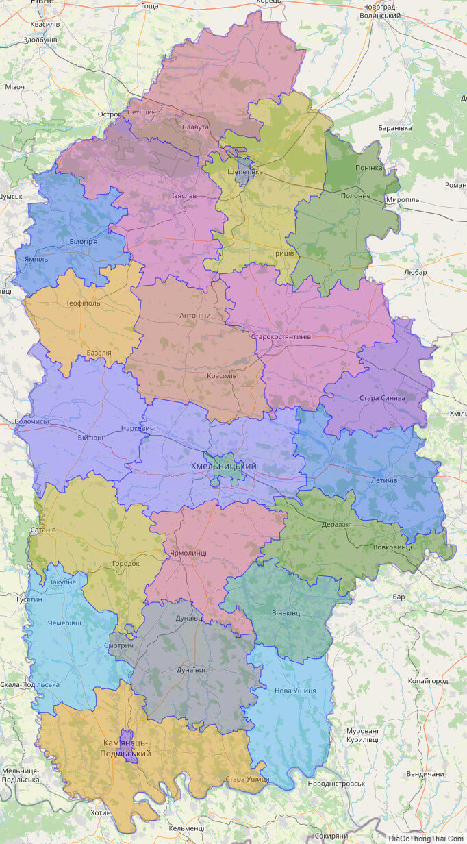
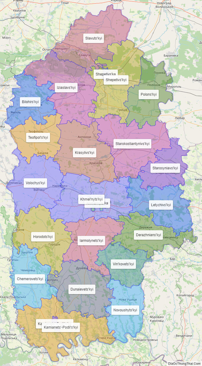
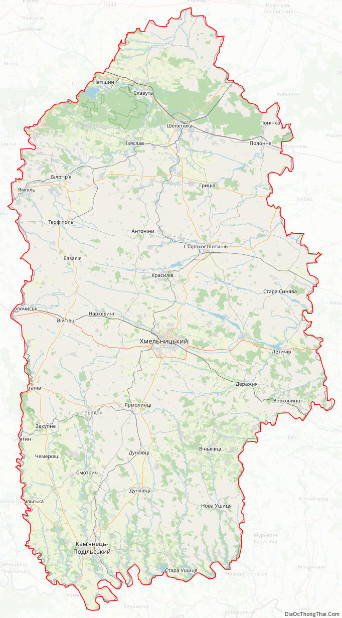
Online subdivision map of Khmel’nyts’kyy oblast
Looking for an easy and efficient way to navigate Khmel’nyts’kyy oblast in Ukraine? Look no further than the online subdivision map! With this handy tool, you can easily explore the various sub-administrative units and boundaries within the oblast.
Using a base map of your choosing, such as Open Street Map or satellite imagery, you can explore the area in detail. The map is also color-coded to help distinguish between different sub-administrative units, allowing you to easily identify and navigate the region.
Whether you’re a local resident looking to explore your own backyard, or a visitor planning a trip to Khmel’nyts’kyy oblast, the online subdivision map is a valuable resource. So why not check it out today and start discovering all that this fascinating region has to offer?
Click on ![]() to view map in "full screen" mode.
to view map in "full screen" mode.
List administrative sub-division of Khmel’nyts’kyy oblast
| # | Name | Type |
|---|---|---|
| 1 | Kamianets’-Podil’s’ka | Misto |
| 2 | Khmel’nyts’ka | Misto |
| 3 | Shepetivs’ka | Misto |
| 4 | Bilohirs’kyi | Raion |
| 5 | Chemerovets’kyi | Raion |
| 6 | Derazhnians’kyi | Raion |
| 7 | Dunaievets’kyi | Raion |
| 8 | Horodots’kyi | Raion |
| 9 | Iarmolynets’kyi | Raion |
| 10 | Iziaslavs’kyi | Raion |
| 11 | Kamianets’-Podil’s’kyi | Raion |
| 12 | Khmel’nyts’kyi | Raion |
| 13 | Krasylivs’kyi | Raion |
| 14 | Letychivs’kyi | Raion |
| 15 | Novoushyts’kyi | Raion |
| 16 | Polons’kyi | Raion |
| 17 | Shepetivs’kyi | Raion |
| 18 | Slavuts’kyi | Raion |
| 19 | Starokostiantynivs’kyi | Raion |
| 20 | Starosyniavs’kyi | Raion |
| 21 | Teofipol’s’kyi | Raion |
| 22 | Vin’kovets’kyi | Raion |
| 23 | Volochys’kyi | Raion |
Explaination:
- Mis’ka Rada: City municipalities (governed by a mayor and a city council)
- Misto: city at least 10,000 people (not a town).
- Raion: often translated as “district”.
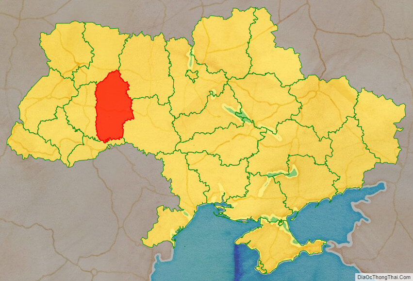
Location map of Khmel’nyts’kyy oblast, Ukraine

Political map of Khmel’nyts’kyy oblast
Khmel’nyts’kyy oblast streeet map
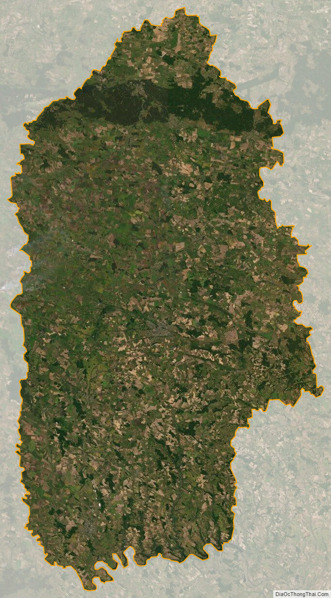
Khmel’nyts’kyy oblast satellite map