Kirovohrad Oblast (Ukrainian: Кіровоградська область, romanized: Kirovohradska oblast), also known as Kirovohradschyna (Ukrainian: Кіровоградщина), is an oblast (province) in central Ukraine. The administrative center of the oblast is the city of Kropyvnytskyi. Its population is 903,712 (2022 est.). It is Ukraine’s second least populated oblast, behind Chernivtsi.
In 2019, the Constitutional Court of Ukraine approved the change of the oblast’s name to Kropyvnytskyi Oblast (Ukrainian: Кропивницька область, romanized: Kropyvnytska oblast), or Kropyvnychchyna (Ukrainian: Кропивниччина). The change is not yet implemented.
| Unit Name | Kirovohrad Oblast |
|---|---|
| Administrative center | Kropyvnytskyi |
| Total area | 24.588 km² (9.493 sq mi) |
| Area Rank | Rank 15th |
| Population (2021) | 920.128 |
| Time zone | UTC+2 (EET) |
| Summer (DST) | UTC+3 (EEST) |
| Postal code | 25000-27999 |
| Area code | +380-52 |
| ISO 3166 code | UA-35 |
| Website | kr-admin.gov.ua |
| Flag |  |
| Coat of arms |  |
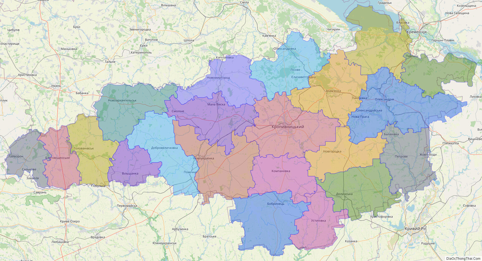
Online subdivision map of Kirovohrad oblast
Kirovohrad Oblast, located in central Ukraine, is home to a diverse range of landscapes and attractions. Whether you’re a local or a visitor, an online subdivision map of the region can be a useful tool for exploring everything it has to offer.
Using an online base map, such as OpenStreetMap or satellite imagery, you can view the oblast and its various sub-administrative units in detail. The map includes a cover layer with different colors to show the borders and boundaries of each area, making it easy to distinguish between them.
You can zoom in and out of the map to get a closer look at the different towns, villages, and cities within Kirovohrad Oblast. This allows you to explore the region’s unique architecture, landmarks, and natural beauty, including the Kremenchuk Reservoir, the Ingul River, and the Dnieper Upland.
Whether you’re planning a day trip or simply curious about the region, an online subdivision map of Kirovohrad Oblast can provide you with a wealth of information and insights. So why not take a virtual tour of the area today?
Click on ![]() to view map in "full screen" mode.
to view map in "full screen" mode.
List administrative sub-division of Kirovohrad oblast
| # | Name | Type |
|---|---|---|
| 1 | Bobrynets’kyi | Raion |
| 2 | Dobrovelychkivs’kyi | Raion |
| 3 | Dolyns’kyi | Raion |
| 4 | Haivorons’kyi | Raion |
| 5 | Holovanivs’kyi | Raion |
| 6 | Kirovohrads’kyi | Raion |
| 7 | Kompani‹vs’kyi | Raion |
| 8 | Malovyskivs’kyi | Raion |
| 9 | Novhorodkivs’kyi | Raion |
| 10 | Novoarkhanhel’s’kyi | Raion |
| 11 | Novomyrhorods’kyi | Raion |
| 12 | Novoukra‹ns’kyi | Raion |
| 13 | Oleksandriis’kyi | Raion |
| 14 | Oleksandrivs’kyi | Raion |
| 15 | Onufri‹vs’kyi | Raion |
| 16 | Petrivs’kyi | Raion |
| 17 | Svitlovods’kyi | Raion |
| 18 | Ul’ianovs’kyi | Raion |
| 19 | Ustynivs’kyi | Raion |
| 20 | Vil’shans’kyi | Raion |
| 21 | Znamians’kyi | Raion |
Explaination:
- Mis’ka Rada: City municipalities (governed by a mayor and a city council)
- Misto: city at least 10,000 people (not a town).
- Raion: often translated as “district”.
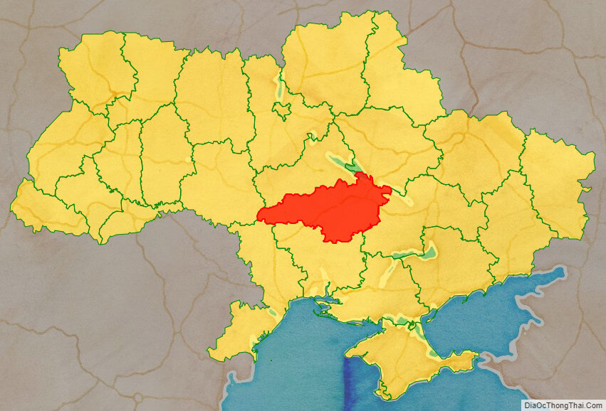
Location map of Kirovohrad oblast, Ukraine

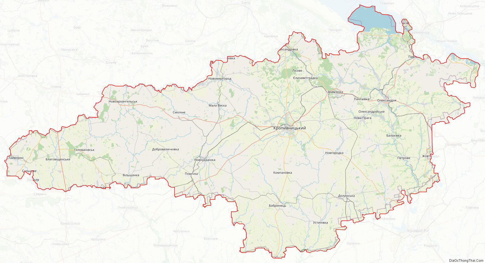
Political map of Kirovohrad oblast

Kirovohrad oblast streeet map
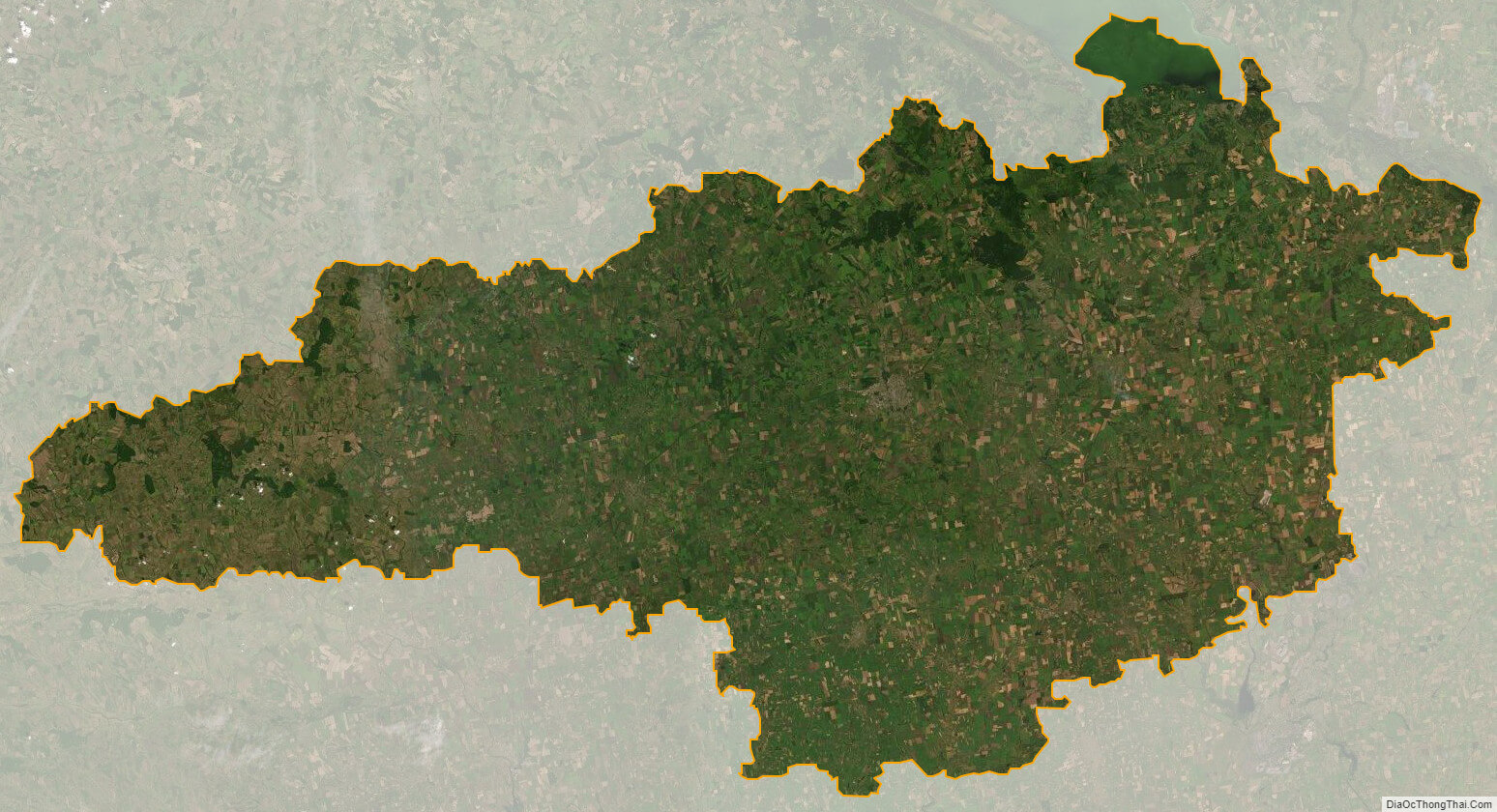
Kirovohrad oblast satellite map