Kyiv Oblast or Kiev Oblast (Ukrainian: Ки́ївська о́бласть, romanized: Kyïvska oblast), also called Kyivshchyna (Ukrainian: Ки́ївщина), is an oblast (province) in central and northern Ukraine. It surrounds, but does not include, the city of Kyiv, which is administered as a city with special status, though Kyiv also serves as the administrative center of the oblast. The Kyiv metropolitan area extends out from Kyiv city into parts of the oblast, which is significantly dependent on the urban economy and transportation of Kyiv.
The population of Kyiv Oblast is 1,795,079 (2022 est.). Its largest city is Bila Tserkva, with a population over 200,000.
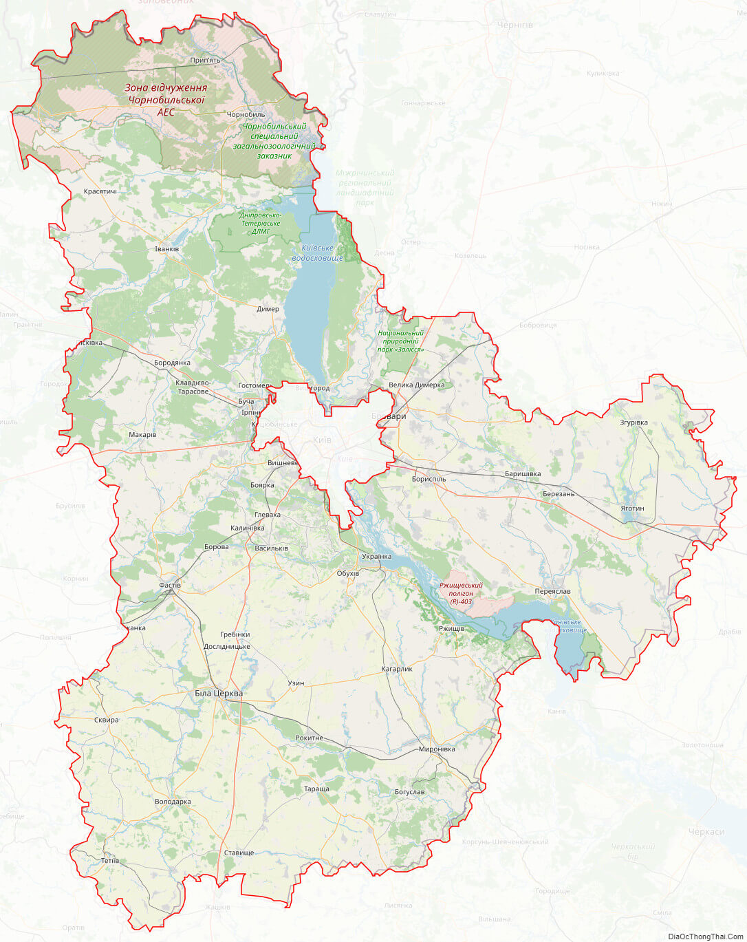
The Chernobyl Exclusion Zone is in the northern part of Kyiv Oblast. It is administered separately from the oblast and public access is prohibited.
| Unit Name | Kiev Oblast |
|---|---|
| Administrative center | Kyiv |
| Total area | 28.131 km² (10.861 sq mi) |
| Area Rank | Rank 8th |
| Population (2021) | 1.788.530 |
| Time zone | UTC+2 (EET) |
| Summer (DST) | UTC+3 (EEST) |
| Postal code | 07-09 |
| Area code | +380 44 (Kyiv city)+380 45 (outside Kyiv city) |
| ISO 3166 code | UA-32 |
| Website | kyiv-obl.gov.ua |
| Flag |  |
| Coat of arms |  |
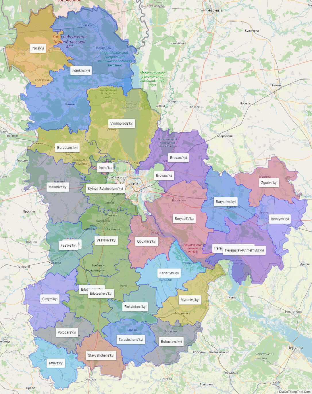
Online subdivision map of Kiev oblast
Looking for an online subdivision map of Kiev Oblast? Look no further! Our online map features a base map using OpenStreetMap or satellite imagery, allowing you to choose the best option for your needs. With a range of colors and boundary lines, the map highlights each sub-administrative unit within the oblast, making it easy to identify the different areas.
Whether you’re a local resident or a visitor to Kiev Oblast, this online subdivision map is an excellent resource for finding your way around. Zoom in to see street names, buildings, and landmarks in greater detail, or zoom out to get a better view of the entire region.
With our online map, you can easily plan your travels or research specific areas of interest within Kiev Oblast. So why wait? Check out our online subdivision map today and start exploring this beautiful and diverse region of Ukraine!
Click on ![]() to view map in "full screen" mode.
to view map in "full screen" mode.
List administrative sub-division of Kiev oblast
| # | Name | Type |
|---|---|---|
| 1 | Boryspil’s’ka | Mis’ka Rada |
| 2 | Irpins’ka | Mis’ka Rada |
| 3 | Bilotserkivs’ka | Misto |
| 4 | Brovars’ka | Misto |
| 5 | Fastivs’ka | Misto |
| 6 | Pereiaslav-Khmel’nyts’ka | Misto |
| 7 | Baryshivs’kyi | Raion |
| 8 | Bilotserkivs’kyi | Raion |
| 9 | Bohuslavs’kyi | Raion |
| 10 | Borodians’kyi | Raion |
| 11 | Brovars’kyi | Raion |
| 12 | Fastivs’kyi | Raion |
| 13 | Iahotyns’kyi | Raion |
| 14 | Ivankivs’kyi | Raion |
| 15 | Kaharlyts’kyi | Raion |
| 16 | Kyievo-Sviatoshyns’kyi | Raion |
| 17 | Makarivs’kyi | Raion |
| 18 | Myronivs’kyi | Raion |
| 19 | Obukhivs’kyi | Raion |
| 20 | Pereiaslav-Khmel’nyts’kyi | Raion |
| 21 | Polis’kyi | Raion |
| 22 | Rokytnians’kyi | Raion |
| 23 | Skvyrs’kyi | Raion |
| 24 | Stavyshchens’kyi | Raion |
| 25 | Tarashchans’kyi | Raion |
| 26 | Tetiïvs’kyi | Raion |
| 27 | Vasyl’kivs’kyi | Raion |
| 28 | Volodars’kyi | Raion |
| 29 | Vyshhorods’kyi | Raion |
| 30 | Zgurivs’kyi | Raion |
Explaination:
- Mis’ka Rada: City municipalities (governed by a mayor and a city council)
- Misto: city at least 10,000 people (not a town).
- Raion: often translated as “district”.
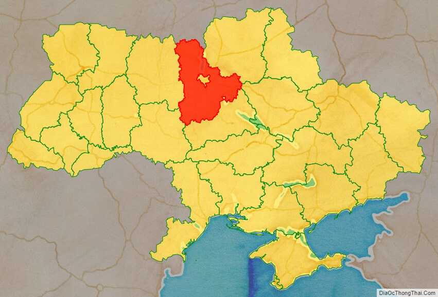
Location map of Kiev oblast, Ukraine

Political map of Kiev oblast

Kiev oblast streeet map
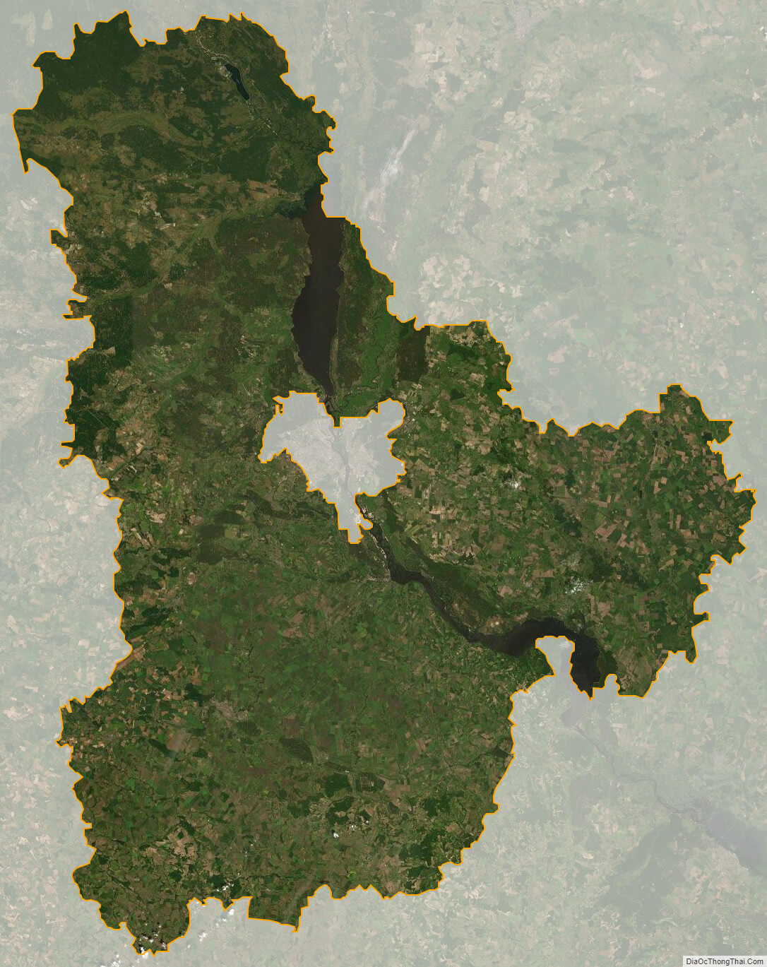
Kiev oblast satellite map