Lee County is a county in U.S. state of Mississippi. At the 2020 census, the population was 83,353. Lee County is included in the Tupelo Micropolitan Statistical Area.
| Name: | Lee County |
|---|---|
| FIPS code: | 28-081 |
| State: | Mississippi |
| Founded: | 1866 |
| Named for: | Gen. Robert E. Lee |
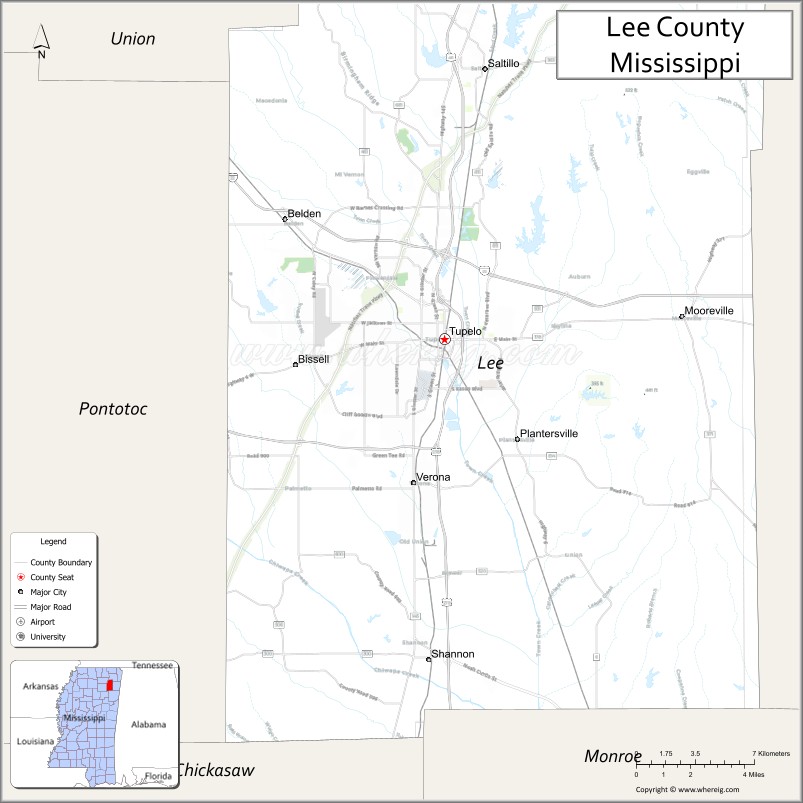
| Seat: | Tupelo |
| Largest city: | Tupelo |
| Total Area: | 453 sq mi (1,170 km²) |
| Land Area: | 450 sq mi (1,200 km²) |
| Total Population: | 83,353 |
| Population Density: | 180/sq mi (71/km²) |
| Time zone: | UTC−6 (Central) |
| Summer Time Zone (DST): | UTC−5 (CDT) |
| Website: | leecoms.com |
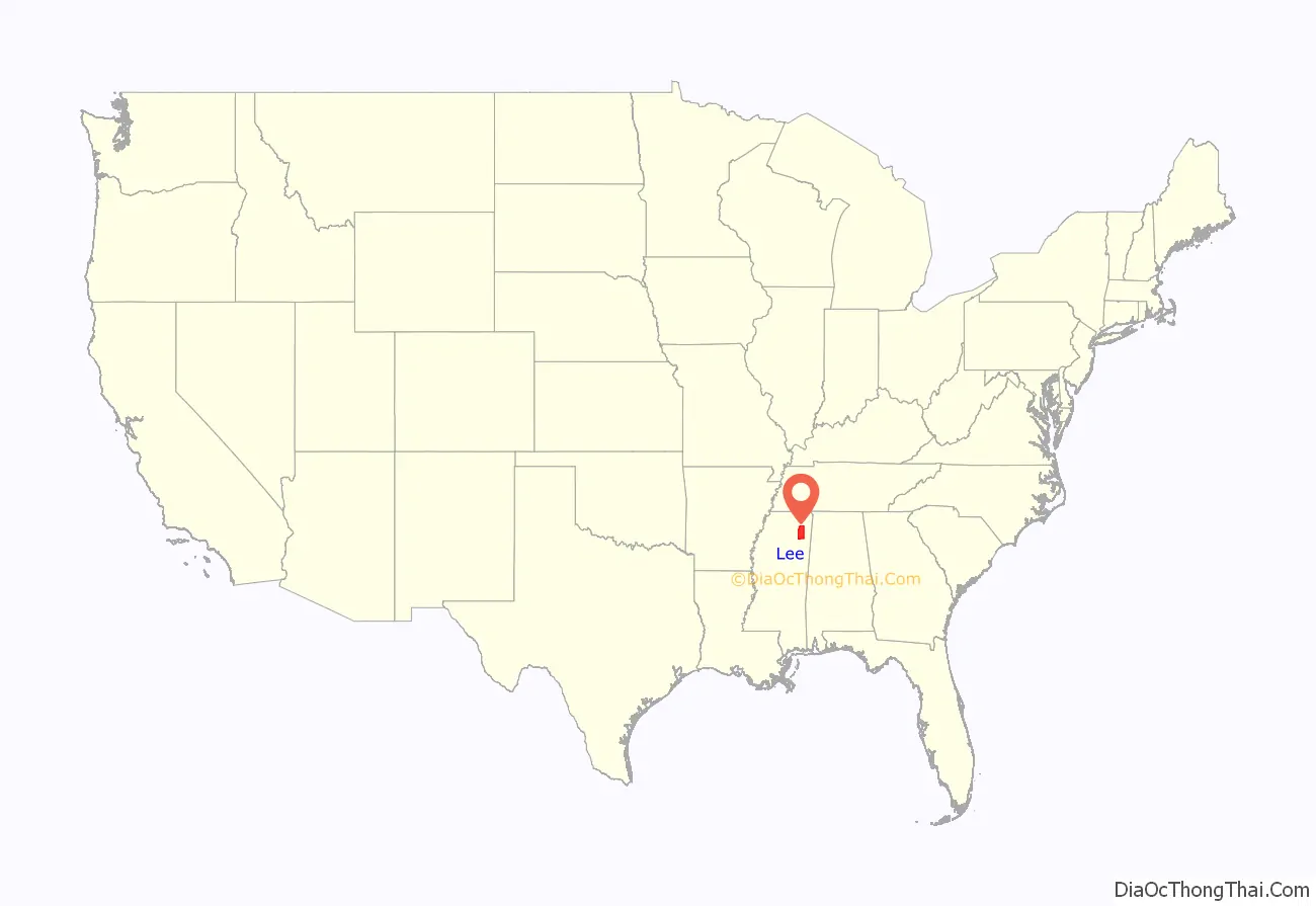
Lee County location map. Where is Lee County?
History
Lee County was established by the state legislature on October 26, 1866, and named for General Robert E. Lee, General in Chief of the Armies of the Confederate States. It was formed from Itawamba and Pontotoc; therefore, the record and list of pioneers mentioned in those counties embrace a great number who were residents of what is now Lee.
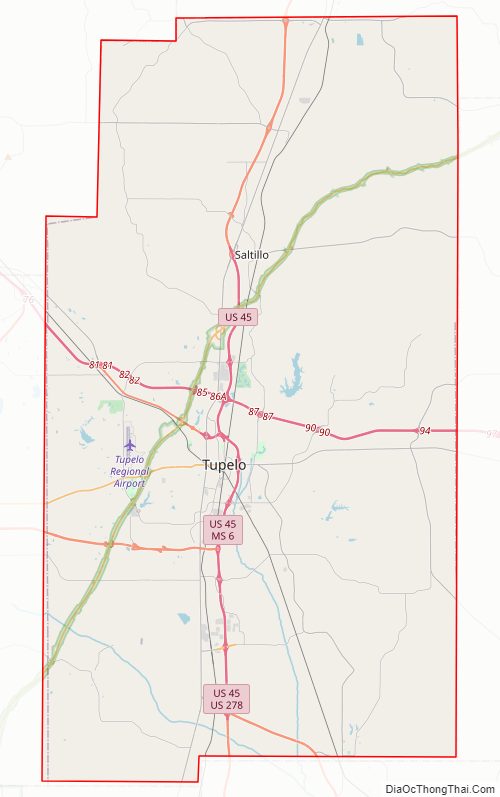
Lee County Road Map
Geography
According to the U.S. Census Bureau, the county has a total area of 453 square miles (1,170 km), of which 450 square miles (1,200 km) is land and 3.2 square miles (8.3 km) (0.7%) is water.
Major highways
- Interstate 22
- U.S. Highway 45
- U.S. Highway 78
- U.S. Route 278
- Natchez Trace Parkway
- Mississippi Highway 6
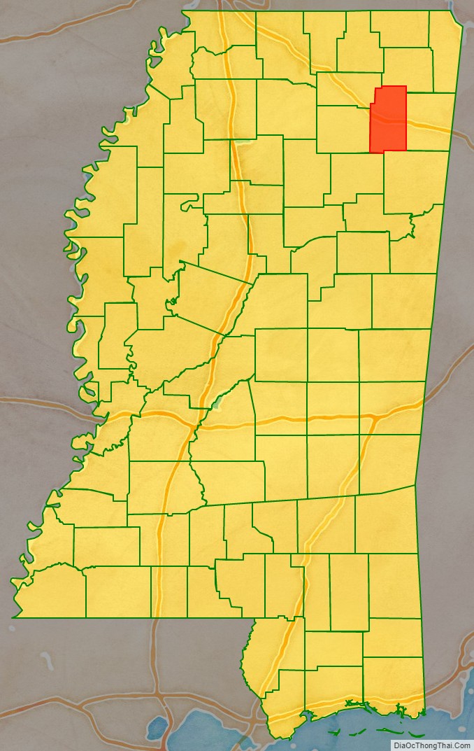
Adjacent counties
- Prentiss County (north)
- Itawamba County (east)
- Monroe County (southeast)
- Chickasaw County (southwest)
- Pontotoc County (west)
- Union County (northwest)
National protected areas
- Brices Cross Roads National Battlefield Site
- Natchez Trace Parkway (part)
- Tupelo National Battlefield
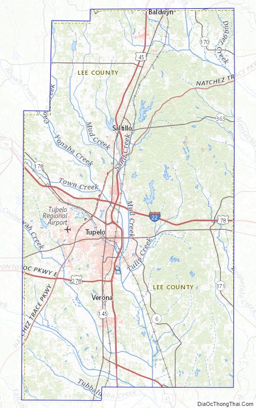
Lee County Topographic Map
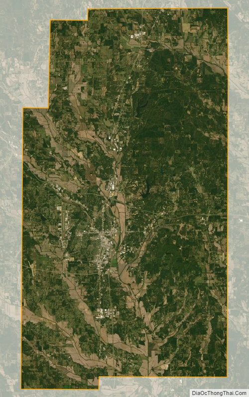
Lee County Satellite Map
Lee County Outline Map