Mason County is a rural county located on the Edwards Plateau in the U.S. state of Texas. At the 2020 census, its population was 3,953. Its county seat is Mason. The county is named for Fort Mason, which was located in the county.
| Name: | Mason County |
|---|---|
| FIPS code: | 48-319 |
| State: | Texas |
| Founded: | 1858 |
| Named for: | Fort Mason |
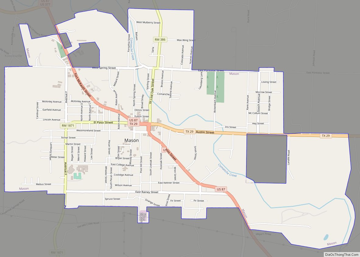
| Seat: | Mason |
| Largest city: | Mason |
| Total Area: | 932 sq mi (2,410 km²) |
| Land Area: | 929 sq mi (2,410 km²) |
| Total Population: | 3,953 |
| Population Density: | 4.2/sq mi (1.6/km²) |
| Time zone: | UTC−6 (Central) |
| Summer Time Zone (DST): | UTC−5 (CDT) |
| Website: | www.co.mason.tx.us |
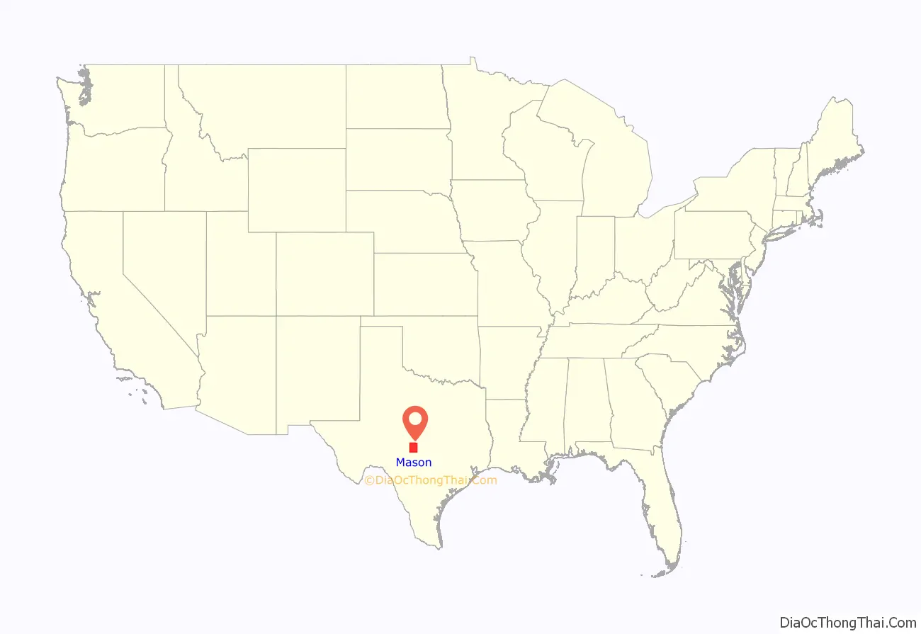
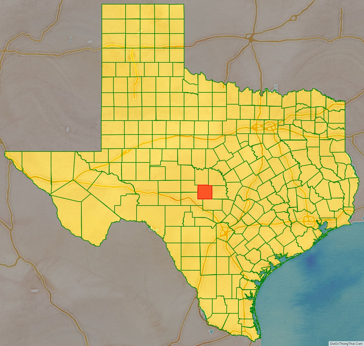
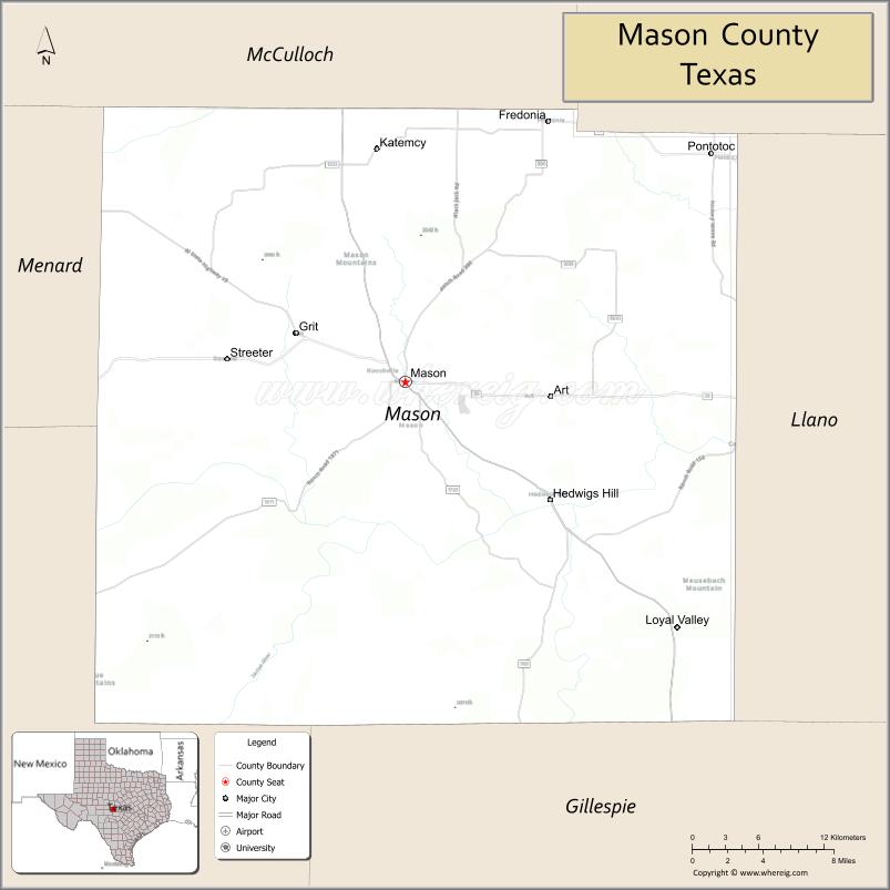
Mason County location map. Where is Mason County?
History
- Original inhabitants Lipan Apache, Comanches
- 1847 Meusebach–Comanche Treaty
- 1851, July 6 – Fort Mason is established.
- 1858, January 22 – Mason County, named for Fort Mason, is established by an act of Texas state legislature. First post offices are established.
- 1860 Population of 630 includes 18 slaves.
- 1861,
- 1866–1868 Federal troops occupy Fort Mason, only to eventually abandon it.
- 1869 Courthouse and jail are erected.
- 1870 May 16 – Herman Lehmann and brother Willie are captured by Apaches, but Willie escapes within days.
- 1870–1898 The county had four women homesteaders: Louisa J. Hendryx, Mahala Hunnicutt, Sarah E. Morris and Priscilla Sparks
- 1875–1877
- 1878, May 12 – Herman Lehmann, escorted by soldiers, finally returns to his family.
- 1880s Manganese is discovered. Wakefield Company opens Spiller mines. Iron ore is discovered. Prospecting begins for gold, silver and coal.
- 1882–83 Hereford cattle are introduced into the county. Provisions made for county wide road work.
- 1887 The county petitions for state aid for needy residents.
- 1890s County places a bounty on wolves, wildcats and mountain lions.
- 1902 Mason installs its first telephone in the county judge’s office.
- 1918 October 3 – Eighteen months after United States Congress declares war on Germany, the Mason County Council of Defense draws up resolution to abandon the use of the German language in the county. The majority of County residents are of German heritage.
- 1919 First oil and gas lease in the county. Construction begins on the Mason County section of the Puget Sound-to-the-Gulf Highway.
- 1920s Radios come to Mason County.
- 1938 Pedernales Electric Cooperative is formed to provide rural electrification. Mason County joins in June.
- 1946 Local soil-conservation board organized. County schools consolidated.
- 2021 Mason County Courthouse (Texas), constructed in 1909, burns down as a result of arson.
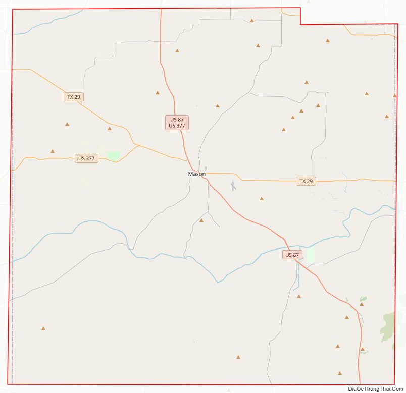
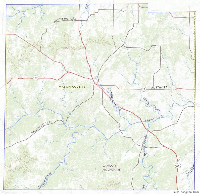
Mason County Road Map
Geography
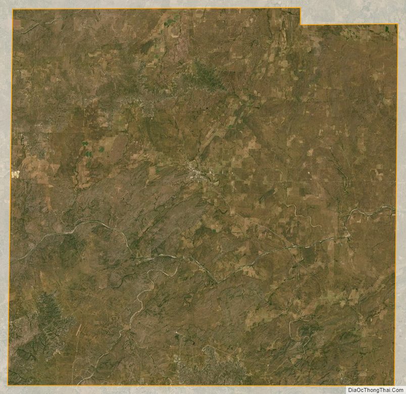
According to the U.S. Census Bureau, the county has a total area of 932 square miles (2,410 km), of which 929 square miles (2,410 km) is land and 3.4 square miles (8.8 km) (0.4%) is water.
Major highways
- U.S. Highway 87
- U.S. Highway 377
- State Highway 29
- State Highway 71
Adjacent counties
- McCulloch County (north)
- San Saba County (northeast)
- Llano County (east)
- Gillespie County (south)
- Kimble County (southwest)
- Menard County (west)
Mason County Topographic Map
Mason County Satellite Map
Mason County Outline Map