Mason is a city in, and the county seat of, Mason County, Texas, United States. The city is an agricultural community on Comanche Creek southwest of Mason Mountain, on the Edwards Plateau and part of the Llano Uplift. Its population was 2,114 at the 2010 census.
| Name: | Mason city |
|---|---|
| LSAD Code: | 25 |
| LSAD Description: | city (suffix) |
| State: | Texas |
| County: | Mason County |
| Elevation: | 1,535 ft (468 m) |
| Total Area: | 3.69 sq mi (9.55 km²) |
| Land Area: | 3.65 sq mi (9.46 km²) |
| Water Area: | 0.03 sq mi (0.08 km²) |
| Total Population: | 2,114 |
| Population Density: | 630.99/sq mi (243.61/km²) |
| ZIP code: | 76856 |
| Area code: | 325 |
| FIPS code: | 4846968 |
| GNISfeature ID: | 1362252 |
Online Interactive Map
Click on ![]() to view map in "full screen" mode.
to view map in "full screen" mode.
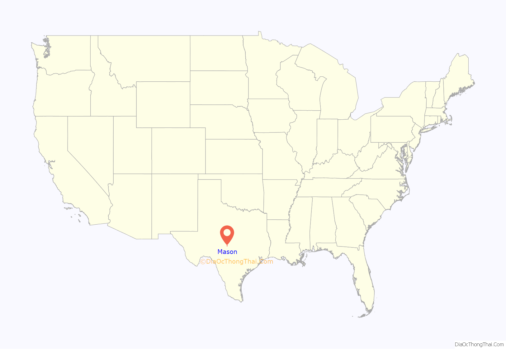
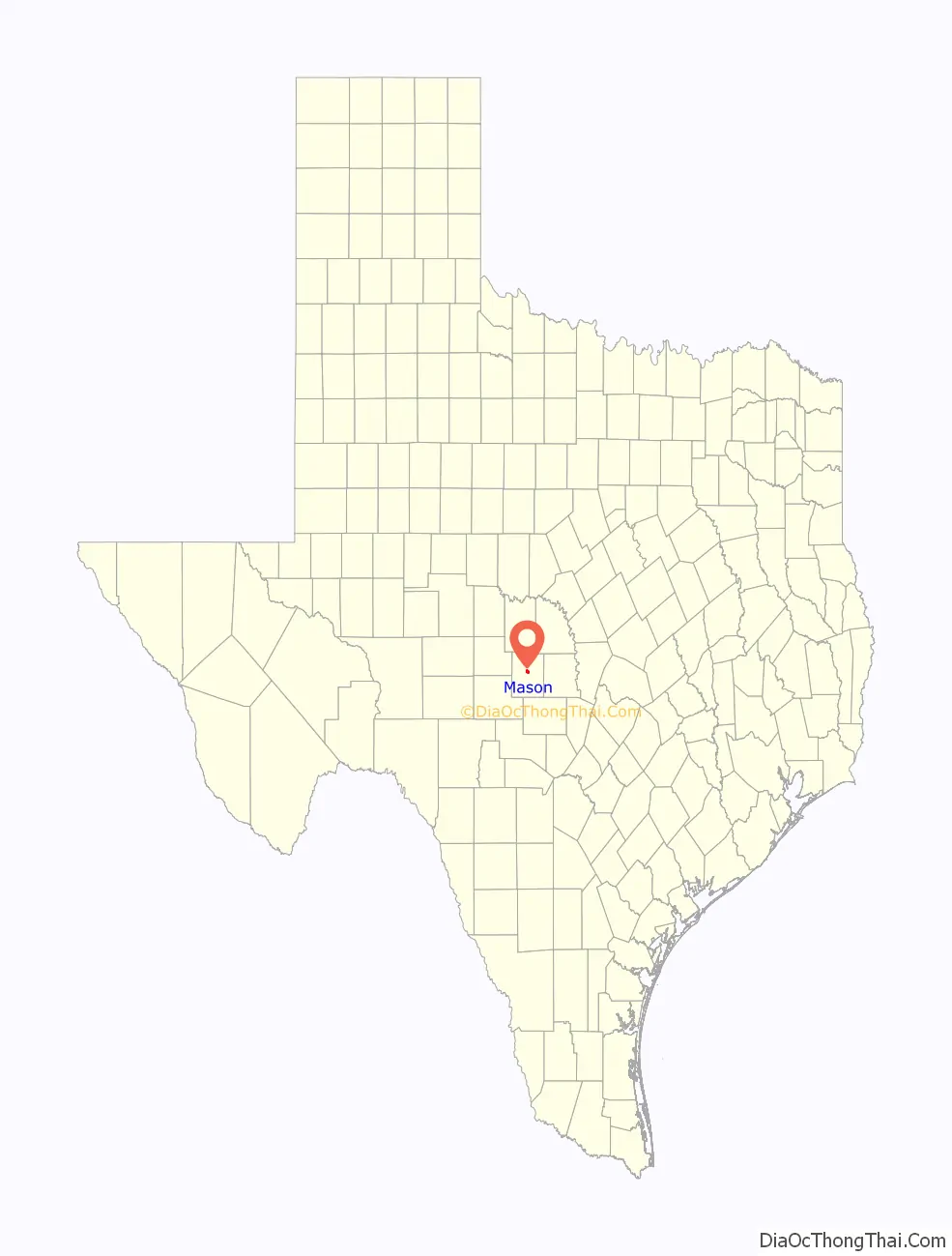
Mason location map. Where is Mason city?
History
The first settler is thought to have been Peter S. Parker in 1846. The settlement of Mason grew up around Fort Mason, which was established by the United States War Department as a front-line defense against Kiowa, Lipan Apache, and Comanche, on July 6, 1851. George W. Todd established a Fort Mason post office March 8, 1858, which became consigned to the civilian settlement on June 26, 1858. The protection and commercial possibilities of the fort drew settlers. W. C. Lewis opened a general store that served soldiers and settlers. In 1860, James E. Ranck opened a second store and later became known as “the Father of Mason”. Ben F. Gooch and he began leasing 5,000 acres (20 km) of land to cotton sharecroppers. Mason was voted the county seat in 1861.
After the U.S. Civil War, returning Confederate veterans and German ranchers clashed in 1875 over cattle rustling and other crimes. The resulting killings were known as the “HooDoo Wars”. In the midst of the war, Loyal Valley homeowner Tim Williamson was murdered by a dozen masked vigilantes, who accused him of cattle theft. Williamson’s adopted son, Texas Ranger Scott Cooley, sought revenge. Cooley and his desperadoes, which included Johnny Ringo, created a reign of terror over the area. During this episode, Ringo committed his first murder, that of James Cheyney.
The first courthouse and jail were built in 1869 of stone walls lined with post oak timbers. After the Hoo Doo War, a new two-story red sandstone jail was built in 1898 by L.T. Noyes of Houston. Noyes was a contractor with Diebold Safe and Lock Company. A courthouse was built in 1875 and burned down in 1877. A new courthouse was built in 1878 and burned down in 1900. The current granite courthouse was erected in 1909 by architect E. H. Hosford and Co. in the Classic Revival style. It burned down in 2021, but courthouse records and most furniture had been removed prior to the fire to prepare for a renovation.
On October 3, 1918, 18 months after United States Congress declared war on Germany, the Mason County Council of Defense drew up resolution to abandon the use of the German language in the county. Most county residents are of German heritage.
The Broad Street Bridge, a reinforced-concrete truss and the only one of its kind in Texas, was built across the Comanche Creek in 1918. The span is 102 ft long and composed of two 51-ft spans supported by concrete abutments with a pier at the center. The bridge was slated for replacement by the Texas Department of Transportation, but funding was cancelled.
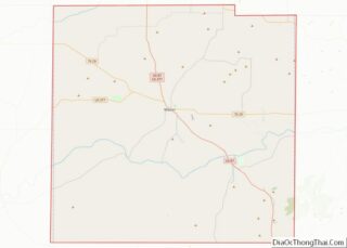
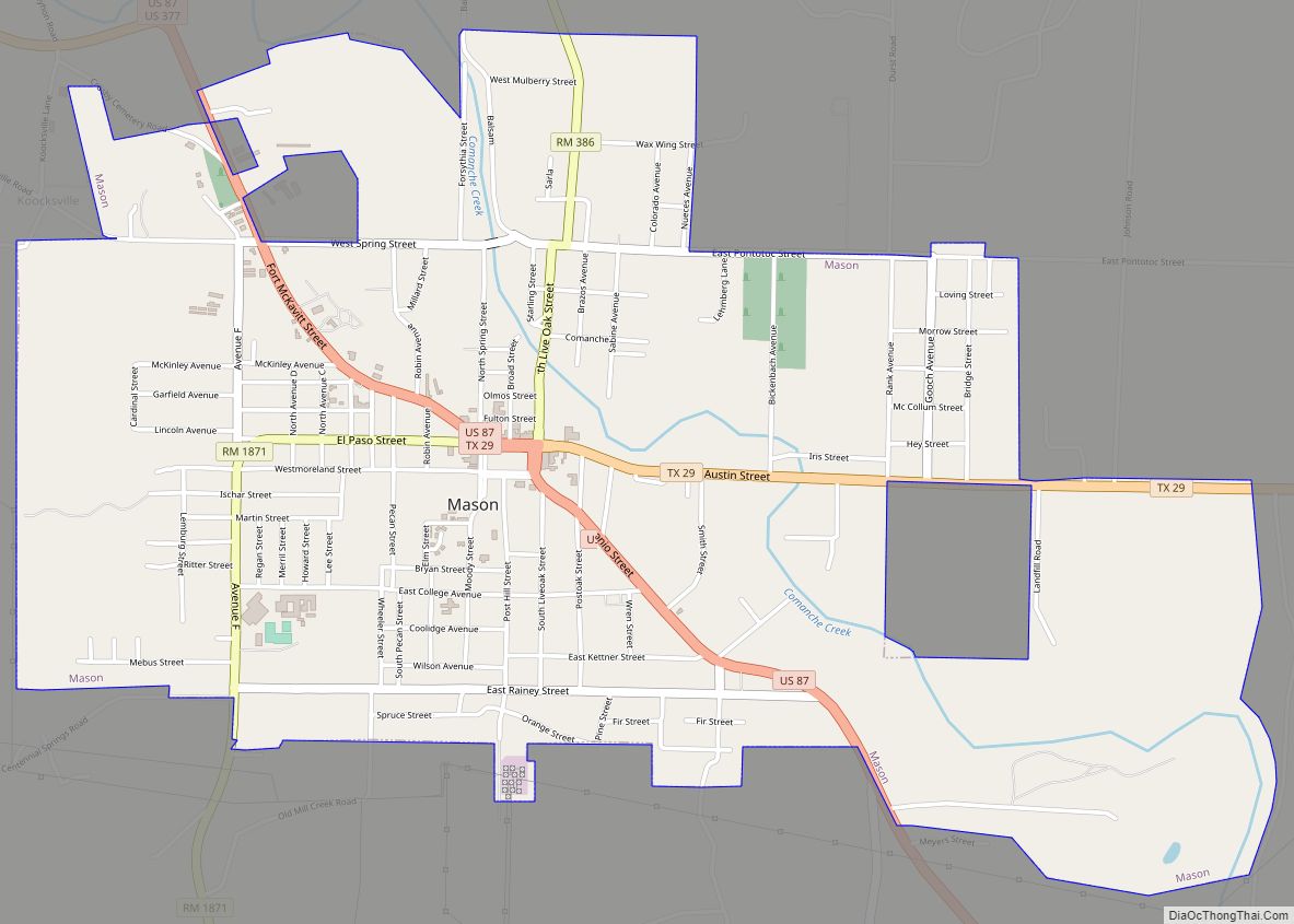
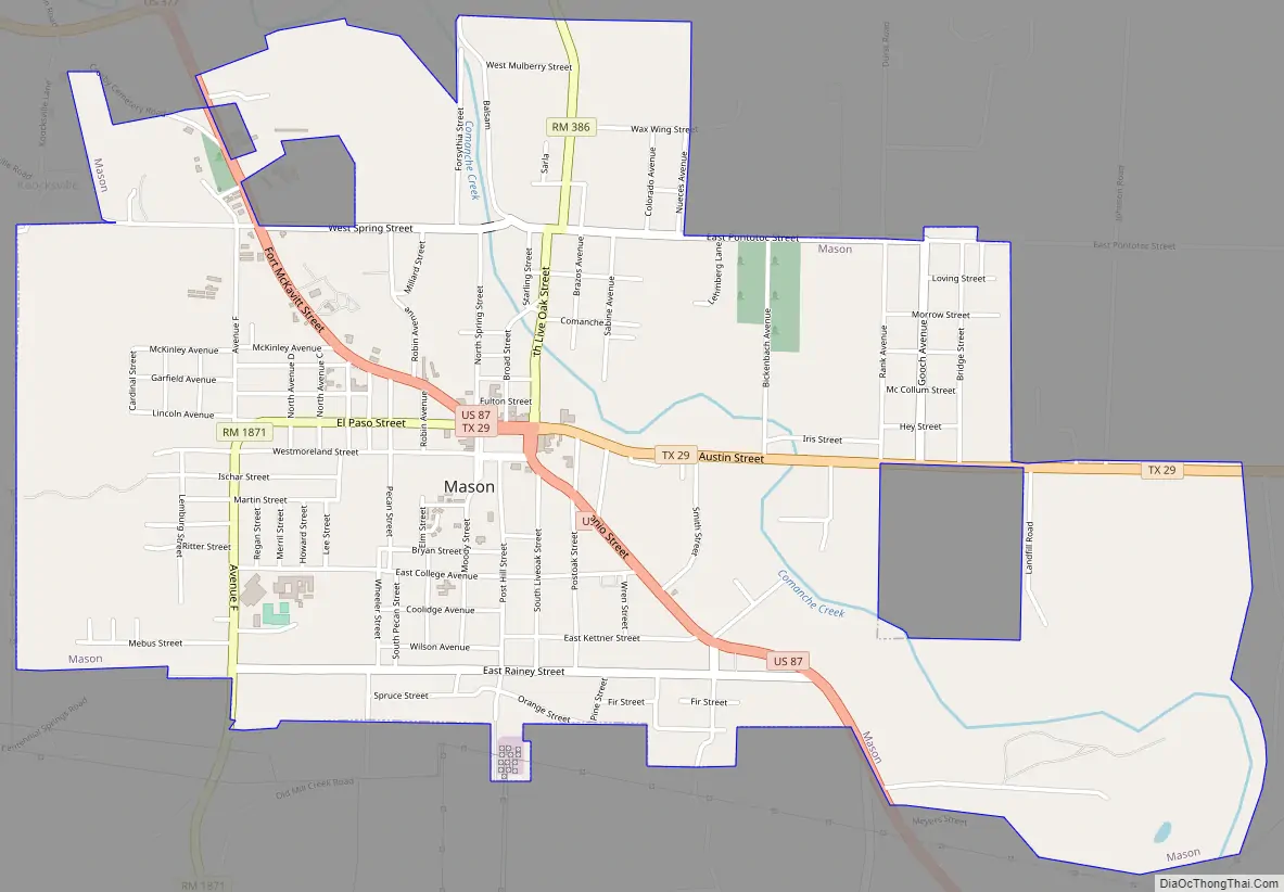
Mason Road Map
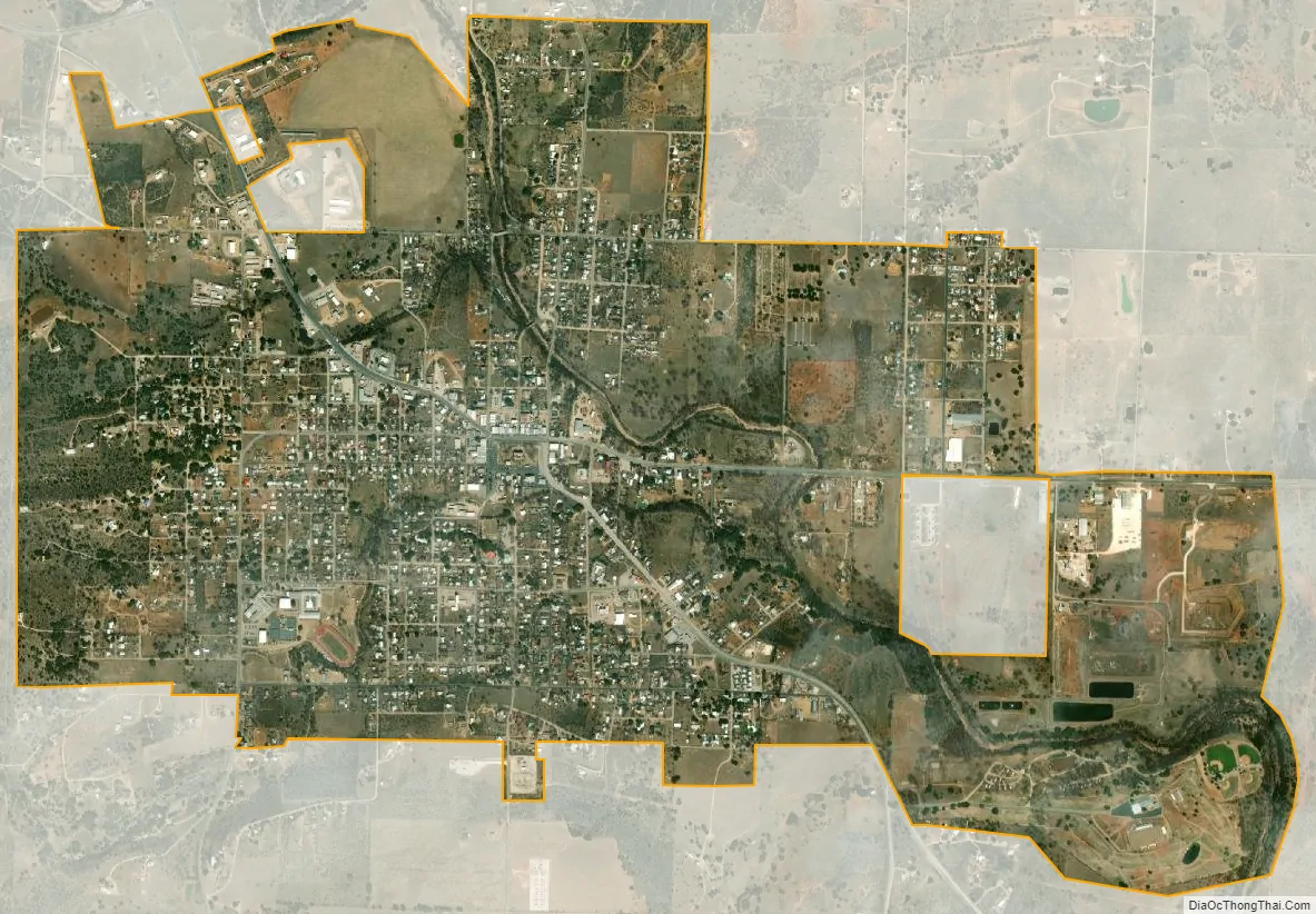
Mason city Satellite Map
Geography
According to the United States Census Bureau, the city has a total area of 3.7 square miles (9.5 km), all of it land.
Geology
The largest gem-quality topaz found in North America came from Mason County, weighing almost 3 lb (1.4 kg). It had been kept in the Smithsonian Institution, and was transferred to Mason’s Museum on the Square.
Climate
Mason experiences a humid subtropical climate, with hot summers and a generally mild winter. Temperatures range from 82 °F (27.8 C) in the summer to 45 °F (7.2 C) during winter.
See also
Map of Texas State and its subdivision:- Anderson
- Andrews
- Angelina
- Aransas
- Archer
- Armstrong
- Atascosa
- Austin
- Bailey
- Bandera
- Bastrop
- Baylor
- Bee
- Bell
- Bexar
- Blanco
- Borden
- Bosque
- Bowie
- Brazoria
- Brazos
- Brewster
- Briscoe
- Brooks
- Brown
- Burleson
- Burnet
- Caldwell
- Calhoun
- Callahan
- Cameron
- Camp
- Carson
- Cass
- Castro
- Chambers
- Cherokee
- Childress
- Clay
- Cochran
- Coke
- Coleman
- Collin
- Collingsworth
- Colorado
- Comal
- Comanche
- Concho
- Cooke
- Coryell
- Cottle
- Crane
- Crockett
- Crosby
- Culberson
- Dallam
- Dallas
- Dawson
- Deaf Smith
- Delta
- Denton
- Dewitt
- Dickens
- Dimmit
- Donley
- Duval
- Eastland
- Ector
- Edwards
- El Paso
- Ellis
- Erath
- Falls
- Fannin
- Fayette
- Fisher
- Floyd
- Foard
- Fort Bend
- Franklin
- Freestone
- Frio
- Gaines
- Galveston
- Garza
- Gillespie
- Glasscock
- Goliad
- Gonzales
- Gray
- Grayson
- Gregg
- Grimes
- Guadalupe
- Hale
- Hall
- Hamilton
- Hansford
- Hardeman
- Hardin
- Harris
- Harrison
- Hartley
- Haskell
- Hays
- Hemphill
- Henderson
- Hidalgo
- Hill
- Hockley
- Hood
- Hopkins
- Houston
- Howard
- Hudspeth
- Hunt
- Hutchinson
- Irion
- Jack
- Jackson
- Jasper
- Jeff Davis
- Jefferson
- Jim Hogg
- Jim Wells
- Johnson
- Jones
- Karnes
- Kaufman
- Kendall
- Kenedy
- Kent
- Kerr
- Kimble
- King
- Kinney
- Kleberg
- Knox
- La Salle
- Lamar
- Lamb
- Lampasas
- Lavaca
- Lee
- Leon
- Liberty
- Limestone
- Lipscomb
- Live Oak
- Llano
- Loving
- Lubbock
- Lynn
- Madison
- Marion
- Martin
- Mason
- Matagorda
- Maverick
- McCulloch
- McLennan
- McMullen
- Medina
- Menard
- Midland
- Milam
- Mills
- Mitchell
- Montague
- Montgomery
- Moore
- Morris
- Motley
- Nacogdoches
- Navarro
- Newton
- Nolan
- Nueces
- Ochiltree
- Oldham
- Orange
- Palo Pinto
- Panola
- Parker
- Parmer
- Pecos
- Polk
- Potter
- Presidio
- Rains
- Randall
- Reagan
- Real
- Red River
- Reeves
- Refugio
- Roberts
- Robertson
- Rockwall
- Runnels
- Rusk
- Sabine
- San Augustine
- San Jacinto
- San Patricio
- San Saba
- Schleicher
- Scurry
- Shackelford
- Shelby
- Sherman
- Smith
- Somervell
- Starr
- Stephens
- Sterling
- Stonewall
- Sutton
- Swisher
- Tarrant
- Taylor
- Terrell
- Terry
- Throckmorton
- Titus
- Tom Green
- Travis
- Trinity
- Tyler
- Upshur
- Upton
- Uvalde
- Val Verde
- Van Zandt
- Victoria
- Walker
- Waller
- Ward
- Washington
- Webb
- Wharton
- Wheeler
- Wichita
- Wilbarger
- Willacy
- Williamson
- Wilson
- Winkler
- Wise
- Wood
- Yoakum
- Young
- Zapata
- Zavala
- Alabama
- Alaska
- Arizona
- Arkansas
- California
- Colorado
- Connecticut
- Delaware
- District of Columbia
- Florida
- Georgia
- Hawaii
- Idaho
- Illinois
- Indiana
- Iowa
- Kansas
- Kentucky
- Louisiana
- Maine
- Maryland
- Massachusetts
- Michigan
- Minnesota
- Mississippi
- Missouri
- Montana
- Nebraska
- Nevada
- New Hampshire
- New Jersey
- New Mexico
- New York
- North Carolina
- North Dakota
- Ohio
- Oklahoma
- Oregon
- Pennsylvania
- Rhode Island
- South Carolina
- South Dakota
- Tennessee
- Texas
- Utah
- Vermont
- Virginia
- Washington
- West Virginia
- Wisconsin
- Wyoming