St. Helena Parish (French: Paroisse de Sainte-Hélène) is a parish in the U.S. state of Louisiana. At the 2020 United States census, the population was 10,920. Its seat is Greensburg. The parish was created in 1810. St. Helena Parish is part of the Baton Rouge metropolitan area.
| Name: | St. Helena Parish |
|---|---|
| FIPS code: | 22-091 |
| State: | Louisiana |
| Founded: | 1810 |
| Named for: | Saint Helena |
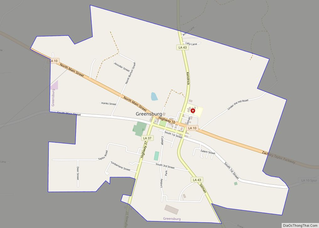
| Seat: | Greensburg |
| Largest town: | Greensburg |
| Total Area: | 409 sq mi (1,060 km²) |
| Land Area: | 408 sq mi (1,060 km²) |
| Total Population: | 10,920 |
| Population Density: | 27/sq mi (10/km²) |
| Time zone: | UTC−6 (Central) |
| Summer Time Zone (DST): | UTC−5 (CDT) |
| Website: | sthelenaparish.la.gov |
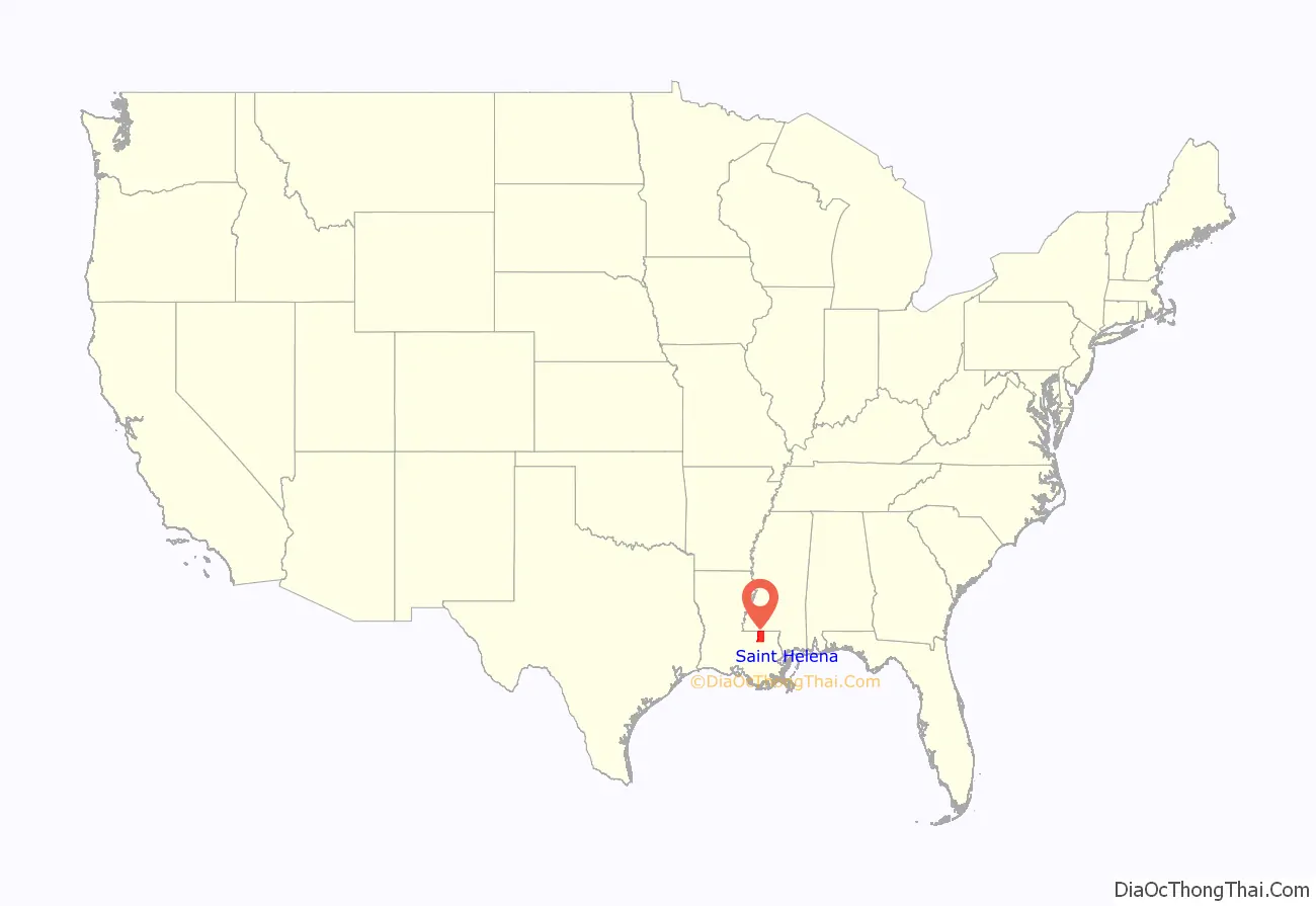
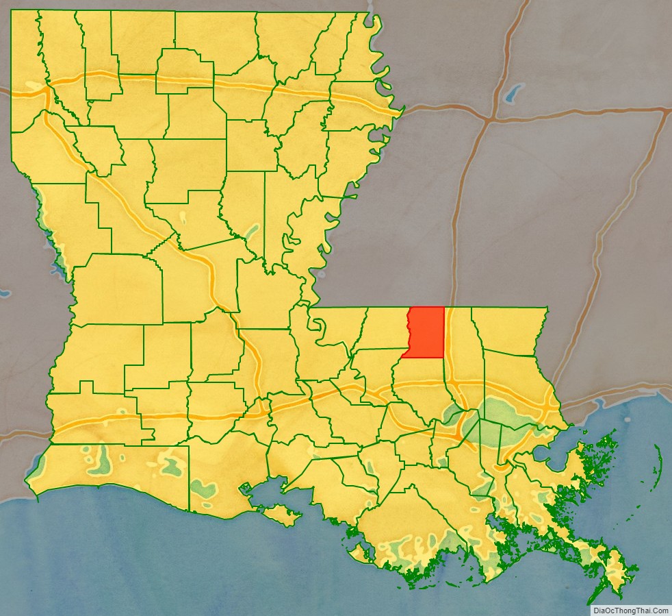
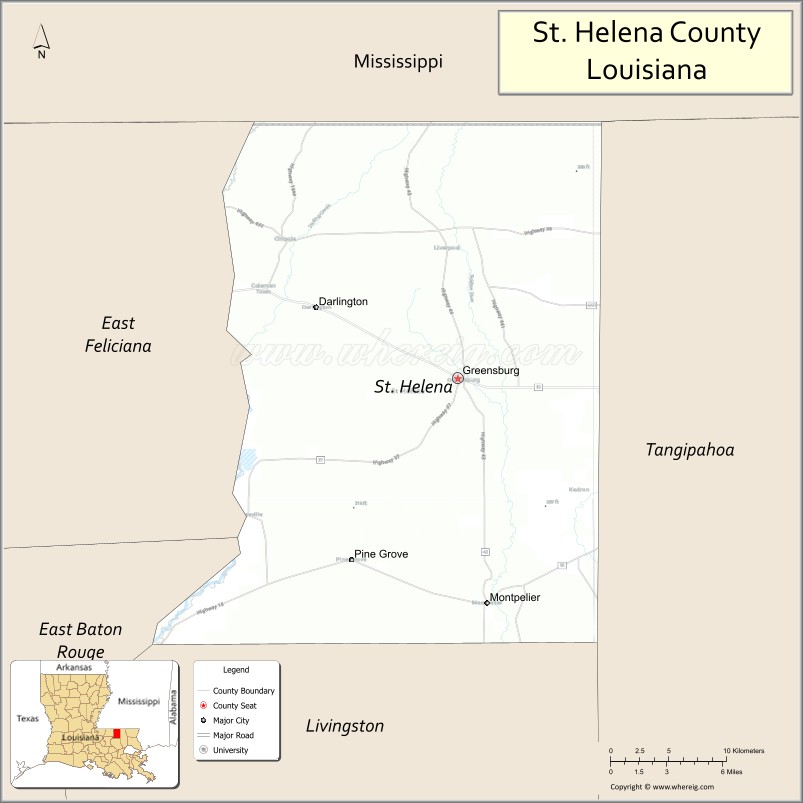
St. Helena Parish location map. Where is St. Helena Parish?
History
The parish is one of the eight Florida Parishes, a region which was once part of colonial West Florida. The area was annexed to the Territory of Orleans in 1810, after the short-lived Republic of West Florida capitulated to the United States.
In 1832, the southern section of the parish was taken to form Livingston Parish and the St. Helena parish seat was redesignated as Greensburg, where it remains today. St. Helena lost another portion of land in 1866, which was subsequently added to land from other parishes to form Tangipahoa Parish.
From 1964 to 1984, St. Helena Parish was represented in the Louisiana State Senate by the Democrat businessman W. E. “Bill” Dykes. In 1983, as a casualty of redistricting, Dykes bowed out of contention in a race which would have pitted him against long-term Senate President Sixty Rayburn of Bogalusa, Louisiana. Rayburn himself lost his senate seat in 1995.
In recent years, St. Helena experienced a series of scandals involving parish officials. In 1997, Sheriff Eugene Holland (13 October 1954 – 14 December 2010) was found guilty of misuse of government funds and property and using prison inmates for personal labor; he spent time in prison as a result. His replacement, Chaney L. Phillips (born c. 1950), served for only a year as sheriff before he was convicted of fraud and money laundering that he had committed while serving as the parish assessor. He was given an eight-year prison sentence on conviction in 1998 of having placed a political supporter on his assessor office staff; the individual performed no duties. Phillips was assigned to the Federal Correctional Institution in Englewood, Colorado. He was released on May 23, 2003.
Ronald “Gun” Ficklin, former mayor of Greensburg, took over the sheriff’s office from Phillips in 1998, but on February 5, 2007, Ficklin himself pleaded guilty on multiple counts involving his role in operating “chop shops” — reselling stolen automobiles and parts — using state prisoners to staff these activities and as a pit crew for his race car. Ficklin died of cancer while in prison (21 October 2011).
In 2007, Nat Williams was elected as Ficklin’s replacement, the first African American to hold the office in that parish.
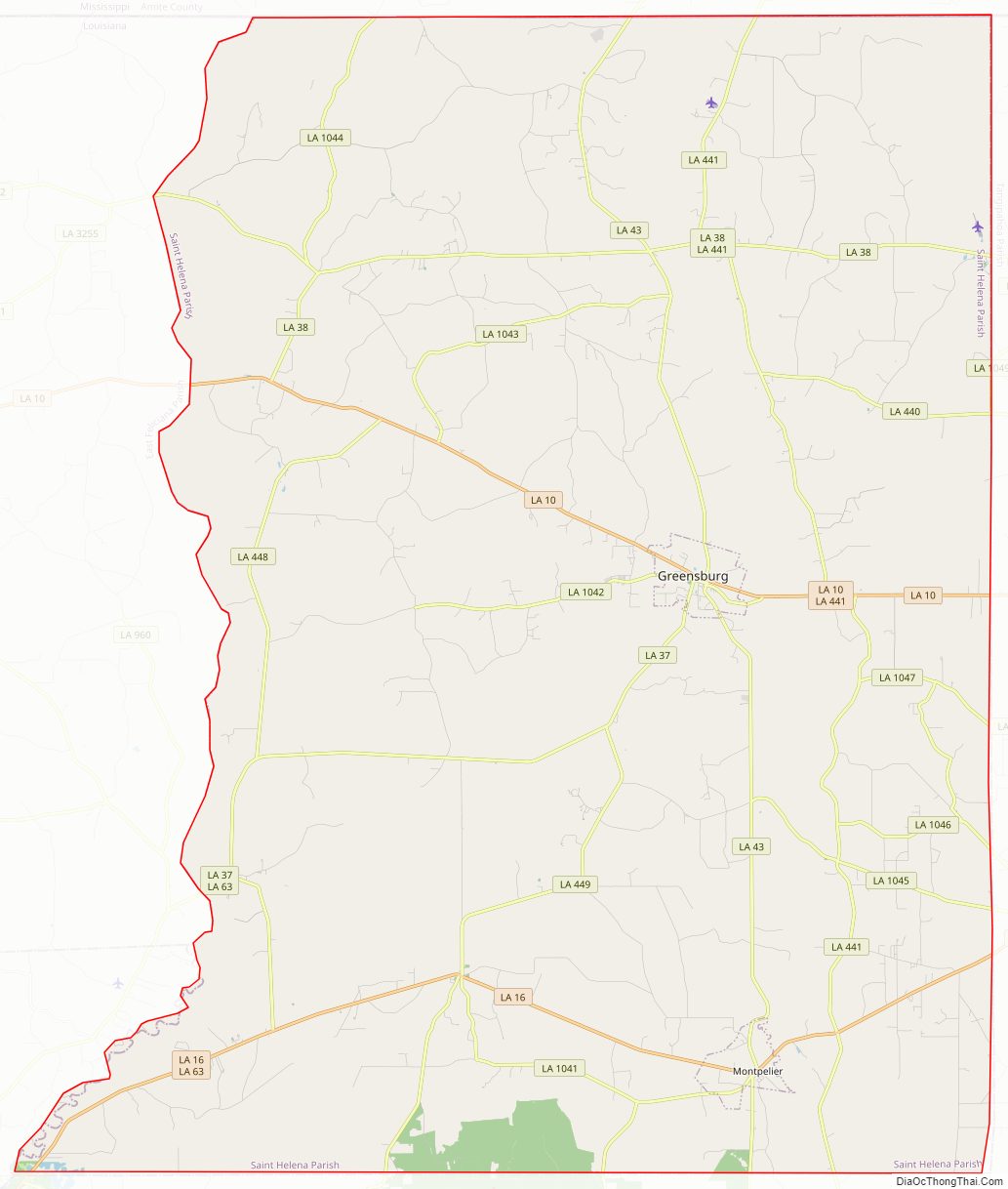
St. Helena Parish Road Map
Geography
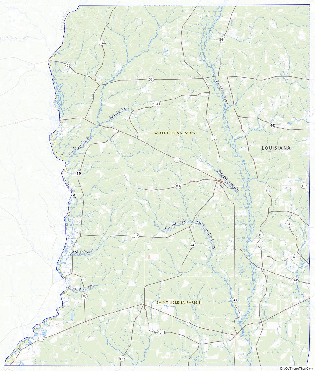
According to the United States Census Bureau, the parish has a total area of 409 square miles (1,060 km), of which 408 square miles (1,060 km) is land and 1.1 square miles (2.8 km) (0.3%) is water. It is located in the northern tier of the Florida Parishes, and within the Baton Rouge metropolitan area.
Major highways
- Louisiana Highway 10
- Louisiana Highway 16
- Louisiana Highway 37
- Louisiana Highway 38
- Louisiana Highway 43
- Louisiana Highway 441
Adjacent parishes and counties
- Amite County, Mississippi – north
- Tangipahoa Parish – east
- Livingston Parish – south
- East Baton Rouge Parish – southwest
- East Feliciana Parish – west
St. Helena Parish Topographic Map
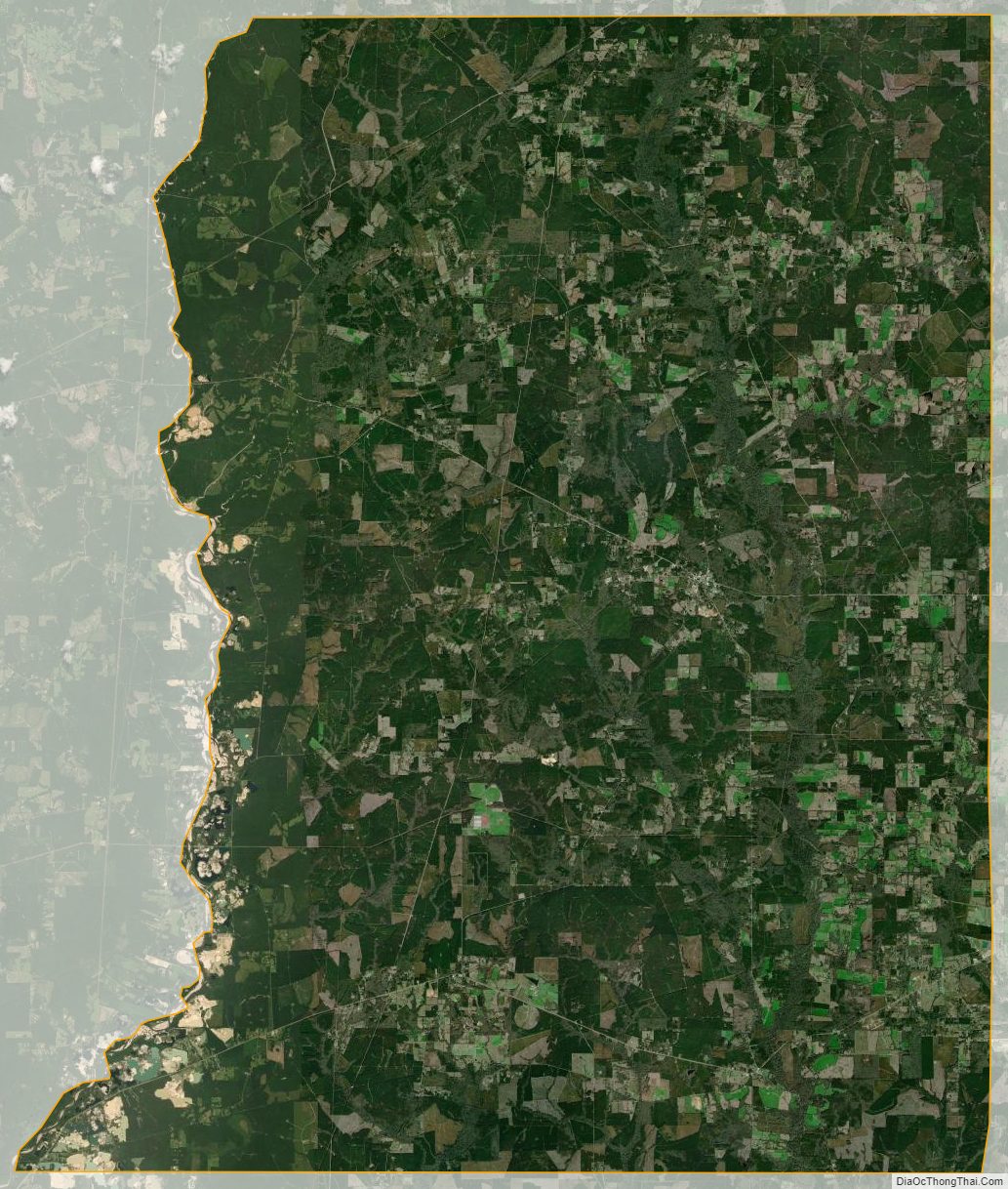
St. Helena Parish Satellite Map
St. Helena Parish Outline Map