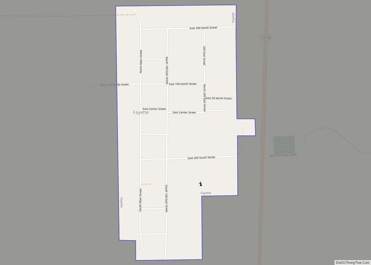
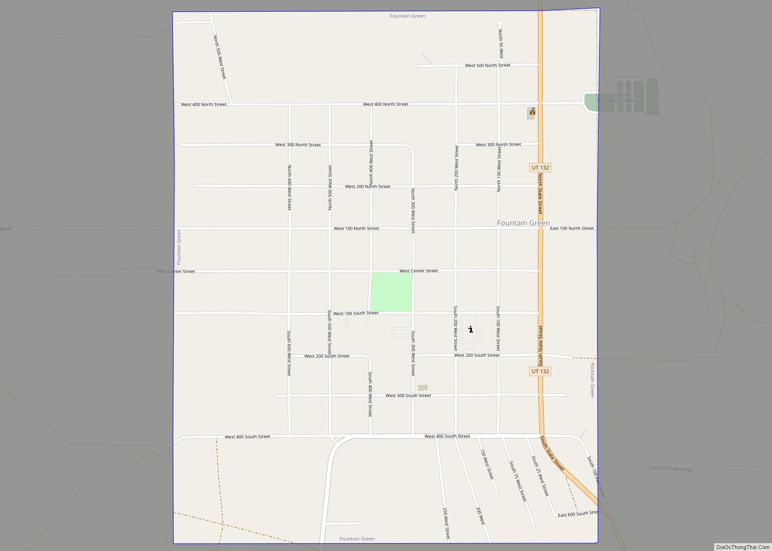
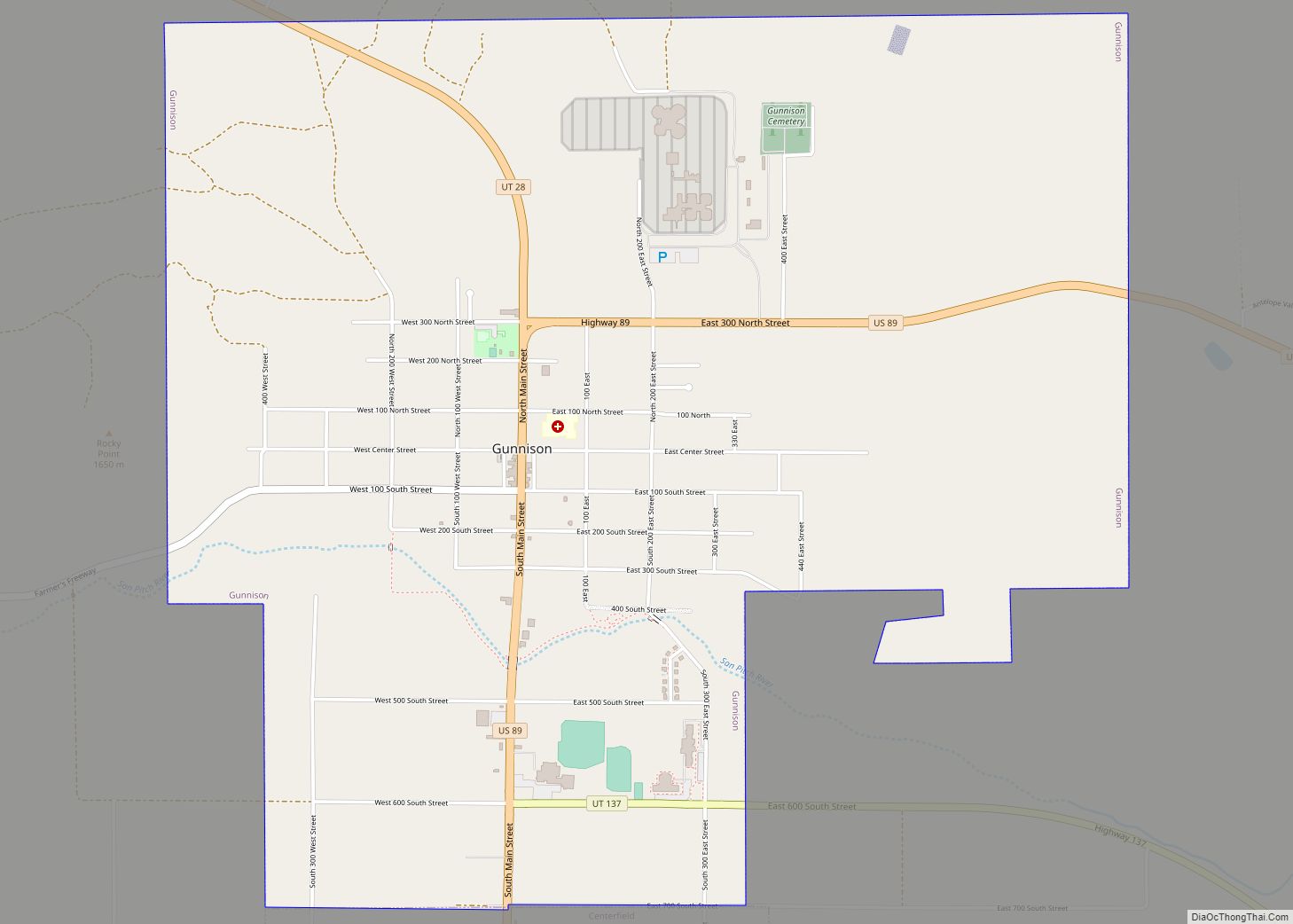
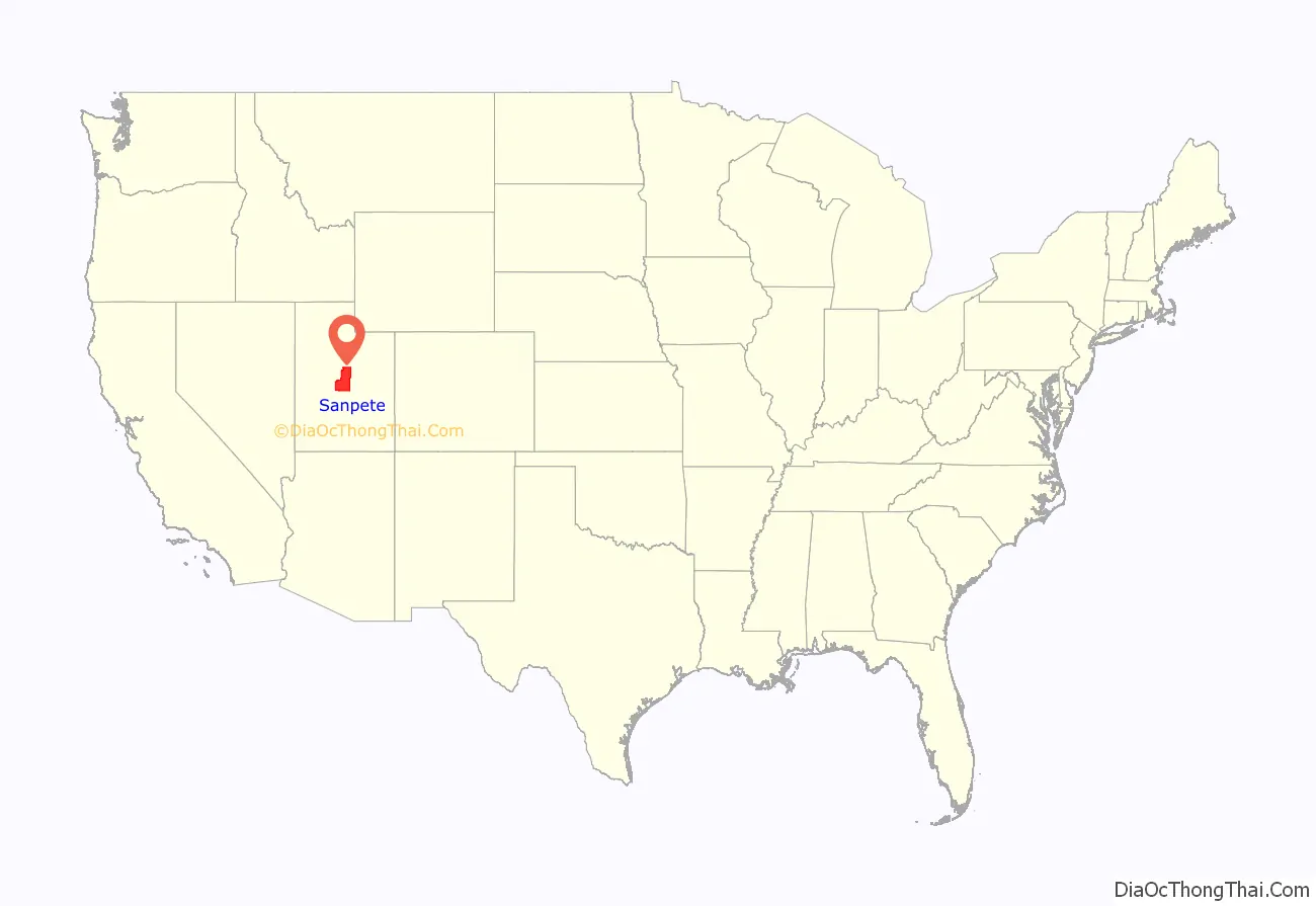
Sanpete County (/sænˈpiːt/ san-PEET) is a county in the U.S. state of Utah. As of the 2010 United States Census, the population was 27,822. Its county seat is Manti, and its largest city is Ephraim. The county was created in 1850.
| Name: | Sanpete County |
|---|---|
| FIPS code: | 49-039 |
| State: | Utah |
| Founded: | January 31, 1850 |
| Named for: | Chief Sanpitch |
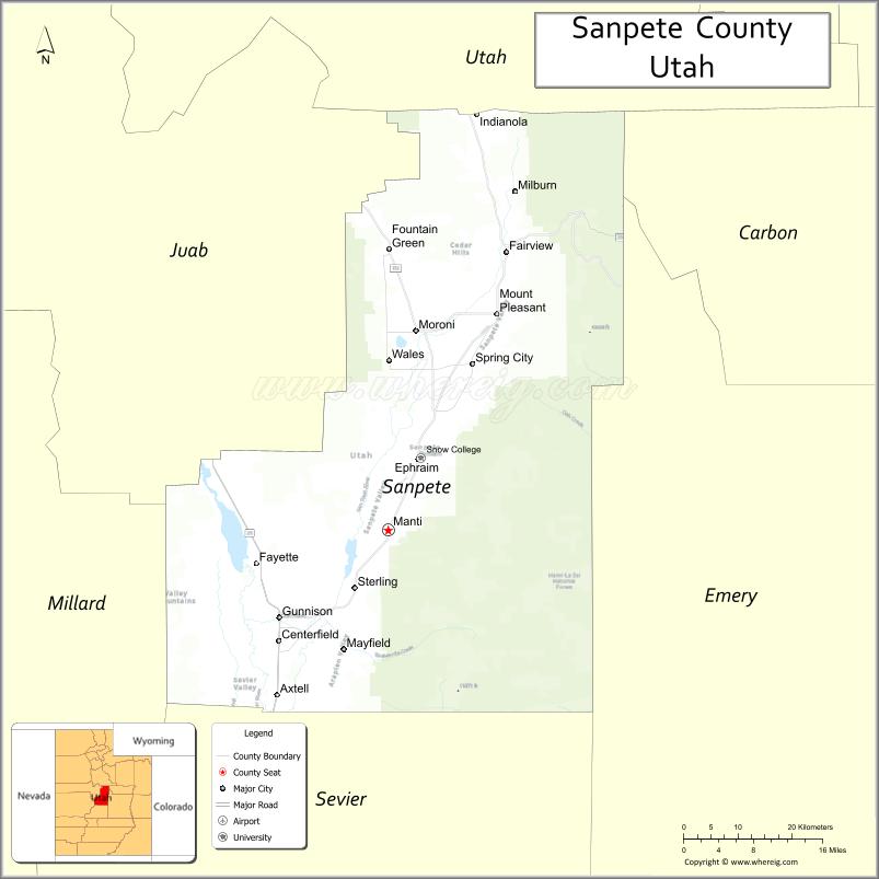
| Seat: | Manti |
| Largest city: | Ephraim |
| Total Area: | 1,603 sq mi (4,150 km²) |
| Land Area: | 1,590 sq mi (4,100 km²) |
| Total Population: | 28,437 |
| Population Density: | 18/sq mi (6.8/km²) |
| Time zone: | UTC−7 (Mountain) |
| Summer Time Zone (DST): | UTC−6 (MDT) |
| Website: | sanpete.com |
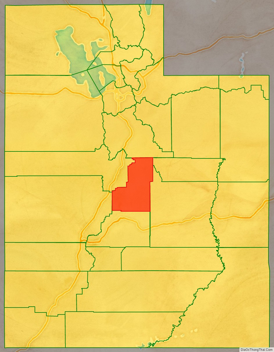
Sanpete County location map. Where is Sanpete County?
History
The Sanpete Valley may have been traversed or inhabited as long as 32,000 BP by small bands of hunters. This habitation may have continued for about 20,000 years when the extinction of larger game animals forced a change. About 8,500 years ago, different groups (characterized by use of atlatls, millstones and textiles) came onto the scene. These also departed the area about 2,500 years ago, for unknown reasons, after which the area does not seem to have been visited by humans for 1,500 years.
Archeological evidence indicates that the Fremont people appeared next on the stage (from about 1-1300 CE), the first inhabitants of the area to domesticate crops and create relatively large communal settlements. In this county, the best-known Fremont site to date is “Witch’s Knoll” three miles (5 km) SE of Ephraim. Around 1300 AD the evidence of Fremont habitation also ceases. The most recent groups of indigenous Americans in the Sanpete region are the Ute, Paiute, Goshute, and Shoshoni, who appeared in Utah about 1300 and “perhaps they displaced, replaced, or assimilated the part-time Fremont hunter-gatherers.” The Utes, Paiutes, Goshute and Shoshone share a common language family called Numic.
Mormon pioneers arrived in the Great Basin in the summer of 1847. The first few years were spent establishing a base in the Great Salt Lake Valley, then groups were sent, usually by the directive of the church leaders, to settle the more outlying areas. In 1849 two Ute chiefs traveled from what is now Sanpete County about 125 miles (201 km) north to the Salt Lake Valley to request a Mormon settlement be established. The chiefs, Walkara and Sowiette, asked Mormon leader Brigham Young to settle a group of his people in the valley of Sanpitch. Young sent a party to explore the area in August of that year. It was deemed favorable to settlement, and Brigham Young called Isaac Morley and George Washington Bradley to organize about fifty families to move south and settle “San Pete.” The group of 224 arrived on 19 November, led by Isaac Morley, Charles Shumway, Seth Taft, and George Washington Bradley. After some debate, the first settlement in the valley was established on the present site of Manti, Utah.
The State of Deseret enacted the county effective January 31, 1850. The region was named for the Ute chief Sanpitch, which was changed to Sanpete. According to William Bright, the name comes from the Ute word saimpitsi, meaning “people of the tules”.
The county boundaries were adjusted more than a dozen times during the 19th century. These adjustments often shrank it from its previous size. As of 1880, the county of Sanpete included the area of what would later become modern-day Carbon County, as well as some of Emery, Uintah, and Grand Counties. An adjustment in 1913 and refining of the county boundary definitions in 1919 brought Sanpete County to its present configuration.
The Sanpete County Courthouse, completed in 1935 by the Works Project Administration, is on the National Register of Historic Places.
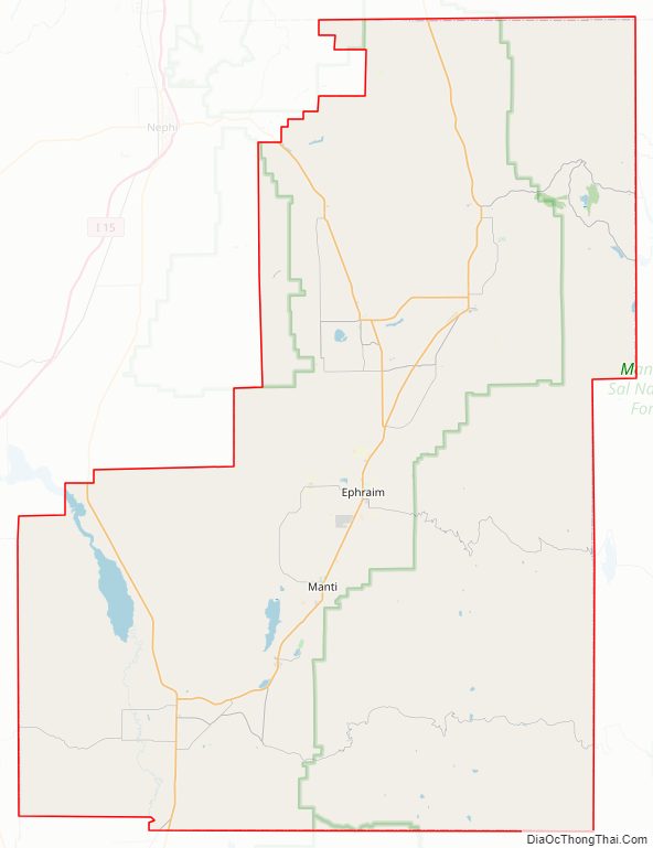
Sanpete County Road Map
Geography
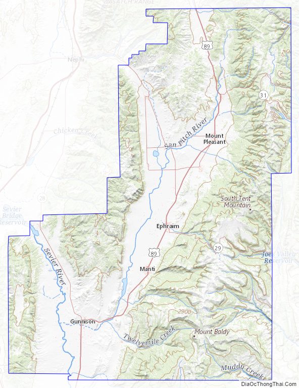
The Sanpete Valley runs from north to south through the center of the county. The county is sloped to the south, with its highest point east of Ephraim, on South Tent Mountain at 11,285′ (3440m) ASL. The county has a total area of 1,603 square miles (4,150 km), of which 1,590 square miles (4,100 km) is land and 12 square miles (31 km) (0.8%) is water. The geographical center of Utah is located in Sanpete County, just west of Ephraim.
Sanpete County is bounded along its eastern side by the Wasatch Plateau (sometimes known as the Manti Mountains). The Wasatch Plateau rises to approximately 11,000 feet (3,300 m). Most of the Wasatch Plateau is encompassed by the Manti Division of the Manti-La Sal National Forest. Runoff from the western slopes of these mountains provides water to the county’s cities and agricultural areas. Central Sanpete is dominated by the Sanpete Valley (sometimes known as the Sanpitch Valley), where most of the county’s cities are located. The western side of the valley is bounded by the lower and drier San Pitch Mountains, which also form part of the western boundary of the county. The San Pitch River runs from north to south through Sanpete and empties into the Sevier River in southwestern Sanpete. This portion of the Sevier River Valley is known as Gunnison Valley.
Major highways
- United States Highway US-89
- Utah State Highway UT-28
- Utah State Highway UT-31
- Utah State Highway UT-116
- Utah State Highway UT-132
- Utah State Highway UT-137
- Utah State Highway UT-264
Adjacent counties
- Utah County – north
- Carbon County – northeast
- Emery County – east
- Sevier County – south
- Millard County – southwest
- Juab County – northwest
Protected areas
- Bald Mountain Wildlife Management Area
- Fishlake National Forest (part)
- Hilltop Wildlife Management Area
- Manti-La Sal National Forest (part)
- Manti Wildlife Management Area
- Mayfield Face Wildlife Management Area
- Palisade State Park
- Spring City Wildlife Management Area
- Uinta-Wasatch-Cache National Forest (part)
- Yuba State Park
Lakes
- Academy Mill Reservoir
- Beaver Dam Reservoir (Benches Pond)
- Big Springs
- Blind Lake
- Blue Lake (near Grassy Lake)
- Blue Lake (near Henningson Reservoir)
- Blue Lake (near Wrigley Springs Reservoir)
- Boulger Reservoir
- Brush Reservoir
- Chester Ponds
- Commissary Spring
- Cottonwood Reservoir
- Cove Lake
- Deep Lake
- Dry Hole Reservoir
- Duck Fork Reservoir
- Emerald Lake
- Emery Reservoir
- Fairview Lakes
- Ferron Reservoir
- Grass Flat Reservoir
- Grassy Lake
- Gunnison Reservoir
- Hamburger Lake
- Harmonica Lake
- Hartney Lake
- Henningson Reservoir
- Huntington Reservoir
- Island Lake
- Jet Fox Reservoir
- John August Lake
- Johnson Springs
- Julius Flat Reservoir
- Little Madsen Reservoir
- Lizard Lake
- Loggers Fork Reservoir
- Lower Gooseberry Reservoir
- Madsen Lake
- Marys Lake
- McKinley Strates Reservoir
- Miller Flat Reservoir (part)
- New Canyon Reservoir
- Newfield Reservoir
- Ninemile Reservoir
- Olafs Pond
- Oleys Lakes
- Olsen Slough
- Palisade Lake
- Patton Reservoir
- Petes Hole Reservoir
- Petes Reservoir
- Rolfson Reservoir
- Rush Pond
- Sevier Bridge Reservoir (Yuba Lake) (part)
- Slide Lake
- Sixmile Ponds
- Lower Pond
- Upper Pond
- Snow Lake
- Soup Bowl
- Spinners Reservoir
- Crooked Creek Spring
- Three Lakes (one of the three)
- Town Reservoir
- Twin Lake
- Wales Reservoir
- Willow Lake
- Woods Lake
- WPA Ponds
- Wrigley Springs Reservoir (part)
- Yearns Reservoir
Sanpete County Topographic Map
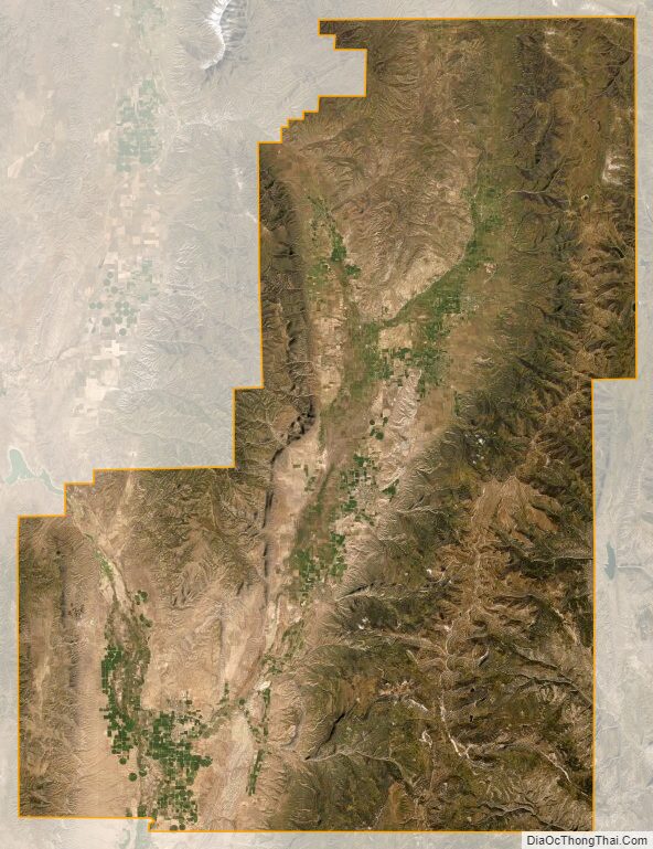
Sanpete County Satellite Map
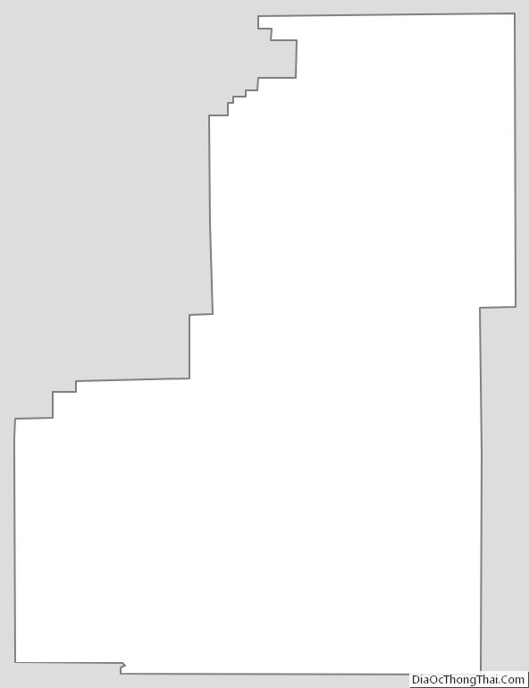
Sanpete County Outline Map