Utah County is the second-most populous county in the U.S. state of Utah. The county seat and largest city is Provo, which is the state’s fourth-largest city, and the largest outside of Salt Lake County. As of the 2020 United States Census, the population was 665,665.
Utah County is one of two counties forming the Provo-Orem metropolitan statistical area, and is part of the larger Salt Lake City-Provo-Orem, UT Combined Statistical Area. In 2010, the center of population of Utah was in Utah County, in the city of Saratoga Springs.
Utah County is one of the fastest-growing counties in the United States, ranking among the top ten counties in numerical growth. Correspondingly, Provo-Orem is among the top eight metropolitan areas by percentage growth in the country.
Utah County is one of seven counties in the United States to have the same name as its state. The other six counties are Arkansas County, Hawaii County, Idaho County, Iowa County, Oklahoma County and New York County (commonly known as Manhattan).
| Name: | Utah County |
|---|---|
| FIPS code: | 49-049 |
| State: | Utah |
| Founded: | 1850 |
| Named for: | Ute Tribe |
| Seat: | Provo |
| Largest city: | Provo |
| Total Area: | 2,144 sq mi (5,550 km²) |
| Land Area: | 2,003 sq mi (5,190 km²) |
| Total Population: | 659,399 |
| Population Density: | 310/sq mi (120/km²) |
| Time zone: | UTC−7 (Mountain) |
| Summer Time Zone (DST): | UTC−6 (MDT) |
| Website: | www.utahcounty.gov |
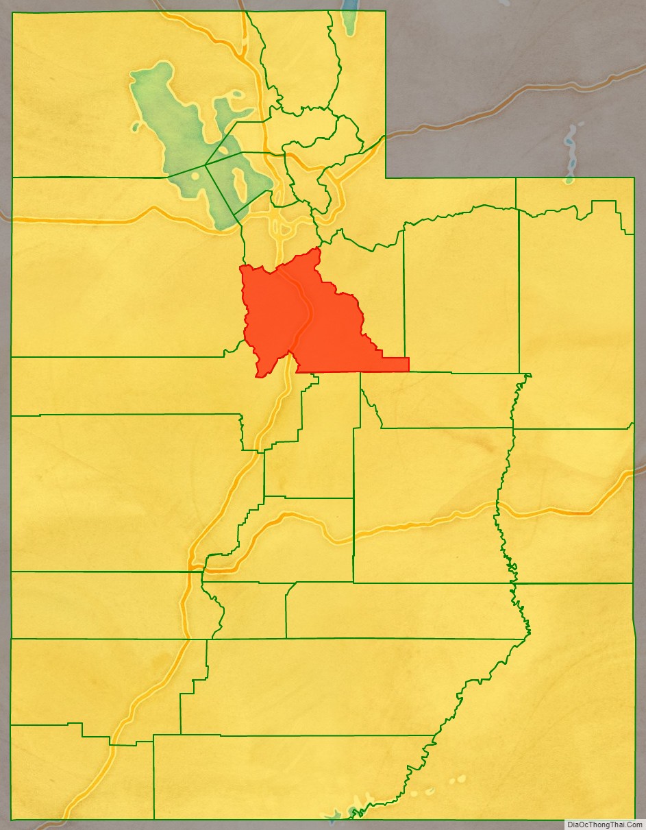
Utah County location map. Where is Utah County?

History
The legislature of the State of Deseret created a county on January 31, 1850, to govern the civic affairs of Utah Valley, which by the 1850s was bustling with newly arrived settlers. The county name is derived from the valley name, which is derived from the Spanish name (Yuta) for the Ute Indians. The State of Deseret dissolved soon after (April 5, 1851), but the counties it had set in place continued. There is little record of any official activity conducted by the fledgling county until April 18, 1852, when a full slate of county officials was published, and recordkeeping began. The first courthouse was built in central Provo in 1866–67. It was soon outgrown and was replaced by a second courthouse (1872–73). By the 1920s, this building was also cramped, and the decision was made to erect a combined city-county building, which was completed in 1926.
The county’s boundaries were adjusted in 1852, 1854, 1856, 1862, 1880, and 1884. It has retained its present boundary since 1884.
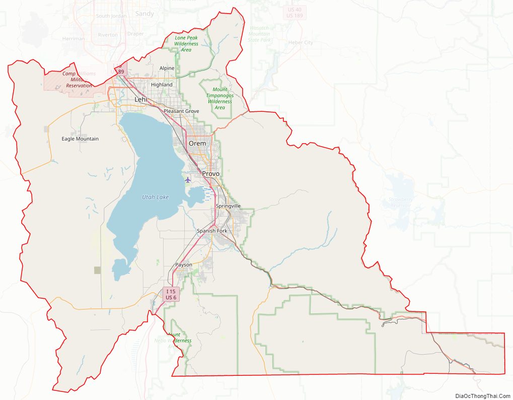
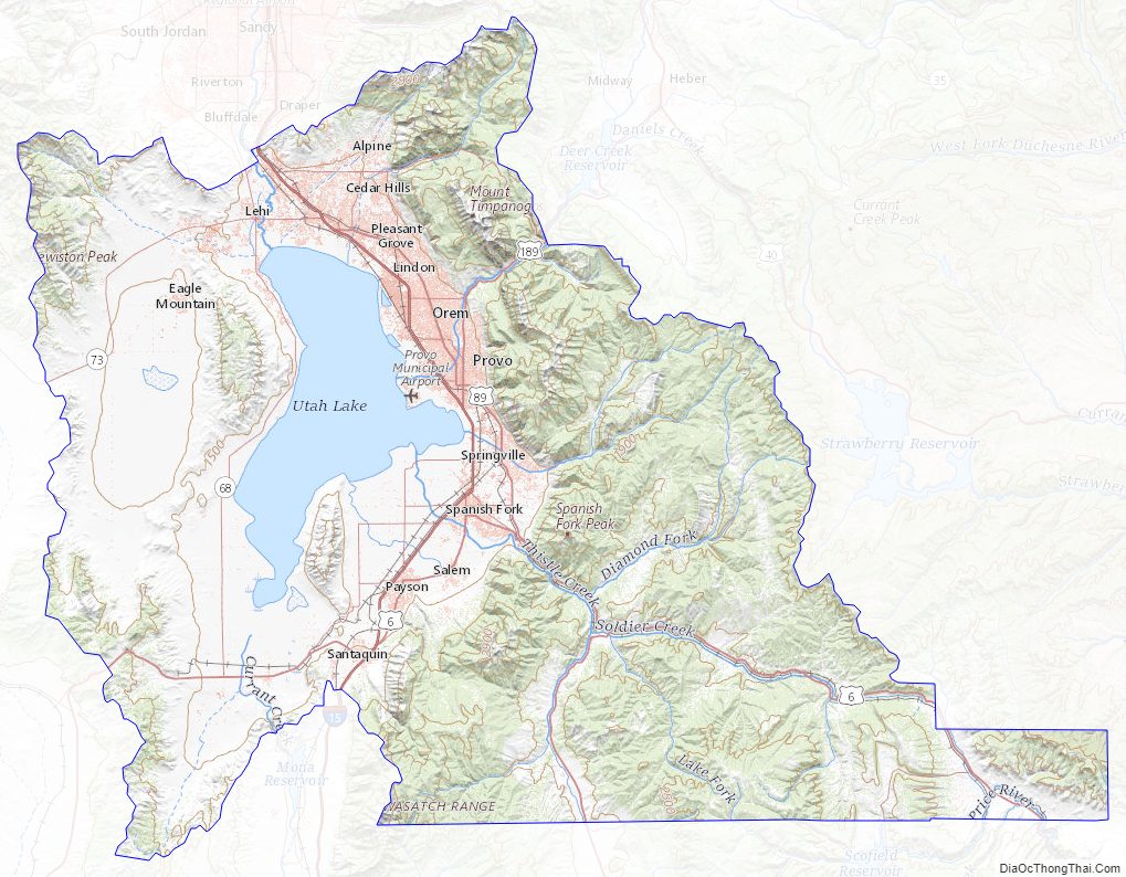
Utah County Road Map
Geography
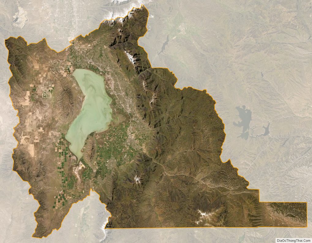
Utah County terrain ranges from stiff mountain ranges in the east (the Wasatch Range), dropping steeply to a large lake-filled valley. Most of the comparatively level ground is dedicated to agriculture or developed uses, while most of the steep terrain is covered with arid-climate forestation. The county generally slopes to the west and north, with its highest point (Mt. Nebo in the southern part of the county), at 11,928′ (3636m) ASL. The county has an area of 2,144 square miles (5,550 km), of which 2,003 square miles (5,190 km) is land and 141 square miles (370 km) (6.6%) is water.
Utah Valley lies at the center of the county, lined by the mountains of the Wasatch Range on the east. Utah Lake occupies a large part of the valley. The elevation ranges from 4,487 feet (1,368 m) above sea level at the lake to 11,928 feet (3,636 m) at the peak of Mount Nebo.
Major highways
- Interstate 15
- U.S. Route 6
- U.S. Route 89
- U.S. Route 189
- Utah State Route 68
- Utah State Route 73
- Utah State Route 77
- Utah State Route 85
- Utah State Route 92
- Utah State Route 146
- Utah State Route 147
- Utah State Route 198
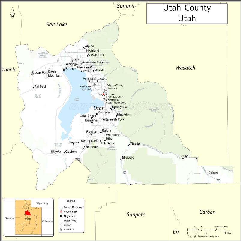
Adjacent counties
- Salt Lake – north
- Wasatch – northeast
- Duchesne – southeast
- Carbon – southeast
- Sanpete – south
- Juab – southwest
- Tooele – west
Protected areas
- Ashley National Forest (part)
- Black Hawk Campground (US Forest Service)
- Finish of the Provo River Parkway
- Manti-La Sal National Forest (part)
- Mount Timpanogos
- Powell Slough Waterfowl Management Area
- Rock Island Waterfowl Management Area
- Scofield State Park (part)
- Starvation Wildlife Management Area
- Timpanogos Cave National Monument
- Uinta-Wasatch-Cache National Forest (part)
- Utah Lake State Park
Lakes
- Utah Lake
- Provo Bay (an extension of Utah Lake)
- Scofield Reservoir (part)
Utah County Topographic Map
Utah County Satellite Map
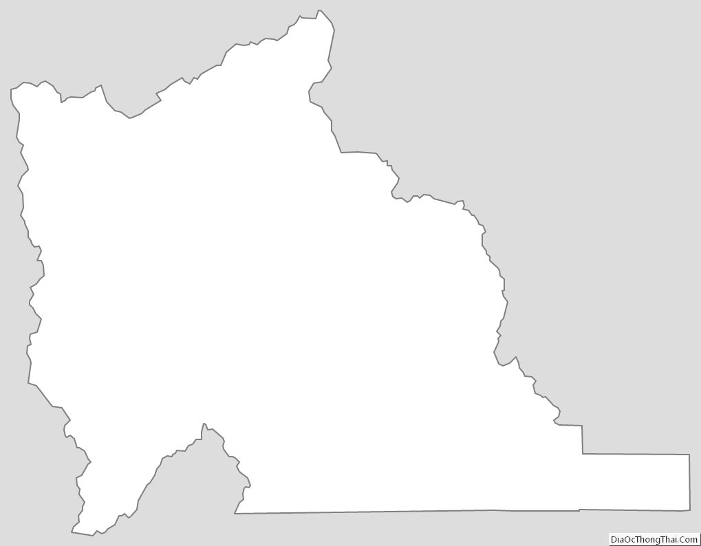
Utah County Outline Map