Spokane County is a county located in the U.S. state of Washington. As of the 2020 census, its population was 539,339, making it the fourth-most populous county in Washington. The largest city and county seat is Spokane, the second largest city in the state after Seattle. The county is named after the Spokane tribe.
Spokane County is part of the Spokane-Spokane Valley metropolitan statistical area, which is also part of the greater Spokane-Coeur d’Alene combined statistical area that includes nearby Kootenai County, Idaho.
| Name: | Spokane County |
|---|---|
| FIPS code: | 53-063 |
| State: | Washington |
| Founded: | January 29, 1858 (created) January 19, 1864 (annexed to Stevens Co.) October 30, 1879 (separated from Stevens Co.) |
| Named for: | Spokane people |
| Seat: | Spokane |
| Largest city: | Spokane |
| Total Area: | 1,781 sq mi (4,610 km²) |
| Land Area: | 1,764 sq mi (4,570 km²) |
| Total Population: | 539,339 |
| Population Density: | 275/sq mi (106/km²) |
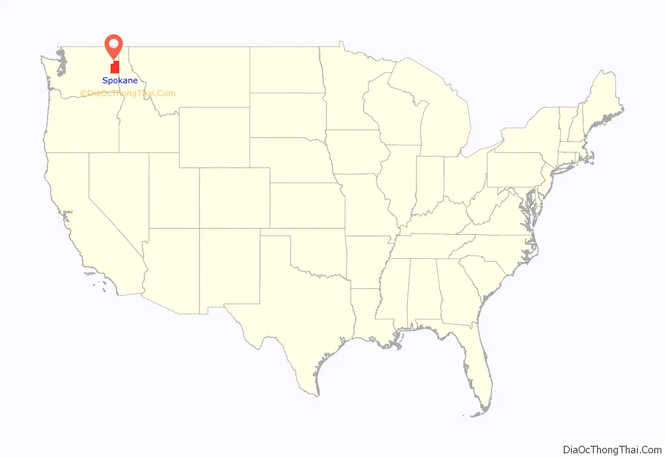
Spokane County location map. Where is Spokane County?
History
The first humans to arrive in what is now Spokane County arrived between 12,000 and 8,000 years ago and were hunter-gatherer societies who lived off the plentiful game in the area. Initially, the settlers hunted predominantly bison and antelope, but after the game migrated out of the region, the native people became dependent on gathering various roots, berries, and nuts, and harvesting fish. The Spokane tribe, after which the county is named, means “Children of the Sun” or “sun people” in Salishan Explorer-geographer David Thompson, working as head of the North West Company’s Columbia Department, became the first European to explore what is now the Inland Northwest. After establishing the Kullyspell House and Saleesh House fur trading posts in what are now Idaho and Montana, Thompson then attempted to expand further west. He sent out two trappers, Jacques Raphael Finlay and Finan McDonald, to construct a fur-trading post on the Spokane River in Washington and trade with the local Indians. This post was established in 1810, at the confluence of the Little Spokane and Spokane Rivers, becoming the first enduring European settlement of significance in Washington. Known as the Spokane House, or simply “Spokane”, it was in operation from 1810 to 1826.
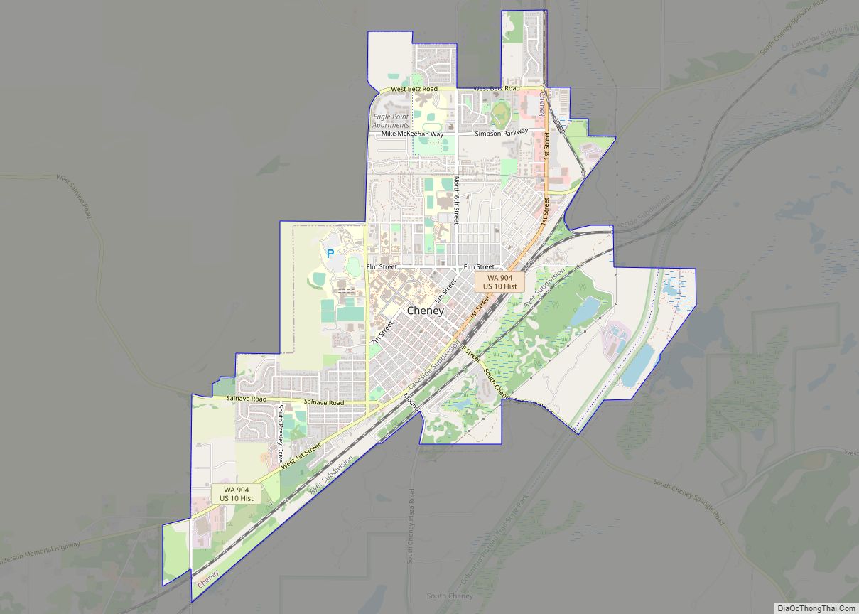
Spokane County was established by the Washington legislature effective January 29, 1858. It was annexed by Stevens County on January 19, 1864, and recreated on October 30, 1879. The first post office in the county was located at Spokane Bridge. The current Spokane county seat holder, Spokane, wrested the seat from Cheney in 1886.
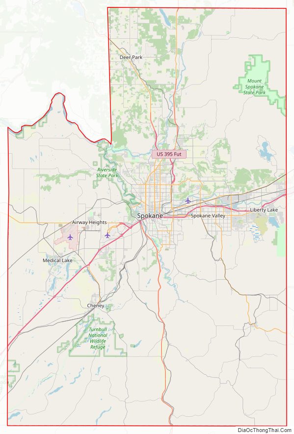
Spokane County Road Map
Geography
According to the United States Census Bureau, the county has a total area of 1,781 sq mi (4,610 km), of which 17 square miles (44 km) (0.9%) are covered by water. The lowest point in the county is the Spokane River behind Long Lake Dam (boundary of Stevens County) at 1,538 feet (469 m) above sea level. (Virtually no change in elevation occurs between the dam and the mouth of the Little Spokane River inside Riverside State Park.) The highest point in the county is the summit of Mount Spokane at 5,887 ft (1,794 m). NAVD 88
Spokane County has a complex geologic history and varied topography. To the west is the barren landscape of the Columbia Basin and to the east are the foothills of the Rockies—the Coeur d’Alene Mountains, which rise to the east in northern Idaho. Spokane County lies in a transition area between the eastern edge of the basaltic Channeled Scablands steppe plains to the west and the rugged, timbered Rocky Mountain foothills to the east. The area exhibits signs of the prehistoric geologic events that shaped the area and region such as the Missoula Floods, which ended 12,000 to 15,000 years ago. The geography to the southeast, such as the Saltese Flats and Saltese Uplands is characterized as a shrub–steppe landscape with grassy hills and ravines.
In ecology, as with the topography, the county is also in a transition area, roughly split between the Columbia Plateau ecoregion in the southwest portion, where it is at the eastern edge of the basaltic Channeled Scablands steppe plain and the Northern Rockies ecoregion in the northwest portion, which is the rugged and forested Selkirk Mountains.
Rivers
- Spokane River
- Little Spokane River
- Latah Creek
- Deep Creek
- Cable Creek
- Saltese Creek
Lakes and reservoirs
- Medical Lake
- West Medical Lake
- Liberty Lake
- Newman Lake
- Shelley Lake
Notable summits and peaks
- Mount Spokane
- Mount Kit Carson
- Mica Peak
- Krell Hill
Notable parks
- Dishman Hills Natural Conservation Area
- Riverside State Park
- Riverfront Park
- Manito Park
- Mount Spokane State Park
National protected area
- Turnbull National Wildlife Refuge
Major highways
- Interstate 90
- U.S. Route 2
- U.S. Route 195
- U.S. Route 395
- State Route 27
- State Route 206
- State Route 290
- State Route 291
- State Route 902
- State Route 904
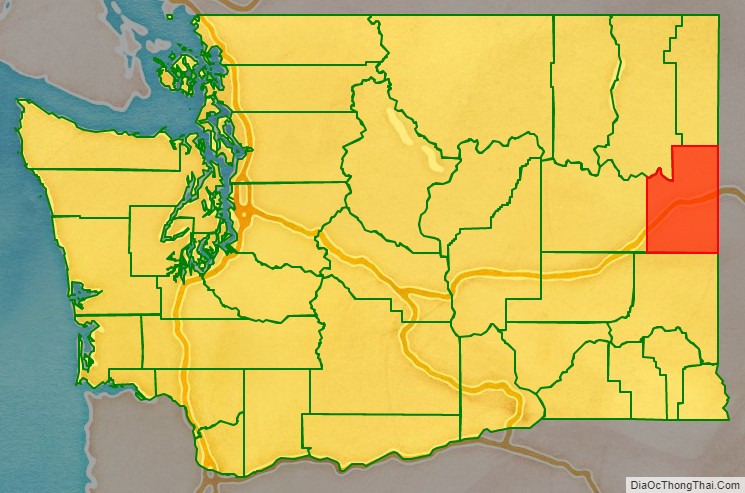
Adjacent counties
- Stevens County – northwest
- Pend Oreille County – north
- Bonner County, Idaho – northeast
- Kootenai County, Idaho – east
- Benewah County, Idaho – southeast
- Whitman County – south
- Lincoln County – west
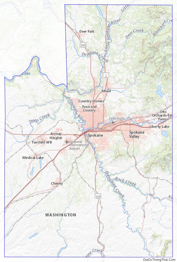
Spokane County Topographic Map
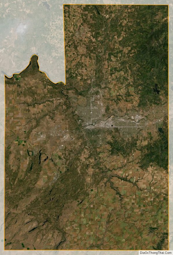
Spokane County Satellite Map
Spokane County Outline Map