Ternopil Oblast (Ukrainian: Тернопі́льська о́бласть, romanized: Ternopilska oblast; also referred to as Ternopilshchyna, Терно́пільщина, or Ternopillia, Тернопілля) is an oblast (province) of Ukraine. Its administrative center is Ternopil, through which flows the Seret, a tributary of the Dniester. Population: 1,021,713 (2022 est.).
One of the natural wonders of the region are its cave complexes. Although Ternopil Oblast is among the smallest regions in Ukraine, over 100 caves have been discovered there. Scientists believe these are only 20% of all possible caves in the region. The biggest cave is Optymistychna Cave. Measuring 267 km (166 mi) in total length, it is the longest cave in Eurasia and the fifth longest in the world (see list of longest caves). Twenty percent of the land in the region is chernozem soil.
Among its attractions, Ternopil Oblast has 34 castles. By at least one account, the most prominent is the Zbarazh Castle with fortifications that expand over 16 ha (40 acres) and was the center of a 17th-century standoff between troops of Bohdan Khmelnytsky and the army of the Polish–Lithuanian Commonwealth. Dniester Canyon passes through the oblast; it is considered one of the wonders of Ukraine, stretching for 250 km (160 mi).
| Unit Name | Ternopil' Oblast |
|---|---|
| Administrative center | Ternopil |
| Total area | 13.823 km² (5.337 sq mi) |
| Area Rank | Rank 22th |
| Population (2021) | 1.030.562 |
| Time zone | UTC+2 (EET) |
| Summer (DST) | UTC+3 (EEST) |
| Postal code | 46-49 |
| Area code | +380-35 |
| ISO 3166 code | UA-61 |
| Website | www.adm.gov.te.ua |
| Flag |  |
| Coat of arms |  |
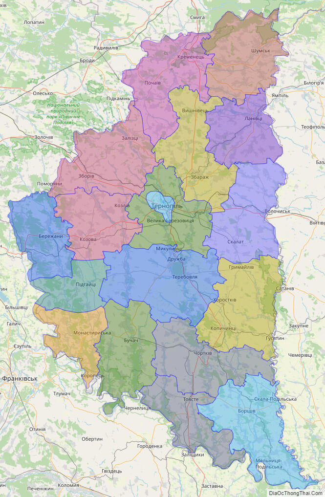
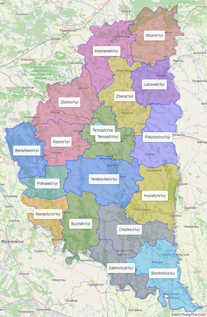
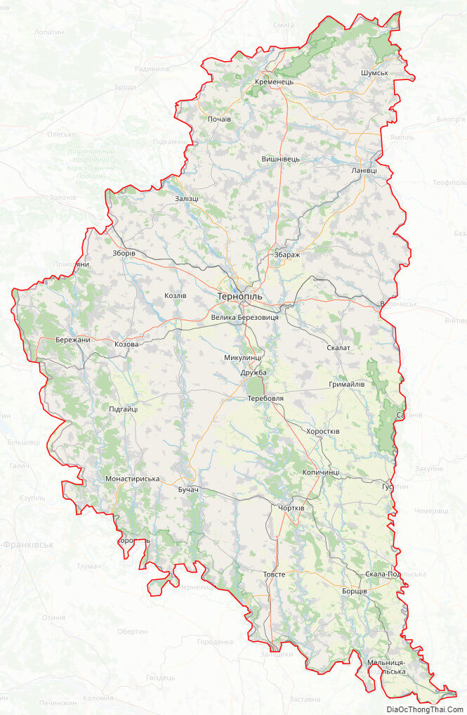
Online subdivision map of Ternopil’ oblast
Ternopil Oblast, located in western Ukraine, is known for its picturesque landscapes, charming towns, and rich history. If you’re looking to explore this fascinating region, an online subdivision map can be an excellent resource to help you plan your trip.
Using an online base map, such as OpenStreetMap or Google Maps, you can view Ternopil Oblast and its various sub-administrative units in detail. The map includes a cover layer with different colors to show the borders and boundaries of each area, making it easy to distinguish between them.
With the help of an online subdivision map, you can discover some of the region’s top attractions, including the Pochaiv Monastery, Zbarazh Castle, and the Ternopil Pond. You can also explore the quaint villages and towns scattered throughout the region, such as Chortkiv, Kremenets, and Berezhany.
One of the great things about using an online subdivision map is that you can plan your trip at your own pace and according to your own interests. Whether you’re looking to soak up some local culture, indulge in some delicious Ukrainian cuisine, or simply relax in a tranquil setting, Ternopil Oblast has something to offer everyone.
So why not grab a cup of coffee, sit back, and start exploring Ternopil Oblast today? With an online subdivision map at your fingertips, you’re sure to uncover some hidden gems and create unforgettable memories.
Click on ![]() to view map in "full screen" mode.
to view map in "full screen" mode.
List administrative sub-division of Ternopil’ oblast
| # | Name | Type |
|---|---|---|
| 1 | Ternopil’s’ka | Misto |
| 2 | Berezhans’kyi | Raion |
| 3 | Borshchivs’kyi | Raion |
| 4 | Buchats’kyi | Raion |
| 5 | Chortkivs’kyi | Raion |
| 6 | Husiatyns’kyi | Raion |
| 7 | Kozivs’kyi | Raion |
| 8 | Kremenets’kyi | Raion |
| 9 | Lanovets’kyi | Raion |
| 10 | Monastyrys’kyi | Raion |
| 11 | Pidhaiets’kyi | Raion |
| 12 | Pidvolochys’kyi | Raion |
| 13 | Shums’kyi | Raion |
| 14 | Terebovlians’kyi | Raion |
| 15 | Ternopil’s’kyi | Raion |
| 16 | Zalishchyts’kyi | Raion |
| 17 | Zbaraz’kyi | Raion |
| 18 | Zborivs’kyi | Raion |
Explaination:
- Mis’ka Rada: City municipalities (governed by a mayor and a city council)
- Misto: city at least 10,000 people (not a town).
- Raion: often translated as “district”.
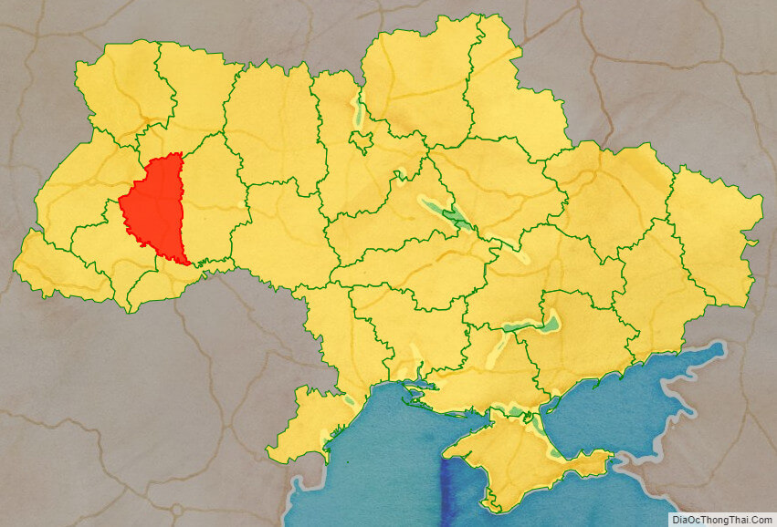
Location map of Ternopil’ oblast, Ukraine

Political map of Ternopil’ oblast
Ternopil’ oblast streeet map
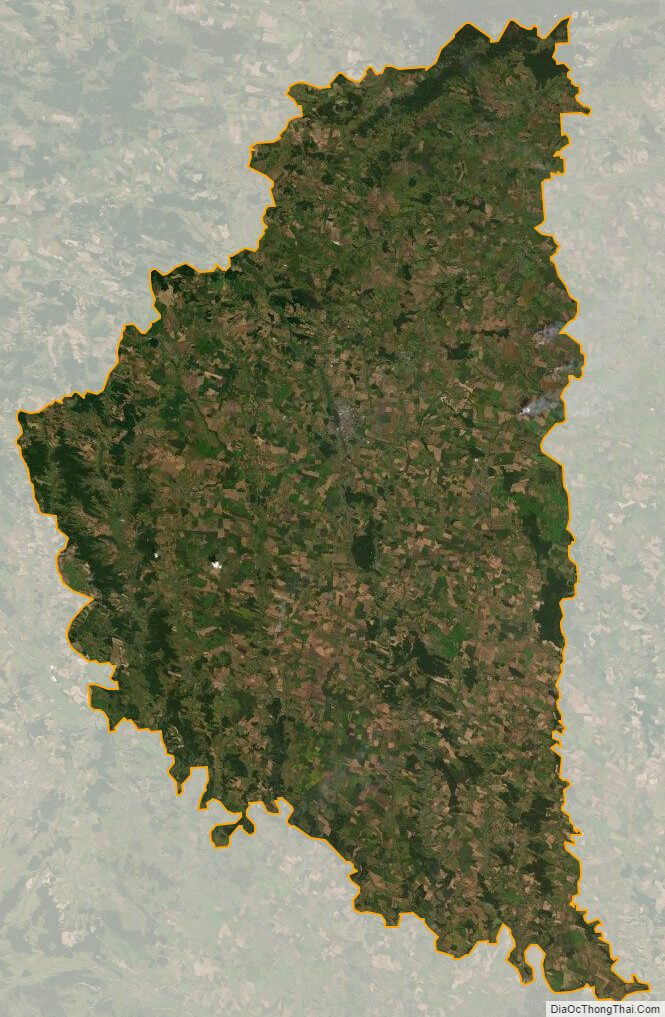
Ternopil’ oblast satellite map