Map of Aliceville city

Map of Aliceville city

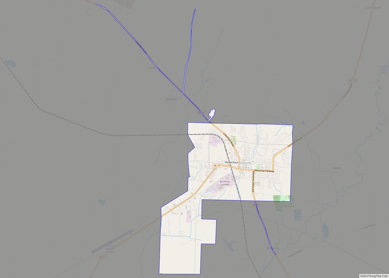
Aliceville is a city in Pickens County, Alabama, United States, located thirty-six miles west of Tuscaloosa. At the 2010 census its population was 2,486, down from 2,567 in 2000. Founded in the first decade of the 20th century and incorporated in 1907, the city has become notable for its World War II-era prisoner-of-war camp, Camp … Read more

Map of Alexandria CDP

Map of Alexandria CDP, Alabama

Alexandria is a census-designated place and unincorporated community in Calhoun County, Alabama, United States. At the 2020 census, the population was 4,032. It is included in the Anniston–Oxford, Alabama Metropolitan Statistical Area. Alexandria CDP overview: Name: Alexandria CDP LSAD Code: 57 LSAD Description: CDP (suffix) State: Alabama County: Calhoun County Elevation: 577 ft (176 m) Total Area: … Read more

Map of Alexander city

Map of Alexander city

Alexander City, known to locals as “Alex City”, is the largest city in Tallapoosa County, Alabama, United States, with a population of 14,843 as of the 2020 census. It has been the largest community in Tallapoosa County since 1910. It is known for Lake Martin with its 750 miles (1,210 km) of wooded shoreline and 44,000 … Read more

Map of Andalusia city

Map of Andalusia city, Alabama

Andalusia is a city in and the county seat of Covington County, Alabama, United States. At the 2020 census, the population was 8,805. Andalusia city overview: Name: Andalusia city LSAD Code: 25 LSAD Description: city (suffix) State: Alabama County: Covington County Incorporated: 1884 Elevation: 348 ft (106 m) Total Area: 19.81 sq mi (51.32 km²) Land Area: 19.66 sq mi (50.91 km²) Water … Read more

Map of Altoona town

Map of Altoona town, Alabama

Altoona is a town in Etowah County (and a small portion of Blount County) in the U.S. state of Alabama. It is part of the Gadsden Metropolitan Statistical Area. At the 2020 census, the population was 948. Altoona town overview: Name: Altoona town LSAD Code: 43 LSAD Description: town (suffix) State: Alabama County: Blount County, … Read more

Map of Allgood town

Map of Allgood town

Allgood, formerly known as Chepultepec, is a town in Blount County, Alabama, United States. At the 2020 census, the population was 548. Allgood town overview: Name: Allgood town LSAD Code: 43 LSAD Description: town (suffix) State: Alabama County: Blount County Elevation: 787 ft (240 m) Total Area: 1.04 sq mi (2.69 km²) Land Area: 1.04 sq mi (2.69 km²) Water Area: 0.00 sq mi (0.00 km²) … Read more

Map of Arab city

Map of Arab city

Arab (/ˈeɪ.ræb/) is a city in Marshall and Cullman counties in the northern part of the U.S. state of Alabama, located 10 miles (16 km) from Guntersville Lake and Guntersville Dam, and is included in the Huntsville-Decatur Combined Statistical Area. As of the 2020 census, the population of the city was 8,461. Arab city overview: Name: … Read more

Map of Anniston city

Map of Anniston city, Alabama

Anniston is the county seat of Calhoun County in Alabama and is one of two urban centers/principal cities of and included in the Anniston-Oxford Metropolitan Statistical Area. As of the 2010 census, the population of the city was 23,106. According to 2019 Census estimates, the city had a population of 21,287. Named “The Model City” … Read more

Map of Anderson town, Alabama

Map of Anderson town, Alabama

Anderson is a town in Lauderdale County, Alabama, United States. It is part of the Florence – Muscle Shoals Metropolitan Statistical Area known as “The Shoals”. As of the 2010 U.S. Census, the town had a population of 282, down from 354 in 2000. Anderson town overview: Name: Anderson town LSAD Code: 43 LSAD Description: … Read more

Map of Ariton town

Map of Ariton town

Ariton is a town in Dale County, Alabama, United States. At the 2020 census, the population was 662. It was incorporated in April 1906. The name is a blend of its two predecessor town names: Ariosto and Charlton. Ariton is part of the Ozark Micropolitan Statistical Area. Ariton town overview: Name: Ariton town LSAD Code: … Read more

Map of Argo town

Map of Argo town

Argo is a town in Jefferson and St. Clair counties, Alabama, United States. It incorporated in 1987. At the 2020 census, the population was 4,368. Argo town overview: Name: Argo town LSAD Code: 43 LSAD Description: town (suffix) State: Alabama County: Jefferson County, St. Clair County Elevation: 814 ft (248 m) Total Area: 10.70 sq mi (27.72 km²) Land Area: … Read more

Map of Ardmore town

Map of Ardmore town, Alabama

Ardmore is a town in Limestone County, Alabama, United States, and is included in the Huntsville-Decatur Metro Area. It is home to the Saturn IB rocket at the Alabama Welcome Center, just south of the Tennessee border, on Interstate 65. As of the 2010 census, the population of the town is 1,194. It borders its … Read more