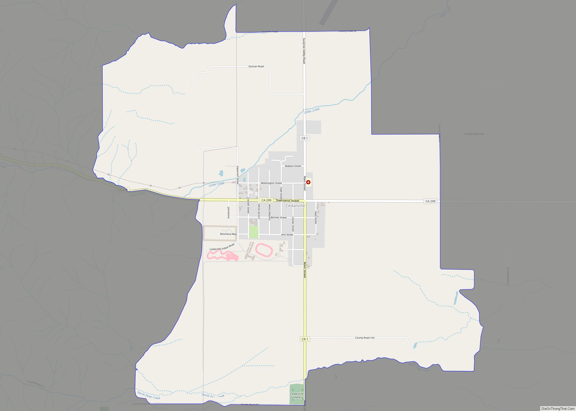
Map of Challenge-Brownsville CDP

Map of Challenge-Brownsville CDP

Challenge–Brownsville is a census-designated place (CDP) in Yuba County, California, United States. The population was 1,148 at the 2010 census, up from 1,069 at the 2000 census. Challenge-Brownsville CDP overview: Name: Challenge-Brownsville CDP LSAD Code: 57 LSAD Description: CDP (suffix) State: California County: Yuba County Total Area: 9.71 sq mi (25.14 km²) Land Area: 9.71 sq mi (25.14 km²) Water Area: … Read more

Map of Chalfant CDP

Map of Chalfant CDP, California

Chalfant (also Chalfant Valley) is an unincorporated community and census-designated place (CDP) in Mono County, California, United States. It is located on the abandoned Southern Pacific Railroad 22 miles (35 km) south-southeast of Benton, at an elevation of 4,258 feet (1,298 m). The population was 660 at the 2020 census. Chalfant is a small, primarily residential community … Read more

Map of Cerritos city

Map of Cerritos city

Cerritos (Spanish for “Little hills”) is a city in Los Angeles County, California, United States, and is one of several cities that constitute the Gateway Cities of southeast Los Angeles County. It was incorporated on April 24, 1956. As of 2019, the population was 49,859. It is part of the Los Angeles–Long Beach–Anaheim, California Metropolitan … Read more

Map of Charter Oak CDP

Map of Charter Oak CDP, California

Charter Oak is a census-designated place (CDP) in Los Angeles County, California, approximately 26 miles (42 km) east of downtown Los Angeles. The population was 9,310 at the 2010 census, up from 9,027 at the 2000 census. Charter Oak is located in the eastern San Gabriel Valley, situated along Arrow Highway in between Covina to the … Read more

Map of Channel Islands Beach CDP

Map of Channel Islands Beach CDP

Channel Islands Beach is an unincorporated community in Ventura County, California, United States consisting of three historic neighborhoods: Hollywood Beach, Hollywood by the Sea, and Silver Strand Beach. This densely populated narrow 1.3-mile-long strip (2.1 km) along the coastal edge of the Oxnard Plain was subdivided using the glamor of Hollywood to sell lots in the … Read more

Map of Cherokee Strip CDP

Map of Cherokee Strip CDP

Cherokee Strip is a census-designated place in Kern County, California. It is located 2.5 miles (4 km) south-southeast of Shafter, at an elevation of 331 feet (101 m). The population was 206 at the 2010 census. Cherokee Strip CDP overview: Name: Cherokee Strip CDP LSAD Code: 57 LSAD Description: CDP (suffix) State: California County: Kern County Elevation: … Read more

Map of Cherryland CDP

Map of Cherryland CDP

Cherryland is an unincorporated community and census-designated place (CDP) in Alameda County, California, United States. Cherryland is located between Ashland to the north and the city of Hayward to the south. The population was 15,808 at the 2020 census. Cherryland CDP overview: Name: Cherryland CDP LSAD Code: 57 LSAD Description: CDP (suffix) State: California County: … Read more

Map of Cherry Valley CDP, California

Map of Cherry Valley CDP, California

Cherry Valley is a census-designated place (CDP) in Riverside County, California, United States. The population was 6,362 at the 2010 census, up from 5,891 at the 2000 census. It is situated at the most northwestern point of the San Gorgonio Pass. The area was planted with many cherry trees, for which Cherry Valley was named. … Read more

Map of Cherokee CDP, California

Map of Cherokee CDP, California

Cherokee is an unincorporated community and census-designated place in Butte County, California. It is an area inhabited by Maidu Indians prior to the gold rush, but that takes its name from a band of Cherokee prospectors who perfected a mining claim on the site. The population was 69 at the 2010 census. It lies at … Read more

Map of Chilcoot-Vinton CDP

Map of Chilcoot-Vinton CDP

Chilcoot-Vinton is a census-designated place (CDP) in Plumas County, California, United States. The population was 454 at the 2010 census, up from 387 at the 2000 census. Chilcoot-Vinton CDP overview: Name: Chilcoot-Vinton CDP LSAD Code: 57 LSAD Description: CDP (suffix) State: California County: Plumas County Total Area: 13.21 sq mi (34.21 km²) Land Area: 13.21 sq mi (34.21 km²) Water Area: … Read more

Map of Chico city

Map of Chico city, California

Chico (/ˈtʃiːkoʊ/ CHEE-koh; Spanish for “little”) is the most populous city in Butte County, California, United States. Located in the Sacramento Valley region of Northern California, the city had a population of 101,475 in the 2020 census, reflecting an increase from 86,187 in the 2010 Census. Chico is the cultural and economic center of the … Read more

Map of Chester CDP, California

Map of Chester CDP, California

Chester (formerly Big Meadows) is a census-designated place (CDP) in Plumas County, California, United States. Chester is located on Lake Almanor, 30 miles (48.3 km) north-northwest of Quincy. The town is located along State Route 36. The US Postal Service ZIP code for the community is 96020. The population was 2,144 at the 2010 census, down … Read more