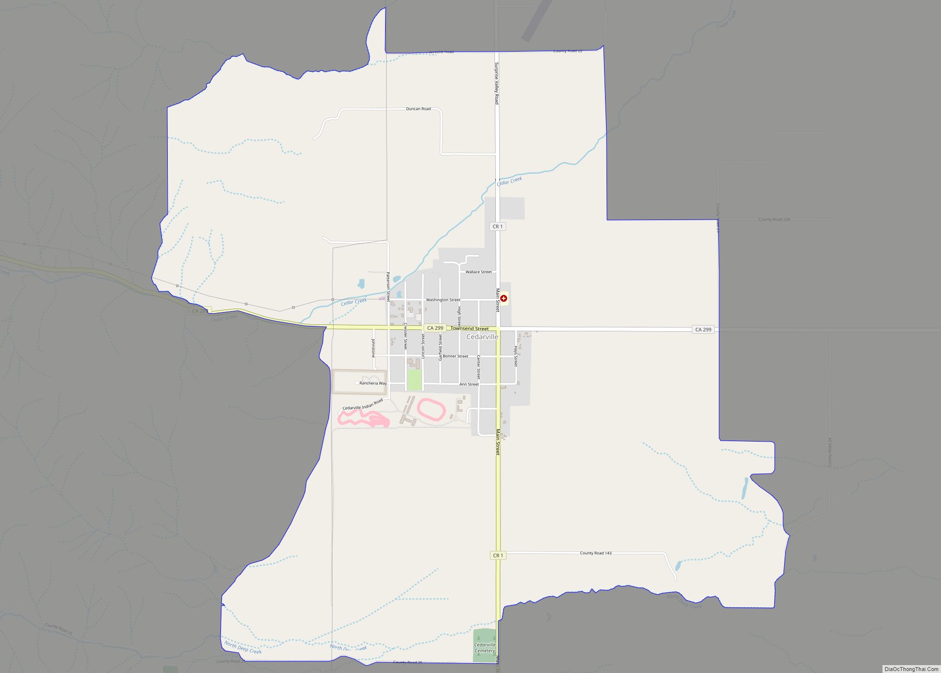
Cedarville (formerly Surprise Valley and Deep Creek) is a census-designated place located 20 miles (32 km) east of Alturas, at an elevation of 4,652 feet (1,418 m), in Modoc County, California. Its population is 437 as of the 2020 census, down from 514 at the 2010 census.
| Name: | Cedarville CDP |
|---|---|
| LSAD Code: | 57 |
| LSAD Description: | CDP (suffix) |
| State: | California |
| County: | Modoc County |
| Elevation: | 4,652 ft (1,418 m) |
| Total Area: | 5.45 sq mi (14.10 km²) |
| Land Area: | 5.44 sq mi (14.10 km²) |
| Water Area: | 0.00 sq mi (0.01 km²) 0.08% |
| Total Population: | 437 |
| Population Density: | 80.30/sq mi (31.00/km²) |
| ZIP code: | 96104 |
| Area code: | 530 |
| FIPS code: | 0612328 |
| GNISfeature ID: | 220805; 2582971 |
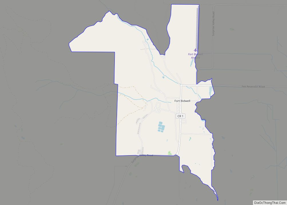
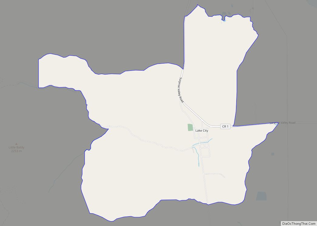
Online Interactive Map
Click on ![]() to view map in "full screen" mode.
to view map in "full screen" mode.
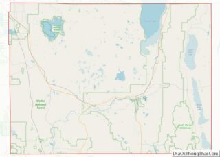
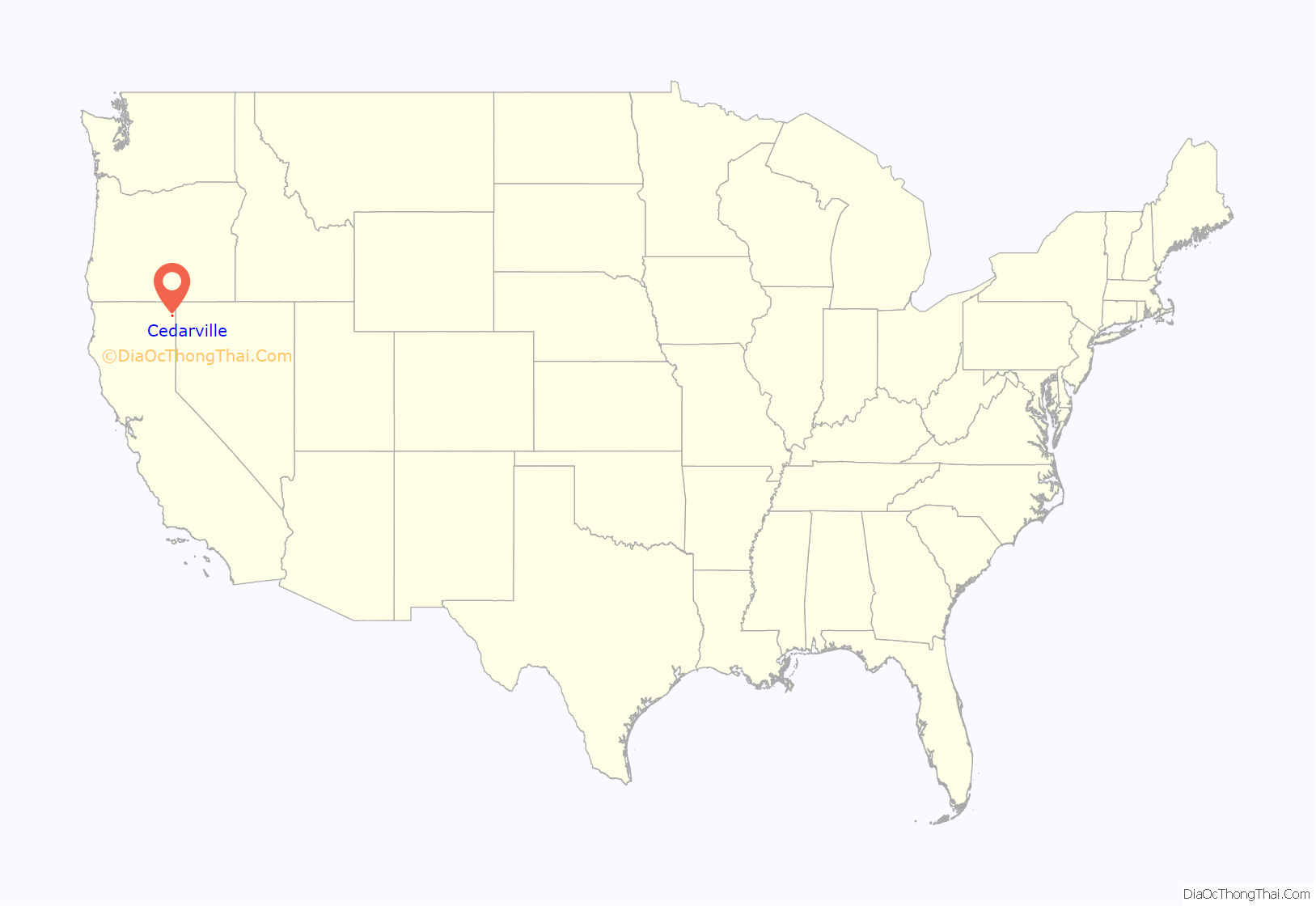
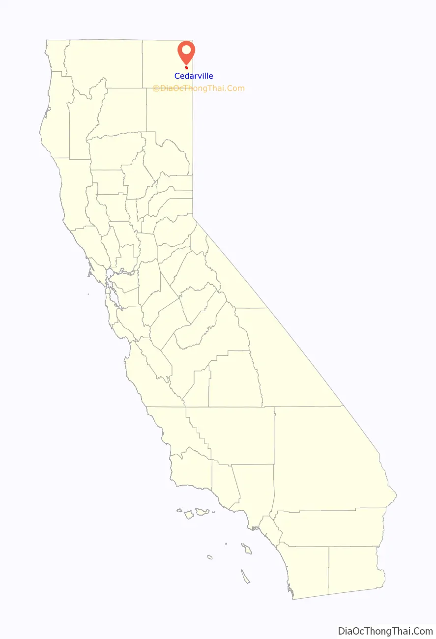
Cedarville location map. Where is Cedarville CDP?
History
Originally known as Deep Creek, Cedarville was founded around 1864 as a stopping place for wagon trains. In 1867 a trading post was being run by William Cressler and John Bonner, who later also built the first road over Cedar Pass, which connected Surprise Valley to Alturas and the rest of Modoc County.
The first post office opened in 1869. The current name is derived from Cedarville, Ohio. As branch county seat of Siskiyou County, nearby Lake City was the population center of Surprise Valley until Modoc County formed in 1874. However, by 1880 Cedarville was the largest town in the valley, with a population of around 220, and once Fort Bidwell, 20 miles (32 km) to the north, was demilitarized Cedarville’s central location and access to Cedar Pass made it the natural population and business center of the valley.
A 1913 book described Cedarville as being on Middle Alkali Lake and having a population of about 500. The Laxague Lumber Company mill was located in Cedarville, and employed from 18 to 60 residents.
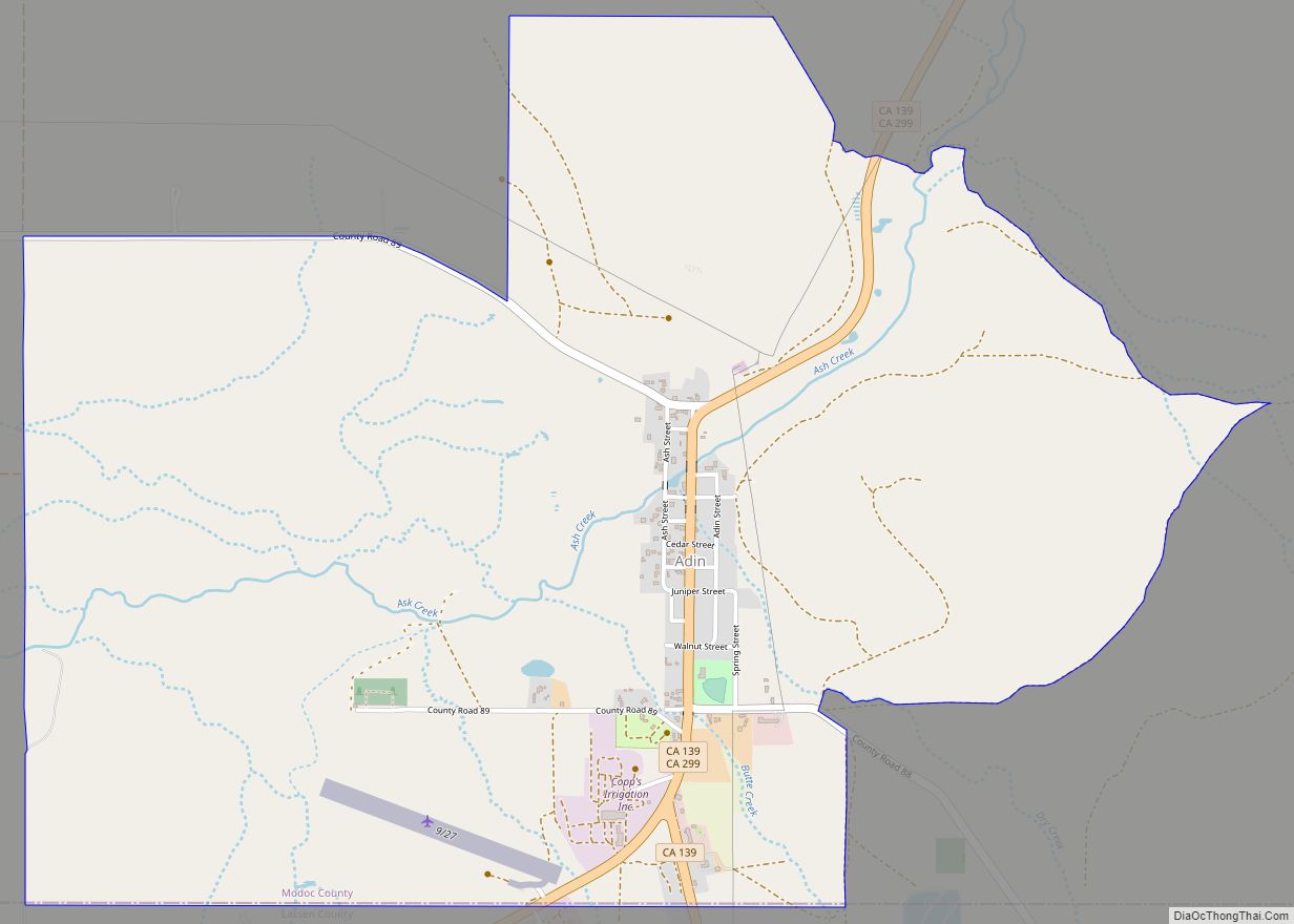
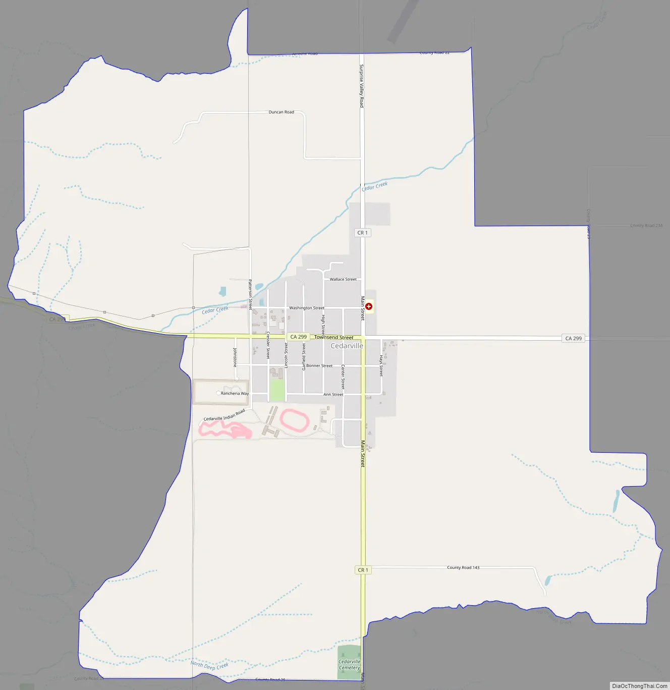
Cedarville Road Map
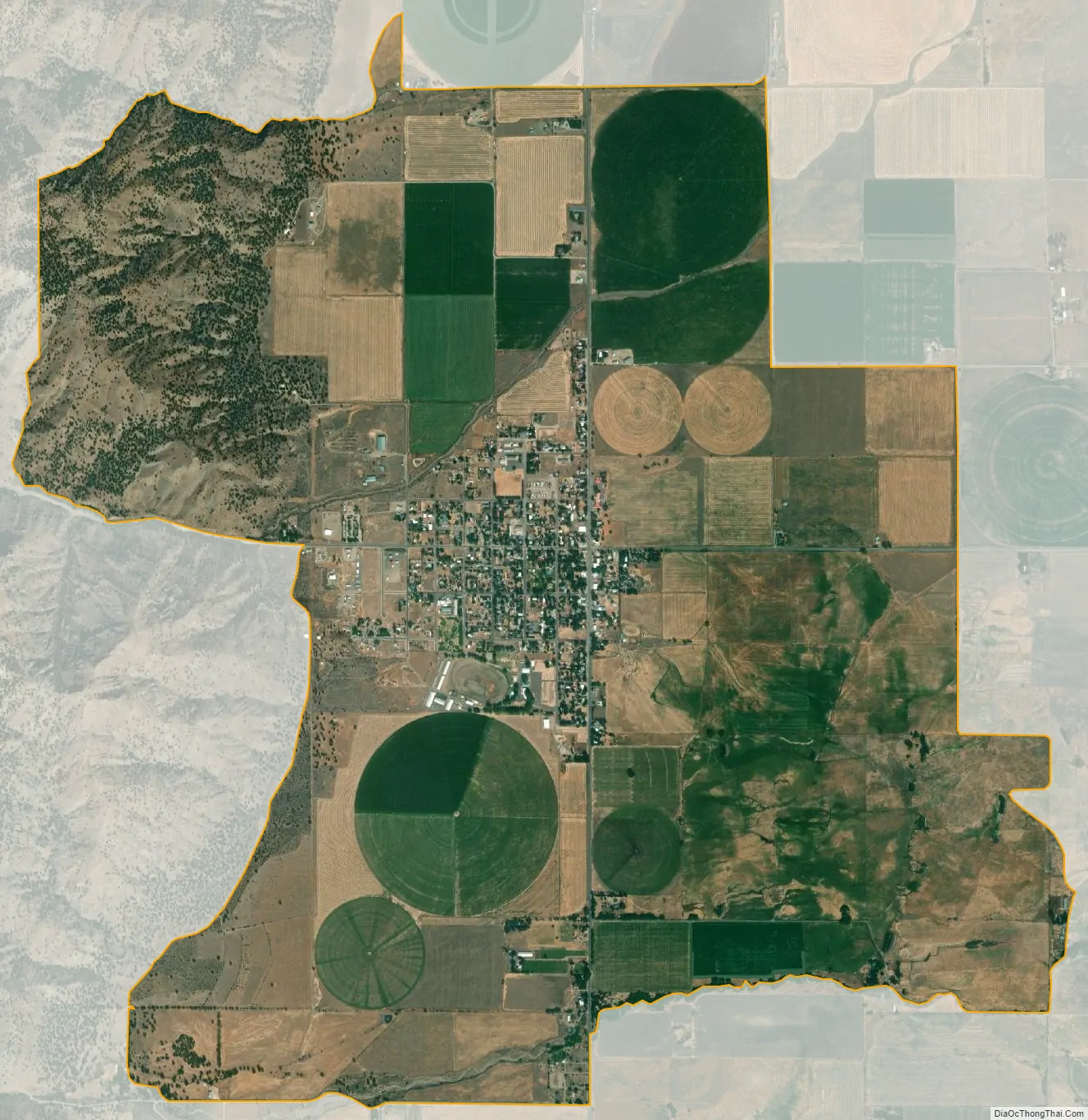
Cedarville city Satellite Map
Geography
Cedarville is located at 41°31′ North, 120°10′ West (41.31, -120.17).
According to the United States Census Bureau, the CDP covers an area of 5.4 square miles (14 km), 99.92% of it land, and 0.08% of it water.
The largest town in Surprise Valley, Cedarville is located on the alluvial apron at the mouth of Cedar Canyon, on the eastern base of the Warner Mountains, near the western shore of Middle Alkali Lake.
See also
Map of California State and its subdivision:- Alameda
- Alpine
- Amador
- Butte
- Calaveras
- Colusa
- Contra Costa
- Del Norte
- El Dorado
- Fresno
- Glenn
- Humboldt
- Imperial
- Inyo
- Kern
- Kings
- Lake
- Lassen
- Los Angeles
- Madera
- Marin
- Mariposa
- Mendocino
- Merced
- Modoc
- Mono
- Monterey
- Napa
- Nevada
- Orange
- Placer
- Plumas
- Riverside
- Sacramento
- San Benito
- San Bernardino
- San Diego
- San Francisco
- San Joaquin
- San Luis Obispo
- San Mateo
- Santa Barbara
- Santa Clara
- Santa Cruz
- Shasta
- Sierra
- Siskiyou
- Solano
- Sonoma
- Stanislaus
- Sutter
- Tehama
- Trinity
- Tulare
- Tuolumne
- Ventura
- Yolo
- Yuba
- Alabama
- Alaska
- Arizona
- Arkansas
- California
- Colorado
- Connecticut
- Delaware
- District of Columbia
- Florida
- Georgia
- Hawaii
- Idaho
- Illinois
- Indiana
- Iowa
- Kansas
- Kentucky
- Louisiana
- Maine
- Maryland
- Massachusetts
- Michigan
- Minnesota
- Mississippi
- Missouri
- Montana
- Nebraska
- Nevada
- New Hampshire
- New Jersey
- New Mexico
- New York
- North Carolina
- North Dakota
- Ohio
- Oklahoma
- Oregon
- Pennsylvania
- Rhode Island
- South Carolina
- South Dakota
- Tennessee
- Texas
- Utah
- Vermont
- Virginia
- Washington
- West Virginia
- Wisconsin
- Wyoming