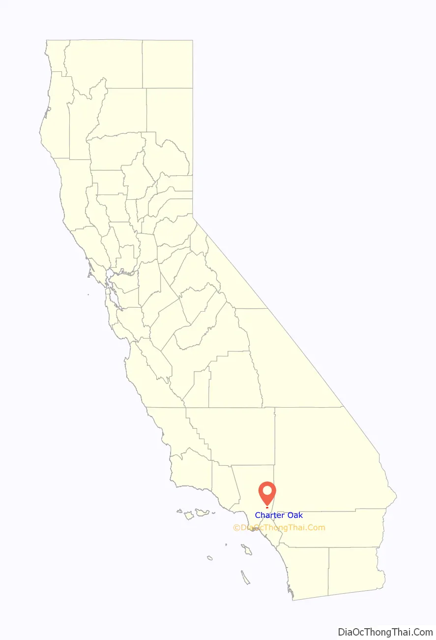
Charter Oak is a census-designated place (CDP) in Los Angeles County, California, approximately 26 miles (42 km) east of downtown Los Angeles. The population was 9,310 at the 2010 census, up from 9,027 at the 2000 census.
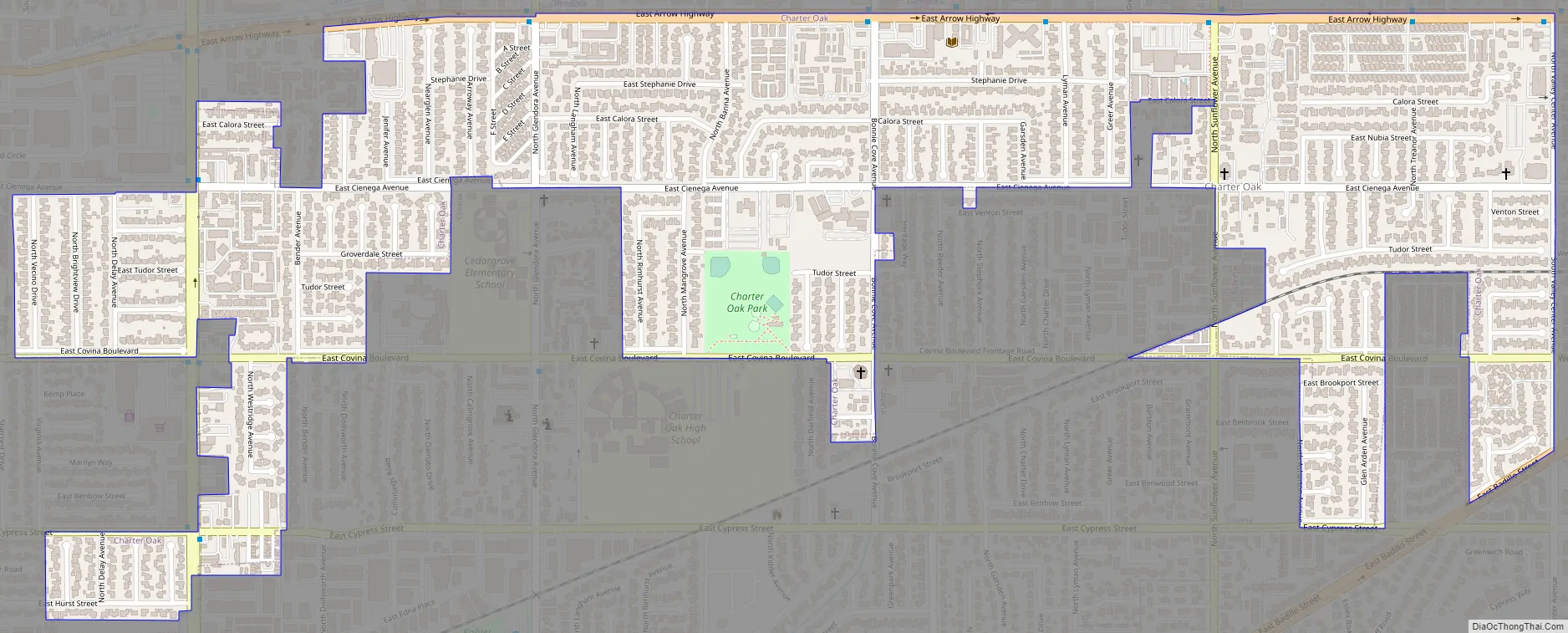
Charter Oak is located in the eastern San Gabriel Valley, situated along Arrow Highway in between Covina to the south, Glendora to the north and San Dimas to the east. Residents tend to refer to the CDP portion as the “unincorporated part of Covina”, or simply as “Covina”.
Originally a small agricultural town (primarily citrus orchards) centered on the intersection of Arrow Highway and Bonnie Cove Avenue, population growth greatly expanded the area recognized as “Charter Oak”. Since the 1960s, it has been known as a “bedroom community” suburb of Los Angeles and commercial agriculture is nearly gone.
Today, the generally accepted boundaries of historical Charter Oak are I-210 to the north, Valley Center Avenue to the east, Covina Hills Road to the south and Grand Avenue to the west, corresponding to the boundaries of Charter Oak Unified School District. However, the actual CDP area is notably smaller in the present day.
| Name: | Charter Oak CDP |
|---|---|
| LSAD Code: | 57 |
| LSAD Description: | CDP (suffix) |
| State: | California |
| County: | Los Angeles County |
| Elevation: | 761 ft (232 m) |
| Total Area: | 0.93 sq mi (2.40 km²) |
| Land Area: | 0.93 sq mi (2.40 km²) |
| Water Area: | 0.00 sq mi (0.00 km²) 0% |
| Total Population: | 9,739 |
| Population Density: | 10,494.61/sq mi (4,052.99/km²) |
| ZIP code: | 91724 |
| Area code: | 626 |
| FIPS code: | 0612734 |
| GNISfeature ID: | 1660472 |
Online Interactive Map
Click on ![]() to view map in "full screen" mode.
to view map in "full screen" mode.
Charter Oak location map. Where is Charter Oak CDP?

Charter Oak Road Map
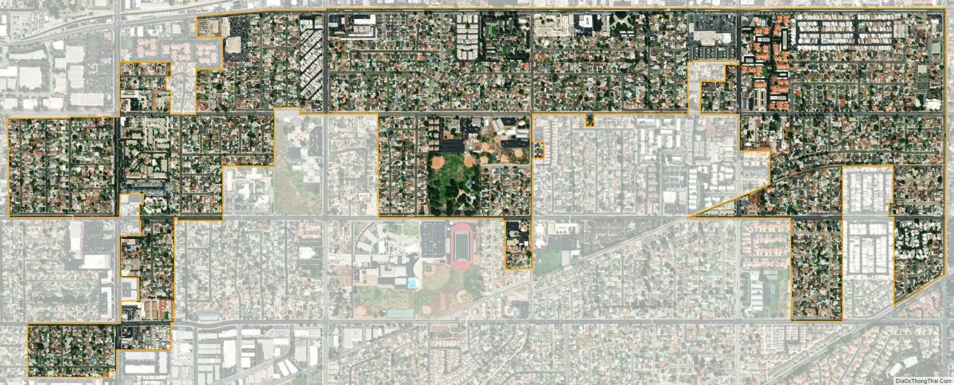
Charter Oak city Satellite Map
Geography
Charter Oak is located at 34°6′5″N 117°51′28″W / 34.10139°N 117.85778°W / 34.10139; -117.85778 (34.101308, -117.857656).
Charter Oak is primarily flat ground, though the South Hills of Glendora form much of the northern border, and there is a small valley in the southeast quadrant, with Walnut Creek flowing in the bottom. The other major water feature in Charter Oak is the San Dimas Wash, a concrete-lined flood control channel which was formerly the San Dimas River, a tributary of the San Gabriel River. Both Walnut Creek and San Dimas wash flow from east-northeast toward west-southwest, the wash in Glendora and the creek in Covina.
The ground is described as “dry riverbed,” with sandy soil which was suitable not only for the citrus orchards which once were the primary industry in the area, but also for several nurseries growing cactus and other small plants.
According to the United States Census Bureau, the CDP has a total area of 2.4 square kilometers (0.9 sq mi), all of it land.
See also
Map of California State and its subdivision:- Alameda
- Alpine
- Amador
- Butte
- Calaveras
- Colusa
- Contra Costa
- Del Norte
- El Dorado
- Fresno
- Glenn
- Humboldt
- Imperial
- Inyo
- Kern
- Kings
- Lake
- Lassen
- Los Angeles
- Madera
- Marin
- Mariposa
- Mendocino
- Merced
- Modoc
- Mono
- Monterey
- Napa
- Nevada
- Orange
- Placer
- Plumas
- Riverside
- Sacramento
- San Benito
- San Bernardino
- San Diego
- San Francisco
- San Joaquin
- San Luis Obispo
- San Mateo
- Santa Barbara
- Santa Clara
- Santa Cruz
- Shasta
- Sierra
- Siskiyou
- Solano
- Sonoma
- Stanislaus
- Sutter
- Tehama
- Trinity
- Tulare
- Tuolumne
- Ventura
- Yolo
- Yuba
- Alabama
- Alaska
- Arizona
- Arkansas
- California
- Colorado
- Connecticut
- Delaware
- District of Columbia
- Florida
- Georgia
- Hawaii
- Idaho
- Illinois
- Indiana
- Iowa
- Kansas
- Kentucky
- Louisiana
- Maine
- Maryland
- Massachusetts
- Michigan
- Minnesota
- Mississippi
- Missouri
- Montana
- Nebraska
- Nevada
- New Hampshire
- New Jersey
- New Mexico
- New York
- North Carolina
- North Dakota
- Ohio
- Oklahoma
- Oregon
- Pennsylvania
- Rhode Island
- South Carolina
- South Dakota
- Tennessee
- Texas
- Utah
- Vermont
- Virginia
- Washington
- West Virginia
- Wisconsin
- Wyoming


