Map of Mount Sterling city, Kentucky

Map of Mount Sterling city, Kentucky

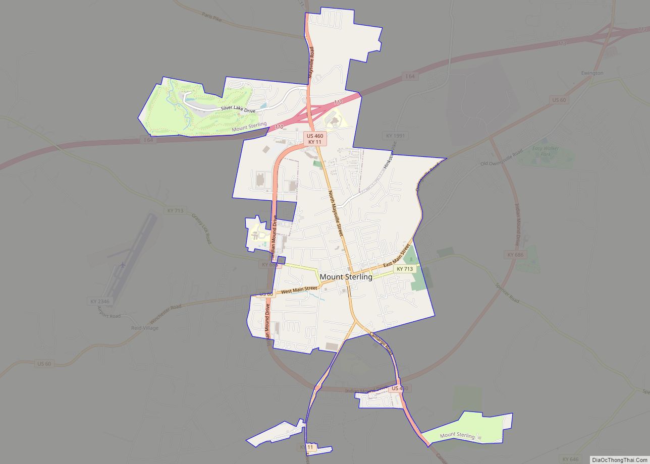
Mount Sterling, often written as Mt. Sterling, is a home rule-class city in Montgomery County, Kentucky, United States. The population was 7,558 as of the 2020 census, up from 6,895 in 2010. It is the county seat of Montgomery County and the principal city of the Mount Sterling micropolitan area. Mount Sterling city overview: Name: … Read more

Map of Murray Hill city

Map of Murray Hill city

Murray Hill is a home rule-class city in Jefferson County, Kentucky, United States, and a part of the Louisville Metro government. The population was 582 during the 2010 census. Murray Hill city overview: Name: Murray Hill city LSAD Code: 25 LSAD Description: city (suffix) State: Kentucky County: Jefferson County Incorporated: 1982 Elevation: 643 ft (196 m) Total … Read more

Map of Munfordville city

Map of Munfordville city

Munfordville is a home rule-class city in, and the county seat of, Hart County, Kentucky, United States. The population was 1,615 at the 2010 U.S. census. Munfordville city overview: Name: Munfordville city LSAD Code: 25 LSAD Description: city (suffix) State: Kentucky County: Hart County Incorporated: 1880 Elevation: 614 ft (187 m) Total Area: 2.25 sq mi (5.82 km²) Land Area: … Read more

Map of Muldraugh city

Map of Muldraugh city

Muldraugh is a home rule-class city in Meade and Hardin counties in the U.S. state of Kentucky. It lies on U.S. Route 31W north of Elizabethtown. The city limits are completely encompassed by the Fort Knox army base. The population was 1,040 as of the 2020 census. The city is part of the Elizabethtown–Fort Knox … Read more

Map of New Castle city, Kentucky

Map of New Castle city, Kentucky

New Castle is a home rule-class city in Henry County, Kentucky, in the United States. It is the seat of its county. As of the 2010 census the population was 912. New Castle city overview: Name: New Castle city LSAD Code: 25 LSAD Description: city (suffix) State: Kentucky County: Henry County Incorporated: 1851 Elevation: 833 ft … Read more

Map of Nebo city, Kentucky

Map of Nebo city, Kentucky

Nebo is a home rule-class city in Hopkins County, Kentucky, in the United States. The population was 236 as of the 2010 census. Nebo city overview: Name: Nebo city LSAD Code: 25 LSAD Description: city (suffix) State: Kentucky County: Hopkins County Incorporated: 1861 Elevation: 404 ft (123 m) Total Area: 0.25 sq mi (0.64 km²) Land Area: 0.25 sq mi (0.64 km²) Water … Read more

Map of Murray city, Kentucky

Map of Murray city, Kentucky

Murray is a home rule-class city in Calloway County, Kentucky, United States. It is the seat of Calloway County and the 19th-largest city in Kentucky. The city’s population was 17,741 during the 2010 U.S. census, and its micropolitan area’s population is 37,191. Murray is a college town and is the home of Murray State University. … Read more

Map of Newport city, Kentucky

Map of Newport city, Kentucky

Newport is a home rule-class city at the confluence of the Ohio and Licking rivers in Campbell County, Kentucky. The population was 15,273 at the 2010 census. Historically, it was one of four county seats of Campbell County. Newport is a major urban center of Northern Kentucky and part of the Cincinnati metropolitan area, which … Read more

Map of New Hope CDP, Kentucky

Map of New Hope CDP, Kentucky

New Hope is an unincorporated community and census-designated place in Nelson County, Kentucky, United States. Its population was 129 as of the 2010 census. New Hope has a post office with ZIP code 40052, which opened on April 5, 1844. New Hope CDP overview: Name: New Hope CDP LSAD Code: 57 LSAD Description: CDP (suffix) … Read more

Map of New Haven city, Kentucky

Map of New Haven city, Kentucky

New Haven is a home rule-class city in Nelson County, Kentucky, United States. The population was 855 at the 2010 census. New Haven city overview: Name: New Haven city LSAD Code: 25 LSAD Description: city (suffix) State: Kentucky County: Nelson County Incorporated: 1839 Elevation: 476 ft (145 m) Total Area: 0.58 sq mi (1.50 km²) Land Area: 0.58 sq mi (1.50 km²) Water … Read more

Map of Nicholasville city

Map of Nicholasville city

Nicholasville is a home rule city in and the county seat of Jessamine County, Kentucky. The population was 31,490 during the 2020 U.S. census, making Nicholasville the 10th-largest settlement in the state. Since the late 20th century, Nicholasville has undergone rapid growth; the population increased 440.23% between 1970 and 2020. The city serves as both … Read more

Map of North Corbin CDP

Map of North Corbin CDP

North Corbin is a census-designated place (CDP) in Laurel and Knox counties in the U.S. state of Kentucky. The population was 1,727 at the 2020 census down from 1,773 at the 2010 census. The census bureau also lists the Laurel County portion of North Corbin as a CCD with a population of 10,729. The city … Read more