North Corbin is a census-designated place (CDP) in Laurel and Knox counties in the U.S. state of Kentucky. The population was 1,727 at the 2020 census down from 1,773 at the 2010 census. The census bureau also lists the Laurel County portion of North Corbin as a CCD with a population of 10,729.
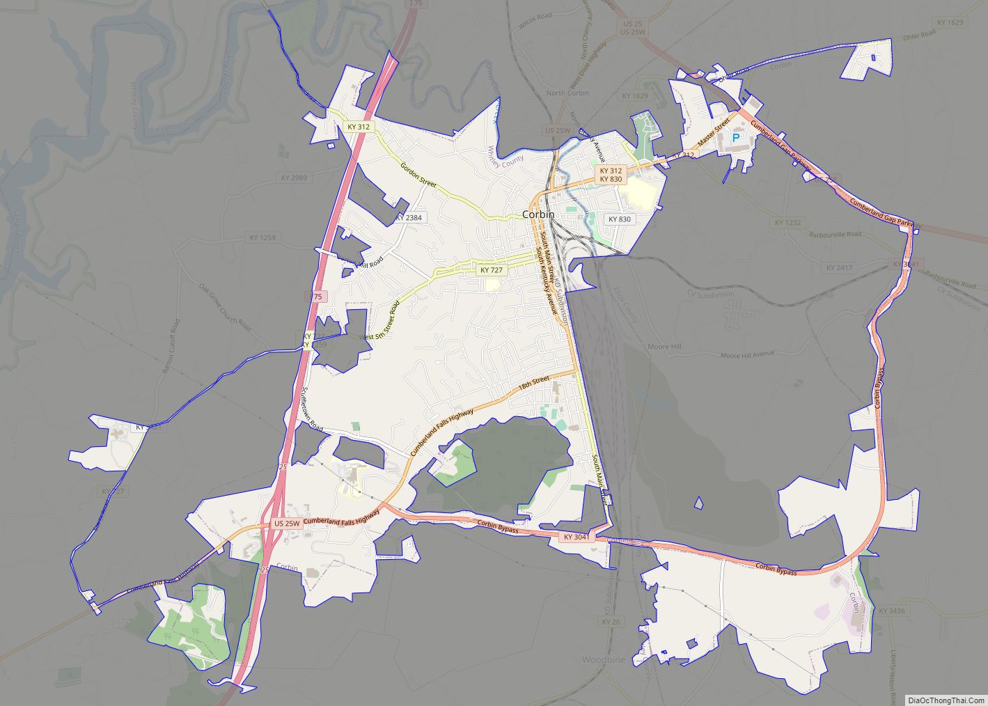
The city of Corbin is located south of North Corbin.
The Harland Sanders Café and Museum, the restaurant where Colonel Sanders developed the fried chicken recipe that would later become famous as Kentucky Fried Chicken, is located in the Laurel County portion of North Corbin.
| Name: | North Corbin CDP |
|---|---|
| LSAD Code: | 57 |
| LSAD Description: | CDP (suffix) |
| State: | Kentucky |
| County: | Knox County, Laurel County |
| Elevation: | 1,109 ft (338 m) |
| Total Area: | 1.80 sq mi (4.66 km²) |
| Land Area: | 1.78 sq mi (4.61 km²) |
| Water Area: | 0.02 sq mi (0.05 km²) |
| Total Population: | 1,727 |
| Population Density: | 970.22/sq mi (374.59/km²) |
| ZIP code: | 40701 (Corbin) |
| Area code: | 606 |
| FIPS code: | 2156694 |
| GNISfeature ID: | 0514286 |
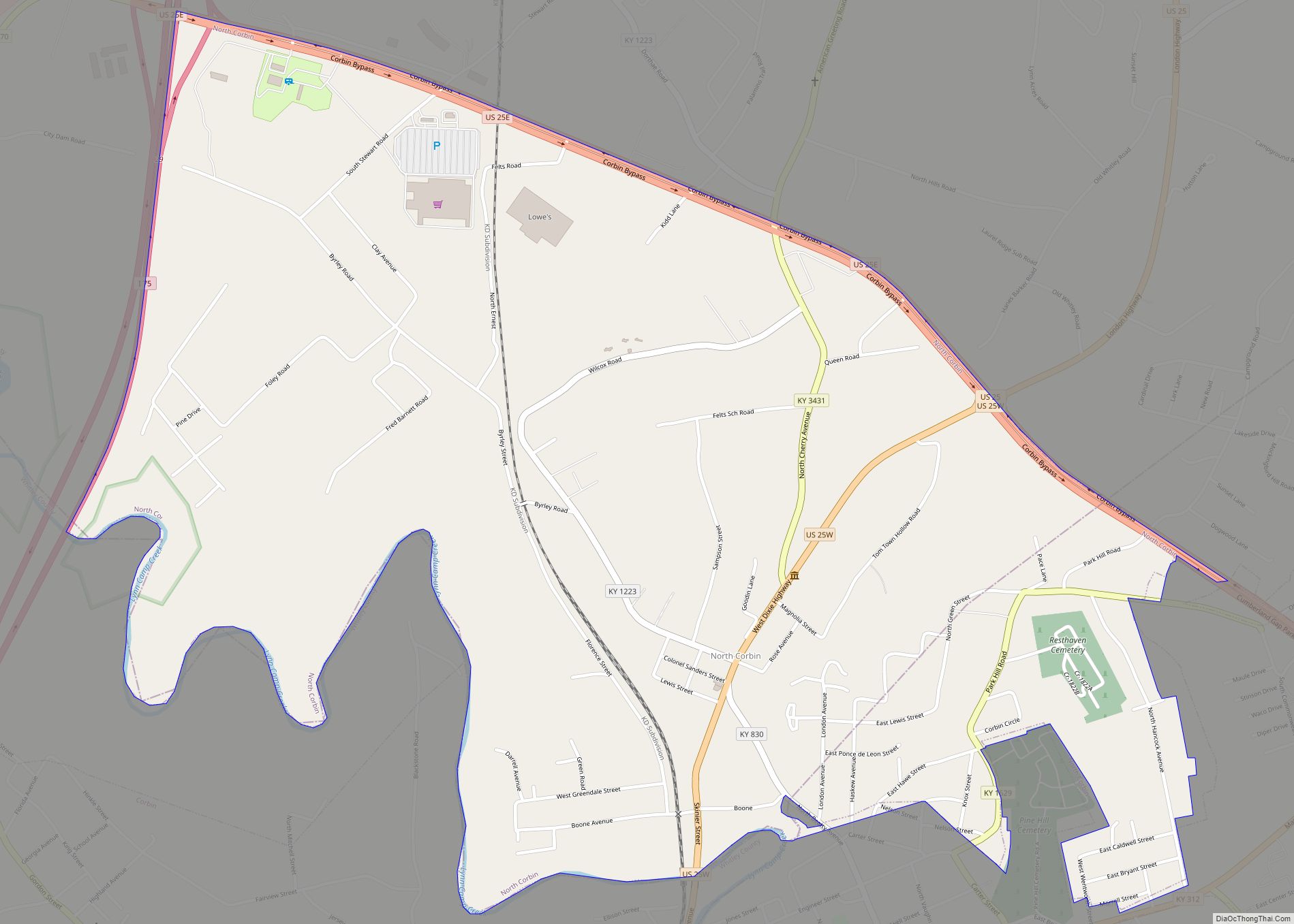
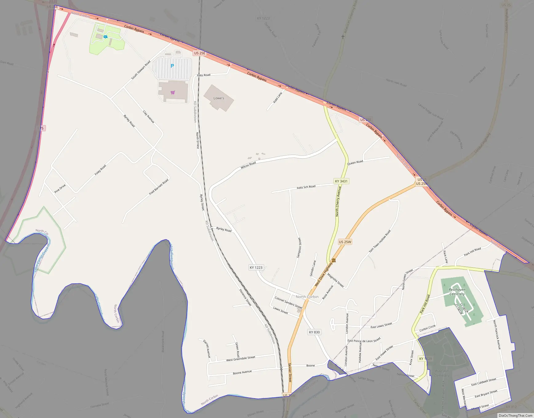
Online Interactive Map
Click on ![]() to view map in "full screen" mode.
to view map in "full screen" mode.
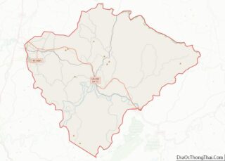
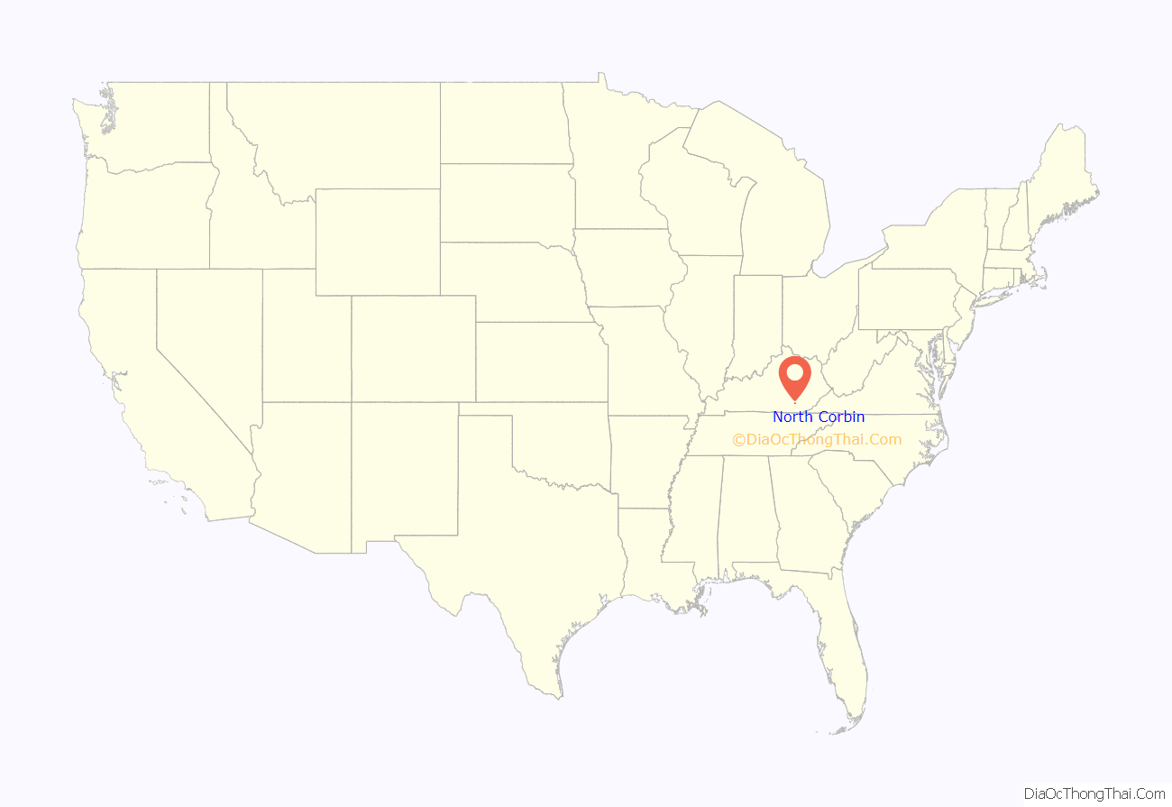
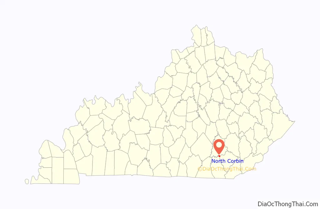
North Corbin location map. Where is North Corbin CDP?
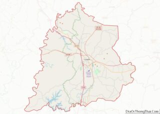
North Corbin Road Map
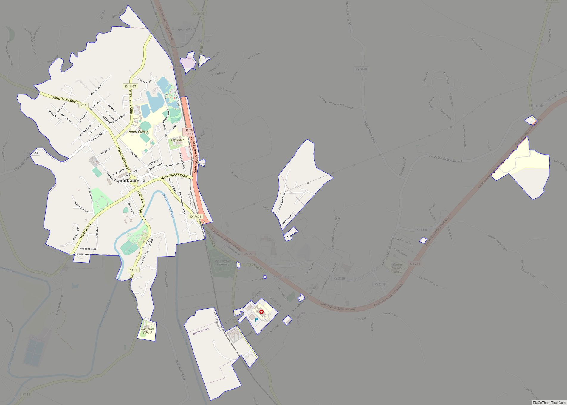
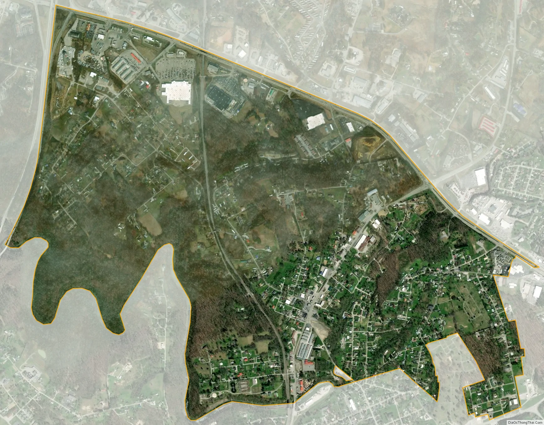
North Corbin city Satellite Map
Geography
North Corbin is located in southern Laurel County at 36°57′38″N 84°5′38″W / 36.96056°N 84.09389°W / 36.96056; -84.09389 (36.960433, -84.093867). A small portion extends east into Knox County. It is bordered to the south by the city of Corbin in Whitley County.
Interstate 75 forms the western edge of the North Corbin CDP, with access from Exit 29, U.S. Route 25E, which forms the northern edge of the CDP. US 25E intersects U.S. Route 25W in North Corbin, forming U.S. Route 25, which leaves town to the north and leads 12 miles (19 km) to London, the Laurel county seat. US 25E leads southeast from North Corbin 16 miles (26 km) to Barbourville, the Knox county seat. US 25W leads south into Corbin and 22 miles (35 km) to Williamsburg, compared to 17 miles (27 km) taking I-75 south. Larger destinations along I-75 include Lexington 85 miles (137 km) to the north and Knoxville, Tennessee, the same distance to the south.
According to the United States Census Bureau, the North Corbin CDP has a total area of 1.80 square miles (4.66 km), of which 0.02 square miles (0.05 km), or 1.05%, are water. Lynn Camp Creek forms the southern boundary of the community as well as the Whitley County line. The creek is a west-flowing tributary of the Laurel River and part of the Cumberland River watershed.
See also
Map of Kentucky State and its subdivision:- Adair
- Allen
- Anderson
- Ballard
- Barren
- Bath
- Bell
- Boone
- Bourbon
- Boyd
- Boyle
- Bracken
- Breathitt
- Breckinridge
- Bullitt
- Butler
- Caldwell
- Calloway
- Campbell
- Carlisle
- Carroll
- Carter
- Casey
- Christian
- Clark
- Clay
- Clinton
- Crittenden
- Cumberland
- Daviess
- Edmonson
- Elliott
- Estill
- Fayette
- Fleming
- Floyd
- Franklin
- Fulton
- Gallatin
- Garrard
- Grant
- Graves
- Grayson
- Green
- Greenup
- Hancock
- Hardin
- Harlan
- Harrison
- Hart
- Henderson
- Henry
- Hickman
- Hopkins
- Jackson
- Jefferson
- Jessamine
- Johnson
- Kenton
- Knott
- Knox
- Larue
- Laurel
- Lawrence
- Lee
- Leslie
- Letcher
- Lewis
- Lincoln
- Livingston
- Logan
- Lyon
- Madison
- Magoffin
- Marion
- Marshall
- Martin
- Mason
- McCracken
- McCreary
- McLean
- Meade
- Menifee
- Mercer
- Metcalfe
- Monroe
- Montgomery
- Morgan
- Muhlenberg
- Nelson
- Nicholas
- Ohio
- Oldham
- Owen
- Owsley
- Pendleton
- Perry
- Pike
- Powell
- Pulaski
- Robertson
- Rockcastle
- Rowan
- Russell
- Scott
- Shelby
- Simpson
- Spencer
- Taylor
- Todd
- Trigg
- Trimble
- Union
- Warren
- Washington
- Wayne
- Webster
- Whitley
- Wolfe
- Woodford
- Alabama
- Alaska
- Arizona
- Arkansas
- California
- Colorado
- Connecticut
- Delaware
- District of Columbia
- Florida
- Georgia
- Hawaii
- Idaho
- Illinois
- Indiana
- Iowa
- Kansas
- Kentucky
- Louisiana
- Maine
- Maryland
- Massachusetts
- Michigan
- Minnesota
- Mississippi
- Missouri
- Montana
- Nebraska
- Nevada
- New Hampshire
- New Jersey
- New Mexico
- New York
- North Carolina
- North Dakota
- Ohio
- Oklahoma
- Oregon
- Pennsylvania
- Rhode Island
- South Carolina
- South Dakota
- Tennessee
- Texas
- Utah
- Vermont
- Virginia
- Washington
- West Virginia
- Wisconsin
- Wyoming