Map of Hancock city, Michigan

Map of Hancock city, Michigan

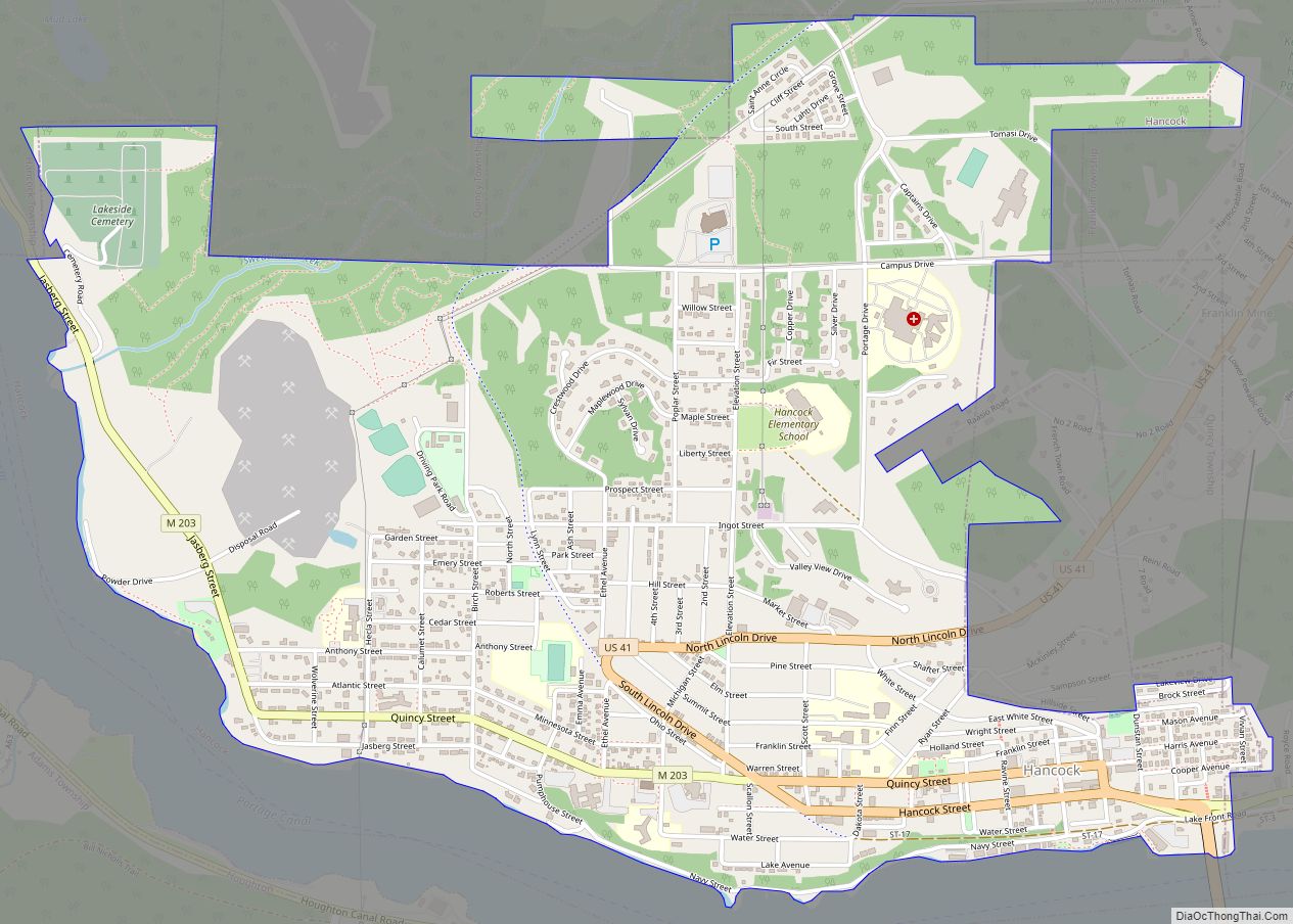
Hancock is a city in Houghton County in the U.S. state of Michigan. It is across the Keweenaw Waterway from the city of Houghton on the Keweenaw Peninsula. The population was 4,634 at the 2010 census. The Weather Channel has consistently ranked Hancock as the third-snowiest city in the U.S. Hancock was named after U.S. … Read more

Map of Hamtramck city

Map of Hamtramck city

Hamtramck (/hæmˈtræmɪk/ ham-TRAM-ik) is a city in Wayne County in the U.S. state of Michigan. As of the 2020 census, the city population was 28,433. Hamtramck is surrounded by the city of Detroit except for a small portion that borders the fellow enclave city of Highland Park. Hamtramck is by far the most densely populated … Read more

Map of Harrison city, Michigan

Map of Harrison city, Michigan

Harrison is a city in and county seat of Clare County in the U.S. state of Michigan. The population was 2,150 at the 2020 census. The community was settled as early as 1877 and was named after William Henry Harrison. Harrison is near the junction of US 127 and M-61. US 127 bypasses the city … Read more

Map of Harrietta village

Map of Harrietta village

Harrietta is a village in Wexford County of the U.S. state of Michigan. The population was 151 at the 2020 census, which ranked it as the fourth least-populated village in the state. The village is split almost evenly between Slagle Township on the west and Boon Township on the east. Harrietta village overview: Name: Harrietta … Read more

Map of Harper Woods city

Map of Harper Woods city

Harper Woods is a city in Wayne County in the U.S. state of Michigan. The city had a population of 15,492 at the 2020 census. Harper Woods is a northeastern suburb of Metro Detroit and shares its southern and western border with the city of Detroit. It was incorporated as a city from the last … Read more

Map of Haring CDP

Map of Haring CDP

Haring is an unincorporated community and census-designated place (CDP) in Wexford County in the U.S. state of Michigan. The population of the CDP was 335 as of the 2020 census. Haring is located within Haring Charter Township just north of the city of Cadillac. Haring CDP overview: Name: Haring CDP LSAD Code: 57 LSAD Description: … Read more

Map of Hardwood Acres CDP

Map of Hardwood Acres CDP

Hardwood Acres is an unincorporated community and census-designated place in Benzie County in the U.S. state of Michigan. The population was 432 at the 2010 census. Hardwood Acres is located within Almira Township. Hardwood Acres CDP overview: Name: Hardwood Acres CDP LSAD Code: 57 LSAD Description: CDP (suffix) State: Michigan County: Benzie County Elevation: 902 ft … Read more

Map of Harrisville city

Map of Harrisville city, Michigan

Harrisville is a city in the U.S. state of Michigan and the county seat of Alcona County. The population was 493 at the 2010 census, making Harrisville the sixth-smallest city by population in the state of Michigan. The city is surrounded by Harrisville Township but is administratively autonomous. Located on Lake Huron, it is an … Read more

Map of Haslett CDP

Map of Haslett CDP

Haslett is a census-designated place (CDP) in Ingham County in the U.S. state of Michigan. It is located mostly within Meridian Charter Township with a small portion extending east into Williamstown Township. The population was 19,220 at the 2010 census. Haslett contains its own school district, as well as its own post office with the … Read more

Map of Harvey CDP, Michigan

Map of Harvey CDP, Michigan

Harvey is a census-designated place (CDP) in Marquette County in the U.S. state of Michigan. The population was 1,393 at the 2010 census. The CDP is located within Chocolay Township. Originally called Harvey Location, the community is a southwest suburb of Marquette at the junction of U.S. Route 41 and M-28. Harvey CDP overview: Name: … Read more

Map of Hartford city, Michigan

Map of Hartford city, Michigan

Hartford is a city in Van Buren County in the U.S. state of Michigan. The population was 2,688 at the 2010 census. The city is located within Hartford Township, but is politically independent. Hartford city overview: Name: Hartford city LSAD Code: 25 LSAD Description: city (suffix) State: Michigan County: Van Buren County Elevation: 659 ft (201 m) … Read more

Map of Hart city

Map of Hart city, Michigan

Hart is a city and county seat of Oceana County, Michigan. The population was 2,126 at the time of the 2010 census. The city is located within Hart Township, but is politically independent. Hart is also home to the north end of the Hart-Montague Trail. Hart city overview: Name: Hart city LSAD Code: 25 LSAD … Read more