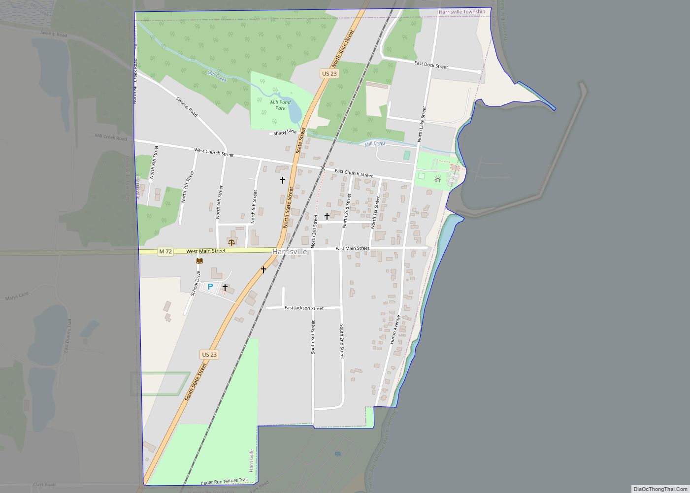
Harrisville is a city in the U.S. state of Michigan and the county seat of Alcona County. The population was 493 at the 2010 census, making Harrisville the sixth-smallest city by population in the state of Michigan. The city is surrounded by Harrisville Township but is administratively autonomous. Located on Lake Huron, it is an official Michigan Department of Natural Resources Harbor of Refuge.
| Name: | Harrisville city |
|---|---|
| LSAD Code: | 25 |
| LSAD Description: | city (suffix) |
| State: | Michigan |
| County: | Alcona County |
| Incorporated: | 1887 (village) 1905 (city) |
| Elevation: | 623 ft (190 m) |
| Total Area: | 0.63 sq mi (1.64 km²) |
| Land Area: | 0.63 sq mi (1.64 km²) |
| Water Area: | 0.00 sq mi (0.00 km²) |
| Total Population: | 437 |
| Population Density: | 691.46/sq mi (266.92/km²) |
| Area code: | 989 |
| FIPS code: | 2636860 |
| GNISfeature ID: | 0627866 |
Online Interactive Map
Click on ![]() to view map in "full screen" mode.
to view map in "full screen" mode.
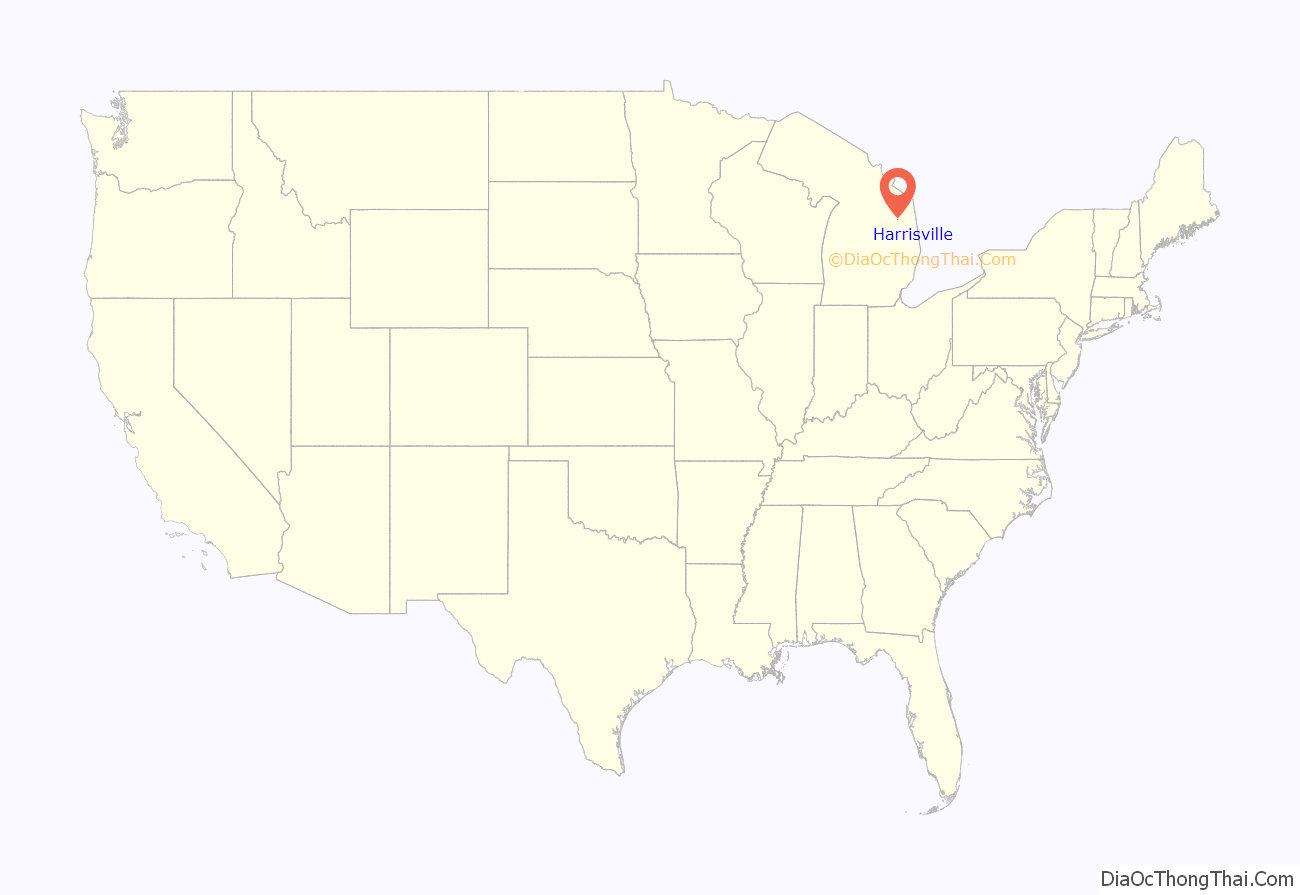
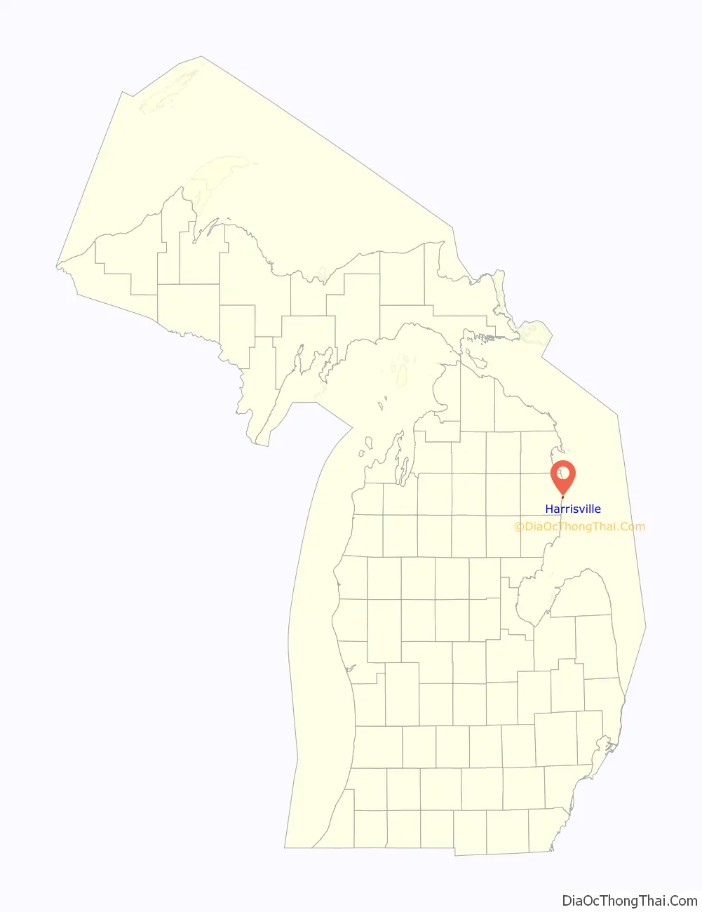
Harrisville location map. Where is Harrisville city?
History
The place was first known as Davison’s Mill after Crosier Davison, who in partnership with Simeon Holden, had purchased land and water power rights here in 1854. Benjamin Harris and his sons, Levi and Henry, of West Bloomfield, New York bought out the partners. A post office established on September 16, 1857 was named Harrisville, with Levi as the first postmaster.
The Harris sold out to Weston, (George L.) Colwell & Company, who had H.G. Rothwell plat the community in 1870. Harrisville was incorporated as a village in 1887 and as a city in 1905.
Pizer’s Variety Store, originally The White Store, was at the corner of Lake Street and Main Street.
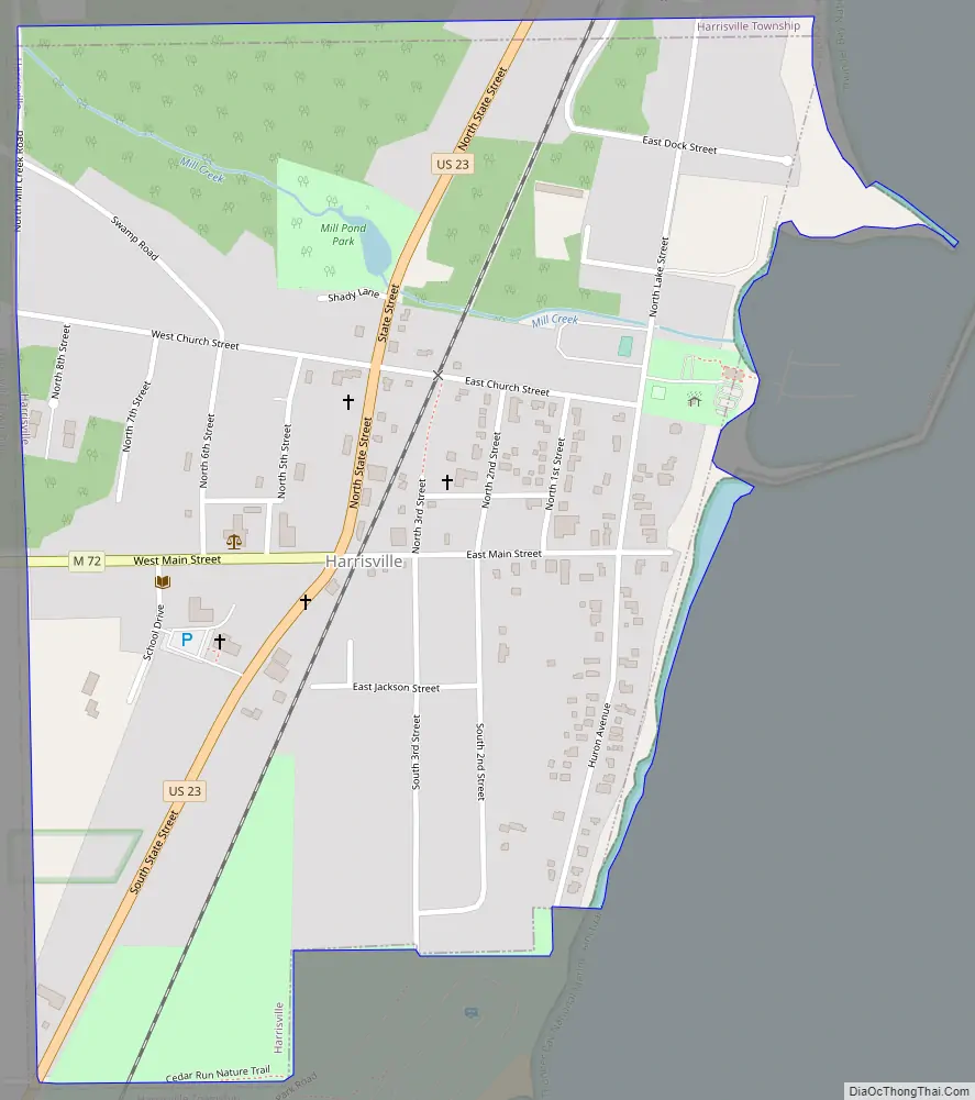
Harrisville Road Map
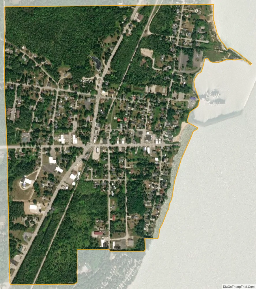
Harrisville city Satellite Map
Geography
According to the United States Census Bureau, the city has a total area of 0.61 square miles (1.58 km), all land. It is considered to be part of Northern Michigan.
The city is on the western shore of Lake Huron and has a harbor for recreational boaters. The harbor is a center for salmon and trout fishing. It is also a designated “Harbor of Refuge” on Lake Huron by the United States Coast Guard. The town also boasts Harrisville State Park, which includes a wooded campground along the beach. Sturgeon Point Light, a lighthouse and museum, is a few miles to the north, and is open to the public.
Harrisville is on the edge of Huron National Forest, which offers outdoor recreational opportunities such as hunting, swimming, cross-country skiing and trout fishing. The forest contains 330 miles (530 km) of hiking trails. The Huron and Manistee National Forests were separately designated but were combined in 1945 for administrative purposes.
The Lake Huron beaches in and around Harrisville (including two state parks) have been recognized as being among the “top ten in Michigan.” “Old-fashioned lake vacations abound on this pretty stretch of Lake Huron.”
Harrisville is situated along the Lake State Railway, formerly the Detroit and Mackinac Railway (D&M). The D&M passenger depot is made of stone, which makes it one of two along the railway (the other being in Standish). It is privately maintained by local citizens as part of the municipality’s historical legacy.
See also
Map of Michigan State and its subdivision:- Alcona
- Alger
- Allegan
- Alpena
- Antrim
- Arenac
- Baraga
- Barry
- Bay
- Benzie
- Berrien
- Branch
- Calhoun
- Cass
- Charlevoix
- Cheboygan
- Chippewa
- Clare
- Clinton
- Crawford
- Delta
- Dickinson
- Eaton
- Emmet
- Genesee
- Gladwin
- Gogebic
- Grand Traverse
- Gratiot
- Hillsdale
- Houghton
- Huron
- Ingham
- Ionia
- Iosco
- Iron
- Isabella
- Jackson
- Kalamazoo
- Kalkaska
- Kent
- Keweenaw
- Lake
- Lake Hurron
- Lake Michigan
- Lake St. Clair
- Lake Superior
- Lapeer
- Leelanau
- Lenawee
- Livingston
- Luce
- Mackinac
- Macomb
- Manistee
- Marquette
- Mason
- Mecosta
- Menominee
- Midland
- Missaukee
- Monroe
- Montcalm
- Montmorency
- Muskegon
- Newaygo
- Oakland
- Oceana
- Ogemaw
- Ontonagon
- Osceola
- Oscoda
- Otsego
- Ottawa
- Presque Isle
- Roscommon
- Saginaw
- Saint Clair
- Saint Joseph
- Sanilac
- Schoolcraft
- Shiawassee
- Tuscola
- Van Buren
- Washtenaw
- Wayne
- Wexford
- Alabama
- Alaska
- Arizona
- Arkansas
- California
- Colorado
- Connecticut
- Delaware
- District of Columbia
- Florida
- Georgia
- Hawaii
- Idaho
- Illinois
- Indiana
- Iowa
- Kansas
- Kentucky
- Louisiana
- Maine
- Maryland
- Massachusetts
- Michigan
- Minnesota
- Mississippi
- Missouri
- Montana
- Nebraska
- Nevada
- New Hampshire
- New Jersey
- New Mexico
- New York
- North Carolina
- North Dakota
- Ohio
- Oklahoma
- Oregon
- Pennsylvania
- Rhode Island
- South Carolina
- South Dakota
- Tennessee
- Texas
- Utah
- Vermont
- Virginia
- Washington
- West Virginia
- Wisconsin
- Wyoming