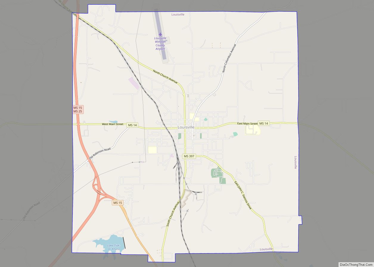
Map of Long Beach city, Mississippi

Map of Long Beach city, Mississippi

Long Beach is a city located in Harrison County, Mississippi, United States. It is part of the Gulfport-Biloxi metropolitan area. As of the 2020 census, the city had a population of 15,829. Long Beach city overview: Name: Long Beach city LSAD Code: 25 LSAD Description: city (suffix) State: Mississippi County: Harrison County Elevation: 26 ft (8 m) … Read more

Map of Lyon town

Map of Lyon town

Lyon is a town in Coahoma County, Mississippi, United States. Per the 2020 census, the population was 296. Lyon town overview: Name: Lyon town LSAD Code: 43 LSAD Description: town (suffix) State: Mississippi County: Coahoma County Elevation: 174 ft (53 m) Total Area: 0.48 sq mi (1.25 km²) Land Area: 0.48 sq mi (1.25 km²) Water Area: 0.00 sq mi (0.00 km²) Total Population: 296 Population … Read more

Map of Lynchburg CDP

Map of Lynchburg CDP, Mississippi

Lynchburg is an unincorporated area and census-designated place (CDP) in DeSoto County, Mississippi, United States. The population was 2,437 at the 2010 census. Lynchburg CDP overview: Name: Lynchburg CDP LSAD Code: 57 LSAD Description: CDP (suffix) State: Mississippi County: DeSoto County Elevation: 302 ft (92 m) Total Area: 1.97 sq mi (5.10 km²) Land Area: 1.93 sq mi (5.01 km²) Water Area: 0.04 sq mi … Read more

Map of Lyman CDP

Map of Lyman CDP, Mississippi

Lyman is a census-designated place (CDP) in Harrison County, Mississippi, United States. It is part of the Gulfport–Biloxi Metropolitan Statistical Area. The population was 1,277 at the 2010 census. Lyman CDP overview: Name: Lyman CDP LSAD Code: 57 LSAD Description: CDP (suffix) State: Mississippi County: Harrison County Elevation: 89 ft (27 m) Total Area: 8.07 sq mi (20.91 km²) Land … Read more

Map of Lumberton city

Map of Lumberton city, Mississippi

Lumberton is a city in Lamar and Pearl River counties, Mississippi, United States. It is part of the Hattiesburg, Mississippi Metropolitan Statistical Area. The population was 2,086 at the 2010 census. Lumberton city overview: Name: Lumberton city LSAD Code: 25 LSAD Description: city (suffix) State: Mississippi County: Lamar County, Pearl River County Elevation: 295 ft (90 m) … Read more

Map of Lula town, Mississippi

Map of Lula town, Mississippi

Lula is a town in Coahoma County, Mississippi, United States. Per the 2020 census, the population was 204. Lula town overview: Name: Lula town LSAD Code: 43 LSAD Description: town (suffix) State: Mississippi County: Coahoma County Elevation: 180 ft (55 m) Total Area: 0.42 sq mi (1.08 km²) Land Area: 0.42 sq mi (1.08 km²) Water Area: 0.00 sq mi (0.00 km²) Total Population: 204 Population … Read more

Map of Magnolia city, Mississippi

Map of Magnolia city, Mississippi

Magnolia is a city in Pike County, Mississippi, United States. The population was 2,420 at the 2010 census. It is the county seat of Pike County, which lies within the McComb, Mississippi Micropolitan Statistical Area. Magnolia city overview: Name: Magnolia city LSAD Code: 25 LSAD Description: city (suffix) State: Mississippi County: Pike County Elevation: 305 ft … Read more

Map of Magee city

Map of Magee city

Magee is a city in Simpson County, Mississippi, United States. It is part of the Jackson metropolitan area. Magee city overview: Name: Magee city LSAD Code: 25 LSAD Description: city (suffix) State: Mississippi County: Simpson County Elevation: 433 ft (132 m) Total Area: 5.26 sq mi (13.62 km²) Land Area: 5.26 sq mi (13.62 km²) Water Area: 0.00 sq mi (0.00 km²) Total Population: 3,988 Population … Read more

Map of Madison city, Mississippi

Map of Madison city, Mississippi

Madison is a city in Madison County, Mississippi, United States. The population was 27,747 at the 2020 census. It is part of the Jackson Metropolitan Statistical Area. Madison city overview: Name: Madison city LSAD Code: 25 LSAD Description: city (suffix) State: Mississippi County: Madison County Elevation: 338 ft (103 m) Total Area: 26.44 sq mi (68.48 km²) Land Area: 25.26 sq mi … Read more

Map of Macon city, Mississippi

Map of Macon city, Mississippi

Macon is a city in Noxubee County, Mississippi along the Noxubee River. The population was 2,768 at the 2010 census. It is the county seat of Noxubee County. Macon city overview: Name: Macon city LSAD Code: 25 LSAD Description: city (suffix) State: Mississippi County: Noxubee County Elevation: 197 ft (60 m) Total Area: 3.85 sq mi (9.98 km²) Land Area: … Read more

Map of Maben town

Map of Maben town

Maben is a town in Oktibbeha and Webster counties, Mississippi. The population was 871 at the 2010 census. Pioneer aviator Charles Lindbergh spent two weeks in Maben making repairs to his Jenny airplane and taking locals up for rides at five dollars each during May 1923. Reference: “We” by Charles Lindbergh, G.P. Putnam’s and Sons, … Read more

Map of Mantachie town

Map of Mantachie town

Mantachie is a town in Itawamba County, Mississippi, United States. The population was 1,121 in the 2020 census. It is located 14 miles (23 km) northeast of Tupelo at the intersection of Mississippi Highways 363 and 371 and 5 miles (8 km) north of Interstate 22. The town began as a crossroads store owned and operated by … Read more