Madison is a city in Madison County, Mississippi, United States. The population was 27,747 at the 2020 census. It is part of the Jackson Metropolitan Statistical Area.
| Name: | Madison city |
|---|---|
| LSAD Code: | 25 |
| LSAD Description: | city (suffix) |
| State: | Mississippi |
| County: | Madison County |
| Elevation: | 338 ft (103 m) |
| Total Area: | 26.44 sq mi (68.48 km²) |
| Land Area: | 25.26 sq mi (65.42 km²) |
| Water Area: | 1.18 sq mi (3.06 km²) |
| Total Population: | 27,747 |
| Population Density: | 1,098.59/sq mi (424.17/km²) |
| ZIP code: | 39110, 39130 |
| Area code: | 601 |
| FIPS code: | 2844520 |
| GNISfeature ID: | 0673053 |
| Website: | madisonthecity.com |
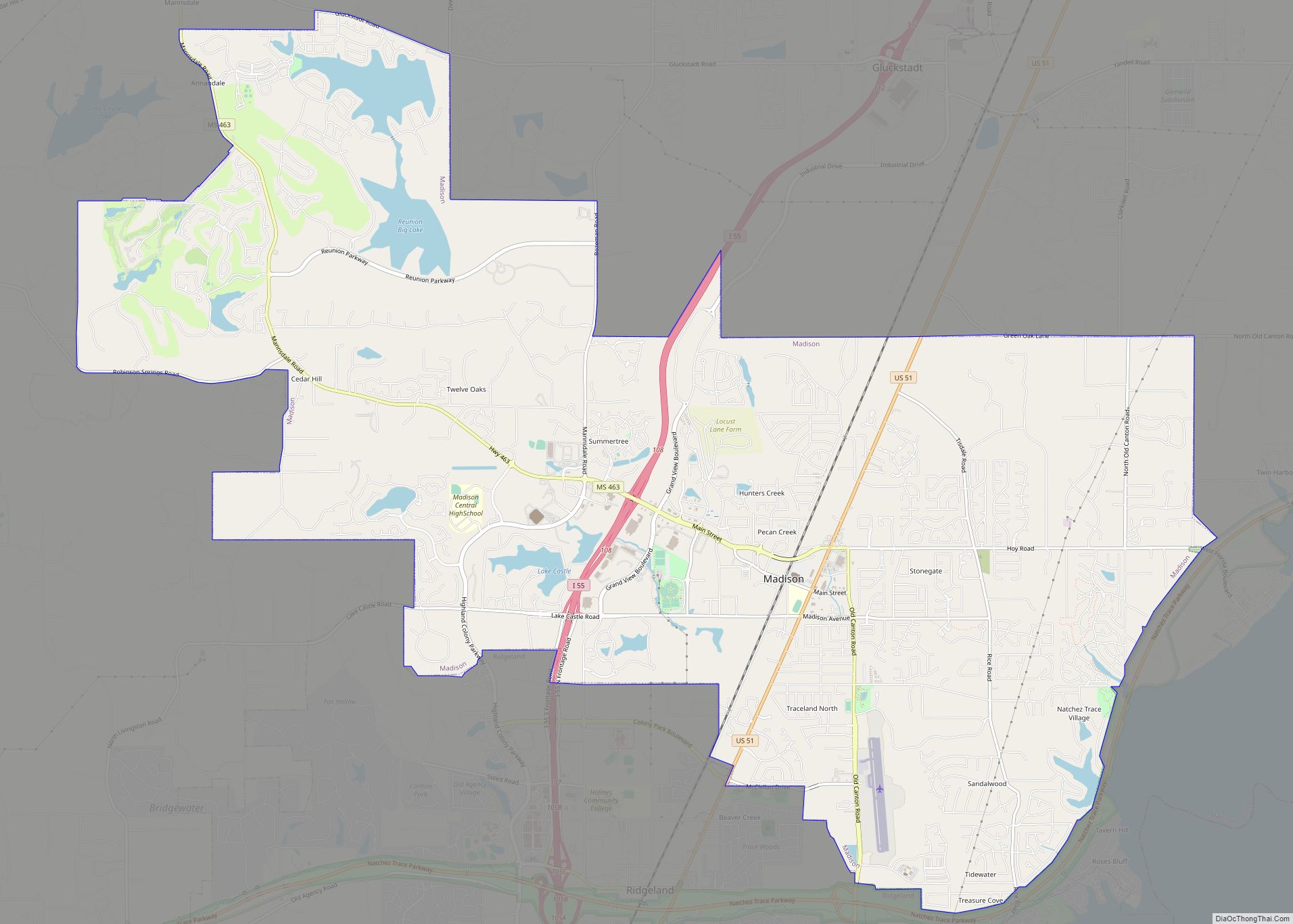
Online Interactive Map
Click on ![]() to view map in "full screen" mode.
to view map in "full screen" mode.
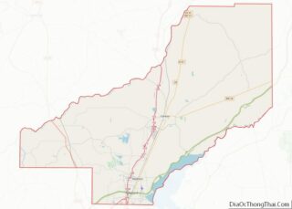
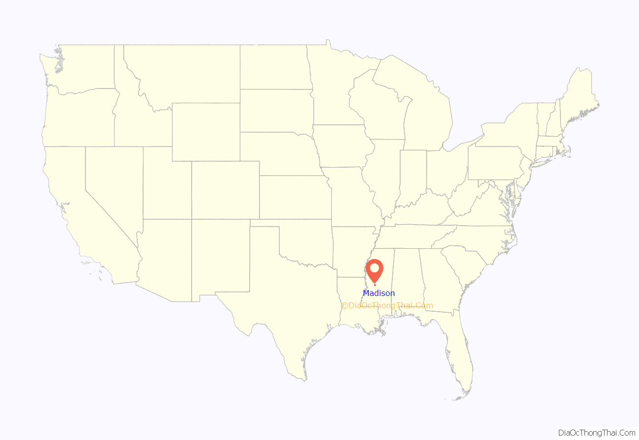
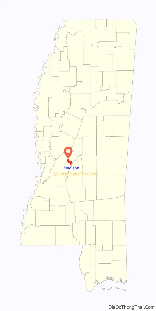
Madison location map. Where is Madison city?
History
The city of Madison, named for James Madison, the fourth President of the United States, developed along a bustling railroad track in antebellum Mississippi. It began in 1856 when the Illinois Central Railroad opened Madison Station, the forerunner of the city of Madison.
The nearby town of Madisonville was a settlement along the stagecoach route on the Natchez Trace. It was the first county seat of Madison County in 1828, and had a race track, two banks, a wagon factory, and at least one hotel. Its residents gradually moved to the new railroad community, and old Madisonville became defunct.
Like many railroad towns in the South, Madison Station was heavily damaged by the Union Army during the Civil War. Ten miles from the state capital of Jackson, Madison Station was largely destroyed in 1863 after the July 18–22 siege of Jackson. No battles were fought in Madison County, but Major General Stephen D. Lee concentrated his command in Madison Station during the month of February 1864. Stephen Lee was later appointed as the first president of Mississippi State College (now Mississippi State University).
The railroad continued to attract growth after the Civil War. In 1897, the Madison Land Company encouraged northerners to “Go South, and grow up with the country.” Located in Chicago, the land company’s interest in development prompted Madison to incorporate as a village, though the charter was lost when regular elections were not held because of the failure of the “land boom”.
The Madison Land Company offered prime land for as little as $3.00 an acre. It claimed that Mississippi had the lowest debt ratio in the United States at $19.00 per capita and that Mississippians were one-third healthier by “official figures” than people in New York and Massachusetts. The figures were quoted in the Madison Land Company’s brochure by Bishop Hugh Miller Thompson, the second Episcopal Bishop of the Diocese of Mississippi and a Madison resident, who originally came from Wisconsin.
After many years of court battles, the city annexed other territory to expand its limits in size in the late 2000s.
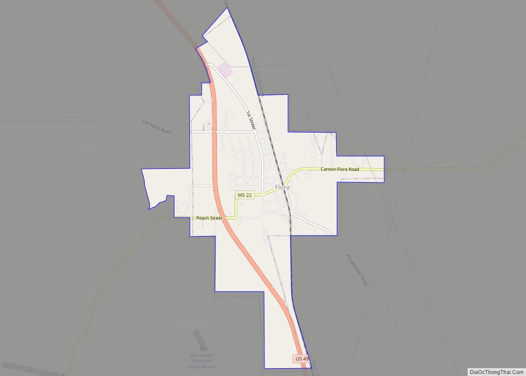
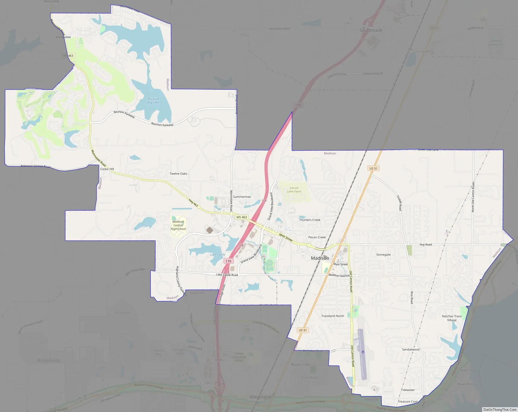
Madison Road Map
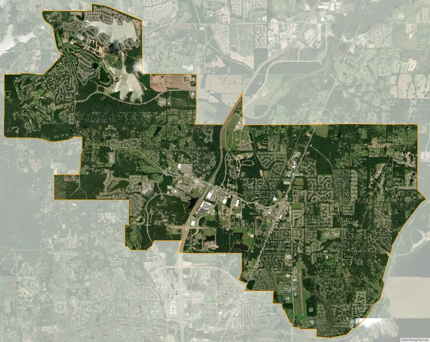
Madison city Satellite Map
Geography
According to the United States Census Bureau, the city has a total area of 13.7 square miles (35 km), of which 13.5 square miles (35 km) is land and 0.2 square miles (0.52 km) (1.61%) is water.
See also
Map of Mississippi State and its subdivision:- Adams
- Alcorn
- Amite
- Attala
- Benton
- Bolivar
- Calhoun
- Carroll
- Chickasaw
- Choctaw
- Claiborne
- Clarke
- Clay
- Coahoma
- Copiah
- Covington
- Desoto
- Forrest
- Franklin
- George
- Greene
- Grenada
- Hancock
- Harrison
- Hinds
- Holmes
- Humphreys
- Issaquena
- Itawamba
- Jackson
- Jasper
- Jefferson
- Jefferson Davis
- Jones
- Kemper
- Lafayette
- Lamar
- Lauderdale
- Lawrence
- Leake
- Lee
- Leflore
- Lincoln
- Lowndes
- Madison
- Marion
- Marshall
- Monroe
- Montgomery
- Neshoba
- Newton
- Noxubee
- Oktibbeha
- Panola
- Pearl River
- Perry
- Pike
- Pontotoc
- Prentiss
- Quitman
- Rankin
- Scott
- Sharkey
- Simpson
- Smith
- Stone
- Sunflower
- Tallahatchie
- Tate
- Tippah
- Tishomingo
- Tunica
- Union
- Walthall
- Warren
- Washington
- Wayne
- Webster
- Wilkinson
- Winston
- Yalobusha
- Yazoo
- Alabama
- Alaska
- Arizona
- Arkansas
- California
- Colorado
- Connecticut
- Delaware
- District of Columbia
- Florida
- Georgia
- Hawaii
- Idaho
- Illinois
- Indiana
- Iowa
- Kansas
- Kentucky
- Louisiana
- Maine
- Maryland
- Massachusetts
- Michigan
- Minnesota
- Mississippi
- Missouri
- Montana
- Nebraska
- Nevada
- New Hampshire
- New Jersey
- New Mexico
- New York
- North Carolina
- North Dakota
- Ohio
- Oklahoma
- Oregon
- Pennsylvania
- Rhode Island
- South Carolina
- South Dakota
- Tennessee
- Texas
- Utah
- Vermont
- Virginia
- Washington
- West Virginia
- Wisconsin
- Wyoming