Magee is a city in Simpson County, Mississippi, United States. It is part of the Jackson metropolitan area.
| Name: | Magee city |
|---|---|
| LSAD Code: | 25 |
| LSAD Description: | city (suffix) |
| State: | Mississippi |
| County: | Simpson County |
| Elevation: | 433 ft (132 m) |
| Total Area: | 5.26 sq mi (13.62 km²) |
| Land Area: | 5.26 sq mi (13.62 km²) |
| Water Area: | 0.00 sq mi (0.00 km²) |
| Total Population: | 3,988 |
| Population Density: | 758.32/sq mi (292.80/km²) |
| ZIP code: | 39111 |
| Area code: | 601 |
| FIPS code: | 2844600 |
| GNISfeature ID: | 0673055 |
| Website: | www.cityofmagee.com |
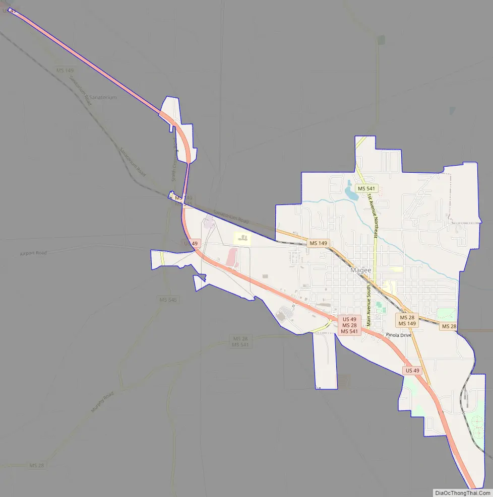
Online Interactive Map
Click on ![]() to view map in "full screen" mode.
to view map in "full screen" mode.
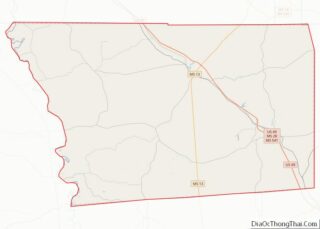
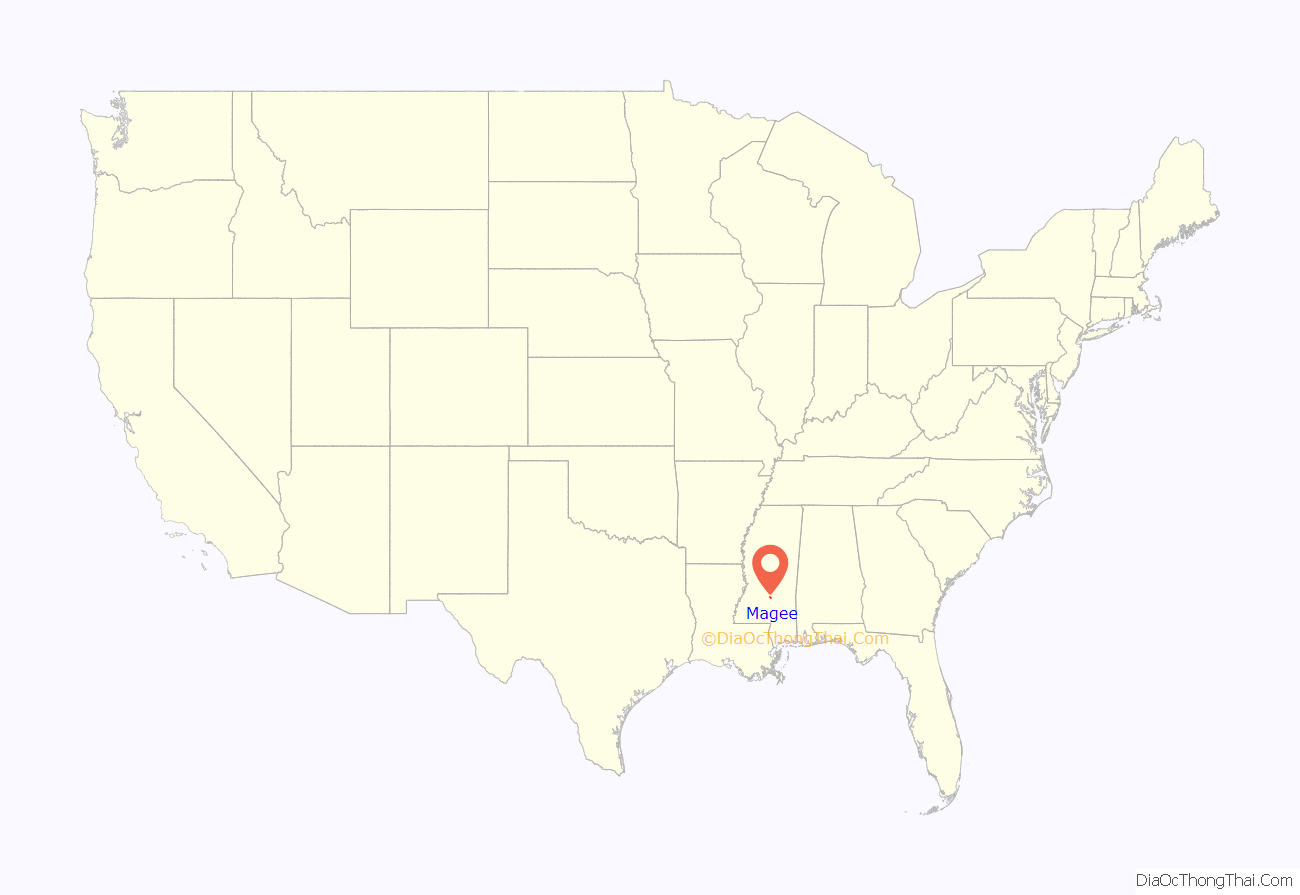
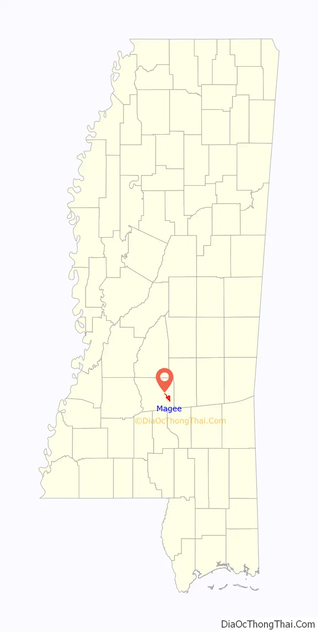
Magee location map. Where is Magee city?
History
The first settlers in the area were Arthur Mangum and Phil Magee, who came into the area around 1820. Pioneers from Virginia and the Carolinas followed. The town of Magee was originally named Mangum, after Arthur Mangum; it kept this name until 1859.
In 1840, Willis Magee built a grist mill on Little Goodwater Creek, inside the present city limits. He started the first and only postal service in the area in 1855.
Robert Solomon Magee was the first post master in Magee and the city of Magee was named after him.
Richard Farthing came to Magee in 1859 when he was in the leather tanning business. He bought 80 acres of land and also built a tanyard and used water from the mill pond to tan his leather. The population of Magee in 1919 was 786. There were approximately 23 businesses in the area at the time.
Magee is approximately 42 miles south of Jackson, 45 miles north of Hattiesburg, and 12 miles south of Mendenhall, the county seat of Simpson County.
Magee’s first mayor was R.P. Vinson, who served from 1900 to 1907.
In 2013, First Baptist Church in downtown Magee was seriously damaged by a fire but has been restored.
Windham’s Restaurant is located in Magee, and was established in 1963, locally known as “Zip’s”. In 2015, the Zip Burger was voted the best hamburger in Mississippi.
In 2017, the Magee Sportsplex was renamed the Jimmy Clyde Sportsplex in honor of former Magee mayor Jimmy Clyde.
As of 2017, the mayor of Magee is Dale Berry.
The city of Magee was featured in the Discovery Channel reality TV series Dirty Jobs.
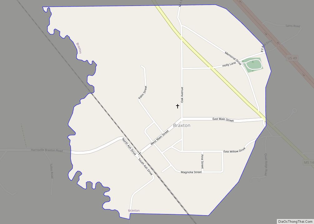
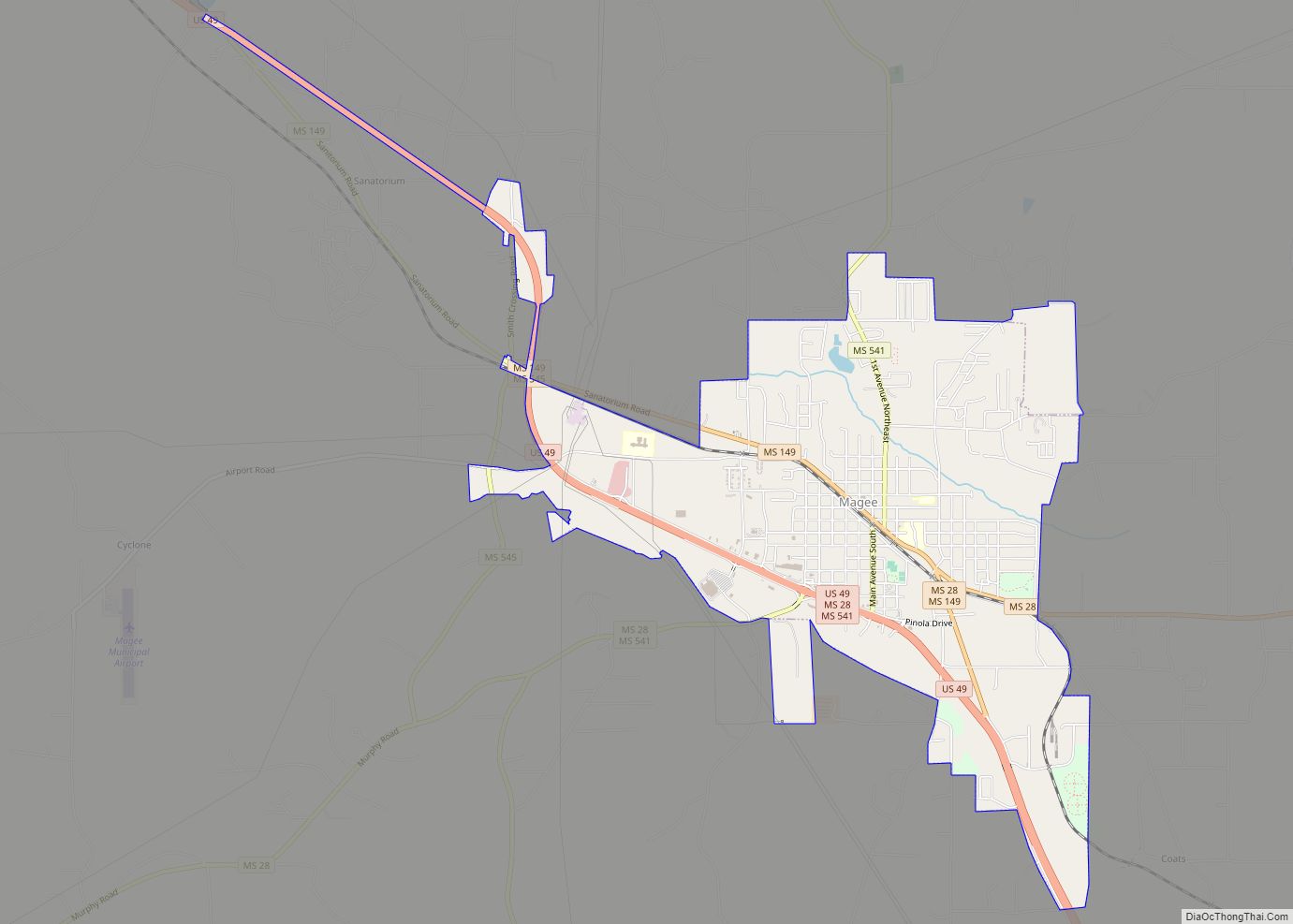
Magee Road Map
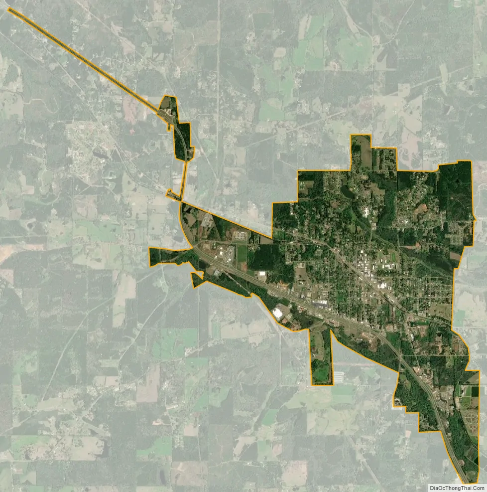
Magee city Satellite Map
Geography
According to the United States Census Bureau, the city has a total area of 4.9 square miles (13 km), all land. Magee is located between Jackson and Hattiesburg on U.S. Highway 49 at the intersection of three Mississippi Highways: 541, 545, and 28. Magee is approximately 155 miles north of New Orleans, Louisiana, and approximately 142 miles north of Mobile, Alabama.
Climate
Magee has a humid subtropical climate, with an annual mean temperature 65.8 degrees and average annual rainfall of 56.9 inches (1,450 mm).
March 2009 tornado
On March 26, 2009, around 1:30 a.m., an EF3 tornado struck the north part of the city. The tornado destroyed 60 homes and caused 25 injuries, with no fatalities. The tornado significantly damaged the town’s water treatment plant, interrupting service to the entire town. Circuit Riders and other technicians from the Mississippi Rural Water Association worked with the city staff, local contractors and the Mississippi Emergency Management Agency to restore water service. Using four MEMA generators, the rural water staff was able to restore service to Magee by 2:20 p.m. the next day.
See also
Map of Mississippi State and its subdivision:- Adams
- Alcorn
- Amite
- Attala
- Benton
- Bolivar
- Calhoun
- Carroll
- Chickasaw
- Choctaw
- Claiborne
- Clarke
- Clay
- Coahoma
- Copiah
- Covington
- Desoto
- Forrest
- Franklin
- George
- Greene
- Grenada
- Hancock
- Harrison
- Hinds
- Holmes
- Humphreys
- Issaquena
- Itawamba
- Jackson
- Jasper
- Jefferson
- Jefferson Davis
- Jones
- Kemper
- Lafayette
- Lamar
- Lauderdale
- Lawrence
- Leake
- Lee
- Leflore
- Lincoln
- Lowndes
- Madison
- Marion
- Marshall
- Monroe
- Montgomery
- Neshoba
- Newton
- Noxubee
- Oktibbeha
- Panola
- Pearl River
- Perry
- Pike
- Pontotoc
- Prentiss
- Quitman
- Rankin
- Scott
- Sharkey
- Simpson
- Smith
- Stone
- Sunflower
- Tallahatchie
- Tate
- Tippah
- Tishomingo
- Tunica
- Union
- Walthall
- Warren
- Washington
- Wayne
- Webster
- Wilkinson
- Winston
- Yalobusha
- Yazoo
- Alabama
- Alaska
- Arizona
- Arkansas
- California
- Colorado
- Connecticut
- Delaware
- District of Columbia
- Florida
- Georgia
- Hawaii
- Idaho
- Illinois
- Indiana
- Iowa
- Kansas
- Kentucky
- Louisiana
- Maine
- Maryland
- Massachusetts
- Michigan
- Minnesota
- Mississippi
- Missouri
- Montana
- Nebraska
- Nevada
- New Hampshire
- New Jersey
- New Mexico
- New York
- North Carolina
- North Dakota
- Ohio
- Oklahoma
- Oregon
- Pennsylvania
- Rhode Island
- South Carolina
- South Dakota
- Tennessee
- Texas
- Utah
- Vermont
- Virginia
- Washington
- West Virginia
- Wisconsin
- Wyoming