Map of Plantersville town

Map of Plantersville town, Mississippi

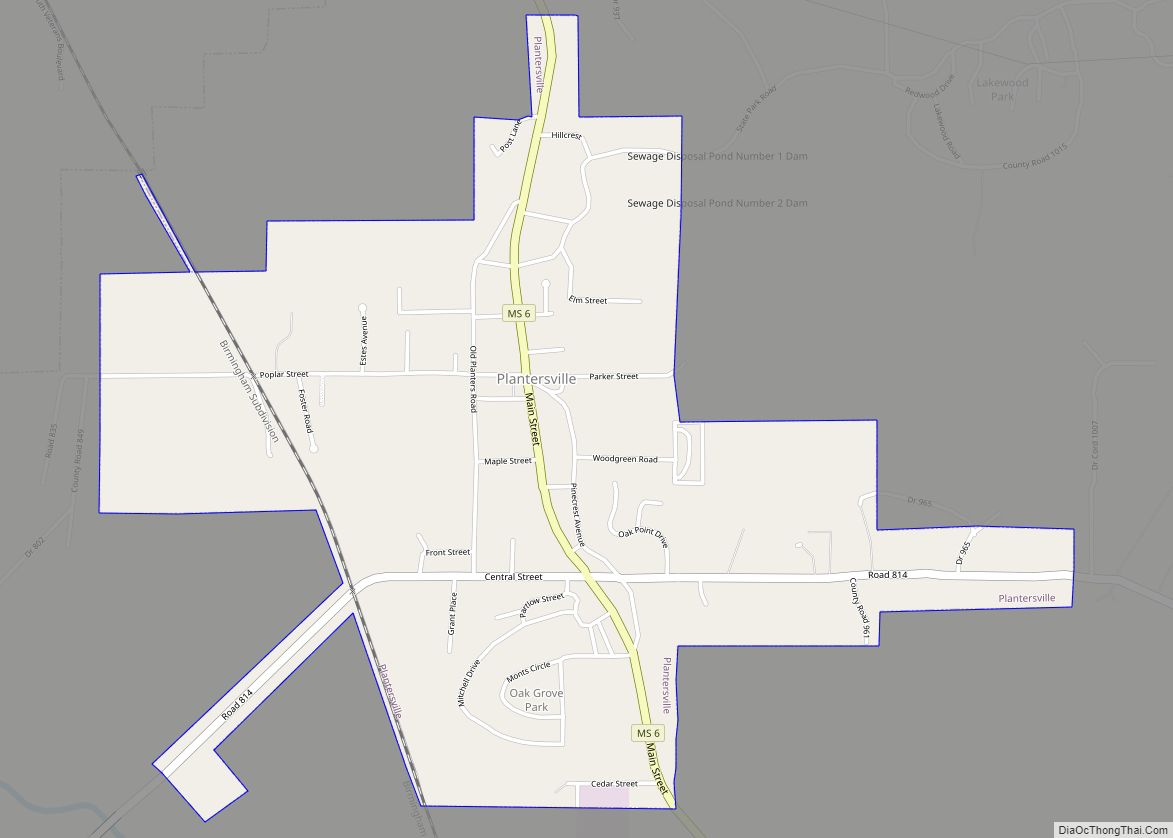
Plantersville is a town in Lee County, Mississippi. The population was 868 at the 2020 census. Plantersville town overview: Name: Plantersville town LSAD Code: 43 LSAD Description: town (suffix) State: Mississippi County: Lee County Elevation: 308 ft (94 m) Total Area: 2.10 sq mi (5.44 km²) Land Area: 2.09 sq mi (5.42 km²) Water Area: 0.01 sq mi (0.02 km²) Total Population: 868 Population Density: 414.72/sq mi … Read more

Map of Pittsboro village, Mississippi

Map of Pittsboro village, Mississippi

Pittsboro is a village in Calhoun County, Mississippi, United States. The population was 202 at the 2010 census. It is the county seat of Calhoun County. Pittsboro village overview: Name: Pittsboro village LSAD Code: 47 LSAD Description: village (suffix) State: Mississippi County: Calhoun County Elevation: 390 ft (119 m) Total Area: 0.98 sq mi (2.54 km²) Land Area: 0.98 sq mi (2.54 km²) … Read more

Map of Pickens town

Map of Pickens town, Mississippi

Pickens is a town in Holmes County, Mississippi, United States. Per the 2020 census, the population was 920. Pickens town overview: Name: Pickens town LSAD Code: 43 LSAD Description: town (suffix) State: Mississippi County: Holmes County Elevation: 243 ft (74 m) Total Area: 1.30 sq mi (3.37 km²) Land Area: 1.28 sq mi (3.31 km²) Water Area: 0.02 sq mi (0.06 km²) Total Population: 920 Population … Read more

Map of Picayune city

Map of Picayune city

Picayune (/pɪkəˈjuːn/ pik-ə-YOON) is the largest city in Pearl River County, Mississippi, United States. The population was 10,878 at the 2010 census. The city is located approximately 45 miles (72 km) from New Orleans, Hattiesburg, and Gulfport–Biloxi. The Stennis Space Center is 10 miles (16 km) away. Picayune is part of the New Orleans–Metairie–Hammond combined statistical area. … Read more

Map of Poplarville city

Map of Poplarville city

Poplarville is a city in Pearl River County, Mississippi, United States. As of the 2010 census, the city population was 2,894. It is the county seat of Pearl River County. It hosts an annual Blueberry Jubilee, which includes rides, craft vendors and rodeos. Poplarville city overview: Name: Poplarville city LSAD Code: 25 LSAD Description: city … Read more

Map of Pope village

Map of Pope village

Pope is a village in Panola County, Mississippi. The population was 241 at the 2000 census. Pope village overview: Name: Pope village LSAD Code: 47 LSAD Description: village (suffix) State: Mississippi County: Panola County Elevation: 226 ft (69 m) Total Area: 1.45 sq mi (3.75 km²) Land Area: 1.45 sq mi (3.75 km²) Water Area: 0.00 sq mi (0.00 km²) Total Population: 268 Population Density: 184.83/sq mi … Read more

Map of Pontotoc city

Map of Pontotoc city

Pontotoc is a city in and the county seat of Pontotoc County, Mississippi, located to the west of the much larger city of Tupelo. The population was 5,625 at the 2010 census. Pontotoc is a Chickasaw word that means, “Land of the Hanging Grapes.” Pontotoc city overview: Name: Pontotoc city LSAD Code: 25 LSAD Description: … Read more

Map of Potts Camp town

Map of Potts Camp town

Potts Camp is a town in Marshall County, Mississippi, United States. The population was 523 at the 2010 census. Potts Camp town overview: Name: Potts Camp town LSAD Code: 43 LSAD Description: town (suffix) State: Mississippi County: Marshall County Elevation: 344 ft (105 m) Total Area: 0.97 sq mi (2.52 km²) Land Area: 0.97 sq mi (2.52 km²) Water Area: 0.00 sq mi (0.00 km²) Total … Read more

Map of Port Gibson city

Map of Port Gibson city, Mississippi

Port Gibson is a city in Claiborne County, Mississippi, United States. The population was 1,567 at the 2010 census. Port Gibson is the county seat of Claiborne County, which is bordered on the west by the Mississippi River. It is the site of the Claiborne County Courthouse. The first European settlers in Port Gibson were … Read more

Map of Raleigh town, Mississippi

Map of Raleigh town, Mississippi

Raleigh is a town and the county seat of Smith County, Mississippi, United States. The population was 1,094 at the 2020 census, making it the second largest town in Smith County. Named for English explorer Sir Walter Raleigh, Raleigh has been home to such Mississippians as Governor Robert Lowry, Governor/U.S. Senator Anselm McLaurin and pioneer … Read more

Map of Quitman city, Mississippi

Map of Quitman city, Mississippi

Quitman is a city in Clarke County, Mississippi, United States, along the Chickasawhay River. The population was 2,323 at the 2010 census. Quitman is the county seat of Clarke County. Quitman city overview: Name: Quitman city LSAD Code: 25 LSAD Description: city (suffix) State: Mississippi County: Clarke County Elevation: 230 ft (70 m) Total Area: 5.90 sq mi (15.29 km²) … Read more

Map of Purvis city

Map of Purvis city

Purvis is a U.S. city in and the county seat of Lamar County, Mississippi. It is part of the Hattiesburg, Mississippi Metropolitan Statistical Area. The population was 2,175 at the 2010 census. The Town of Purvis was incorporated on February 25, 1888 and was founded by and named after Thomas Melville Purves, originally of Marion … Read more