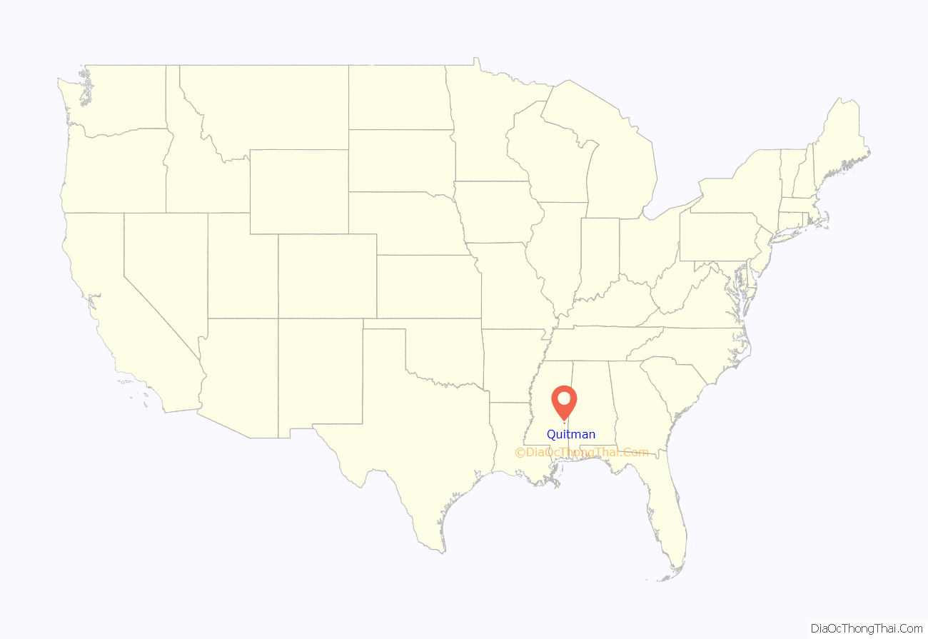
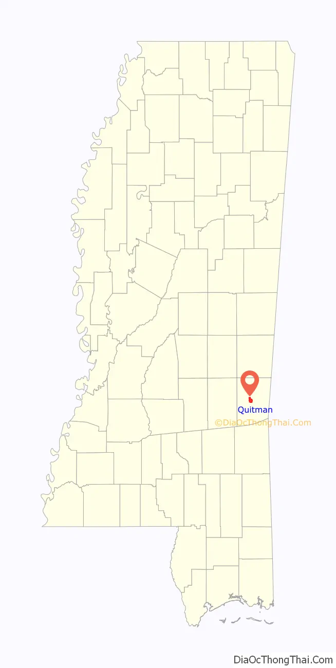
Quitman is a city in Clarke County, Mississippi, United States, along the Chickasawhay River. The population was 2,323 at the 2010 census. Quitman is the county seat of Clarke County.
| Name: | Quitman city |
|---|---|
| LSAD Code: | 25 |
| LSAD Description: | city (suffix) |
| State: | Mississippi |
| County: | Clarke County |
| Elevation: | 230 ft (70 m) |
| Total Area: | 5.90 sq mi (15.29 km²) |
| Land Area: | 5.18 sq mi (13.41 km²) |
| Water Area: | 0.73 sq mi (1.88 km²) |
| Total Population: | 2,061 |
| Population Density: | 398.11/sq mi (153.71/km²) |
| ZIP code: | 39355 |
| Area code: | 601 |
| FIPS code: | 2860720 |
| GNISfeature ID: | 0676438 |
| Website: | www.cityquitman.net |
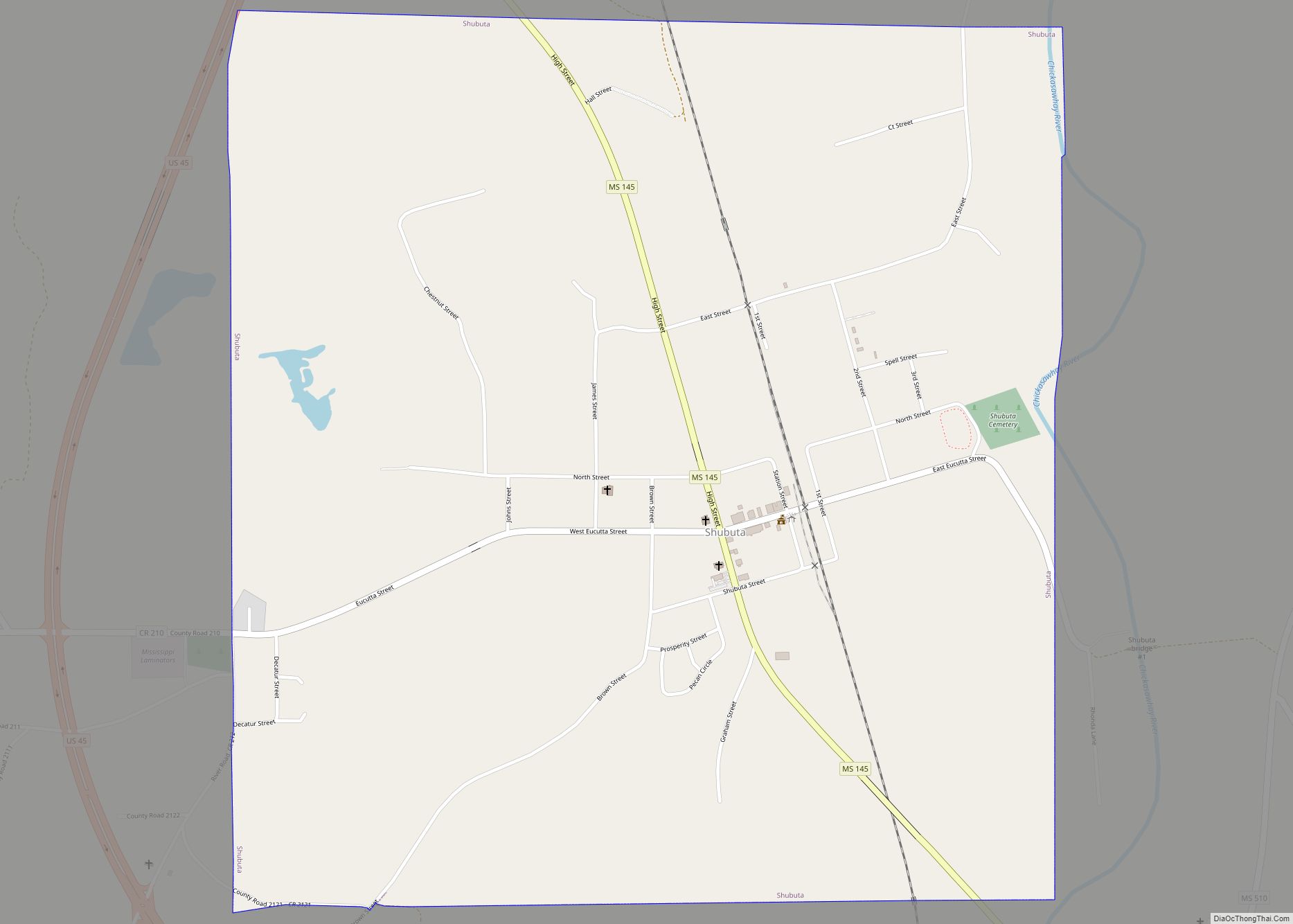
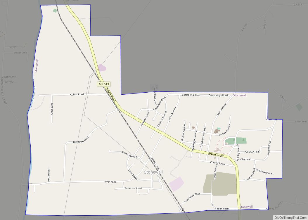
Online Interactive Map
Click on ![]() to view map in "full screen" mode.
to view map in "full screen" mode.
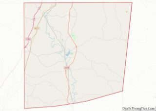
Quitman location map. Where is Quitman city?
History
Quitman was established in 1839 and named as the county seat.
During the Civil War, a hospital built with funds raised in Galveston and Houston, among other places, was built there for the care of Confederate soldiers from Texas. Originally staffed by Louis Bryan with supplies purchased in Mexico, he was joined, and later supplanted, by Enos Bonney, a surgeon from Enterprise, Mississippi, who stayed until the hospital was burned down. Though it cared for troops from any state, the hospital was colloquially known as “The Texas Hospital.” Wounded soldiers from the Second Battle of Corinth, Battle of Iuka, Battle of Jackson, Tennessee, and more local engagements, as well as those suffering from wartime diseases, were treated at the hospital. A cemetery was established adjacent to the hospital for those who succumbed to disease or wounds.
During General Sherman’s Meridian Campaign, Brigadier General Walter Q. Gresham, Commander of the Third Brigade, Fourth Division, 17th Army Corps, was detached and sent to Quitman to destroy bridges crossing the Chickasawhay river and through Alligator Swamp, as well as any other infrastructure that could be of any use to the Confederacy. The force arrived at Quitman and proceeded to burn the town jail, courthouse, various stores, the railroad depot, and the Methodist Church, which was being used as a hospital. Troops then burned down the entire Texas Hospital complex, which included two main buildings as well as twelve to fifteen barracks. The hospital was never rebuilt.
Quitman was officially recognized by the Mississippi Legislature on February 13, 1839, and was named for the second Chancellor of the State, Gen. John A. Quitman, a strongly pro-slavery politician, leading Fire Eater, veteran of the Mexican–American War.
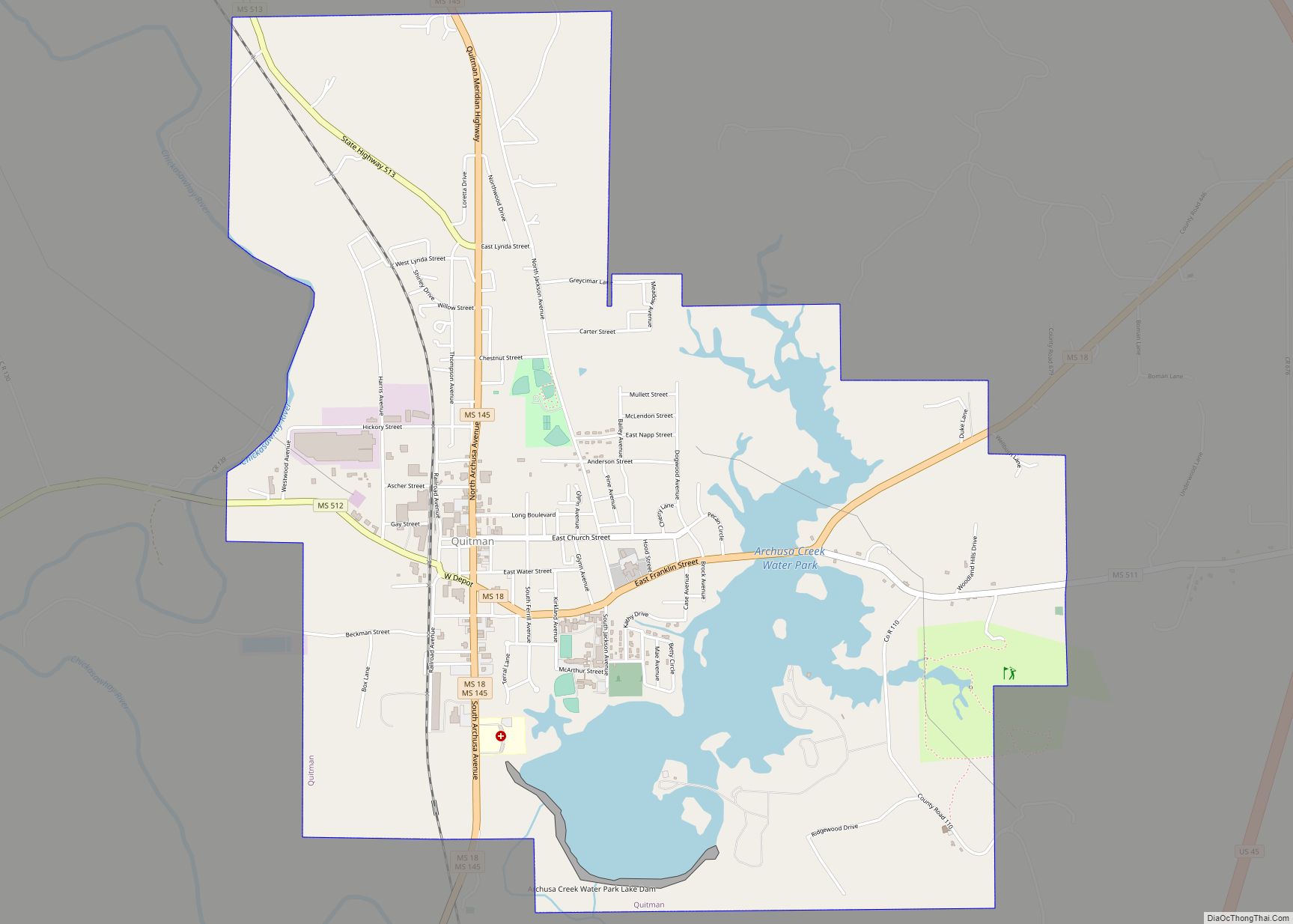
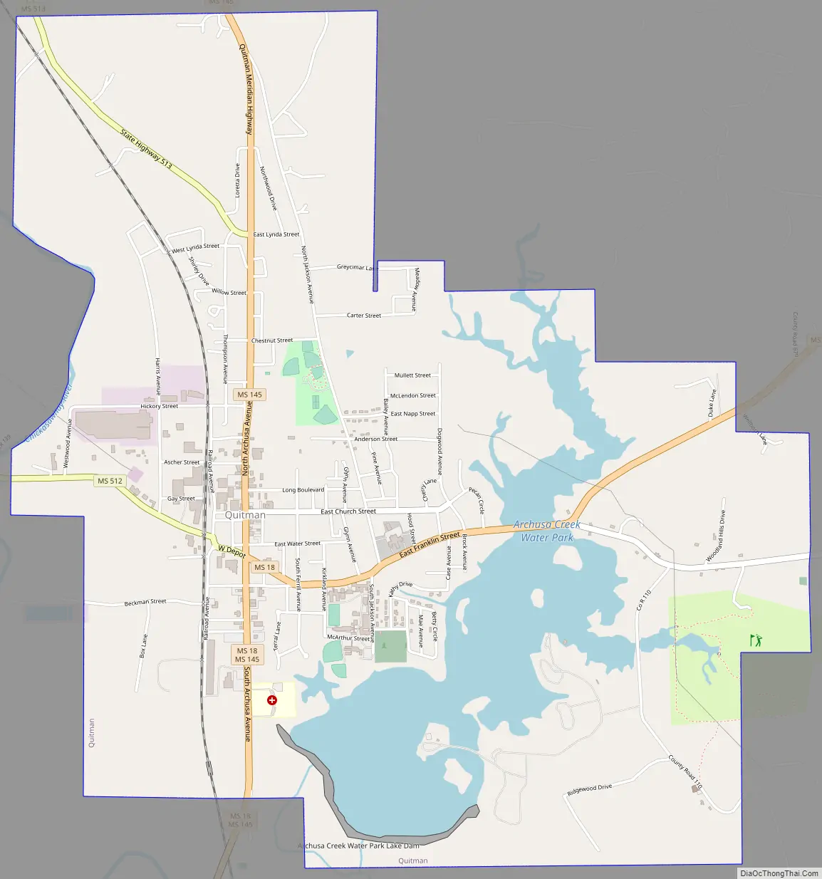
Quitman Road Map
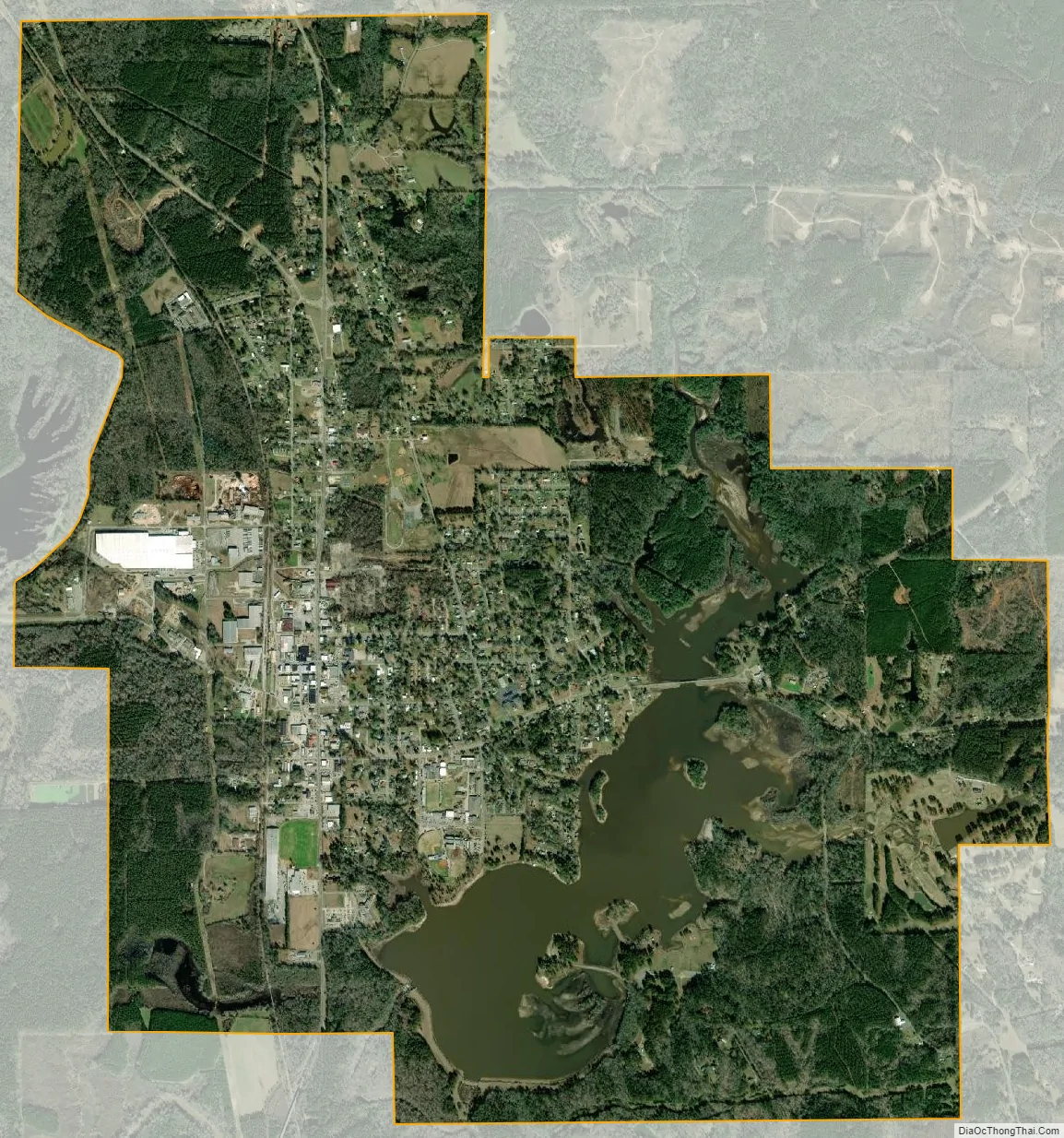
Quitman city Satellite Map
Geography
Quitman is located near the center of Clarke County. Mississippi Highway 18 passes through the center of the city.
According to the United States Census Bureau, the city has a total area of 5.9 square miles (15.3 km), of which 5.2 square miles (13.4 km) is land and 0.73 square miles (1.9 km), or 12.28%, is water.
Climate
See also
Map of Mississippi State and its subdivision:- Adams
- Alcorn
- Amite
- Attala
- Benton
- Bolivar
- Calhoun
- Carroll
- Chickasaw
- Choctaw
- Claiborne
- Clarke
- Clay
- Coahoma
- Copiah
- Covington
- Desoto
- Forrest
- Franklin
- George
- Greene
- Grenada
- Hancock
- Harrison
- Hinds
- Holmes
- Humphreys
- Issaquena
- Itawamba
- Jackson
- Jasper
- Jefferson
- Jefferson Davis
- Jones
- Kemper
- Lafayette
- Lamar
- Lauderdale
- Lawrence
- Leake
- Lee
- Leflore
- Lincoln
- Lowndes
- Madison
- Marion
- Marshall
- Monroe
- Montgomery
- Neshoba
- Newton
- Noxubee
- Oktibbeha
- Panola
- Pearl River
- Perry
- Pike
- Pontotoc
- Prentiss
- Quitman
- Rankin
- Scott
- Sharkey
- Simpson
- Smith
- Stone
- Sunflower
- Tallahatchie
- Tate
- Tippah
- Tishomingo
- Tunica
- Union
- Walthall
- Warren
- Washington
- Wayne
- Webster
- Wilkinson
- Winston
- Yalobusha
- Yazoo
- Alabama
- Alaska
- Arizona
- Arkansas
- California
- Colorado
- Connecticut
- Delaware
- District of Columbia
- Florida
- Georgia
- Hawaii
- Idaho
- Illinois
- Indiana
- Iowa
- Kansas
- Kentucky
- Louisiana
- Maine
- Maryland
- Massachusetts
- Michigan
- Minnesota
- Mississippi
- Missouri
- Montana
- Nebraska
- Nevada
- New Hampshire
- New Jersey
- New Mexico
- New York
- North Carolina
- North Dakota
- Ohio
- Oklahoma
- Oregon
- Pennsylvania
- Rhode Island
- South Carolina
- South Dakota
- Tennessee
- Texas
- Utah
- Vermont
- Virginia
- Washington
- West Virginia
- Wisconsin
- Wyoming