Poplarville is a city in Pearl River County, Mississippi, United States. As of the 2010 census, the city population was 2,894. It is the county seat of Pearl River County. It hosts an annual Blueberry Jubilee, which includes rides, craft vendors and rodeos.
| Name: | Poplarville city |
|---|---|
| LSAD Code: | 25 |
| LSAD Description: | city (suffix) |
| State: | Mississippi |
| County: | Pearl River County |
| Elevation: | 318 ft (97 m) |
| Total Area: | 5.42 sq mi (14.04 km²) |
| Land Area: | 5.41 sq mi (14.01 km²) |
| Water Area: | 0.01 sq mi (0.03 km²) |
| Total Population: | 2,833 |
| Population Density: | 523.85/sq mi (202.26/km²) |
| ZIP code: | 39470 |
| Area code: | 601/769 |
| FIPS code: | 2859480 |
| GNISfeature ID: | 0676247 |
| Website: | www.poplarvillems.gov |
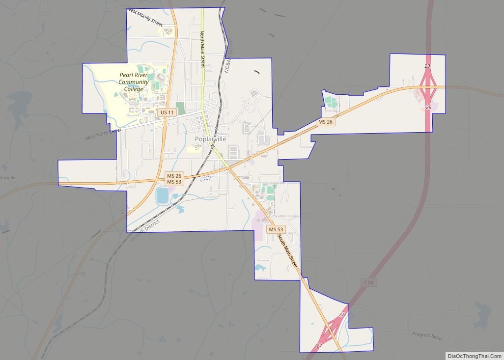
Online Interactive Map
Click on ![]() to view map in "full screen" mode.
to view map in "full screen" mode.
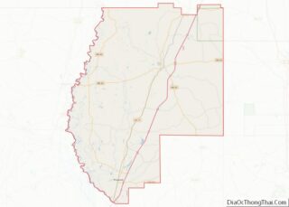
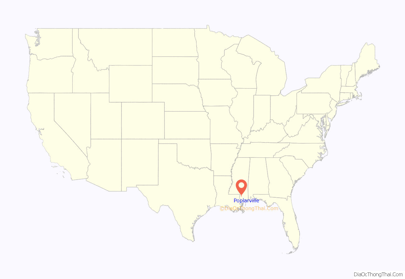
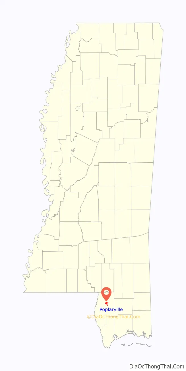
Poplarville location map. Where is Poplarville city?
History
Poplarville was named for Poplar Jim Smith, the original owner of the town site.
In 1959, Mack Charles Parker, an African-American accused of rape, was abducted from the Pearl River County jail in Poplarville by a mob and shot to death. Despite confessions, no charges were filed against anyone. The mayor of Poplarville told a New York Times reporter, “You couldn’t convict the guilty parties if you had a sound film of the lynching.” It was the fourth lynching in Poplarville since the Civil War. The case focused national attention on the persistence of lynching in the South and helped accelerate the American Civil Rights Movement.
On August 29, 2005, Hurricane Katrina inflicted heavy damage on the small town. The storm’s most powerful, unofficially recorded gust of wind was reported at Pearl River Community College, at 135 mph (217 km/h). On September 2, 2005, the 1st Battalion, 134th Field Artillery (Ohio Army National Guard) arrived at the National Guard armory in Poplarville to assist the community and Pearl River County in recovery efforts in the wake of Hurricane Katrina. Initial efforts were the security of banks, pharmacies and gas stations as well as initial responses to rural emergencies. The unit stayed for three weeks ultimately checking on every family and structure in the county. On September 5, 2005, Poplarville played host to a visit by George W. Bush, Laura Bush, and Governor Haley Barbour to Pearl River Community College in the aftermath of Hurricane Katrina.
On December 21, 2006, an early morning fire destroyed three downtown buildings.
On March 25, 2014 citizens voted to allow for beer and wine sales. The final vote count was 361 votes for the measure and 149 against.
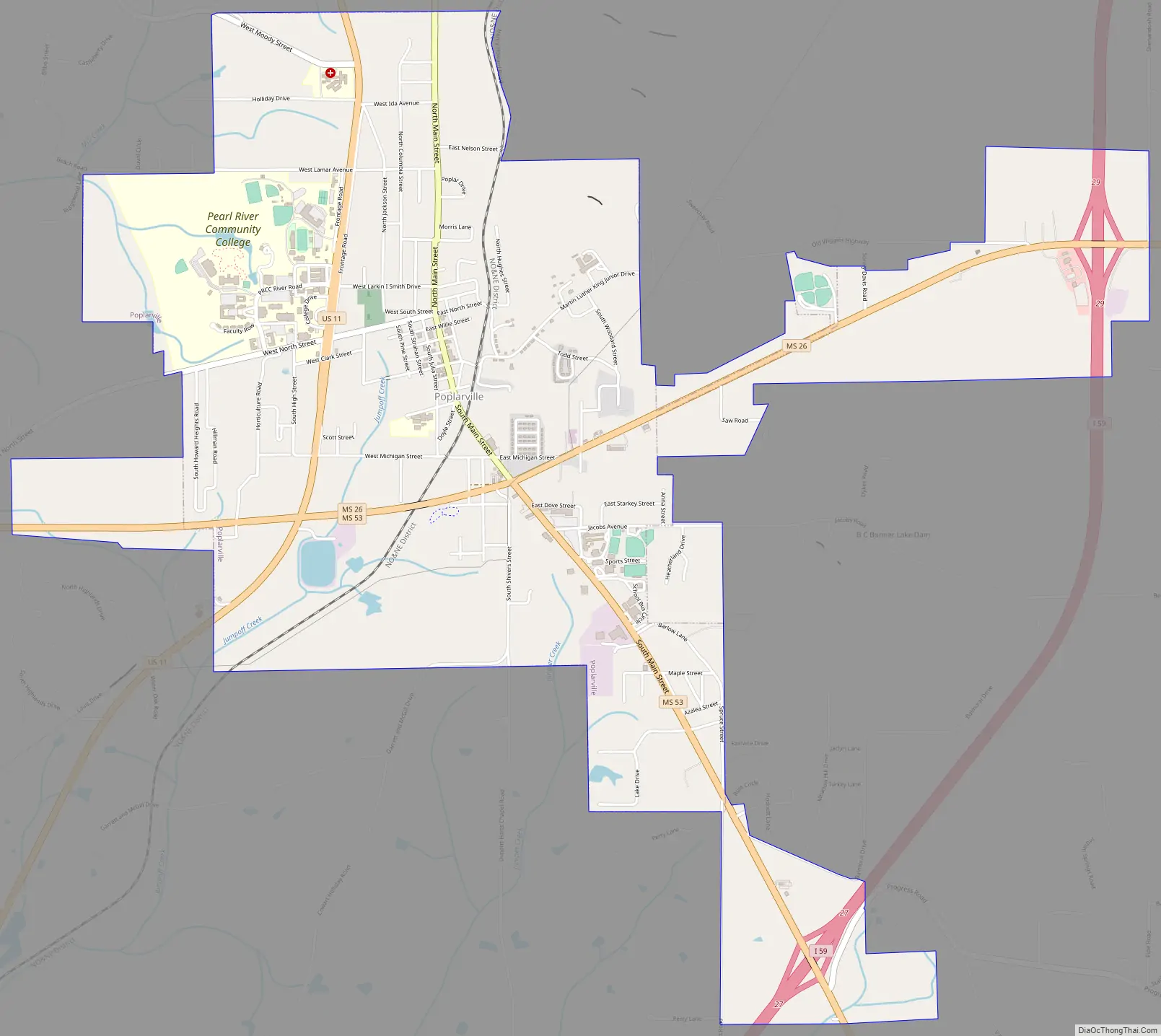
Poplarville Road Map
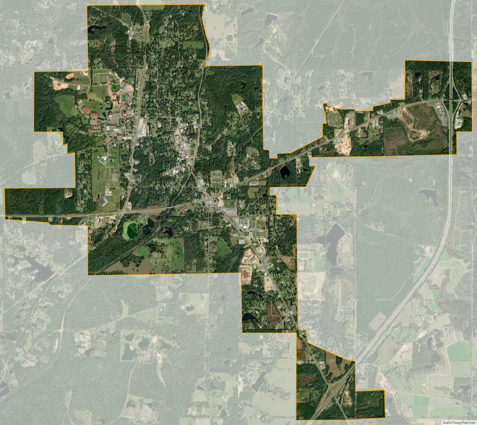
Poplarville city Satellite Map
Geography
According to the United States Census Bureau, the city has a total area of 3.9 square miles (10 km), of which, 3.8 square miles (9.8 km) of it is land and 0.04 square miles (0.10 km) of it (0.52%) is water.
See also
Map of Mississippi State and its subdivision:- Adams
- Alcorn
- Amite
- Attala
- Benton
- Bolivar
- Calhoun
- Carroll
- Chickasaw
- Choctaw
- Claiborne
- Clarke
- Clay
- Coahoma
- Copiah
- Covington
- Desoto
- Forrest
- Franklin
- George
- Greene
- Grenada
- Hancock
- Harrison
- Hinds
- Holmes
- Humphreys
- Issaquena
- Itawamba
- Jackson
- Jasper
- Jefferson
- Jefferson Davis
- Jones
- Kemper
- Lafayette
- Lamar
- Lauderdale
- Lawrence
- Leake
- Lee
- Leflore
- Lincoln
- Lowndes
- Madison
- Marion
- Marshall
- Monroe
- Montgomery
- Neshoba
- Newton
- Noxubee
- Oktibbeha
- Panola
- Pearl River
- Perry
- Pike
- Pontotoc
- Prentiss
- Quitman
- Rankin
- Scott
- Sharkey
- Simpson
- Smith
- Stone
- Sunflower
- Tallahatchie
- Tate
- Tippah
- Tishomingo
- Tunica
- Union
- Walthall
- Warren
- Washington
- Wayne
- Webster
- Wilkinson
- Winston
- Yalobusha
- Yazoo
- Alabama
- Alaska
- Arizona
- Arkansas
- California
- Colorado
- Connecticut
- Delaware
- District of Columbia
- Florida
- Georgia
- Hawaii
- Idaho
- Illinois
- Indiana
- Iowa
- Kansas
- Kentucky
- Louisiana
- Maine
- Maryland
- Massachusetts
- Michigan
- Minnesota
- Mississippi
- Missouri
- Montana
- Nebraska
- Nevada
- New Hampshire
- New Jersey
- New Mexico
- New York
- North Carolina
- North Dakota
- Ohio
- Oklahoma
- Oregon
- Pennsylvania
- Rhode Island
- South Carolina
- South Dakota
- Tennessee
- Texas
- Utah
- Vermont
- Virginia
- Washington
- West Virginia
- Wisconsin
- Wyoming