Picayune (/pɪkəˈjuːn/ pik-ə-YOON) is the largest city in Pearl River County, Mississippi, United States. The population was 10,878 at the 2010 census. The city is located approximately 45 miles (72 km) from New Orleans, Hattiesburg, and Gulfport–Biloxi. The Stennis Space Center is 10 miles (16 km) away. Picayune is part of the New Orleans–Metairie–Hammond combined statistical area.
| Name: | Picayune city |
|---|---|
| LSAD Code: | 25 |
| LSAD Description: | city (suffix) |
| State: | Mississippi |
| County: | Pearl River County |
| Elevation: | 73 ft (22 m) |
| Total Area: | 18.11 sq mi (46.91 km²) |
| Land Area: | 18.04 sq mi (46.72 km²) |
| Water Area: | 0.08 sq mi (0.20 km²) |
| Total Population: | 11,885 |
| Population Density: | 658.89/sq mi (254.40/km²) |
| ZIP code: | 39466 |
| Area code: | 601 |
| FIPS code: | 2857160 |
| GNISfeature ID: | 0675698 |
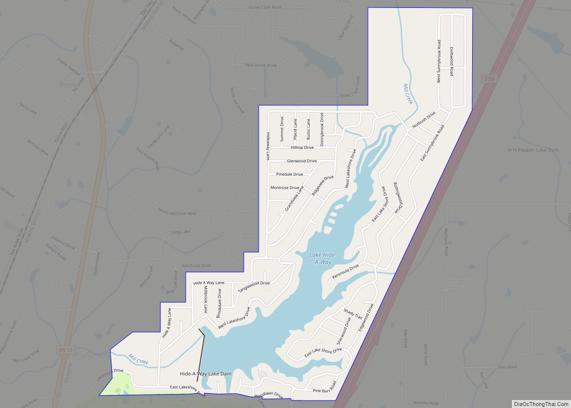
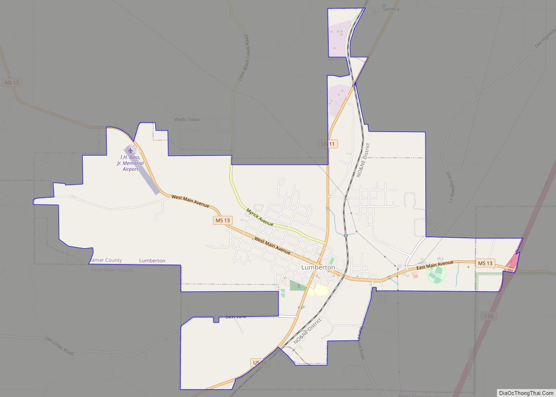
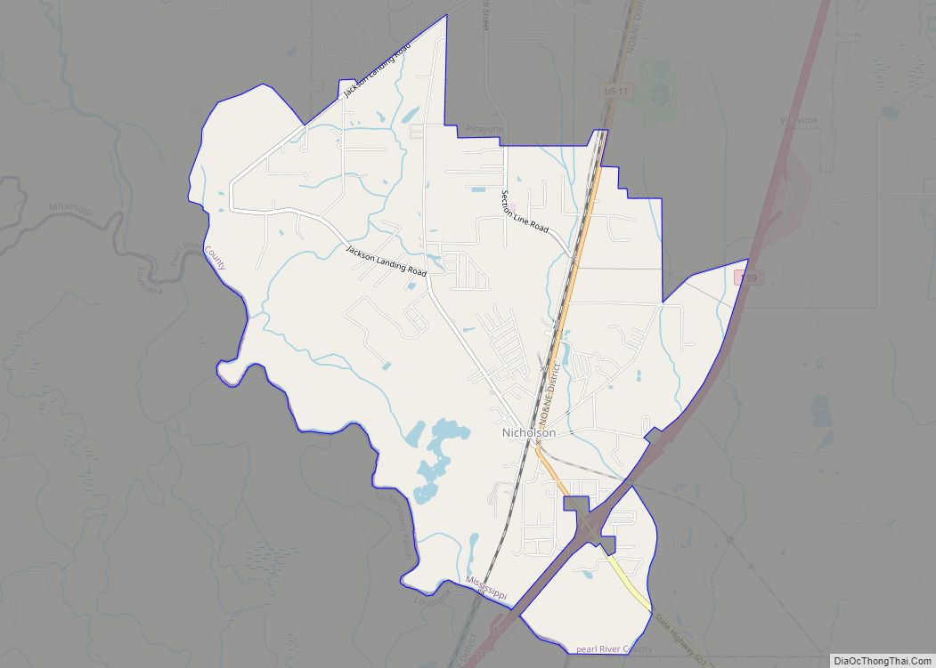
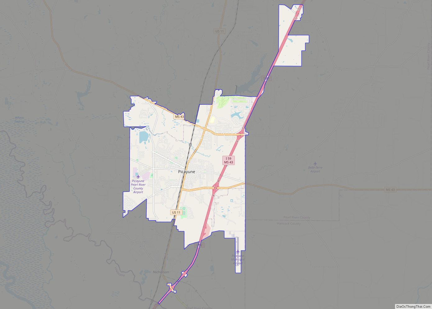
Online Interactive Map
Click on ![]() to view map in "full screen" mode.
to view map in "full screen" mode.
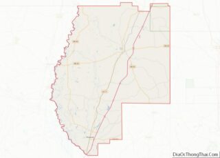
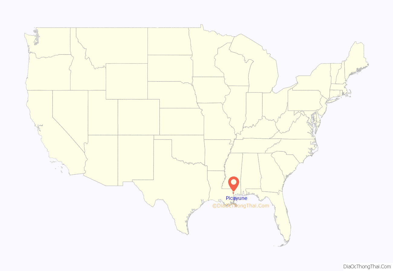
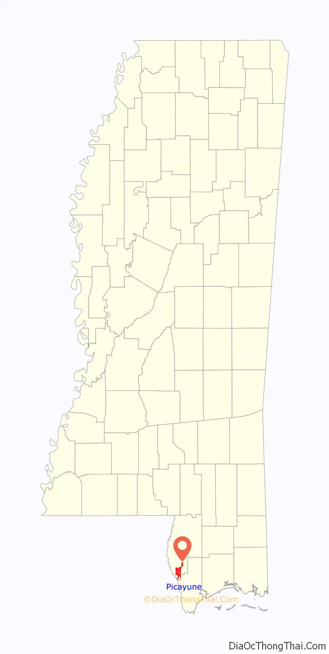
Picayune location map. Where is Picayune city?
History
The word “picayune” was the name of a Spanish coin, worth half a real. Its name derives from the French “picaillon”, which is itself from the Provençal “picaioun”, the name of an unrelated small copper coin from Savoy. By extension, picayune can mean “trivial” or “of little value”. Picayune was incorporated in 1904, and was named by Eliza Jane Poitevent Nicholson in 1884, the owner and publisher of the New Orleans Daily Picayune, a newspaper named for the coin.
The local post office contained a mural, subsequently covered over, Lumber Region of Mississippi, painted by Donald H. Robertson in 1940. Federally commissioned murals were produced from 1934 to 1943 in the United States through the Section of Painting and Sculpture, later called the Section of Fine Arts, of the Treasury Department.
Hurricane Katrina
While Picayune received extensive damage from Hurricane Katrina, it was not as severe as in other nearby cities. This caused Picayune to become the temporary home for many who relocated from the New Orleans area and from the Mississippi Gulf Coast who were seeking a safer home site with easy commuting to those areas.
The bulk of the Katrina damage in Picayune was caused by high winds, as the eye wall passed over the city. This resulted in widespread roof, window, and fence damage. The wind also caused hundreds, if not thousands, of downed trees and power outages of up to a few weeks.
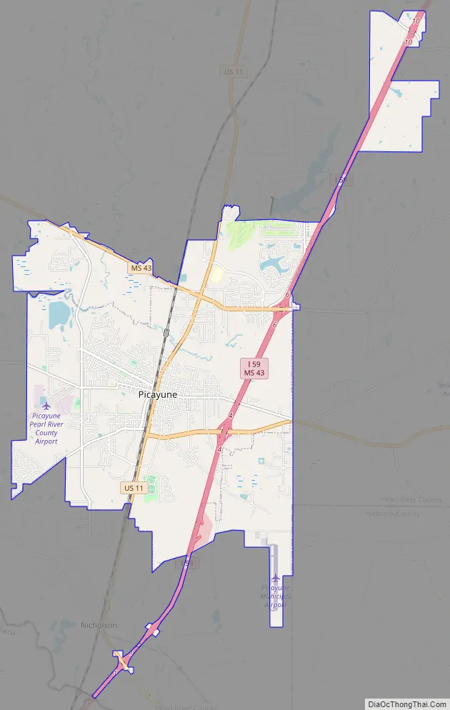
Picayune Road Map
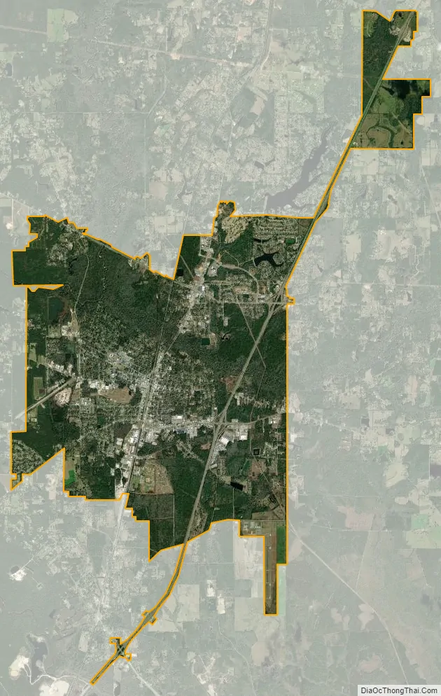
Picayune city Satellite Map
Geography
According to the United States Census Bureau, the city has a total area of 11.8 square miles (31 km), of which 11.8 square miles (31 km) is land and 0.04 square miles (0.10 km) (7.34%) is water. Picayune is a part of the New Orleans–Metairie–Hammond combined statistical area.
See also
Map of Mississippi State and its subdivision:- Adams
- Alcorn
- Amite
- Attala
- Benton
- Bolivar
- Calhoun
- Carroll
- Chickasaw
- Choctaw
- Claiborne
- Clarke
- Clay
- Coahoma
- Copiah
- Covington
- Desoto
- Forrest
- Franklin
- George
- Greene
- Grenada
- Hancock
- Harrison
- Hinds
- Holmes
- Humphreys
- Issaquena
- Itawamba
- Jackson
- Jasper
- Jefferson
- Jefferson Davis
- Jones
- Kemper
- Lafayette
- Lamar
- Lauderdale
- Lawrence
- Leake
- Lee
- Leflore
- Lincoln
- Lowndes
- Madison
- Marion
- Marshall
- Monroe
- Montgomery
- Neshoba
- Newton
- Noxubee
- Oktibbeha
- Panola
- Pearl River
- Perry
- Pike
- Pontotoc
- Prentiss
- Quitman
- Rankin
- Scott
- Sharkey
- Simpson
- Smith
- Stone
- Sunflower
- Tallahatchie
- Tate
- Tippah
- Tishomingo
- Tunica
- Union
- Walthall
- Warren
- Washington
- Wayne
- Webster
- Wilkinson
- Winston
- Yalobusha
- Yazoo
- Alabama
- Alaska
- Arizona
- Arkansas
- California
- Colorado
- Connecticut
- Delaware
- District of Columbia
- Florida
- Georgia
- Hawaii
- Idaho
- Illinois
- Indiana
- Iowa
- Kansas
- Kentucky
- Louisiana
- Maine
- Maryland
- Massachusetts
- Michigan
- Minnesota
- Mississippi
- Missouri
- Montana
- Nebraska
- Nevada
- New Hampshire
- New Jersey
- New Mexico
- New York
- North Carolina
- North Dakota
- Ohio
- Oklahoma
- Oregon
- Pennsylvania
- Rhode Island
- South Carolina
- South Dakota
- Tennessee
- Texas
- Utah
- Vermont
- Virginia
- Washington
- West Virginia
- Wisconsin
- Wyoming