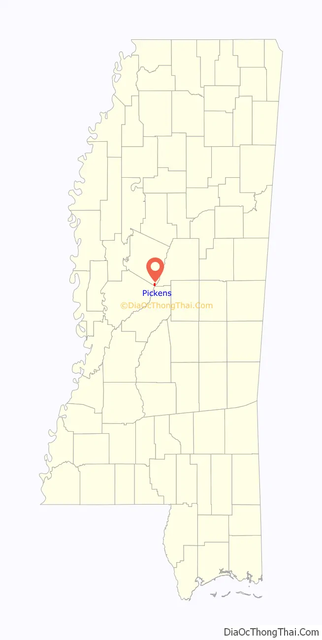
Pickens is a town in Holmes County, Mississippi, United States. Per the 2020 census, the population was 920.
| Name: | Pickens town |
|---|---|
| LSAD Code: | 43 |
| LSAD Description: | town (suffix) |
| State: | Mississippi |
| County: | Holmes County |
| Elevation: | 243 ft (74 m) |
| Total Area: | 1.30 sq mi (3.37 km²) |
| Land Area: | 1.28 sq mi (3.31 km²) |
| Water Area: | 0.02 sq mi (0.06 km²) |
| Total Population: | 920 |
| Population Density: | 720.44/sq mi (278.24/km²) |
| ZIP code: | 39146 |
| Area code: | 662 |
| FIPS code: | 2857200 |
| GNISfeature ID: | 0675699 |
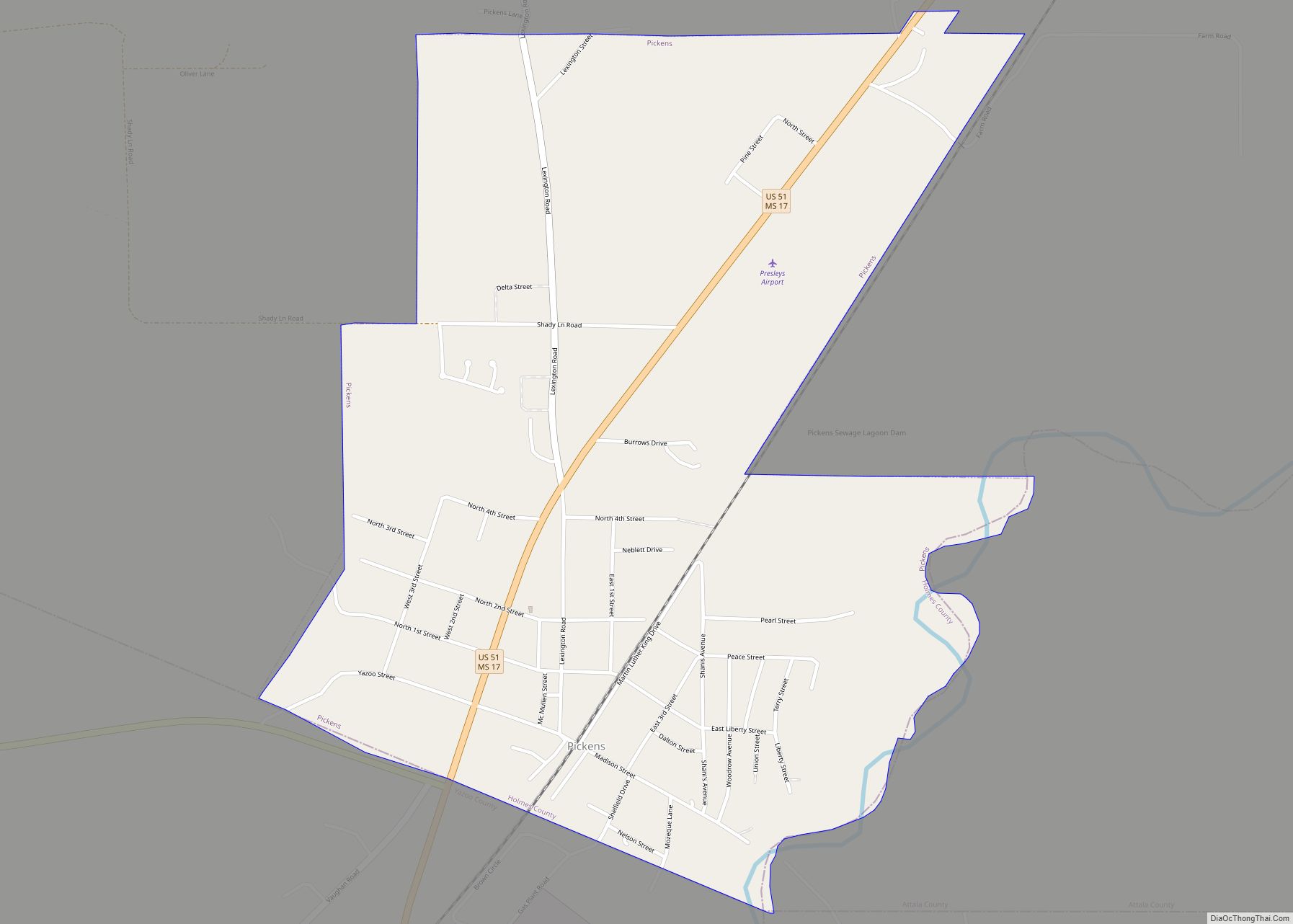
Online Interactive Map
Click on ![]() to view map in "full screen" mode.
to view map in "full screen" mode.
Pickens location map. Where is Pickens town?

History
The town was named for landowner James Pickens and was incorporated in 1858.
On May 9, 1919, an African American veteran was lynched as part of the Red Summer of 1919 because of an “improper note” written to a white woman.
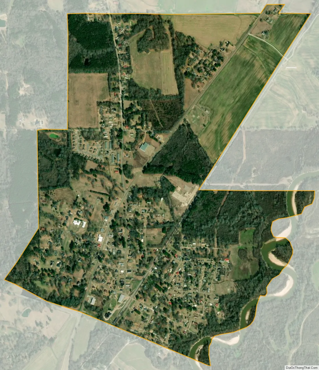
Pickens Road Map

Pickens city Satellite Map
Geography
Pickens is located in the southeast corner of Holmes County at 32°53′12″N 89°58′12″W / 32.88667°N 89.97000°W / 32.88667; -89.97000 (32.886672, -89.970092), on the west side of the Big Black River. It is bordered to the south by Yazoo County and to the east across the Big Black by Attala County.
U.S. Route 51 passes through the town, leading northeast 7 miles (11 km) to Goodman and south 19 miles (31 km) to Canton. Mississippi Highway 17 follows US 51 through Pickens, but leaves the highway south of town to lead southeast 13 miles (21 km) to Camden, and splits from US 51 north of Pickens to lead north 18 miles (29 km) to Lexington, the Holmes County seat. Mississippi Highway 432 leads west from Pickens 18 miles (29 km) to Benton. Interstate 55 passes 3 miles (5 km) west of Pickens, with access from Exit 139 (Highway 432) and Exit 144 (Highway 17). I-55 leads south 44 miles (71 km) to Jackson, the state capital, and north 70 miles (110 km) to Grenada.
According to the United States Census Bureau, the town of Pickens has a total area of 1.3 square miles (3.4 km), of which 0.03 square miles (0.07 km), or 1.96%, are water.
See also
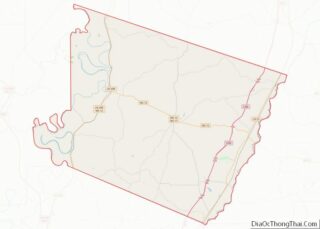
Map of Mississippi State and its subdivision:- Adams
- Alcorn
- Amite
- Attala
- Benton
- Bolivar
- Calhoun
- Carroll
- Chickasaw
- Choctaw
- Claiborne
- Clarke
- Clay
- Coahoma
- Copiah
- Covington
- Desoto
- Forrest
- Franklin
- George
- Greene
- Grenada
- Hancock
- Harrison
- Hinds
- Holmes
- Humphreys
- Issaquena
- Itawamba
- Jackson
- Jasper
- Jefferson
- Jefferson Davis
- Jones
- Kemper
- Lafayette
- Lamar
- Lauderdale
- Lawrence
- Leake
- Lee
- Leflore
- Lincoln
- Lowndes
- Madison
- Marion
- Marshall
- Monroe
- Montgomery
- Neshoba
- Newton
- Noxubee
- Oktibbeha
- Panola
- Pearl River
- Perry
- Pike
- Pontotoc
- Prentiss
- Quitman
- Rankin
- Scott
- Sharkey
- Simpson
- Smith
- Stone
- Sunflower
- Tallahatchie
- Tate
- Tippah
- Tishomingo
- Tunica
- Union
- Walthall
- Warren
- Washington
- Wayne
- Webster
- Wilkinson
- Winston
- Yalobusha
- Yazoo
- Alabama
- Alaska
- Arizona
- Arkansas
- California
- Colorado
- Connecticut
- Delaware
- District of Columbia
- Florida
- Georgia
- Hawaii
- Idaho
- Illinois
- Indiana
- Iowa
- Kansas
- Kentucky
- Louisiana
- Maine
- Maryland
- Massachusetts
- Michigan
- Minnesota
- Mississippi
- Missouri
- Montana
- Nebraska
- Nevada
- New Hampshire
- New Jersey
- New Mexico
- New York
- North Carolina
- North Dakota
- Ohio
- Oklahoma
- Oregon
- Pennsylvania
- Rhode Island
- South Carolina
- South Dakota
- Tennessee
- Texas
- Utah
- Vermont
- Virginia
- Washington
- West Virginia
- Wisconsin
- Wyoming