Port Gibson is a city in Claiborne County, Mississippi, United States. The population was 1,567 at the 2010 census. Port Gibson is the county seat of Claiborne County, which is bordered on the west by the Mississippi River. It is the site of the Claiborne County Courthouse.
The first European settlers in Port Gibson were French colonists in 1729; it was part of their La Louisiane. After the United States acquired the territory from France in 1803 in the Louisiana Purchase, the town was chartered that same year. To develop cotton plantations in the area after Indian Removal of the 1830s, planters who moved to the state brought with them or imported thousands of enslaved African Americans from the Upper South, disrupting many families. Well before the Civil War, the majority of the county’s population were enslaved.
Several notable people are natives of Port Gibson. The town saw action during the American Civil War. Port Gibson has several historical sites listed on the National Register of Historic Places (National Register of Historic Places listings in Claiborne County, Mississippi).
In the twentieth century, Port Gibson was home to The Rabbit’s Foot Company. It had a substantial role in the development of blues in Mississippi, operating taverns and juke joints now included on the Mississippi Blues Trail.
With the decline in agricultural jobs since the late twentieth century, because of industrial agriculture, and a lack of other jobs, the city and surrounding rural county have suffered from reduced population and long-term poverty. The peak of population in the city was in 1950. The last major employer, the Port Gibson Oil Works, a cottonseed mill, closed in 2002.
| Name: | Port Gibson city |
|---|---|
| LSAD Code: | 25 |
| LSAD Description: | city (suffix) |
| State: | Mississippi |
| County: | Claiborne County |
| Elevation: | 118 ft (36 m) |
| Total Area: | 1.75 sq mi (4.55 km²) |
| Land Area: | 1.75 sq mi (4.55 km²) |
| Water Area: | 0.00 sq mi (0.00 km²) |
| Total Population: | 1,269 |
| Population Density: | 723.08/sq mi (279.18/km²) |
| ZIP code: | 39150 |
| Area code: | 601 |
| FIPS code: | 2859560 |
| GNISfeature ID: | 0676254 |
| Website: | portgibsonms.org |
Online Interactive Map
Click on ![]() to view map in "full screen" mode.
to view map in "full screen" mode.
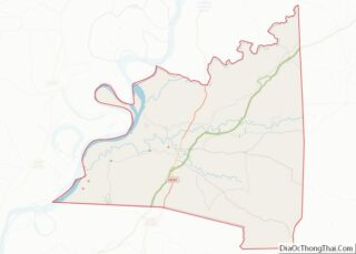
Port Gibson location map. Where is Port Gibson city?


History
Port Gibson is the third-oldest European-American settlement in Mississippi. Its development began in 1729 by French colonists and was then within French-claimed territory known as La Louisiane. The British acquired this area after the French ceded their colonies east of the Mississippi River in 1763, following their defeat in the Seven Years’ War.
Following the U.S. acquisition of former French territory through the Louisiana Purchase of 1803, more Americans entered the area. Port Gibson was chartered as a town that year on March 12, 1803. The federal government carried out Indian Removal in the 1830s, pushing the Five Civilized Tribes, including the Choctaw and Chickasaw peoples, west of the Mississippi River to Indian Territory. It took over their lands in the Southeast for sale and development by European Americans.
Planters developed cotton plantations in the fertile river lowlands of the Mississippi Delta and other riverfront areas, dependent on the labor of enslaved African Americans, initially brought from the Upper South. The African Americans comprised a majority in the county before the Civil War, and this continued.
With international demand high for cotton, such planters prospered. As the planter population increased, they founded the Port Gibson Female College in 1843 to educate their daughters. The college later closed and one of its buildings now serves as the city hall. Similarly, they founded Chamberlain-Hunt Academy in 1879, a military boarding school for white male youths. It operated into the early twenty-first century.
Port Gibson was the site of several clashes during the American Civil War and figured in Union General Ulysses S. Grant’s Vicksburg Campaign. He was attempting to gain control over the Mississippi River. The Battle of Port Gibson occurred on May 1, 1863, and resulted in the deaths of more than 200 Union and Confederate soldiers. The Confederate defeat resulted in their losing the ability to hold Mississippi and defend against an amphibious attack.
Later nineteenth century to present
Reportedly, many of the historic buildings in the town survived the Civil War because Grant proclaimed the city to be “too beautiful to burn”. These words appear on the sign marking the city limits.
Despite postwar economic upheaval, the city continued as a center of trade and economy associated with cotton. In 1882, the Port Gibson Oil Works started operating, established as one of the first cottonseed oil plants in the United States. This historic industrial building was listed on the National Register of Historic Places in 1979. The mill finally closed in 2002.
Gemiluth Chessed synagogue, built in 1892, had an active congregation when the town was thriving as the county seat and a trading center. It had attracted nineteenth-century Jewish immigrants from the German states and Alsace-Lorraine. After starting as peddlers, the later generations of men became cotton brokers and merchants. This is the oldest synagogue and the only Moorish Revival building in the state. It is topped by a Russian-style dome. As the economy changed, the Jewish population gradually moved to larger cities and areas offering more opportunity, and none remain in Port Gibson.
The Rabbit’s Foot Company was established in 1900 by Pat Chappelle, an African-American theatre owner in Tampa, Florida. This was the leading traveling vaudeville show in the southern states, with an all-black cast of singers, musicians, comedians, and entertainers.
After Chappelle’s death in 1911, the company was taken over by Fred Swift Wolcott, a white planter. After 1918, he based the touring company at his plantation near Port Gibson, with offices in town. He continued to manage it until 1950, when he sold it. The Rabbit’s Foot Company remained popular, but as some white performers joined and used blackface, it was no longer considered “authentic”.
In 2002 the New York Times characterized Port Gibson as 80 percent black and poor, with 20 percent of families living on incomes of less than $10,000 a year, according to the 2000 Census. It also had an “entrenched population of whites, many of whom are related and have some historical connection to cotton”.
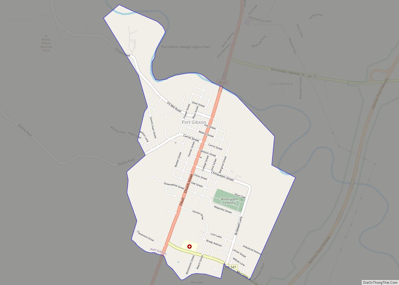
Port Gibson Road Map

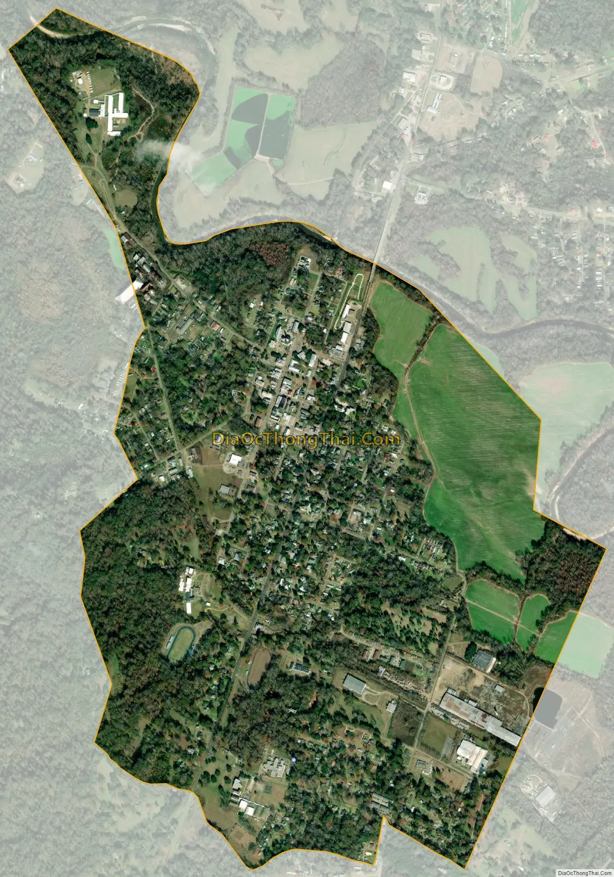
Port Gibson city Satellite Map
Geography
According to the United States Census Bureau, the city has a total area of 1.8 square miles (4.7 km), all land.
See also
Map of Mississippi State and its subdivision:- Adams
- Alcorn
- Amite
- Attala
- Benton
- Bolivar
- Calhoun
- Carroll
- Chickasaw
- Choctaw
- Claiborne
- Clarke
- Clay
- Coahoma
- Copiah
- Covington
- Desoto
- Forrest
- Franklin
- George
- Greene
- Grenada
- Hancock
- Harrison
- Hinds
- Holmes
- Humphreys
- Issaquena
- Itawamba
- Jackson
- Jasper
- Jefferson
- Jefferson Davis
- Jones
- Kemper
- Lafayette
- Lamar
- Lauderdale
- Lawrence
- Leake
- Lee
- Leflore
- Lincoln
- Lowndes
- Madison
- Marion
- Marshall
- Monroe
- Montgomery
- Neshoba
- Newton
- Noxubee
- Oktibbeha
- Panola
- Pearl River
- Perry
- Pike
- Pontotoc
- Prentiss
- Quitman
- Rankin
- Scott
- Sharkey
- Simpson
- Smith
- Stone
- Sunflower
- Tallahatchie
- Tate
- Tippah
- Tishomingo
- Tunica
- Union
- Walthall
- Warren
- Washington
- Wayne
- Webster
- Wilkinson
- Winston
- Yalobusha
- Yazoo
- Alabama
- Alaska
- Arizona
- Arkansas
- California
- Colorado
- Connecticut
- Delaware
- District of Columbia
- Florida
- Georgia
- Hawaii
- Idaho
- Illinois
- Indiana
- Iowa
- Kansas
- Kentucky
- Louisiana
- Maine
- Maryland
- Massachusetts
- Michigan
- Minnesota
- Mississippi
- Missouri
- Montana
- Nebraska
- Nevada
- New Hampshire
- New Jersey
- New Mexico
- New York
- North Carolina
- North Dakota
- Ohio
- Oklahoma
- Oregon
- Pennsylvania
- Rhode Island
- South Carolina
- South Dakota
- Tennessee
- Texas
- Utah
- Vermont
- Virginia
- Washington
- West Virginia
- Wisconsin
- Wyoming