Alzada (also known as Stoneville and Telegraph Point) is a census-designated place in southern Carter County, Montana, United States. As of the 2010 census it had a population of 29. It is located at the intersection of U.S. Route 212 with Montana Secondary Highways 323 and 326, near the Wyoming and South Dakota borders. The Little Missouri River flows northwards to the west of the community. Alzada is in the Mountain Time Zone.
| Name: | Alzada CDP |
|---|---|
| LSAD Code: | 57 |
| LSAD Description: | CDP (suffix) |
| State: | Montana |
| County: | Carter County |
| Elevation: | 3,442 ft (1,049 m) |
| Total Area: | 0.51 sq mi (1.33 km²) |
| Land Area: | 0.51 sq mi (1.33 km²) |
| Water Area: | 0.00 sq mi (0.00 km²) |
| Total Population: | 25 |
| Population Density: | 48.64/sq mi (18.79/km²) |
| ZIP code: | 59311 |
| Area code: | 406 |
| FIPS code: | 3001300 |
| GNISfeature ID: | 801990 |
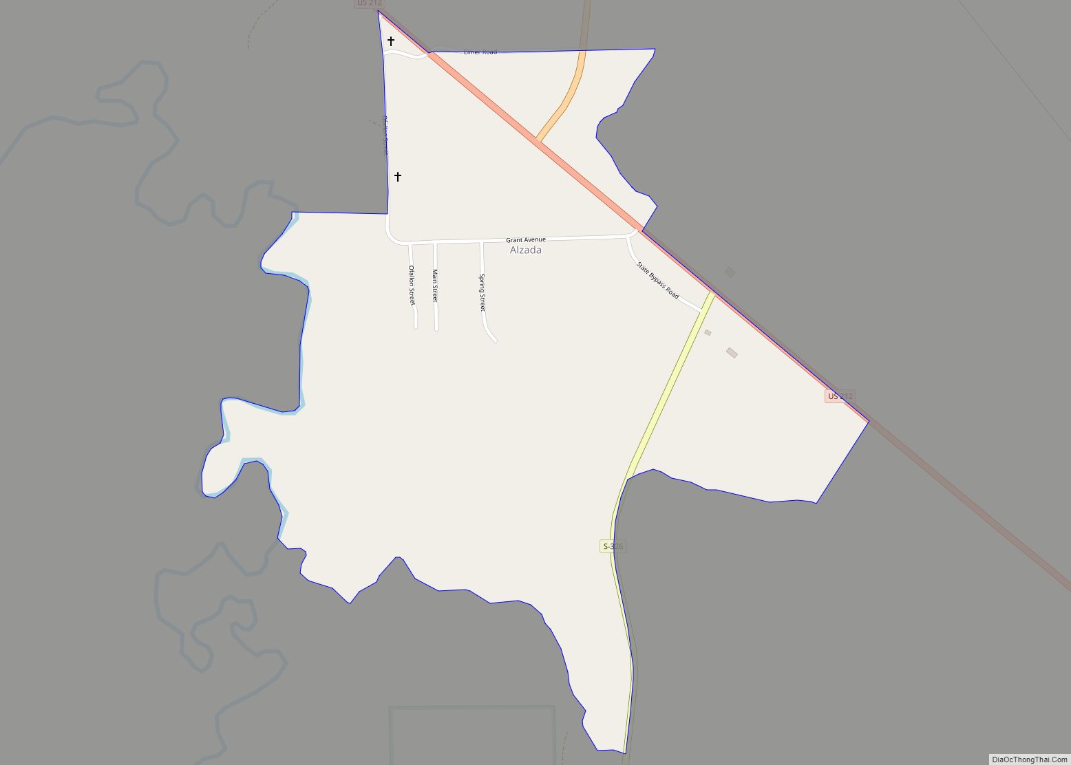
Online Interactive Map
Click on ![]() to view map in "full screen" mode.
to view map in "full screen" mode.
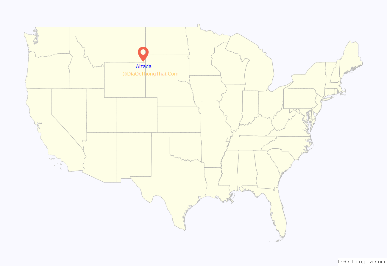
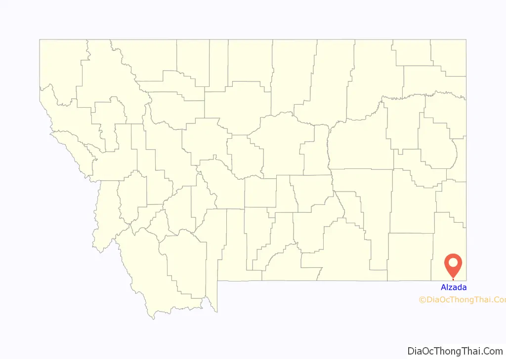
Alzada location map. Where is Alzada CDP?
History
Alzada was first established in 1878, by 9th U.S. Infantry soldiers as Camp Devin, on the Deadwood, Dakota Territory to Fort Keogh, Montana Territory telegraph line. It was called the Little Missouri River Telegraph Station, and manned by soldiers of the 7th U.S. Cavalry. Then it was named Stoneville, after the local bartender Lou Stone. It served as a stagecoach stop between Deadwood and Miles City, Montana. It was the site of a gun battle in 1884 between local authorities and rustlers known as the Exelby gang. The town’s name was changed from Stoneville in 1885, because of confusion with another similarly named community. The name “Alzada” came from an early settler named Laura Alzada Shelden. Later settlers of the area were largely homesteaders.
In 1890, Private Peter Thompson, a 7th Cavalry survivor and recipient of the Medal of Honor for the Battle of the Little Bighorn, moved from Lead, Dakota Territory, with his brother William and homesteaded north of Alzada on the Little Missouri River at Nine Mile Creek.
Alzada was briefly in the news in September 1997, when a B-1 bomber crashed nearby.
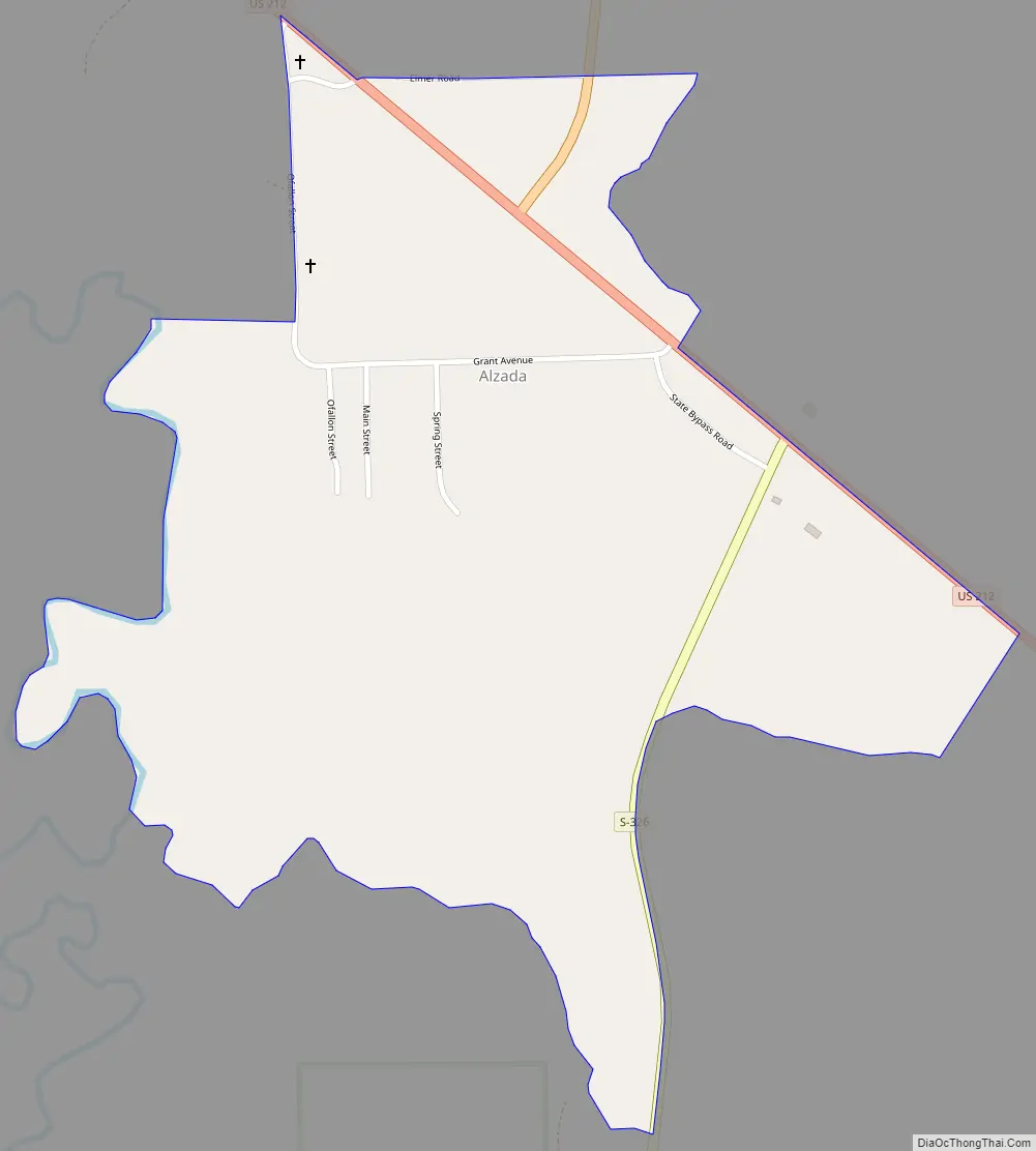
Alzada Road Map
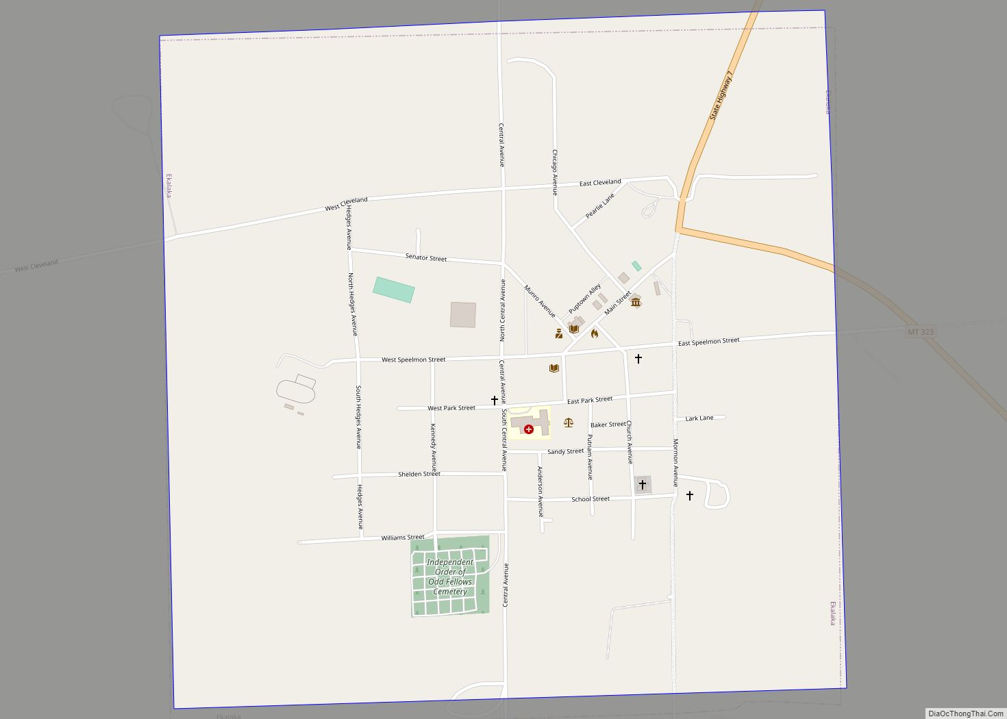
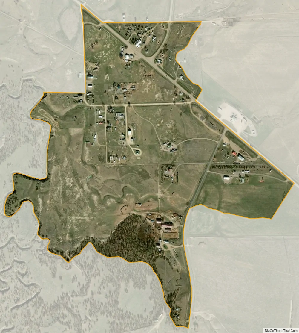
Alzada city Satellite Map
See also
Map of Montana State and its subdivision:- Beaverhead
- Big Horn
- Blaine
- Broadwater
- Carbon
- Carter
- Cascade
- Chouteau
- Custer
- Daniels
- Dawson
- Deer Lodge
- Fallon
- Fergus
- Flathead
- Gallatin
- Garfield
- Glacier
- Golden Valley
- Granite
- Hill
- Jefferson
- Judith Basin
- Lake
- Lewis and Clark
- Liberty
- Lincoln
- Madison
- McCone
- Meagher
- Mineral
- Missoula
- Musselshell
- Park
- Petroleum
- Phillips
- Pondera
- Powder River
- Powell
- Prairie
- Ravalli
- Richland
- Roosevelt
- Rosebud
- Sanders
- Sheridan
- Silver Bow
- Stillwater
- Sweet Grass
- Teton
- Toole
- Treasure
- Valley
- Wheatland
- Wibaux
- Yellowstone
- Alabama
- Alaska
- Arizona
- Arkansas
- California
- Colorado
- Connecticut
- Delaware
- District of Columbia
- Florida
- Georgia
- Hawaii
- Idaho
- Illinois
- Indiana
- Iowa
- Kansas
- Kentucky
- Louisiana
- Maine
- Maryland
- Massachusetts
- Michigan
- Minnesota
- Mississippi
- Missouri
- Montana
- Nebraska
- Nevada
- New Hampshire
- New Jersey
- New Mexico
- New York
- North Carolina
- North Dakota
- Ohio
- Oklahoma
- Oregon
- Pennsylvania
- Rhode Island
- South Carolina
- South Dakota
- Tennessee
- Texas
- Utah
- Vermont
- Virginia
- Washington
- West Virginia
- Wisconsin
- Wyoming