Map of Dumont borough, New Jersey

Map of Dumont borough, New Jersey

Dumont is a borough in Bergen County, in the U.S. state of New Jersey. As of the 2020 United States census, the borough’s population was 17,863, an increase of 384 (+2.2%) from the 2010 census count of 17,479, which in turn reflected a decrease of 24 (−0.1%) from the 17,503 counted in the 2000 census. … Read more

Map of Dover town, New Jersey

Map of Dover town, New Jersey

Dover is a town in Morris County, in the U.S. state of New Jersey. Located on the Rockaway River, Dover is about 31 miles (50 km) west of New York City and about 23 miles (37 km) west of Newark, New Jersey. As of the 2020 United States census, the town’s population was 18,460, an increase of … Read more

Map of Dover Beaches South CDP

Map of Dover Beaches South CDP

Dover Beaches South, more commonly known as Ortley Beach, is an unincorporated community and census-designated place (CDP) located within Toms River, in Ocean County, New Jersey, United States. As of the 2010 United States Census, the CDP’s population was 1,209. Dover Beaches South is situated on the Barnegat Peninsula, a long, narrow barrier peninsula that … Read more

Map of Dover Beaches North CDP

Map of Dover Beaches North CDP

Dover Beaches North is an unincorporated community and census-designated place (CDP) located within Toms River, in Ocean County, New Jersey, United States. As of the 2010 United States Census, the CDP’s population was 1,239. The CDP includes the communities of Ocean Beaches 1, 2 and 3, Chadwick Beach, Chadwick Island, Seacrest Beach, Monterey Beach, Silver … Read more

Map of Diamond Beach CDP

Map of Diamond Beach CDP

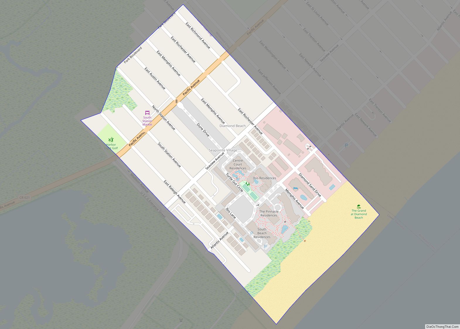
Diamond Beach is an unincorporated community and census-designated place (CDP) located within Lower Township in Cape May County, New Jersey, United States. The CDP, and all of Cape May County, is part of the Ocean City metropolitan statistical area, and is part of the Philadelphia–Wilmington–Camden, PA-NJ-DE–MD combined statistical area, also known as the Delaware Valley … Read more

Map of Demarest borough

Map of Demarest borough

Demarest is a borough in Bergen County, in the U.S. state of New Jersey. As of the 2020 United States census, the borough’s population was 4,981, an increase of 100 (+2.0%) from the 2010 census count of 4,881, which in turn reflected an increase of 36 (+0.7%) from the 4,845 counted in the 2000 census. … Read more

Map of Echelon CDP

Map of Echelon CDP

Echelon is an unincorporated community and census-designated place (CDP) located within Voorhees Township in Camden County, New Jersey, United States. As of the 2010 United States Census, the CDP’s population was 10,743. The Voorhees Town Center (formerly known as Echelon Mall) is located in Echelon. The mall offers 730,000 square feet (68,000 m) of shopping, with … Read more

Map of Eatontown borough

Map of Eatontown borough

Eatontown is a borough in Monmouth County, in the U.S. state of New Jersey. As of the 2020 United States census, the borough’s population was 13,597, an increase of 888 (+7.0%) from the 2010 census count of 12,709, which in turn reflected a decline of 1,299 (−9.3%) from the 14,008 counted in the 2000 census. … Read more

Map of East Rutherford borough

Map of East Rutherford borough

East Rutherford is a borough in Bergen County, in the U.S. state of New Jersey. As of the 2020 United States census, the borough’s population was 10,022, an increase of 1,109 (+12.4%) from the 2010 census count of 8,913, which in turn reflected an increase of 197 (+2.3%) from the 8,716 counted in the 2000 … Read more

Map of East Rocky Hill CDP

Map of East Rocky Hill CDP

East Rocky Hill is an unincorporated community and census-designated place (CDP) located in Franklin Township, in Somerset County, New Jersey, United States. As of the 2010 United States Census, the CDP’s population was 469. East Rocky Hill CDP overview: Name: East Rocky Hill CDP LSAD Code: 57 LSAD Description: CDP (suffix) State: New Jersey County: … Read more

Map of East Orange city

Map of East Orange city

East Orange is a city in Essex County, in the U.S. state of New Jersey. As of the 2020 United States census, the city’s population was 69,612, an increase of 5,342 (+8.3%) from the 2010 census count of 64,270, which in turn reflected a decline of 5,554 (−8.0%) from the 69,824 counted in the 2000 … Read more

Map of East Newark borough

Map of East Newark borough

East Newark is a borough in the western part of Hudson County, in the U.S. state of New Jersey. It is a suburb of Newark, which sits across the Passaic River. The borough is the second-smallest municipality by total area in the state. The Borough of East Newark was established on July 2, 1895, from … Read more