Dumont is a borough in Bergen County, in the U.S. state of New Jersey. As of the 2020 United States census, the borough’s population was 17,863, an increase of 384 (+2.2%) from the 2010 census count of 17,479, which in turn reflected a decrease of 24 (−0.1%) from the 17,503 counted in the 2000 census.
The borough was originally formed on July 20, 1891, as the Borough of Schraalenburgh from portions of Harrington Township and Palisades Township, based on the results of a referendum held the previous day. The borough was formed during the “Boroughitis” phenomenon then sweeping through Bergen County, in which 26 boroughs were formed in the county in 1894 alone. On March 7, 1898, portions of the borough were annexed to Palisades Township. On June 13, 1898, the borough’s name was changed to Dumont in honor of Dumont Clarke, the borough’s first mayor.
| Name: | Dumont borough |
|---|---|
| LSAD Code: | 21 |
| LSAD Description: | borough (suffix) |
| State: | New Jersey |
| County: | Bergen County |
| Incorporated: | July 20, 1891 |
| Elevation: | 98 ft (30 m) |
| Total Area: | 1.95 sq mi (5.06 km²) |
| Land Area: | 1.95 sq mi (5.05 km²) |
| Water Area: | 0.00 sq mi (0.01 km²) 0.15% |
| Total Population: | 17,863 |
| Population Density: | 9,165.2/sq mi (3,538.7/km²) |
| ZIP code: | 07628 |
| Area code: | 201 |
| FIPS code: | 3418400 |
| GNISfeature ID: | 0885197 |
| Website: | www.dumontnj.gov |
Online Interactive Map
Click on ![]() to view map in "full screen" mode.
to view map in "full screen" mode.
Dumont location map. Where is Dumont borough?


Dumont Road Map

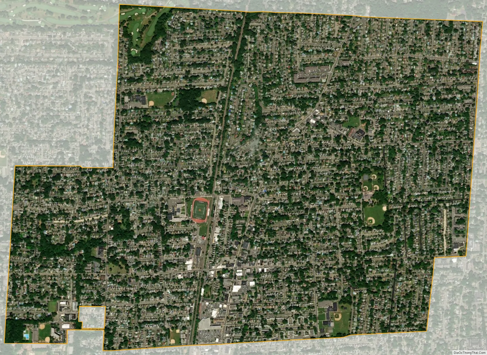
Dumont city Satellite Map
Geography
According to the United States Census Bureau, the borough had a total area of 1.95 square miles (5.06 km), including 1.95 square miles (5.05 km) of land and <0.01 square miles (0.01 km) of water (0.15%).
Municipalities bordering the borough include the Bergen County communities of Bergenfield, Cresskill, Demarest, Haworth, New Milford and Oradell.
See also
Map of New Jersey State and its subdivision: Map of other states:- Alabama
- Alaska
- Arizona
- Arkansas
- California
- Colorado
- Connecticut
- Delaware
- District of Columbia
- Florida
- Georgia
- Hawaii
- Idaho
- Illinois
- Indiana
- Iowa
- Kansas
- Kentucky
- Louisiana
- Maine
- Maryland
- Massachusetts
- Michigan
- Minnesota
- Mississippi
- Missouri
- Montana
- Nebraska
- Nevada
- New Hampshire
- New Jersey
- New Mexico
- New York
- North Carolina
- North Dakota
- Ohio
- Oklahoma
- Oregon
- Pennsylvania
- Rhode Island
- South Carolina
- South Dakota
- Tennessee
- Texas
- Utah
- Vermont
- Virginia
- Washington
- West Virginia
- Wisconsin
- Wyoming


